
History
The fortifications of the hillfort, now called Tre’r Ceiri, were built around 200 BC. It were probably built by the local Celtic population, organized around a tribal chief. However, the largest number of people lived in the hillfort between 150 and 400 AD, practically throughout the Roman period. Since Tre’r Ceiri was situated high above sea level, it may have served as a refuge for summer shepherds who also had winter dwellings in the lowlands. The hillfort was abandoned in the 5th century AD.
Architecture
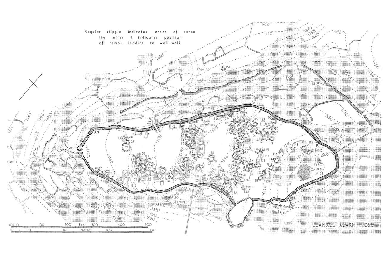
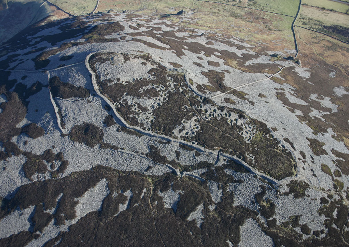
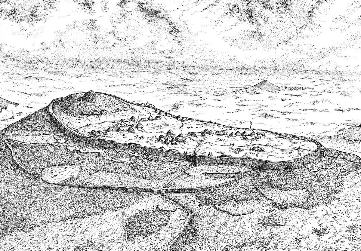
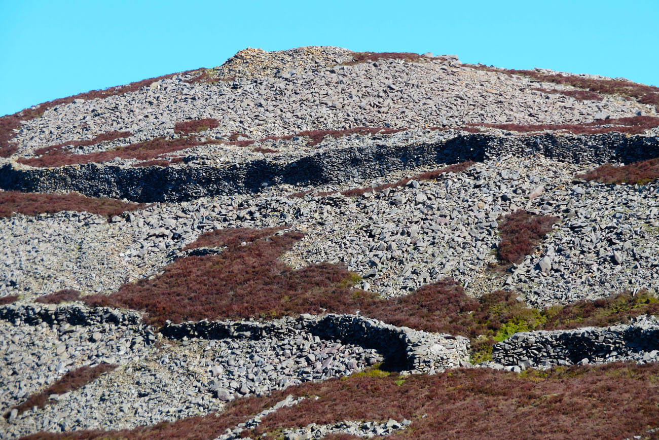
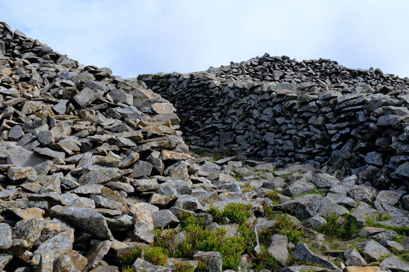
The hillfort was erected on a hill elongated in plan, 485 meters high. Steep and high drops protected Tre’r Ceiri mainly from the south and east, where hill sloped down to the valley, and also a little further away from the fortifications from the north, where rock cliffs faced the coast of the Irish Sea. In the west, the approach was gentler, because nature had created a pass there, connecting with the next hill of Yr Eifl. Tre’r Ceiri was surrounded by a perimeter of stone walls along the edges of the slopes, with a shape similar to an extended oval measuring 289 by 103 meters. The length of the defensive walls was about 620 meters. In addition, on the north and west sides, where the slope of the hill was the mildest, a second, outer wall was erected.
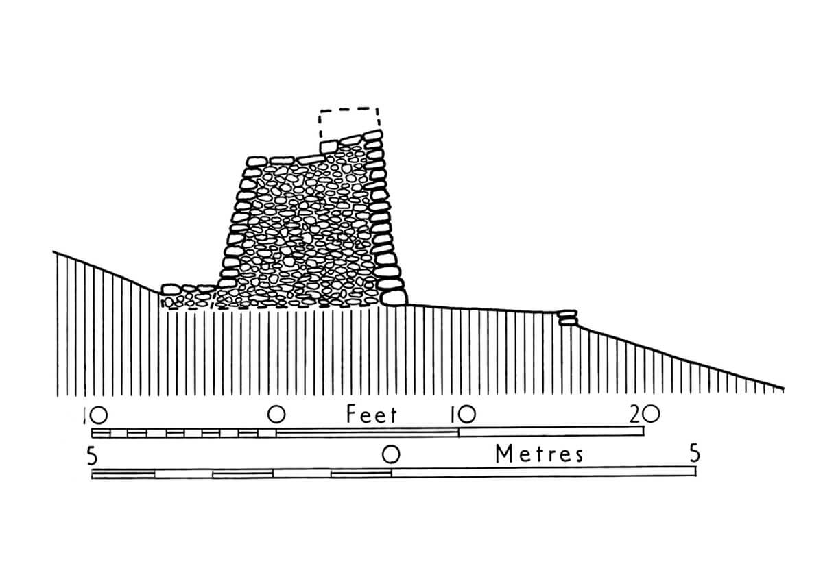
The thickness of the main wall ranged from 2.1 to 4.6 meters on the north-west side and from 1.8 to 3 meters in the safer southern and eastern sections. The height of the fortifications in some places reached about 3.5-4 meters from the outside (only 1.8 meters from the inside), with the parapet taking up about half the thickness of the wall and rising to at least 0.9 meters in height, and probably slightly higher. The entrance to the wall-walk was carried out by means of inclined ramps attached to the curtains. An experimental maintenance program has shown that the masonry was built by placing flat stones without careful selection for fit or facing. This meant that the wall could be built fairly quickly. Reconstruction work has shown that three men could build about 1 meter of wall per day. Surprisingly, the entire circuit could be completed by 100 workers in approximately 20 days.
The outer wall, apart from an obstacle directed against potential attackers, was a revetment against the slopes of the hill. Unlike the main wall, it did not have a parapet, although in places the top of the fortifications slopes so that it formed a depression with the hillside. The crown of the outer wall was probably not intended for defense, but it could have been used for sentinel purposes. Built of large, polygonal blocks of stones from the slopes of the hill, it was probably a later, secondary addition to the main fortifications of the hillfort.
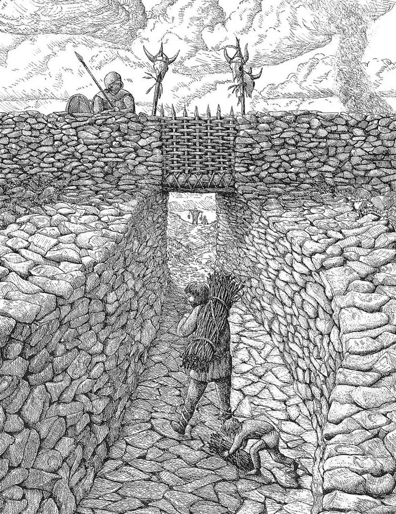
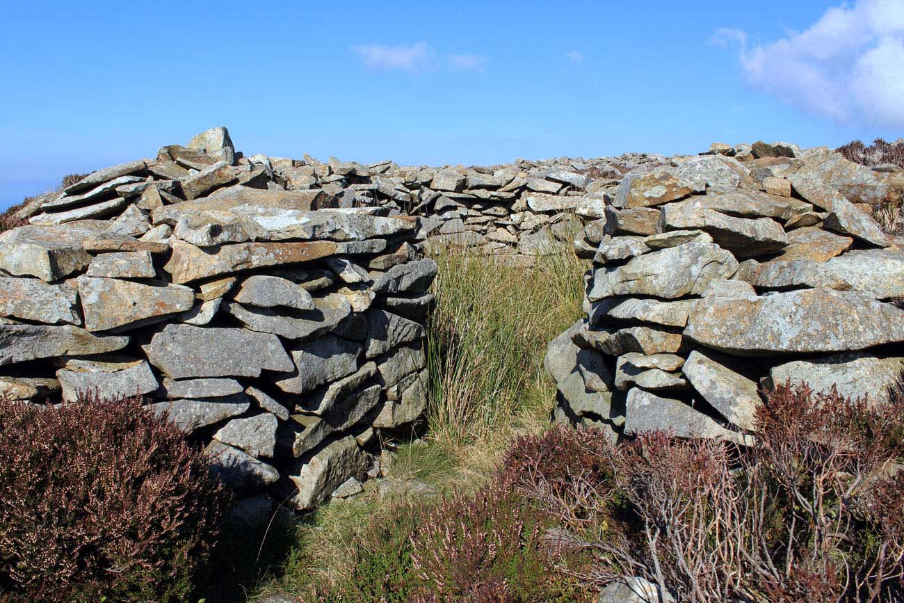
The entrance to the hillfort was provided by two main gates and three smaller posterns in the form of ordinary gaps in the wall, about 0.9 meters wide. One of them was placed in such a place as to allow the inhabitants to reach the water source by a narrow path. The main gates were on the south-west and north-west sides, the latter referring to the gate of the outer wall, behind which the path turned sharply. The south-west gate was a 1.8-meter-wide break in the wall, preceded by external walls for a distance of about 15 meters, usually with the function of strengthening the slopes of the hill. On the inside, the gate passage was 5.5 meters long, flanked by a wall that was formed in the form of two semicircular bastions. Above the gate passages, there were probably a wooden footbridges connecting two sections of the wall, from which it was possible to control those arriving at the hillfort.
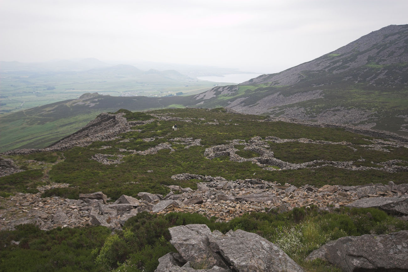
The area of the hill covered by the fortifications was sloping gently from the south-west to the north-east, until in the eastern part it reached the highest elevation of the Yr Eifl, surrounded by a defensive wall. There was a stone mound (cairn) with a diameter of about 15 meters, built of carefully placed but unworked stones. When the hillfort was built, it was already hundreds of years old. Its structure was included in the fortifications, perhaps due to respect for ancestors, but it could also be an excellent guard and observation point. The area around the cairn was left free of residential buildings.
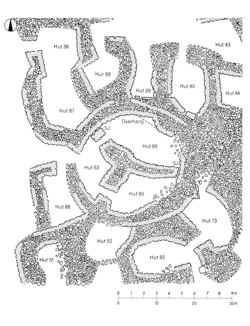
There were at least 150 smaller and 26 larger stone houses within the hillfort walls. It had round shapes, horseshoe shapes with the backs connected to each other, and free-standing horseshoe shapes. There were also oval, polygonal and quadrilateral houses. The round ones were probably created and functioned in the Iron Age, while the irregular and four-sided ones may have been related to the Roman period. In the latter, people still lived in round houses, but they were divided into smaller rooms by internal walls. Round houses had diameters from 2.4 to less than 8 meters, but were usually in the range of 3.6 – 4.6 meters. Elongated houses varied greatly in size, were usually built with a width of 2.4 to 3 meters and twice as long, oscillating around 4.5 – 6 meters of length. All of them were built of local stones, with floors slightly below ground level, and originally probably with wooden roof trusses covered with grass. In Roman times, the hillfort could accommodate up to 400 people. Subsequent families could have lived at the foot of the hill, in houses fenced with stone walls with rounded corners.
Current state
Tre’r Ceiri (“Town of Giants”) is one of the best preserved Iron Age fortified hillforts in Britain. The defensive wall has been preserved to this day, visible on a large part of the perimeter, reaching in parts to the original height of 3.5-4 meters, and the lower parts of round and four-sided houses. In 1989, Cyngor Dosfor Dwyfor and Gwynedd County Council, funded by the government agency Cadw, began a long program of consolidation and repair of the fort under archaeological supervision. Over the course of ten years, the original construction techniques were analyzed, the form of the Iron Age buildings was recreated, the progress of work was recorded in detail, the erosion of the walls was stopped and this exceptionally valuable monument was finally restored. Admission to the site is free, accessible via a path leading from the west, from the car park above the village of Llithfaen, and via a shorter approach from Llanaelhaearn.
bibliography:
Driver T., The Hillforts of Iron Age Wales, Eardisley 2023.
Forde-Johnston J., Hillforts of the Iron Age in England and Wales, Liverpool 1976.
Hopewell D., Tre’r Ceiri Iron-Age Hillfort Management Plan, [b.m.w.] 2013.
The Royal Commission on The Ancient and Historical Monuments and Constructions in Wales and Monmouthshire. An Inventory of the Ancient and Historical Monuments in Caernarvonshire, volume II: central, the Cantref of Arfon and the Commote of Eifionydd, London 1960.
Smith G.H., Hillforts and Hut Groups of North-West Wales, [b.m.w.] 2008.