

History
Talyfan Castle was probably built in the early 12th century as the center of the local lordship, which was incorporated into Glamorgan in 1245. It was then that Richard Siward rebelled against Earl Richard de Clare and, as a result, was deprived of his Llanblethian and Talyfan possessions. Although the castle lost its primacy, it was in a strategically important place, from which it could secure the road going north from Cowbridge, founded in 1254. In 1295, the Talyfan was recorded in connection with the death of Earl Gilbert II de Clare, although the castle itself was not mentioned. Its functioning was evidenced by an inventory created in 1307 after the death of Countess Joan, although the annual income of one shilling was purely nominal.
With the death of Gilbert III de Clare in the Battle of the Scots at Bannockburn, an anti-English uprising broke out in Wales. Talyfan and Llanblethian were affected by hostilities, which the then royal castle keeper John Gifford blamed in 1316 for extensive damages and reduced receipts. Then Talyfan was included in the group of estates handed over to the royal favorite, Hugh Despenser the younger, so that in 1321 the castle was ravaged by army of rebellious barons fighting against King Edward II and his hated advisor.
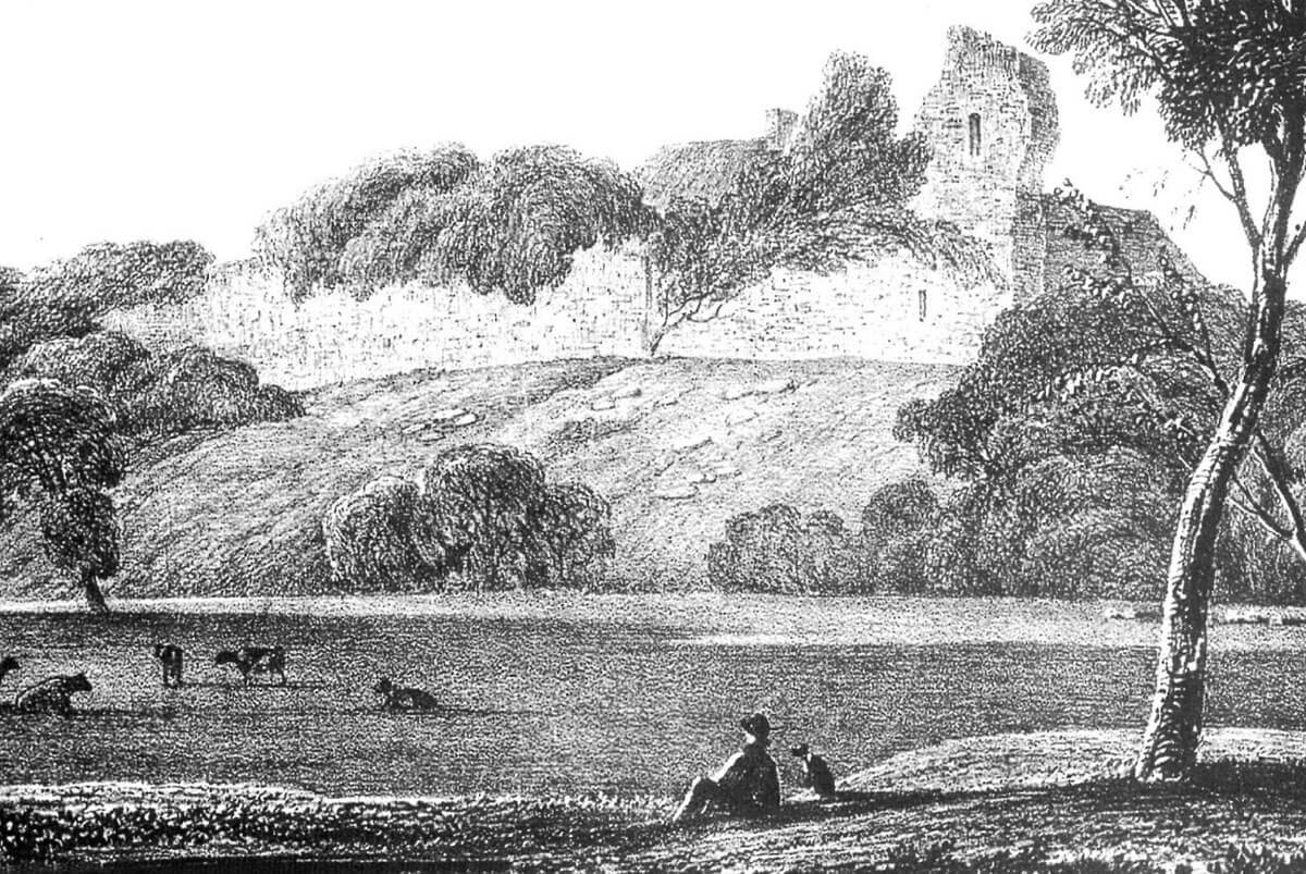
The castle was rebuilt in 1349. Although Edward II was dethroned and Hugh Despenser the younger hanged, Talyfan remained the property of the Despenser family. After Edward Despenser’s death in 1375, Talyfan and Llanblethian passed to his wife Elizabeth as part of the widow’s dower. The castle was still maintained until the end of the 15th century, but at the beginning of the 16th century it was in ruin. Even in 1828, it was shown in the engraving together with the significant remains of the walls, as well as the farm built around 1700. However, they were almost completely demolished between 1828 and 1860 in order to use building materials for the current Castell Tal-y-van farm.
Architecture
The castle was built on the north-facing spur of the hill, part of the Pen Tal-y-fan ridge extended along the east-west line. From the north-west and east, the natural slopes were reinforced with scarping to embrace a level area of the castle courtyard. In the south-east and south, the terrain sloped more gently, creating the most convenient place for the access road. From the south-west, this neck was cut with a ditch, originally ended on the south-eastern slope. Another, straight section of the ditch reinforced with an embankment was created on the eastern side. The line of this ditch ran northward, curving to the north-east and marking a roughly oval area approximately 50 meters by 40 meters.
The original timber fortifications in the second quarter of the 13th century (before 1245) were replaced with a stone wall up to 1.5 meters thick above the battered plinth, surrounding a roughly oval courtyard with a diameter of about 45 meters, perhaps with straight curtains on the south-west and south. The entry took place from the south-east, presumably through a simple gate pierced through the wall. Perhaps it was protected by a tower at the end of the eastern curtain, which would explain the location of the main tower of the castle at a distance from the gate.
In the center of the courtyard there was a cylindrical tower with a diameter of about 15 meters. The thickness of its wall at the level of the plinth was 3.3 meters, and above at least 1.8 meters. On the north-eastern side, a two-story latrine annex was attached to the tower. It protruded 3.6 meters with a width of 5.3 meters, which was then increased to 7.5 meters. The thickness of the walls of the annex was about 1 meter. Its façades, like the façades of the main tower, were marked with numerous putlog holes, remnants of scaffoldings installed during construction works. The tower of Talyfan probably served as a free-standing keep, characterized by a large size. Other residential and economic buildings were probably added to the internal façades of the defensive wall.
Current state
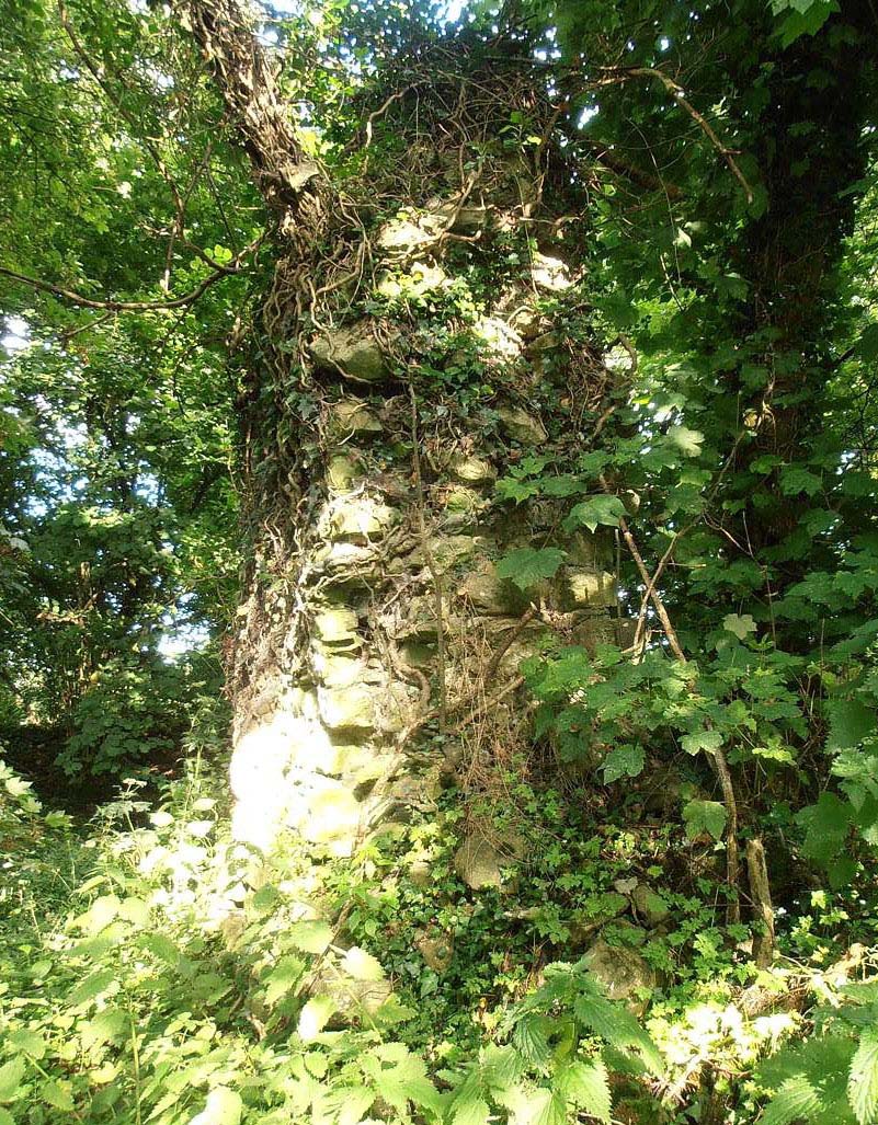
Until today, only small ruins have survived from the castle, among which there are also relics of the farm from the beginning of the 18th century. The remains of the defensive wall are mostly reduced to the foundations, visible in piles of rubble incorporated into the hedge. The relics of the main tower are up to 2.8 meters high, its annex is 4.5 meters high (which is due to better mortar), fragments of a medieval ditch are also visible, but the causeway at the entrance to the castle was filled in the 19th century. The area is overgrown with vegetation and neglected.
bibliography:
Salter M., The castles of Gwent, Glamorgan & Gower, Malvern 2002.
The Royal Commission on Ancient and Historical Monuments of Wales, Glamorgan Later Castles, London 2000.