

History
The first reference to the Ruthin Castle dates back to 1277, when it was handed over to Dafydd ap Gruffudd, after the First War of Welsh Independence. Ruthin, along with Caergwle and Denbigh, was king Edward I’s reward for the support Dafydd gave him. As the stronghold was built of red sandstone, its original name was Castell Coch yn yr Gwernfor, meaning “Red Castle in the Great Marsh”.
Dafydd did not hold the stronghold for too long, because he rebelled against the English reign in 1282, leading to the Second War of Welsh Independence. Edward I quickly conquered all of North Wales and began a great castle building programme, protecting captured territories. He also tried to reduce the cost of the occupation, giving Welsh land to the Anglo-Norman lords. Ruthin was granted to Reginald de Gray, who carried out numerous repairs and extensions to the castle. Among other, he erected six cylindrical towers and separated fortified outer bailey. During the work he was supported by a well-known architect and master builder of king Edward, James of Saint George.
The Gray family owned the castle throughout the 14th and 15th centuries. In 1400, they were one of the reasons for the outbreak of the great Welsh uprising of Owain Glyndŵr. In previous years, they had a dispute with Owain about the land plot in Croesau. The then owner of the Ruthin castle, another named Reginald Gray, took control of it, and Glyndŵr turned to the English parliament for support. However, due to prejudices against the Welsh, his request was ignored. At the same time, Gray tried to discredit Glyndŵr, not delivering royal calls to the magnates who would provide troops for the war in Scotland. Then he used his influences on the royal court to condemn the Welshman as a traitor. As a result, on September 18, 1400 Glyndŵr attacked Ruthin, burned and plundered the town. The castle itself resisted the invasion. The revolt turned into a significant rebellion that lasted ten years. In the course of it, Gray was captured by Glyndŵr in 1402 and had to buy back for a huge sum of 10,000 marks, which almost bankrupt him.
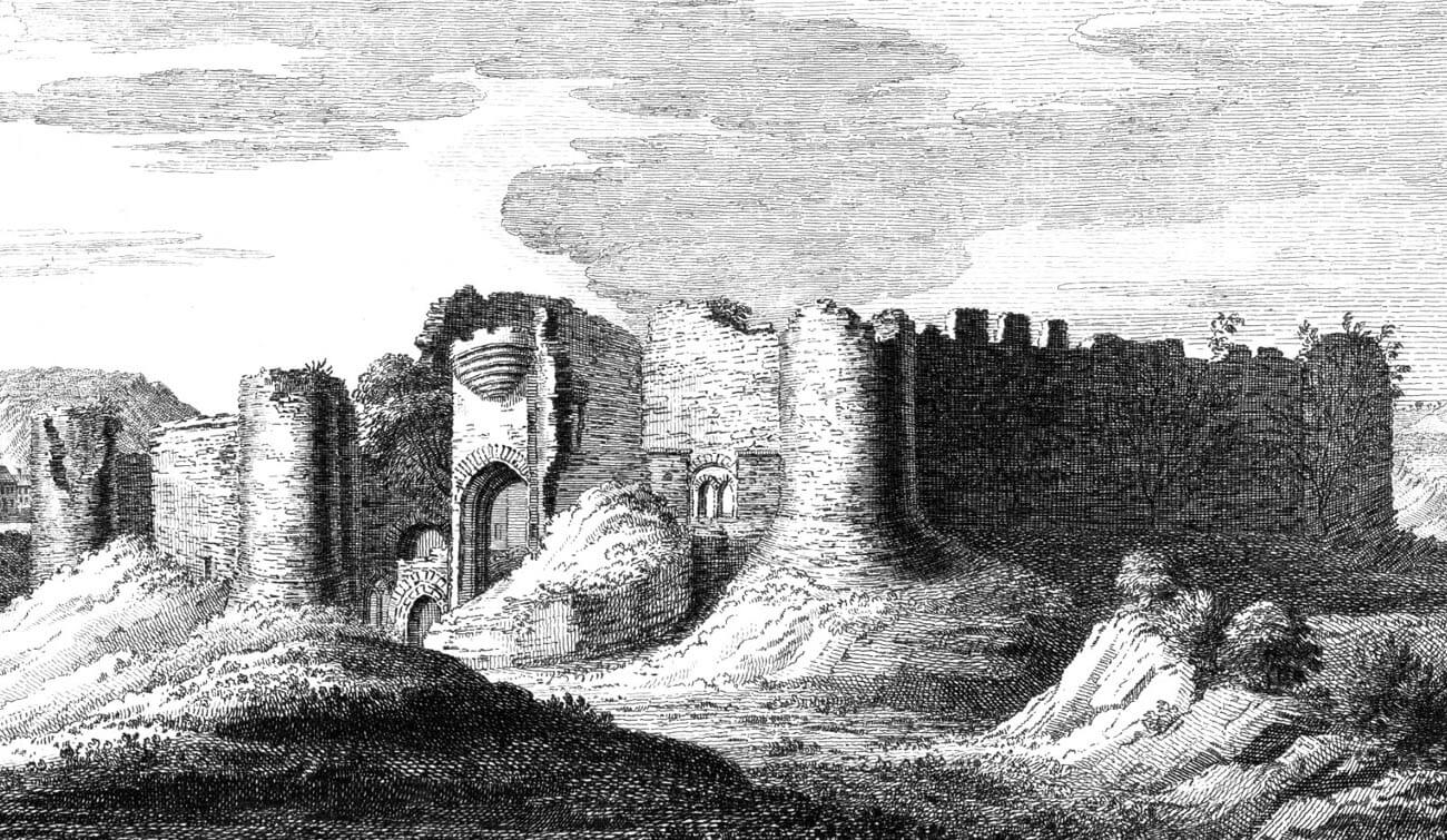
After the fall of the uprising, the Gray family continued to play a significant role in contemporary politics. In 1508 George de Gray, Earl of Kent sold the castle to the Crown. Although king Henry VIII briefly gave Ruthin to his illegitimate son, Henry Fitzroy, the castle remained royal until the 17th century. It was not until 1632 that it was sold by Karol I to Sir Thomas Myddleton of Chirk. At that time the fortifications of the castle were neglected and only the outbreak of the civil war in 1642, caused that it was quickly restored. In 1646, the royalist garrison of Ruthin was besieged by Parliament’s troops under General Major Thomas Mytton. The castle lasted 11 weeks, until the threat of undermining, forced the defenders to surrender. To prevent further use of the castle, it was deliberately destroyed in 1648. The ruins were abandoned, until in 1826 the Myddleton family built a house in the south-eastern part of the castle.
Architecture
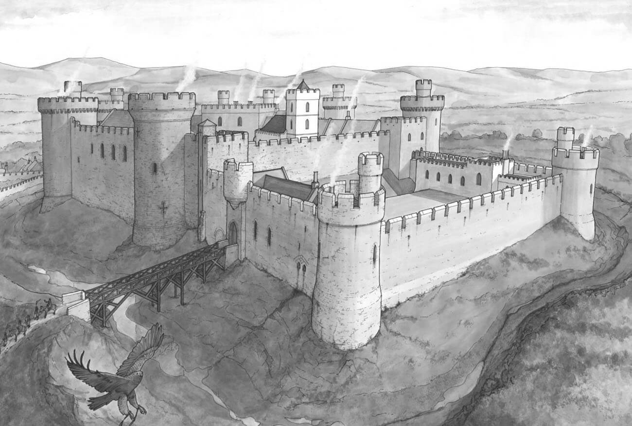
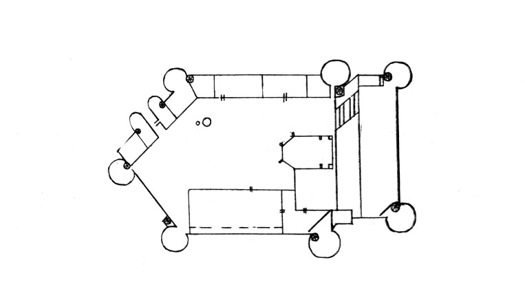
The castle was erected on the plan of a pentagon at the top of the rocky elevation of red sandstone, surrounded by a wide ditch. It consisted of a pentagonal upper ward (inner ward) measuring approximately 105 x 75 meters and a lower rectangular shaped ward (outer ward) measuring 73 x 49 meters. They were separated by a defensive wall and a wide dry moat. The only connection between both parts of the castle was possible with a spiral staircase embedded in a small turret pressed into the northern corner of the moat.
The perimeter wall was reinforced by a total of six cylindrical and semicircular towers and a two-tower gatehouse in the north-east corner of the upper ward. Apart from the gate towers, all the towers were strongly extended in the foreground, giving the possibility of side firing of adjacent curtains. Probably they were one storey higher than the defensive walls and, like them, topped with a battlement. The lower ward had its less fortified gate on the west side.
The main building of the great hall, 30 x 12 meters, was erected by the western curtain. The defensive walls were 2 to 2.7 meters thick and were almost 30 meters high from the level of the moat. The outer zone of the castle’s defense was on the one side the moat irrigated by the river Clwyd, and on the other, a deep, dry ditch. Especially high riverside scarp was located on the northwestern side of the castle.
Current state
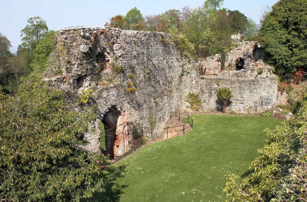
Today, almost half of the castle (upper ward) is in an advanced state of ruin, and the second part (the original lower ward) has been rebuilt into an early modern residence. In the reconstructed part the hotel is currently located.
bibliography:
Lindsay E., The castles of Wales, London 1998.
Salter M., The castles of North Wales, Malvern 1997.
Taylor A. J., The Welsh castles of Edward I, London 1986.
The Royal Commission on The Ancient and Historical Monuments and Constructions in Wales and Monmouthshire. An Inventory of the Ancient and Historical Monuments in Wales and Monmouthshire, IV County of Denbigh, London 1914.