
History
Local estates appeared in documents under the name Lamecare in 1086. From the end of the 12th century to the end of the 13th century, it were in the hands of the Fitzpayn family, the supposed founders of the castle. Among them, in 1271 a certain Robert Fitzpayn, residing at his seat in Llanvair (Llanfair), was recorded. However the castle was built a little earlier, probably in the first quarter of the 13th century, in the time of Roger Fitzpayn.
The Fitzpayn family did not die out before the end of the 14th century, but for unknown reasons around 1290 the castle passed into the hands of Sir Ralph Monthermer, an initially unknown man, a squire who allowed himself to secretly marry Joan of Acre, daughter of King Edward I, and widow of Earl Gilbert II de Clare. The angry king initially imprisoned Ralph and deprived daughter of her property, but eventually implored by Joan released him and allowed to retain the title of earl until Joan’s death in 1307. The Llanvair then passed to the young Gilbert III de Clare, and Ralph was awarded the title of Baron of Monthermer.
Llanvair Discoed remained in the hands of Ralph’s sons, Edward and Thomas, until their death in 1340. Subsequently, through the marriage of Thomas’ daughter Margaret, the castle passed to John Montacute, Earl of Salisbury, although it was probably not of great importance to the English family, located in far Wales. Subsequent generations of Montacute family members owned Llanvair Discoed throughout the 15th century. They lost their Welsh property only after the execution in 1541 of Margaret, the wife of Sir Richard Pole, beheaded by order of Henry VIII. The castle, taken by the Crown, was then sold to local noble families. In 1635, Rhys Kemeys built a residential house near the Llanvair grounds, so the castle must have been in poor condition by then. It is not known when it was abandoned and fell into disrepair.
Architecture
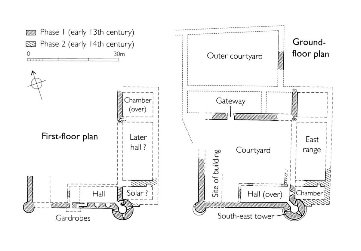
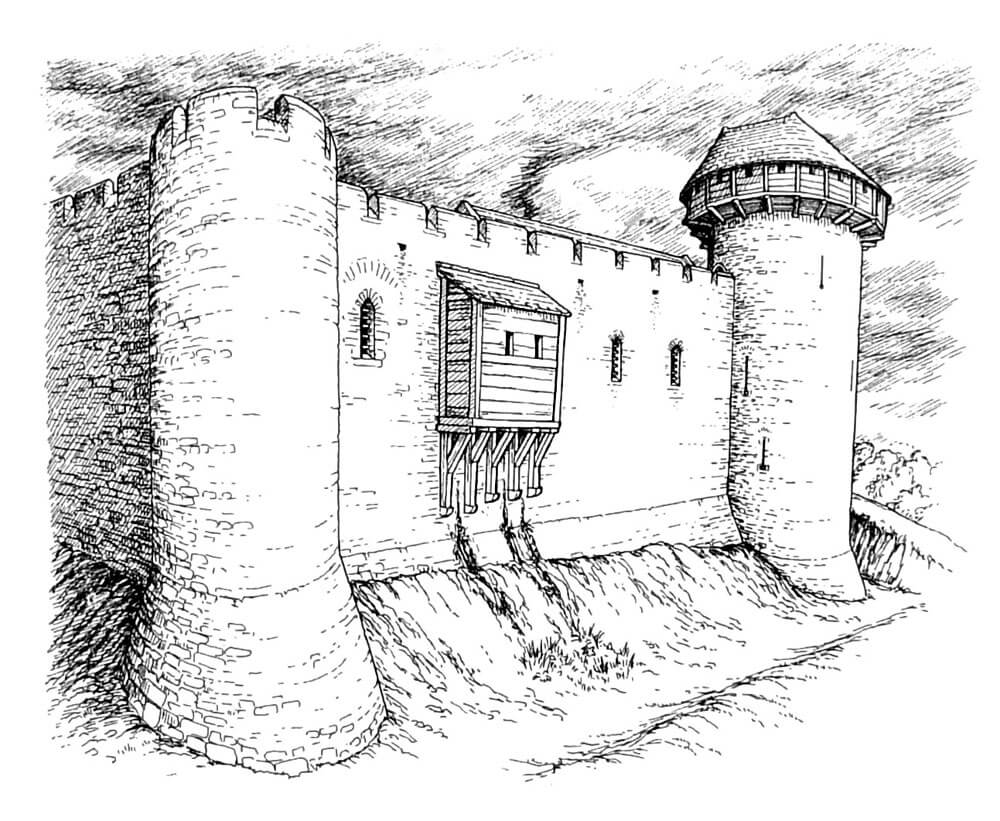
The castle was built on the west side of the settlement and the church of the St. Mary. It was erected on a quadrilateral plan with two corner, cylindrical towers about 30 meters apart at the southern curtain: the larger south-east one and a small south-west one. The oldest residential and economic buildings were attached to the internal facades of the defensive walls. In the eastern part of the southern side of the courtyard there was an elongated building, probably housing a great hall, and another building could be attached to the west wall. The hall, i.e. the room where the daily life of the residents was concentrated, where feasts were held, guests were received and courts were conducted, was located on the first floor of the building, while the dark ground floor was traditionally intended for pantries and warehouses. From the hall, through passages in the thickness of the wall, it was possible to get to the latrines, most probably placed in timber projections hung on stone corbels.
The south-eastern tower was at least 14 meters high and 3 meters in internal diameter. It had at least three floors and an entrance from the ground and first floors, probably leading to the adjacent wall-walk on the defensive walls. It was strongly extended in front of the adjacent curtains, and on each floor it had three symmetrically arranged arrowslits, so it had a purely military function, flanking the adjacent sections of the walls and the foreground of the castle. Its interior was not equipped with latrines or fireplaces, while the upper floor could be surrounded by a wooden hoarding, mounted in openings in the wall. The smaller south-west tower at the ground floor and first floor was full, devoid of rooms.
In the later period of the Middle Ages, the castle was significantly expanded, especially on the eastern and northern sides. It probably took place at a time when defensive considerations ceased to be important, because the eastern wing was added on the outer side of the wall, in the area of the ditch. It had a three-room layout on the ground and first floor, traditional for the Middle Ages, with a large chamber in the middle and two smaller on sides. Another wing was built on the north side, in place of the supposed original entrance gate. Behind this wing there could be a courtyard of the outer bailey, although the auxiliary buildings were also to be located on the west side of the castle.
Current state
Two cylindrical towers, fragments of the defensive wall preserved up to a height of 4 meters and relics of building from the Tudor period have survived to the present day. The latter, probably serving as a dovecote, is located several meters from the castle on the west side. The whole area is overgrown with vegetation and difficult to access due to its location on private property.

bibliography:
Davis P.R., Forgotten Castles of Wales and the Marches, Eardisley 2021.
Newman J., The buildings of Wales, Gwent/Monmouthshire, London 2000.
Salter M., The castles of Gwent, Glamorgan & Gower, Malvern 2002.