
History
The fortified settlement of Castell Henllys was built in the Iron Age around 600 BC. The settlement of the hillfort was discontinued more or less at the beginning of first century AD and resumed in the late Roman period. At that time, a small Roman-Breton farm was set up on the sidelines. Later reconstruction of the hillfort probably had a connection with the Irish settlers during the Roman period. Traces of fire at the gate and large amounts of stones to slings indicate warfare in the area of the settlement.
Architecture
The settlement occupied an inland promontory of a hill, approximately 74 x 88 meters in size, overlooking the confluence of the Duad and Hafren rivers on the eastern side. These rivers surrounded the base of the hill on three sides, creating a marshy and boggy valley floor. Only the western and northwestern sides were free from water obstructions, where the promontory connected to the rest of the plateau by a neck. Although the hill was not very high, approximately 20 meters high, the slopes were quite steep and provided good protection for the settlement’s inhabitants. The natural slope of the land on which the settlement was founded, which descended from the north and northwest to the south and along the sides of the promontory ridge, may have posed a certain difficulty for the builders.
The northwestern section of the fortifications, the least protected by the natural conditions of terrain, required the most extensive fortification work. Initially, a ditch was created, measuring 5.5-6 meters wide between two escarpments and a maximum depth of 2-2.5 meters. Behind it, a low rampart was built, approximately 4 meters wide, constructed primarily of red clay. In the next stage, the rampart was raised, and another one, approximately 3 meters wide, was constructed on the outer side, with another ditch in front of it. As a result, the settlement in its final form was protected on the front by a double rampart and a double ditch, while a single rampart and ditch surrounded it along the remaining perimeter, with a palisade likely located at the top of the rampart. The inner rampart was more massive, towering at least 2-3 meters above the interior of the settlement and about 5 meters above the ditch floor. The outer rampart rose about 3 meters above the inner ditch and at least 4 meters on the outer side. The outer, farthest defensive zone from the gate was a strip of scattered stones, irregular and often sharp, intended to impede the movement of chariots, horses, and warriors.
The entrance gate to the settlement’s courtyard consisted of a long, stone-lined passage, created across the ramparts on the northwest side. The ditch of the original moat was filled in this section, and the ramparts were bent inward toward the settlement, creating two rounded bulges at the front of the passage, providing better firepower from the flanks. The stones facing the rampart and passage were narrow, flat pieces of slate, laid without mortar, but fitted together precisely. At the rear of the passage, two circular chambers were created on each side, which could have served as guard stations. A wooden tower or some form of defensive bridge may have stood above the break in the ramparts, connecting the western and eastern sections of the rampart’s crown and overlooking those using the gateway. Heavy double doors may have served to close the gate.
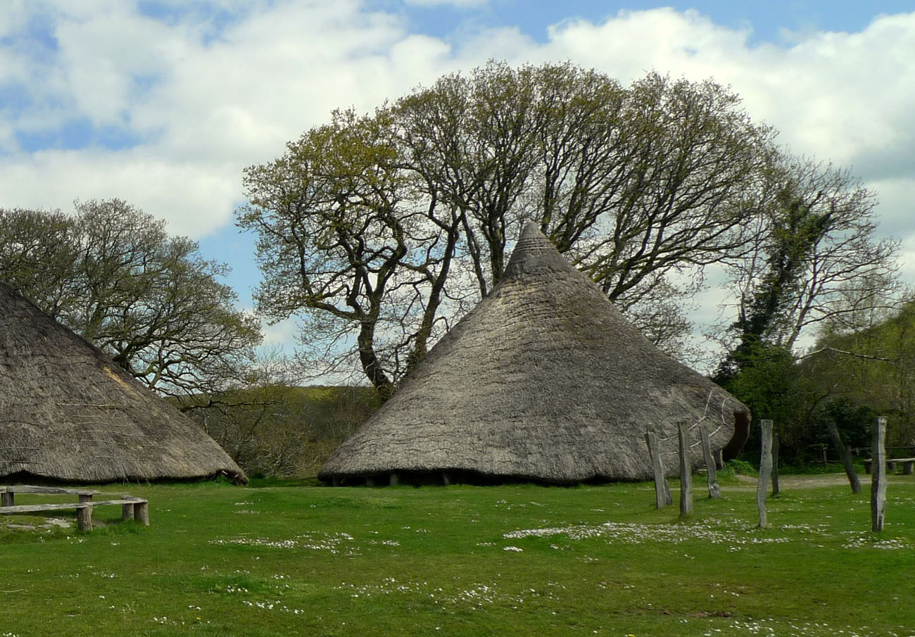
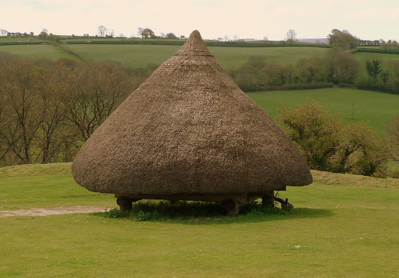
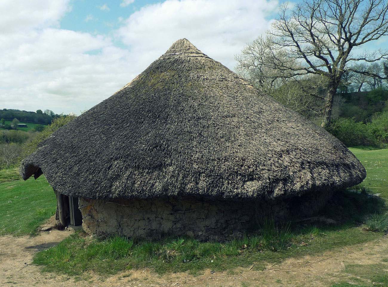
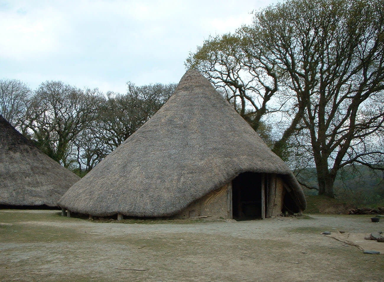
Within the settlement were roundhouses, ranging from 5 to over 15 meters in diameter, which were the standard form of housing in Britain from the Bronze Age through the Iron Age, and in some areas even into the post-Roman period. It were constructed of clay and wooden posts, with the largest building having two rings of posts: an outer ring forming the walls and an inner ring providing additional roof support (the so-called double-ring form). The posts forming the walls were set in concentric trenches dug into the ground or in individual pits, then connected with wattle and covered with clay. The pits were not deep, but after weaving hazel wattle between the posts, the tension provided a rigid cylinder, reinforced by the application of clay both inside and outside the house. The post-roof supports were sometimes set on slate slabs to protect against moisture, which, when the house floor was raised to a higher level, gave the impression of being set in shallow pits. At Castell Henllys, due to the settlement’s courtyard, which sloped downward toward the south, the walls of the roundhouses varied significantly in height around their perimeter, to create a horizontal, and therefore structurally stable, base for the roof.
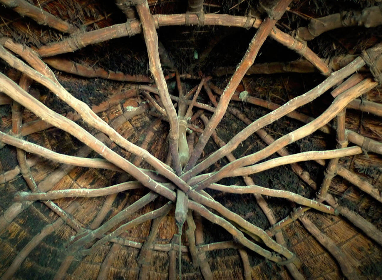
On the exterior, drainage ditches were created near the house walls, directing rainwater away from the building’s walls. The position of the wall and eaves-drip gully suggests that the walls were low and the roof angle steep. The high, conical roofs, devoid of openings, likely served to harmlessly evacuate smoke from the fireplace, which slowly escaped through the roof covering. The roof structure consisted of radially and diagonally arranged rafters, stiffened by beams laid horizontally across the entire width of the building, above the heads of the occupants (without these beams, the structural stability was insufficient). Some rafters likely reached all the way to the top of the roof, others only to the horizontal beams, and all could have been connected by thinner, horizontally placed purlins to which bundles of reed thatch could be tied. The thatch could not be too dense, as this would hinder the removal of smoke from the fireplace. Furthermore, looser thatching prevented birds from building nests within it. The posts were most susceptible to rodents and rot, but a properly constructed wattle-and-daub wall eventually provided such a stable base for the roof that it could even assume the role of structural support.
The walls of roundhouses likely lacked windows, due to a reluctance to weaken the structure and concerns about cold and drafts. Furthermore, they would have been of little use, as the roof eaves were close to the ground, protecting the walls from erosion and creating storage space under the roof. Entrances were quite wide, facing south or east, and in some cases, the two doorway pits were so massive that each had to accommodate a deep-set, tall wooden post. For this reason, door lintels could be high, and the eaves at these locations could be raised to facilitate entry and alter the angle of the roof slope. In exceptional cases, houses had two entrances, located opposite each other.
Current state
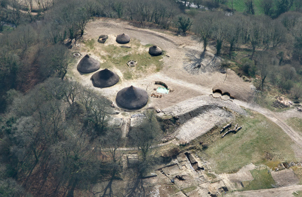
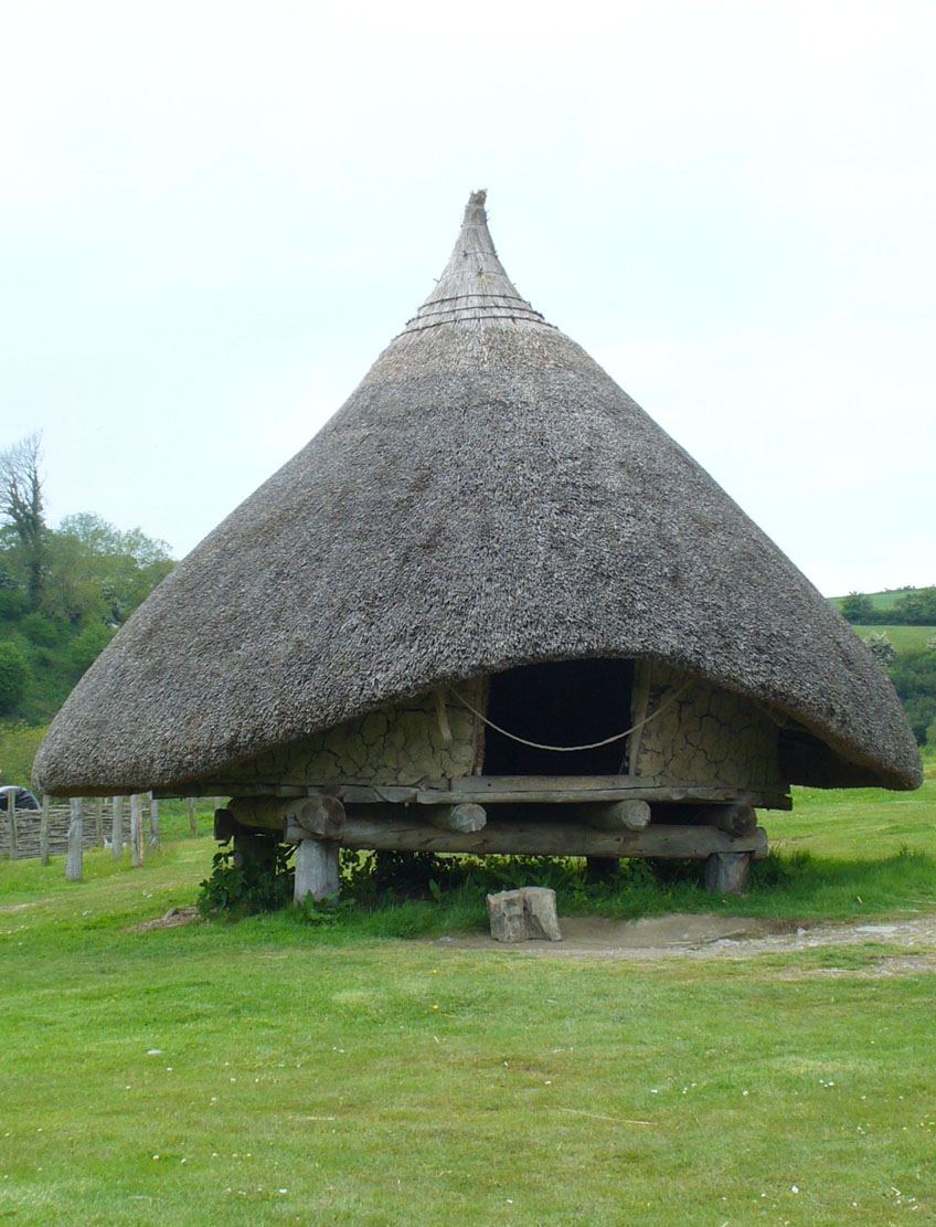
As a result of archaeological excavations that have been carried out for more than forty years, Iron Age thatched roundhouses at Castell Henllys have been reconstructed on their original foundations. The roundhouses were recreated using a wide range of materials, including wood, various types and sizes of reeds, clay, dung, and hemp rope. To date, four houses and one granary have been reconstructed, with only the largest structure in the northeastern part of the site having dimensions that differ from those discovered during the archaeological excavations. Although these are the main attractions, Castell Henllys also houses a visitor center with interactive exhibitions, a shop, and a café. Furthermore, earthen ramparts are still visible in the area.
bibliography:
Cunliffe B., Iron Age Britain, London 1995.
Driver T., The Hillforts of Iron Age Wales, Eardisley 2023.
Meek J., Mytum H., Experimental archaeology and roundhouse excavated signatures: the investigation of two reconstructed Iron Age buildings at Castell Henllys, Wales, “Archaeological and Anthropological Sciences”, 12/2020.
Mytum H., Castell Henllys excavations 1997 field raport, [n.p.p.] 1997.
The Royal Commission on The Ancient and Historical Monuments and Constructions in Wales and Monmouthshire. An Inventory of the Ancient and Historical Monuments in Wales and Monmouthshire, VII County of Pembroke, London 1925.