
History
In the 16th century, the bridge was mentioned by John Leland, a renowned antiquarian and the father of local historiography, who visited Bridgend around 1539 (“whereof that part that stondith on the western side of the bridge is caullid Castelle Newith, and is in West Thawan, and that part of it that is on the eastern side of the bridge is caullid Henecastelle”). Interestingly, he described the bridge as consisting of four spans, not five, which suggests that it had been rebuilt by then, or that one span had already been hidden by urban development. The Bridgend Bridge was also schematically depicted on Christopher Saxton’s map of Glamorgan from 1578.
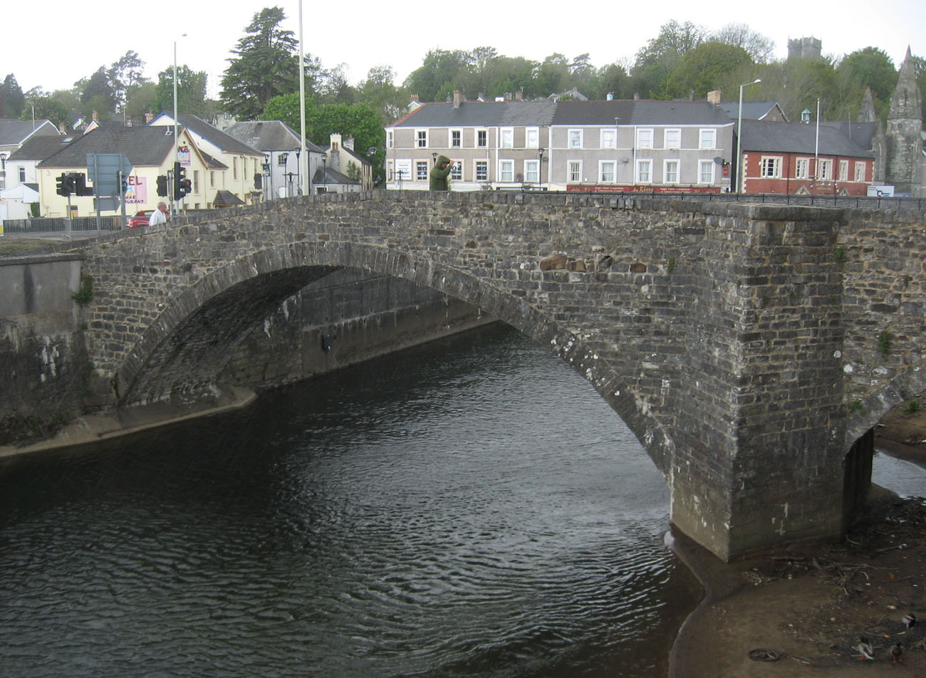
In 1775, a flood destroyed the western riverbank, damaging two of the bridge’s arches on the western side of the river. These were then rebuilt as a single, double-span arcade. Another, eastern arcade disappeared by 1830, when urban development encroached on the riverbank, and the end of the bridge was connected to the rear of the houses. In 1920, the bridge was closed to motor vehicles, leaving it as a pedestrian bridge.
Architecture
The bridge spanned the River Ogmore, between the castle and settlement of Newcastle to the west and the smaller hamlet of Nolton to the east. The terrain on the eastern side of the bridge was likely relatively flat, while in the west, close to the bridge, it began to rise towards the castle to the northwest. The original medieval bridge structure was five-span, with three riverside arcades and smaller flood arches on each bank (water only covered them when the river level was high). The arcades were likely constructed of ashlar voussoirs. It were separated by simple starlings with pointed ends, intended to weaken the river current and strengthen the bridge structure.
Current state
The bridge now consists fewer spans than originally, wedged into the concreted banks of the artificially regulated river. Only two spans are visible to the naked eye, while others may be hidden beneath modern buildings. The wide western arch is entirely modern, built in the 18th century by connecting two collapsed, shorter medieval arches. The smaller eastern arch likely dates from the late Middle Ages, but it has certainly undergone early modern renovations and reconstructions.
bibliography:
Newman J., The buildings of Wales, Glamorgan, London 1995.
Poucher P., Coed Parc, Newcastle, Bridgend. Archaeological Desk-Based Assessment, [n.p.p.] 2016.
Salter M., Medieval Bridges, Malvern 2015.
Toulmin-Smith L., The itinerary in Wales of John Leland in or about the years 1536-1539, London 1906.