
History
The hill known today as Sharp Rock (Ostra Skala) has been inhabited since the Eneolithic times. Its convenient form for defense was noticed by the Celts, and specifically the population creating the Puchów Culture, which was a combination of Celts and representatives of the Lusatian Culture. The Celtic defensive settlement over time grew to the lower slopes at the foot of the mountain, from where water, food and work were provided for the citadel at the top. On the other hand, the population living below, could get to the fortifications in time of danger and find shelter from enemies.
The favorable location of the stronghold was rediscovered at the turn of the 8th and 9th centuries by the Slavs, who renovated part of the fortifications and erected new residential buildings. The scale of the complex would indicate that the hillfort probably performed a central administrative function in the region at that time. Although it survived the Hungarian invasion and the incorporation of the Orava region into the Hungarian state, its role probably declined in the 10th century. In the second Slavic phase, it was settled until the turn of the 12th and 13th centuries, when it was finally abandoned.
Architecture
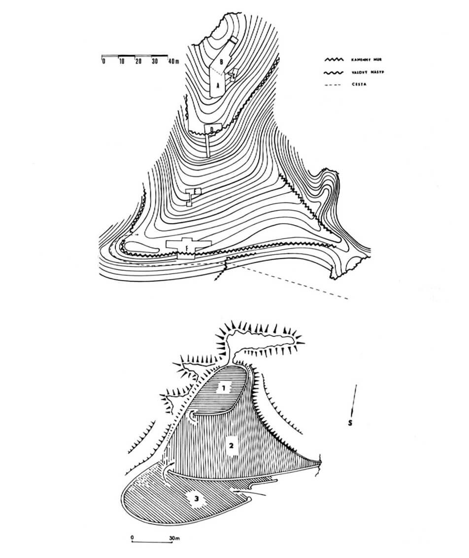
The hilllfort was erected on a rock massif with an absolute height of 812 meters above sea level. From the south, as well as from the east and west, its protection was provided by stone, practically vertical escarpments, falling into valleys to a height of 50 to 70 meters. Gentle slopes devoid of rock outcroppings were formed by nature only on the north side, which also became a place where outer baileys developed. On the western side, the pass separated Ostra Skala from the neighboring, more extensive peak of the hill called Tupá Skala, also inhabited at various times.
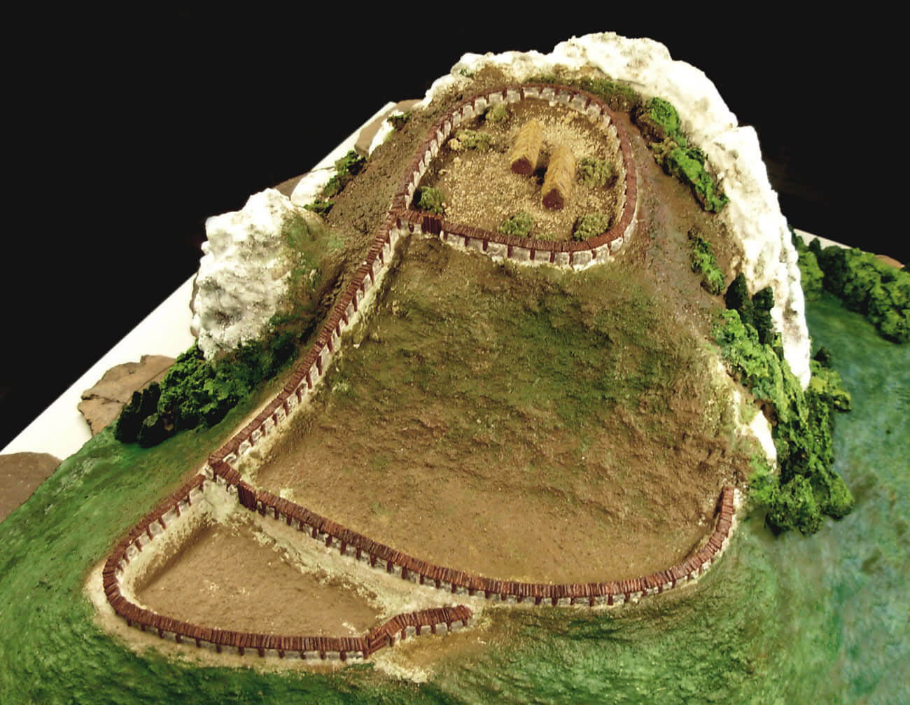
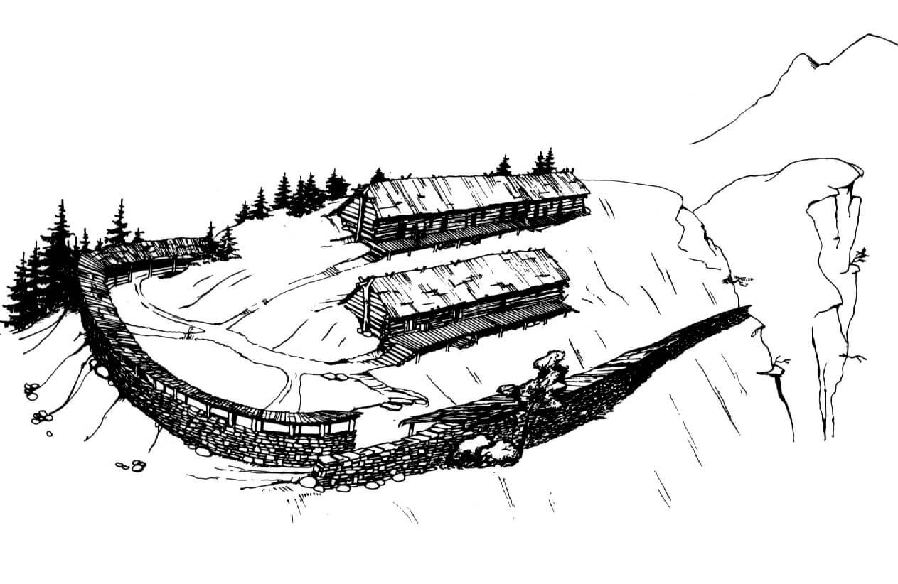
In the La Tène period, access to Sharp Rock led through a gate from the north-west. Behind it was a lower courtyard of a horseshoe shape in plan and a relatively sloping terrain in the south. The entrance to the middle courtyard was enabled by the second gate on the eastern side, located near the corner of the first courtyard. The middle, most extensive courtyard, due to the slope of the hill, was probably not permanently inhabited, it rather served a defensive and refugial role in the event of a danger. The main residential buildings of the stronghold were located in the third, highest part on the hill, where they were protected by separate fortifications. They had the form of two rows of houses, situated on a previously leveled area, at different heights on the north-south line. In the middle of these buildings there were massive pillars, probably supporting the roof truss. The interiors, presumably divided into smaller rooms, were heated with open hearths.
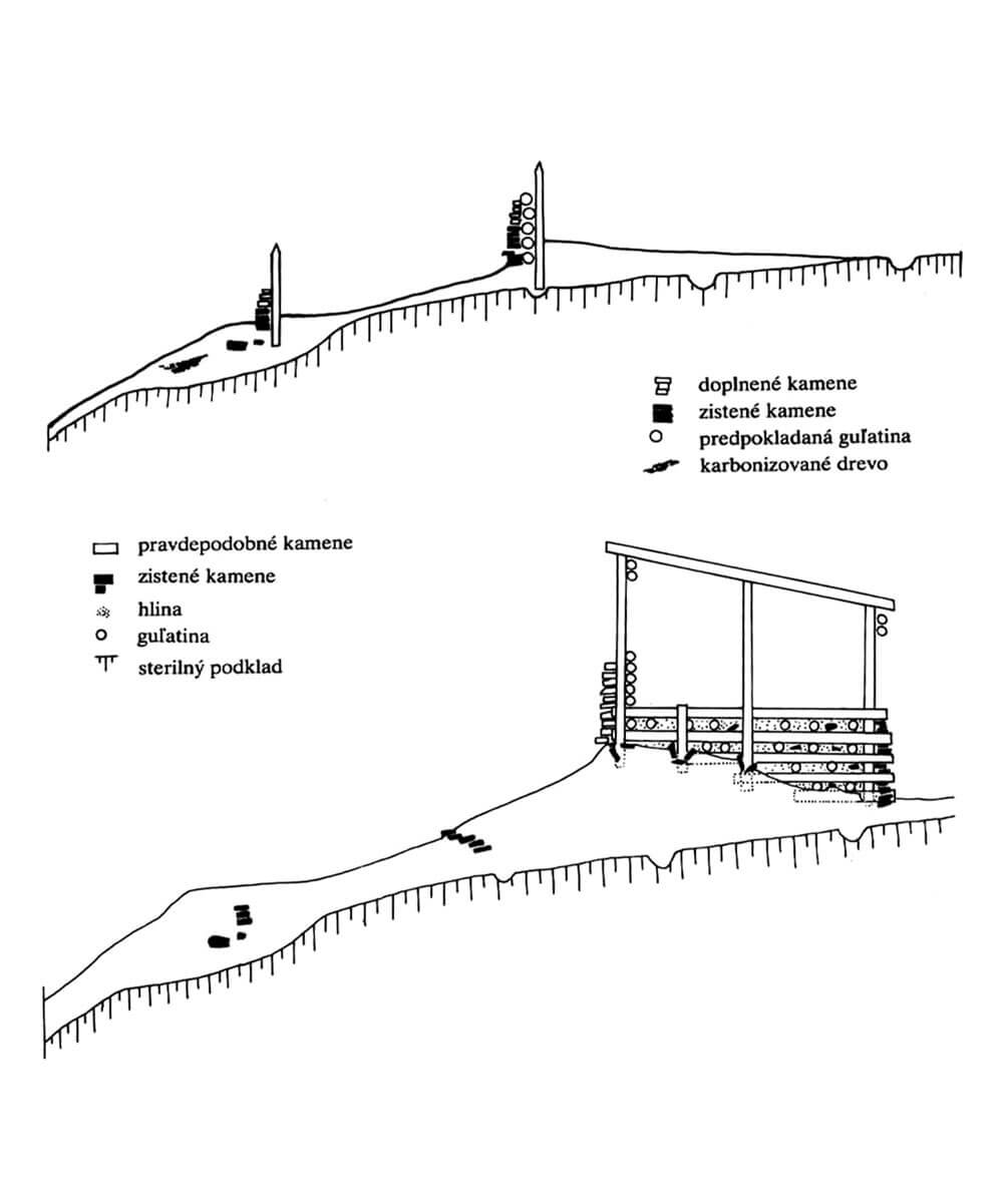
The fortifications in the Hallstatt-La Tène period were 2 to 3 meters high. It had the form of a wooden palisade, preceded by a stone cladding on the front to protect against fire. Such fortifications protected two outer courtyards, while the main, highest part of the stronghold was surrounded by a high earth rampart with a wooden chest structure, also clad with stones from the outside. In the crown of this rampart, a wall-walk could run, protected by a parapet made of a palisade.
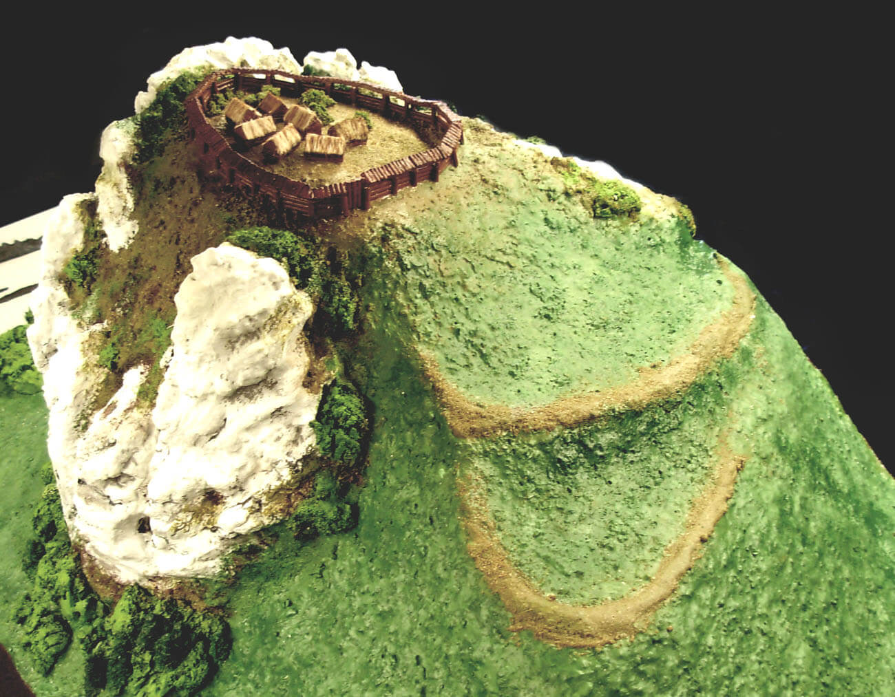
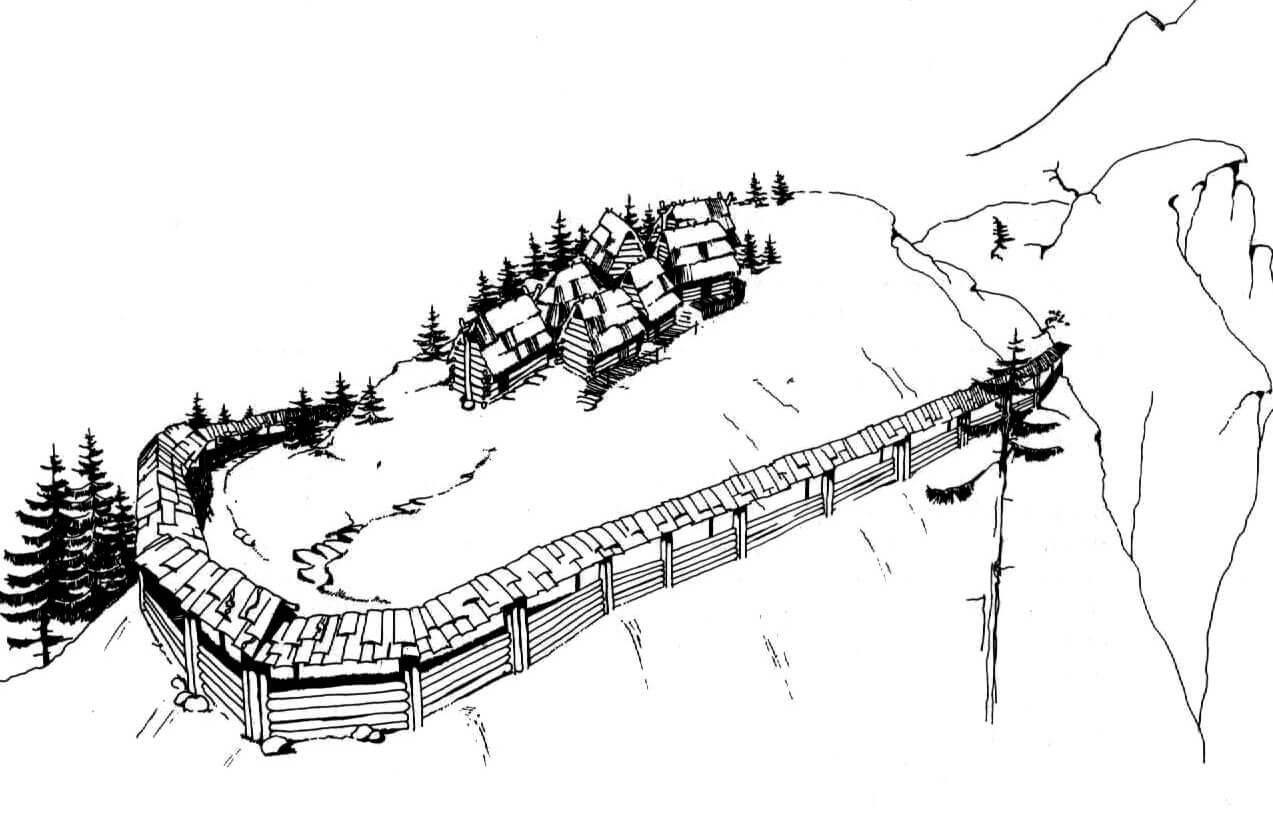
In the 10th-12th century, i.e. in the Slavic period of the hillfort, only the safest, highest part of the former settlement was inhabited. Houses were erected on it in the log technique, i.e. built of horizontally laid wooden logs joined in the corners. The individual houses were no longer grouped in rows, but separated by open spaces, though they were clustered at the highest point of the hill. The technique of building fortifications also changed. It were made only of wood, in the form of a palisade embedded on older earth embankments. Due to the use of the former embankments, the range of the upper part of the stronghold has not changed.
Current state
Today, the relics of the hillfort attract attention with their location on a picturesque hill, apart of the rocky escarpments covered with a dense forest. The most convenient trail leads to the site from the town of Vyšný Kubín. On the hill, earth embankments of the former fortifications have been preserved, especially in the middle and upper courtyard, but hardly visible due to the growing trees. On the neighboring hill on the west side, called Tupá Skala, there was another fortified settlement related mainly to settlements from the period of the Lusatian Culture.

bibliography:
Čajka M., Drahoslav H., Včasnostredoveké hradiská na Orave v kontexte hradísk na strednom a západnom Slovensku, “Slovenská Archeológia”, LII, 1/2004.
Čaplovič P., Orava v praveku a včasnej dobe dejinnej, Bratislava 1987.