
History
In the middle of the 13th century, the land on the left bank of the Hron was in the hands of the Archbishops of Esztergom. From 1243, this office was held by István (Štefan) Báncsa, who granted the lands on Hron to his brothers: Vincent and Peter Báncsa (de Vancha). They founded the Šušol Castle (“castro Susol”), recorded for the first time in documents in 1253. Together with the nearby Revište Castle, it was built to protect the route running along the Hron River and the nearby toll station. Both castles also closed access to the gold-bearing areas in the Štiavnica and Kremnica Mountains. Although it were not built at the same time, over the centuries they often shared similar fates and owners.
Vincent Báncsa, one of the builders of the castle, reached the high position of the Esztergom zupan (comes), which was helped by his brother, the archbishop, who later became a cardinal. Other members of the family also often held high Church offices, so the family quickly began to lose heirs in the late 13th century. Moreover, at the beginning of the 14th century, the castle could have been captured by Máté Csák (Matúš Čák), a magnate sovereignly ruling over the northern part of the Kingdom of Hungary, during whose time a thorough early Gothic reconstruction of the initially modest castle was carried out. After the fall of Csák in 1321, the owner of the castle could change again, as indicated by the change of name from Šušol to Šašov, associated with a certain Ján Sas. In 1340, the castellans Ján, son of Sas, and Imrich Beče, serving Charles Robert, the king of the new in Hungary Anjou dynasty, were recorded in documents. Presumably, after the end of Csák’s conflict with the Hungarian ruler and his supporters, the castle was taken by Charles I, who gave it to his loyal supporters.
In 1387, King Sigismund of Luxembourg exchanged the Čabrad Castle for Šašov with Frank from Sečany (Szécsény). Frank and his brother Šimon only owned the new estate for a short time. Already in 1389, the king took the castle and the customs house from them, giving Topoľčany instead. The profitable Šašov gave to his courtier Leustach of Jelšava. Seven years later, the owner of the castle, by the will of the king, changed again to the steward Juraj of Štítnik and his brother Michal. Šašov returned to the ruler in 1409, this time for longer. In 1424, the castle began to be treated as a seat of royal spouses. The first was Barbara, the wife of Sigismund of Luxembourg, who probably never came to Šašov, preferring the nearby, more convenient Zvolen. After the death of Sigismund of Luxemburg, the local estates were inherited by his and Barbara’s daughter, Princess Elisabeth, on whose behalf Šašov was held by Captain Peter Koler (Kolár), a supporter of Jan Jiskra, a mercenary fighting on the side of the Habsburgs, and later Ladislaus the Posthumous. Koler received the title of captain from Jiskra in 1448, which made him feel confident enough that in the mid-15th century he often came into conflict with townspeople and miners from nearby Banská Štiavnica. Finally, in 1464, the castle returned to the authority of King Matthias Corvinus, who gave it briefly to Ladislav from Úpor. The new owner lost Šašov due to a conflict with the king, rebellion and accusations of treason.
In 1490, Queen Beatrice, the widow of Matthias Corvinus, gave Šašov and Revište to the royal treasurer, Urban of Veľká Lúca, his brothers and heirs, as a deposit for a loan of 16,000 zlotys. Until the beginning of the 16th century, the owners of the castle had to change often, which led to conflicts and assaults, during which the ownership of the castle was consolidated by the Dóczy family related to Urban. Dóczys sued their neighbors for their estates, and after unfavorable verdicts, they waged private wars with them. They became unfamous for plundering the monastery in Hronský Beňadik and for repeatedly ravaging the lands of the Union of Seven Mining Towns. Their bad reputation spread throughout central Slovakia. However, this did not prevent them from holding high offices in the state: they were zupans, guardians of the crown, military commanders. The family died out in 1647, when its last representative, Sigismund Dóczy, was captured by the Turks and beheaded on the market square in Żarnowica, and his wife of extraordinary beauty was sent as a gift to the sultan.
In 1650, the castle and the adjacent property were bought by Gaspar Lippay, but his descendants did not enjoy the castle for long. During the Thököly uprising, which broke out in 1672, Šašov was captured and plundered by the hajduks, and in 1676 damaged during the recapture by the imperial Habsburg army. Further damages could have been caused by military operations during the anti-Habsburg uprising in the early 18th century. In 1708, the imperial troops were to set fire to the building, so the dilapidated castle was finally abandoned and fell into complete ruin.
Architecture
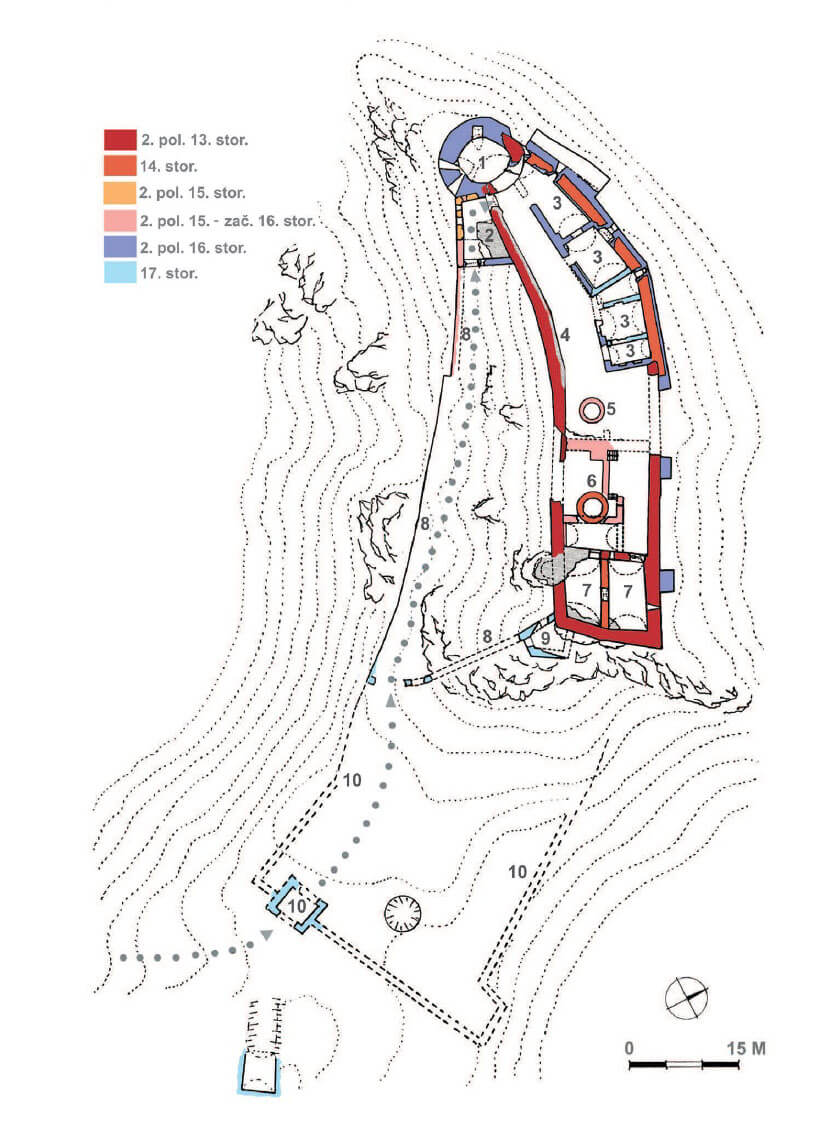
Initially, the late Romanesque castle consisted of a stone perimeter of defensive walls, about 1.7 meters thick, shaped to match the form of the highest point of the terrain in the eastern part of the rock ridge. It is not known whether a stone building was located inside the walls, or whether the entire residential buildings were still of wooden construction, because the extensive early Gothic reconstruction from the beginning of the 14th century overlapped with the original premise.
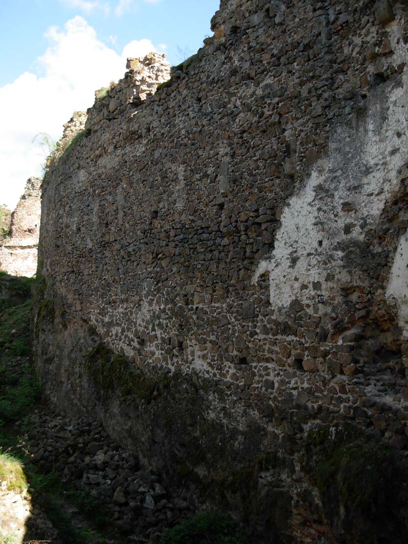
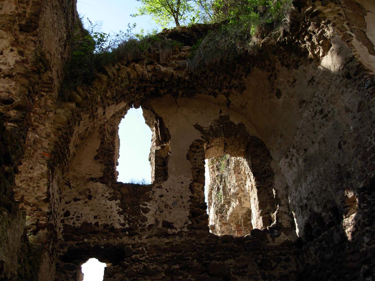
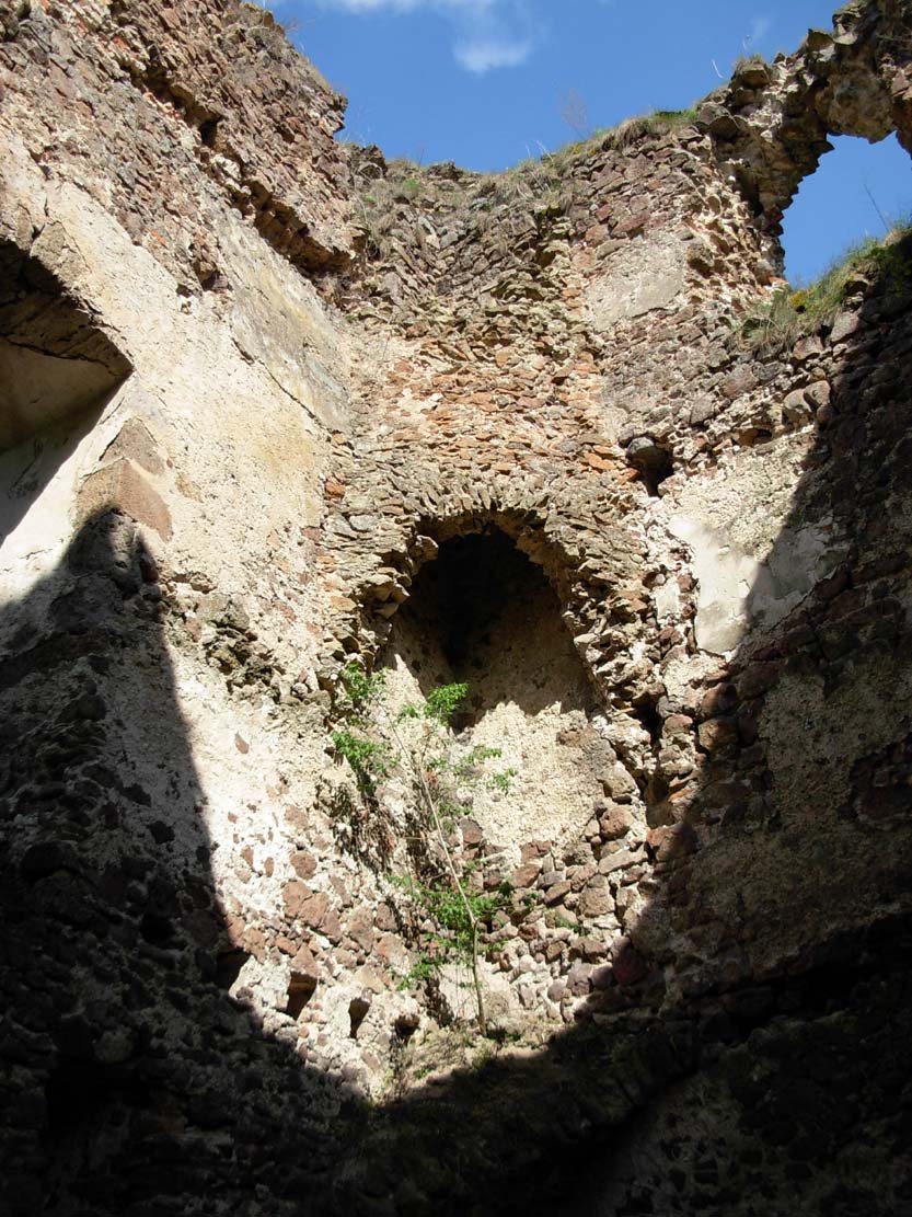
The walls erected in the early fourteenth century covered a larger space of the rock ridge, creating a slightly curved courtyard measuring approximately 75 x 16 meters. It were 6-8 meters high, equipped with a wall-walk and battlements (merlons 2 meters wide were spaced every 0.8 meters). A gate in the form of an portal in the wall was created in the extreme western part, under the protection of a cylindrical corner tower. On the opposite, eastern side of the castle, the main residential building was created, located at the highest point of the hill. The building had dimensions of 15 x 12-13 meters and at least three floors giving the character of a massive tower house. The entrance to it led from the ground level from the side of the courtyard. The lowest storey was single-space, illuminated by two windows and covered with a flat ceiling. Probably the upper floors were also covered with ceilings. The early Gothic castle also had a four-sided tower measuring 5.8 x 4.7 meters, located entirely inside the eastern part of the courtyard (its southern wall was in line with the perimeter wall of the castle). The entrance to it led from the north through a staircase carved in the rock.
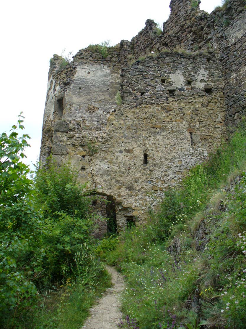
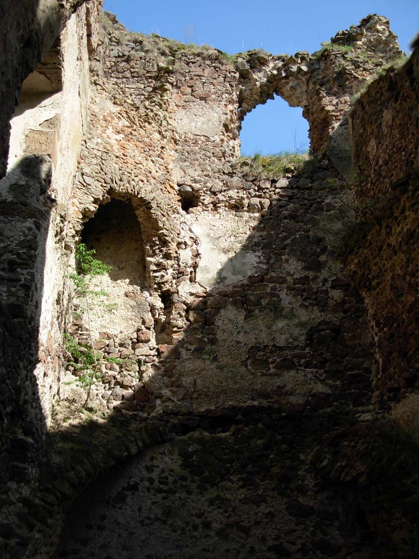
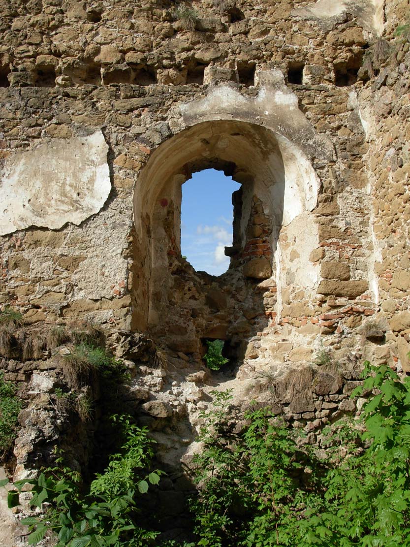
In the second half of the 14th century or at the beginning of the 15th century, the main residential building was thoroughly rebuilt. Its dimensions were similar to the older structure, but from the height of the first floor the walls were rebuilt or even dismantled and built from scratch. The interior is divided into two rooms both on the ground floor and on the first floor. The residential chambers on the floors were covered with wooden ceilings, moreover, a new entrance was created from the courtyard leading directly to the first floor, and windows in Gothic frames were inserted into the walls. In front of the palace there was a cylindrical water tank with a diameter of 2.6 meters and a depth of 7 meters, made of carefully worked ashlar. Around the beginning of the 15th century, the defensive wall of the castle in the southern part was raised and crowned with a wooden hoarding porch, while the northern part of the wall, better protected by the natural conditions of the terrain and not adjacent to the access road, retained the old battlement.
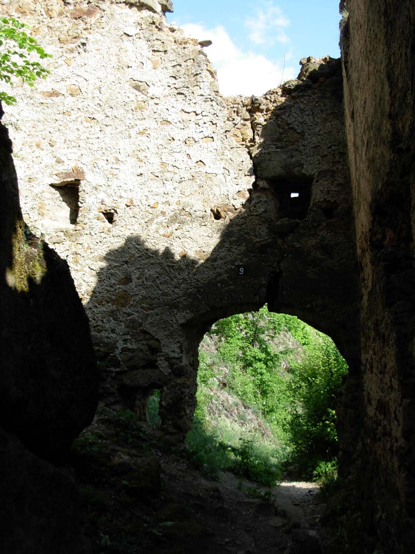
In the second half of the 15th century, a trapezoidal foregate measuring 12 x 8-11.5 meters was created in front of the castle gate. From then on, the entrance had the shape of the letter L and was equipped with a drawbridge over a pit carved in the rock. In addition, it was flanked by an early Gothic cylindrical tower, at the foot of which it was located, and the access road itself led along the long southern curtain of the castle, under the watchful eye of guards patrolling the porches in the crown of the walls.
At the beginning of the 16th century, the castle began to lack residential space, which initiated another, late-Gothic reconstruction. The main residential building was extended to the west, reaching dimensions of 29 x 15 meters and absorbing the space occupied by a water tank and a four-sided tower. Inside the building, some ceilings were replaced with vaults, a corner fireplace was placed on the first floor, and new, larger windows were created on the floors. In front of the palace, the area of the courtyard was leveled and a second cylindrical rainwater tank was created on it. The internal buildings of the castle were enriched by a northern wing, 33 meters long, added to the defensive wall and slightly bent along with it. In addition, the southern defensive wall of the castle was once again raised, topped with a hoarding dated dendrochronologically to 1503.
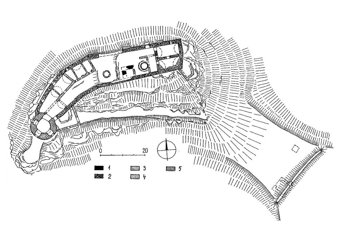
Around the mid-15th century, on the top of the hill, about 200 meters away from the eastern residential building of the castle, fortifications were erected. The building of the watchtower was the result of the development of gunpowder weapons, which posed a threat to the castle due to the hill surpassing it by as much as 45-70 meters. The watchtower also controlled the access road from the valley. Its central part was a wooden building, probably a tower equipped with heating. The fortifications took the form of a pentagon measuring 21.5 x 18 meters, consisting of a 2-meter-thick wall and a palisade in front of which, at a distance of 11-15 meters, an earth rampart was built and a ditch was dug on a plan similar to a circle. The whole had a diameter of about 62-65 meters.
At the end of the 15th century, the outer bailey on the south side of the castle was fortified. It stretched for a length of 59 meters, adjoining the upper ward with its longer side. Initially, it was the outer part of the castle, but in the 17th century it was separated from the second outer bailey by a wall ending at the upper ward with a pentagonal bastion. The protection of the second outer bailey, measuring 35 x 44 meters, located on a flattened area under the castle, was provided by a four-sided gatehouse.
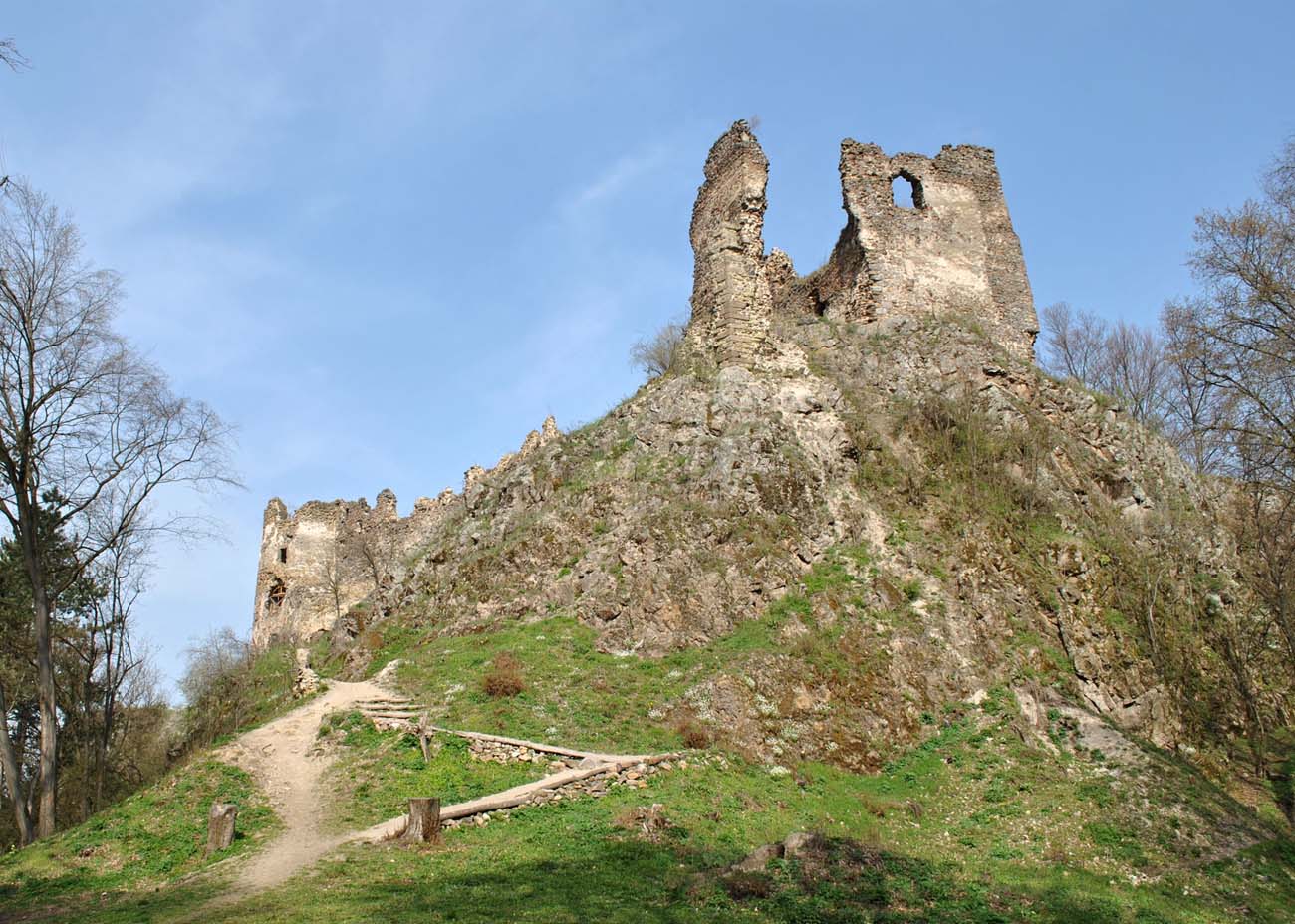
Extensive construction works from the second half of the 16th century led to the demolition of the corner cylindrical tower. In its place a cylindrical, but more massive tower adapted to the use of artillery was erected. This was evidenced by the fact that all storeys were equipped with cannon loop holes and the way the tower was connected to the defensive wall. The thickness of its walls in the ground floor ranged between 2.4-2.9 meters, and the dimensions of the interior with the appearance of an irregular hexagon were 5.5 x 6.5 meters. Along with the construction of the tower, the northern building was thoroughly transformed and the eastern palace was raised.
Current state
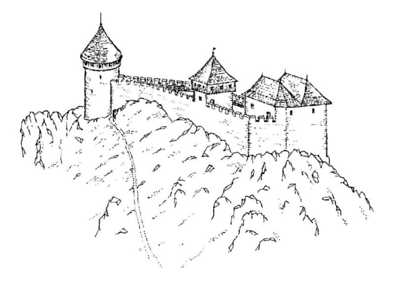
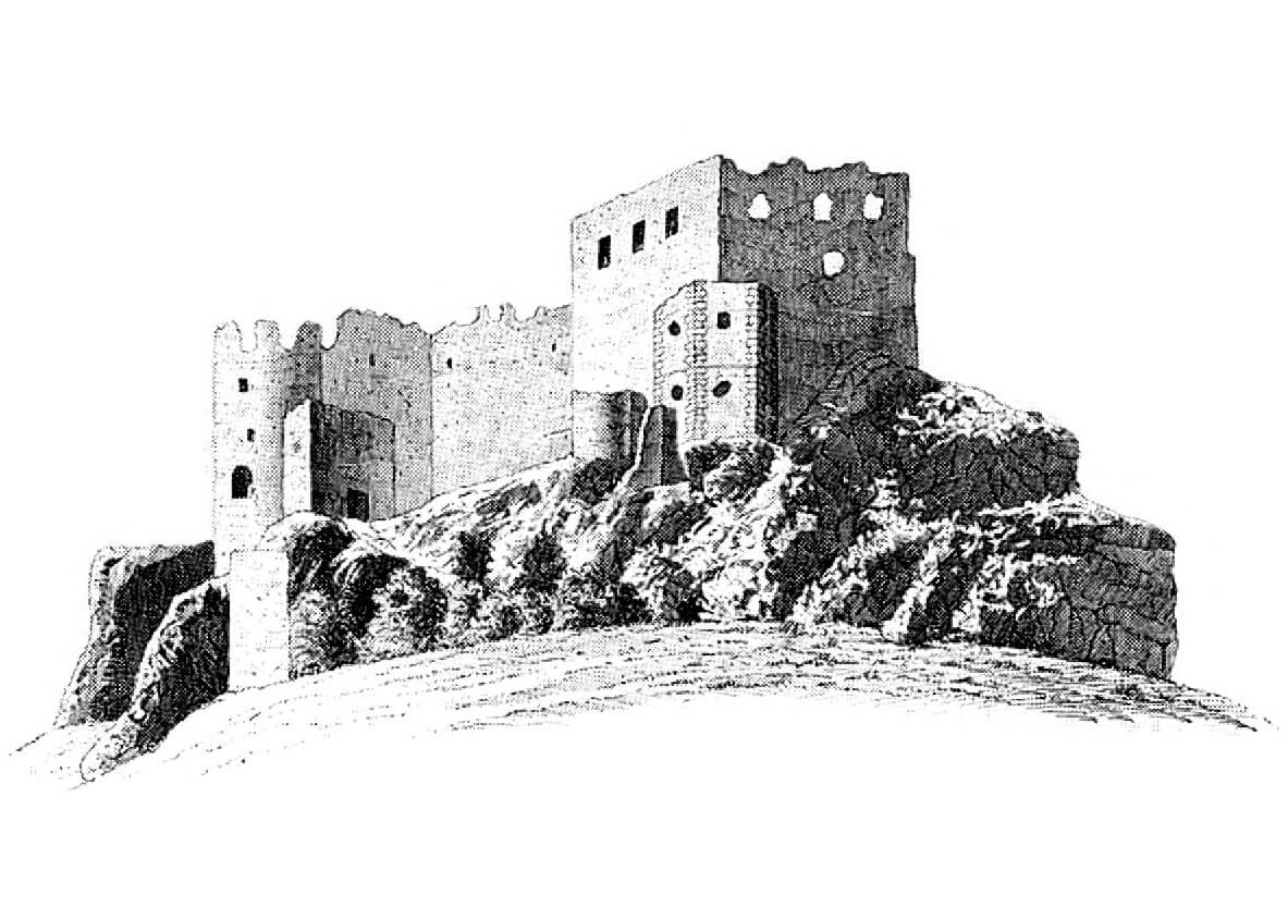
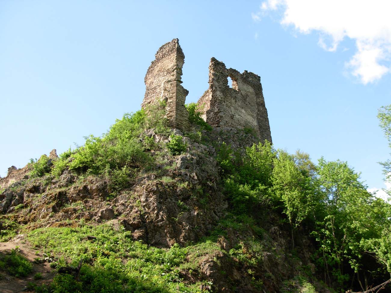
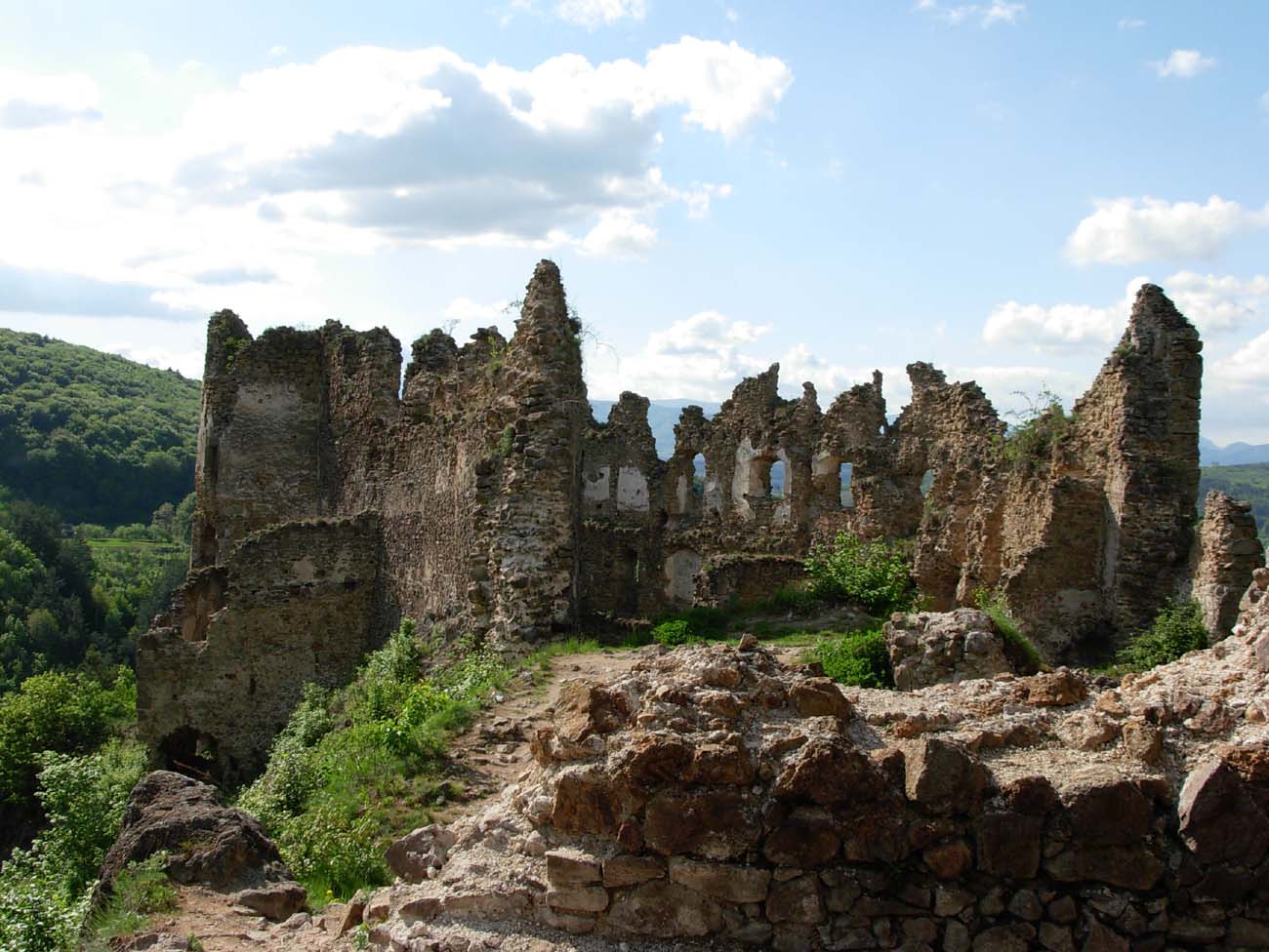
The two youngest baileys that used to form the lower part of the castle have practically not been preserved. From the outer one, located south-east of the upper ward, only fragments of the gatehouse and traces of ramparts and well remain, hidden in the forest. The relics of the southern bailey are limited to short fragments of the wall and the remains of the bastion under the former residential building. The upper ward is today the best-preserved fragment of ruins. Its perimeter walls, although badly chipped, have been preserved in places almost to their full height. What’s more, in recent years intensive renovation works have been carried out, combined with partial reconstruction (e.g. the rear wall of the cannon tower, collapsed during the winter of 1999 and 2000). Access to the monument leads along a path marked with a green tourist trail, leading from the small village of Šášovské Podhradie.


bibliography:
Bóna M., Stredoveké hrady na strednom Pohroní, Nitra 2021.
Bóna M., Plaček M., Encyklopedie slovenských hradů, Praha 2007.
Stredoveké hrady na Slovensku. Život, kultúra, spoločnosť, red. D.Dvořáková, Bratislava 2017.
Wasielewski A., Zamki i zamczyska Słowacji, Białystok 2008.