
History
The first record of Prešov appeared in a letter of King Bela IV from 1247 (“Epuryes”). In 1299, King Andrew III issued a privilege that placed Prešov (“Eperies”) under the law of Spiš, next extended by Louis I in 1374. As a result, Prešov became a free royal town with the right to build its own fortifications. The erection of the fortifications had to begin shortly after this event, because four years later the ruler released the townspeople from tributes, in order to obtain funds for construction works. He also sent his master builder, Ambrose of Diósgyőr, to Presov.
The construction of the town walls dragged on for most of the 15th century, as evidenced by the twelve-year tax-free period under Sigismund of Luxemburg in 1404, and later tax exemptions under Matthias Corvinus in 1459. The monarchs also allowed the acquisition of building materials from quarries, cutting trees and burning lime on royal estates, and their import for the construction of walls. In 1411, the king allowed the sale of salt worth 2,000 florins and transferred the profit to fortification works, and in 1433, Cardinal Julian allowed the inhabitants of Prešov to work on the walls even on Sundays and holidays (after fulfilling liturgical duties in the church), especially due to the danger of an invasion of Hussites. In 1435 (or after the fire of 1418), the perimeter of the walls was expanded and enlarged due to the necessity to include into fortifications town that had grown in the south and west. The last late gothic transformations of the town walls took place in the 16th century.
The medieval fortifications of Prešov, like in most other European cities, began to lose their importance in the 17th century due to the faster development of firearms, artillery and the art of siege. In 1751, Maria Theresa ordered the city walls to be demolished, most of which slightened to the ground by the 19th century.

Architecture
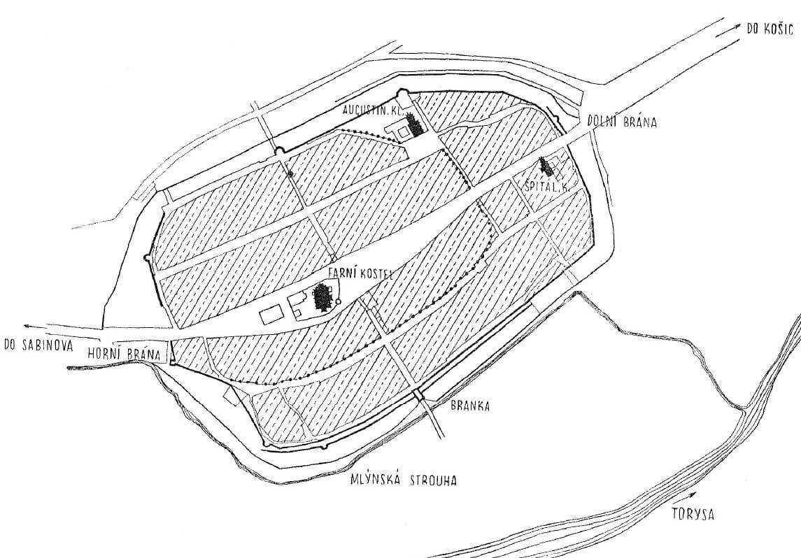
The perimeter of the Prešov defensive walls was built on an elongated oval plan, with longer sides roughly on the north-south line and a slight narrowing on the south-east side. From the west, the town was surrounded by the Torysa River, from which a small mill channel was drawn under the western and partly northern and southern part of the fortifications.
Initially, the ring of fortifications surrounded a small area about 28 ha with a single line, which was the later north-eastern part of the Old Town. This space soon ceased to be sufficient for the developing town, therefore, after the fire of 1418, the suburbs were included in the city wall on the west side (the mill channel was filled in and a new one was dug further to the west) and on the south also the Augustinian monastery and the town hospital with the church were included into the fortifications. At that time, the enlarged defensive circuit covered 48.9 ha (the town was about 800 meters long, 500 meters wide).
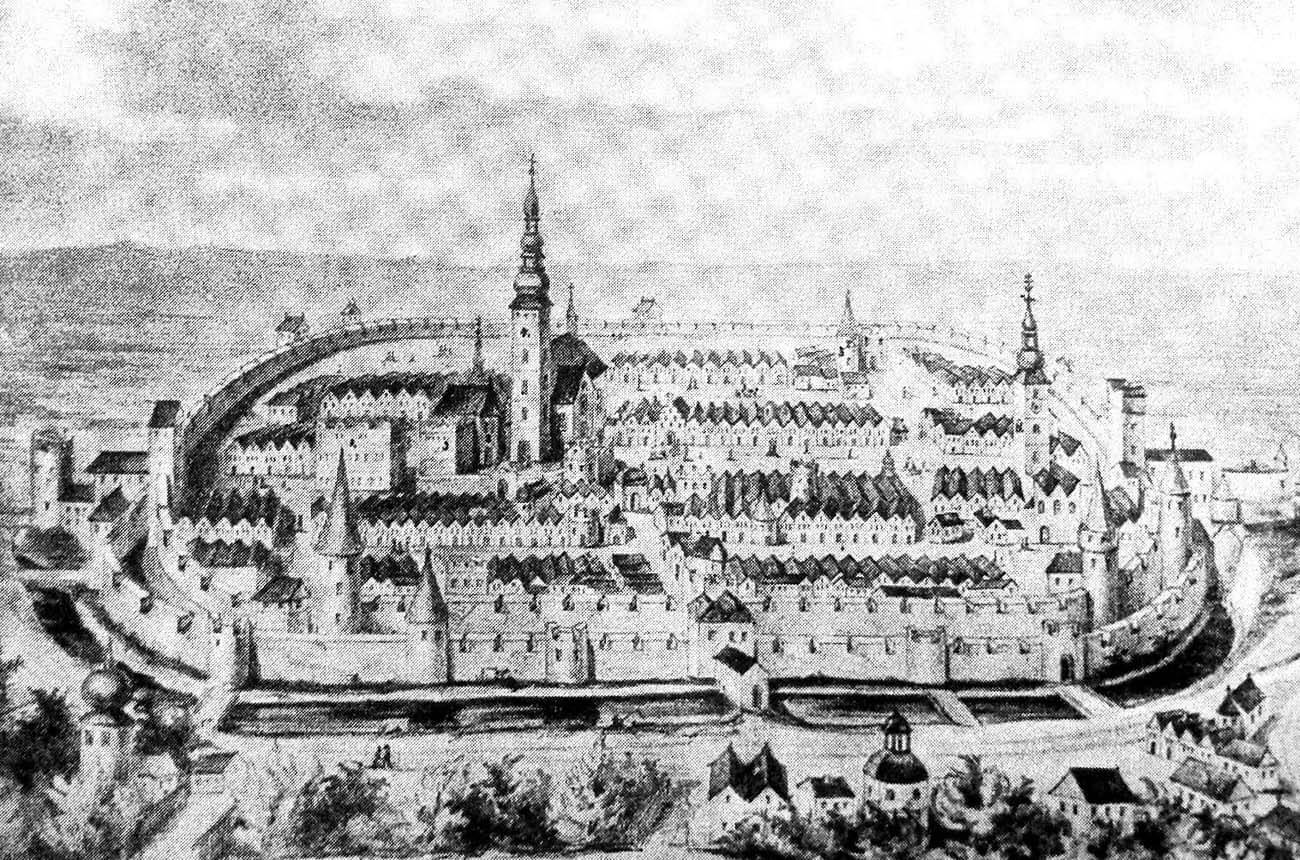
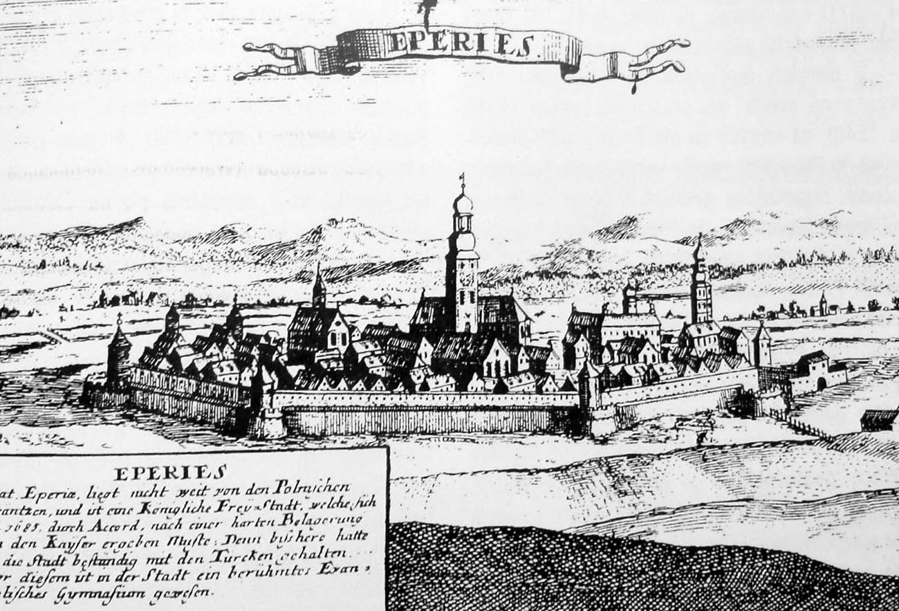
In the peak period in the 16th century, the defensive circuit consisted of two lines of walls, reinforced with numerous horseshoe towers. While most of the towers of the main defensive wall were closed from the town side, high and topped with roofs, the towers of the outer perimeter were relatively low (they slightly exceeded the height of the wall) and mostly topped with battlement, without a roof. The battlement was also crowning both rings of the defensive walls, but at a later stage it could be replaced with a simple breastwork with pierced loop holes and a roofed porch for defenders.
Two main gates led to the town, situated on the north-south axis, on the extension of the main street running through the town square. In the south it was the Lower Gate (Košice Gate), and in the north it was the Upper Gate, directed to the route to Sabinov. Their foregates have reached the form of barbicans. In addition, communication was also provided by two smaller gates: one on the west side (called the Florian Gate or the Small Gate), leading to the river and one to the east. The outer defense zone was an irrigated moat.
Current state
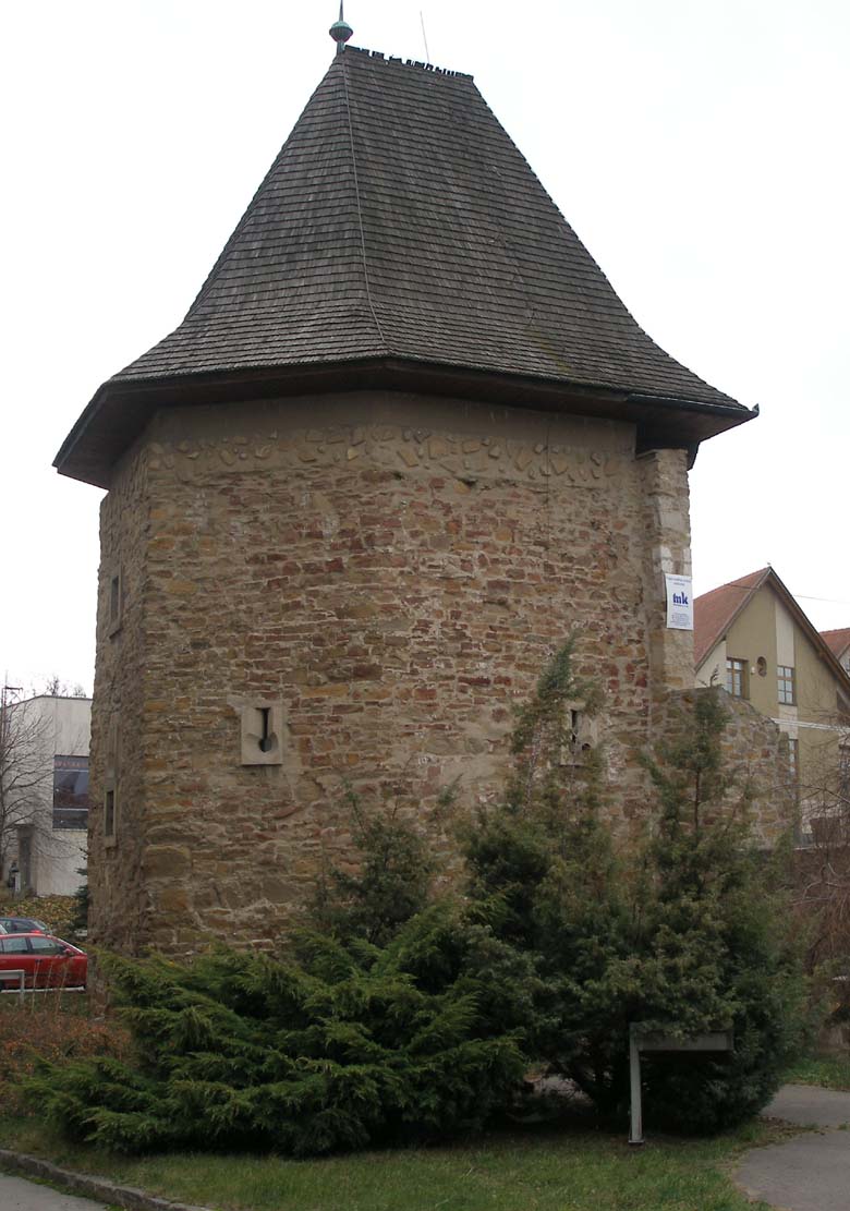
Today, the best-preserved element of the former fortifications is the tower on Kováčska Street. Additionally, the transformed Water Tower on Okružná Street in the northern part of the city have been preserved and Florian’s Gate on the western side, also located on Okružná Street. The latter has completely lost its original stylistic features and today has the form of an early modern residential building with a wide passage on the ground floor.
bibliografia:
Lexikon stredovekých miest na Slovensku, red. Štefánik M., Lukačka J., Bratislava 2010.
Mencl V., Stredoveka mesta na Slovensku, Bratislava 1938.