

History
The castle was built on the order of the Hungarian king Bela IV on the site of an older, abandoned settlement from the 1st century BC, probably shortly after the great Mongol invasion of 1241-1242. It was first mentioned in writing in 1262. It guarded the western part of the Liptov Basin, including a busy trade route running through the Sesterska Valley to Orava and further to Poland.
In the fourteenth century, the castle was ruled by the powerful Upper Hungarian magnate Máté Csák, and after his fall in 1321, the zupan Donch (Donč). Since 1340 it was the seat of the Liptov zupans. At the end of the fourteenth century, the castle was briefly occupied by the Moravian margrave Prokop, from whose hands it was recaptured by the army of Sigismund of Luxemburg. During these fights, the magnate Imrich Perényi was to be wounded in the leg with a spear. Then the castle was still in the hands of the royal zupans, until 1430, when Sigismund donated Liptov to his wife Barbara.
In the years 1431-1434 the castle was under the control of the Hussites. During their removal, it was destroyed, as mentioned in documents from 1440 – 1441. From 1453 it was in the possession of Pongrác of Svaty Mikuláš, who rebuilt it and enlarged it by the eastern ward. In 1458, for merits in the fights with the post-Hussite rebels, Liptov was obtained by Sebastian of Rozhanovice, and after him, since 1459, it was ruled by the Polish magnate Piotr Komorowski, who favored the Jagiellonians in their attempts to gain the Hungarian throne. After the unsuccessful expedition in 1471 of the young Kazimierz Jagiellończyk for the Hungarian crown, Matthias Corvinus forced Komorowski to hand over the castle, which he ordered to burn and demolish in 1474.
Architecture
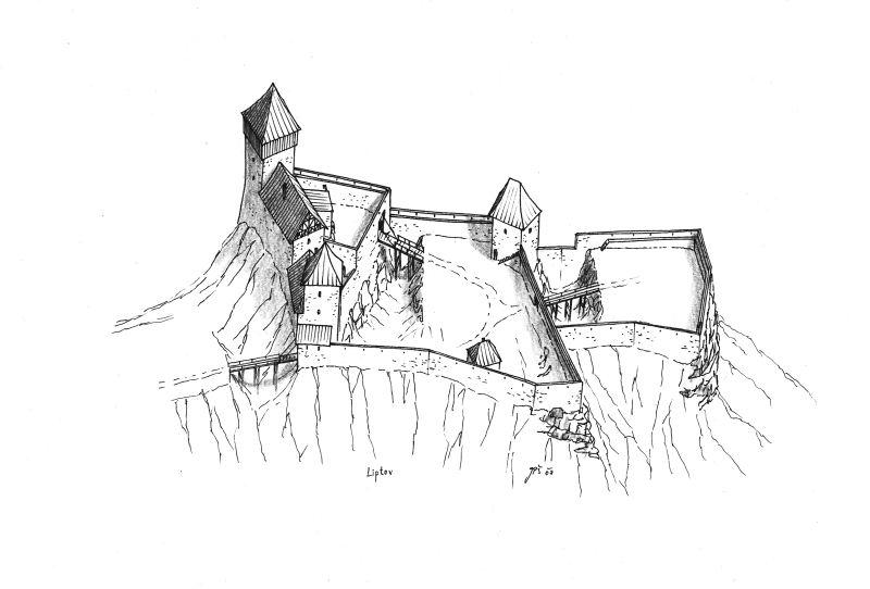
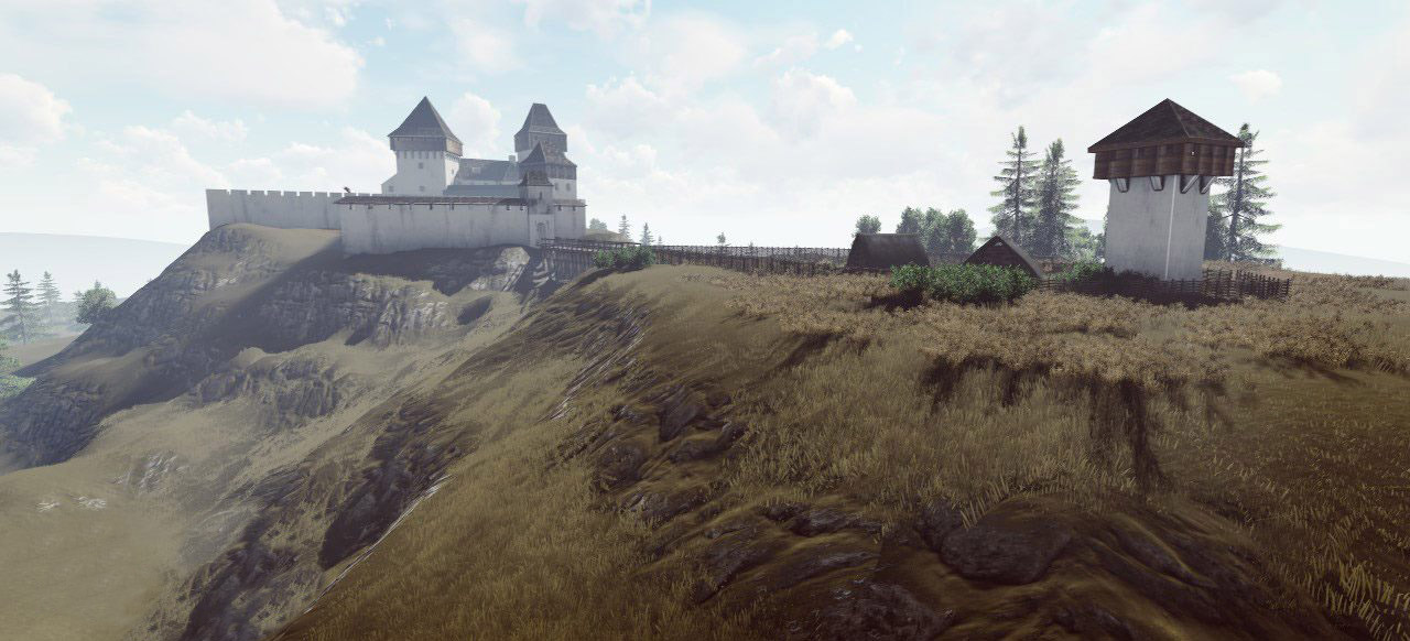
The castle was situated on a high hill, protected on two sides by vertical rocky walls (from the east and west), and on two sides with steep slopes (from the north and south). Located at an altitude of approximately one thousand meters above sea level, it was one of the highest castles in the northern part of the Kingdom of Hungary. Access to it was along the ridge of the hill on the northern side and then through narrow valleys surrounding the castle hill on all sides.
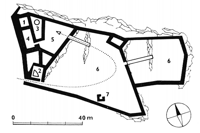
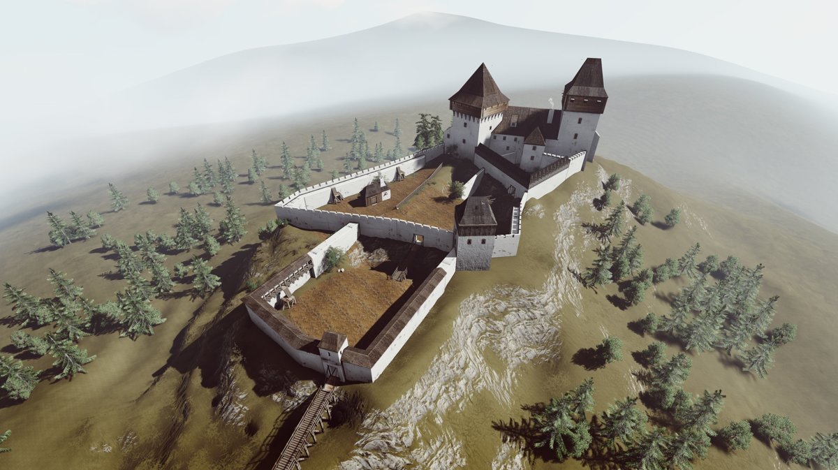
The castle consisted of a residential building and an irregular perimeter of the defensive walls. Perhaps the northern part of the building had the form of a square tower, but its existence in newer literature is questioned, and the square part is considered only as a separate room of the residential building. This would be indicated by the same thickness of the wall as in the rest of the building, although some wooden or half-timbered superstructure of this part cannot be ruled out, as it was the highest place of the castle. The wall on the north-west side had an unusual thickness of up to 4 meters. It secured the castle from the access road, creating the so-called shield wall, protecting the inside of the castle from missles. A miniature courtyard was located in front of the building, housing a rainwater tank (it was not possible to dig a well at such a high altitude), followed by a larger economic ward. The original entrance gate was unusually located in the south-west part of the building, but before the mid-fourteenth century it was moved near the new quadrilateral tower on the south side. Inside tower, a second rainwater tank was placed.
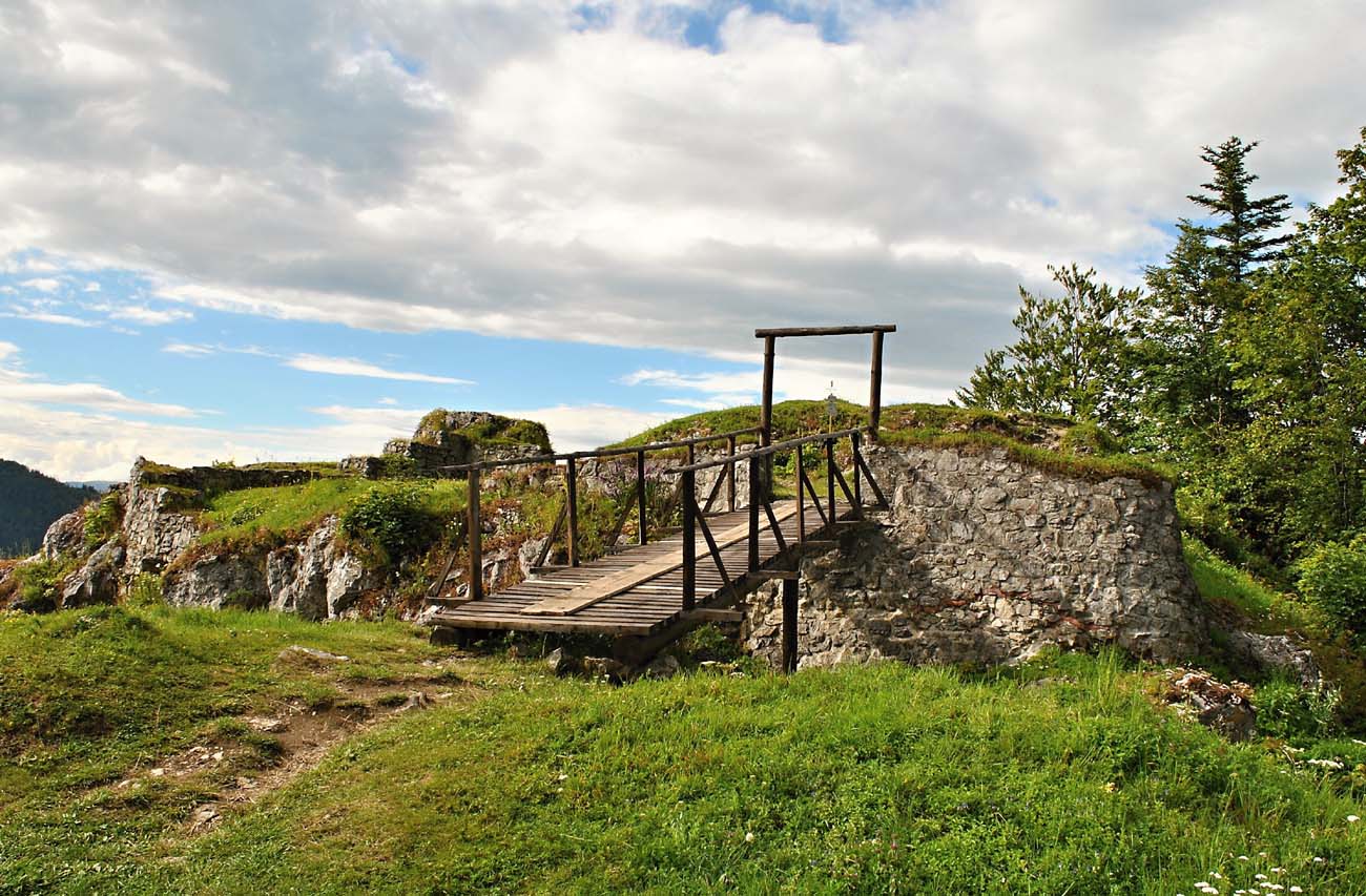
At the end of the 14th century, the eastern outer bailey was fortified with a stone wall, although this part was probably earlier protected by timber fortifications. Perhaps the new wall was reinforced with a four-sided, corner tower on the north side. The first gate was moved to the north-west side of the four-sided tower with rainwater, from where, after passing the drawbridge and reaching the eastern courtyard of the outer ward, the road turned to the middle and upper ward, through a rock carved ditch and a wooden bridge placed over it. In the eastern bailey there was certainly a lighter, wooden or half-timbered economic buildings, among others traces of the forge’s functioning were found there. In the mid-fifteenth century, a low wall was built forming another courtyard in the lower, eastern part of the castle.
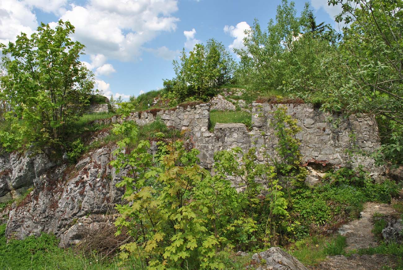
Current state

bibliografia:
Bóna M., Plaček M., Encyklopedie slovenských hradů, Praha 2007.
Stredoveké hrady na Slovensku. Život, kultúra, spoločnosť, red. D.Dvořáková, Bratislava 2017.
Wasielewski A., Zamki i zamczyska Słowacji, Białystok 2008.