
History
The Havránok stronghold was probably an important center of the population of the Púchov culture dating from 300 – 180 BC, in which the dominant Celtic element mixed with the older peoples of the Lusatian culture. The Celts living in the surrounding area belonged to the Kotyn tribe. Their prosperous oppidum was destroyed along with other surrounding Celtic settlements in the early 1st century AD by the Germanic tribe of the Quadi or by the Dacians. The abandoned settlement was re-inhabited in the 11th or 12th century. In the 12th century, a small hillfort or timber castle was erected in its place, functioning until the 15th century. It was first recorded in documents in 1286, when king Ladislaus IV of Hungary gave Mikuláš and Marcel, sons of a certain Ilário, the lands between Vah and Potok, where the Havran family had already settled.
Architecture
The stronghold was built on the Havránok Hill, 692 meters above sea level, which is the south-eastern part of the larger Úložiska Mountain. The slopes of the hill originally down towards the Váh River in the south, while the great massif of the Choč Mountains stretched in the north. In the east, the hill dominated the lower and flatter areas of the Liptov region.
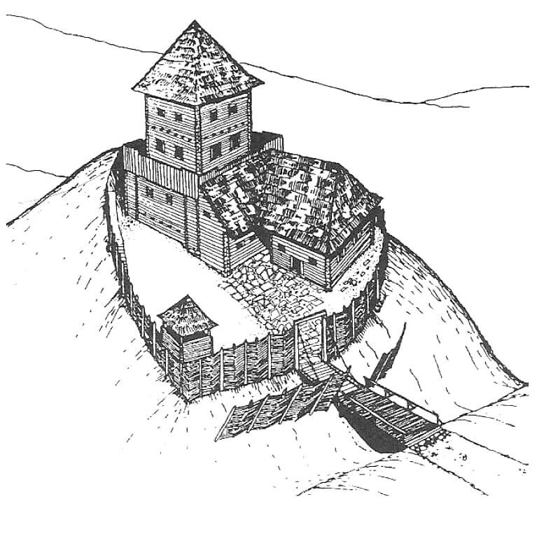
The medieval stronghold was founded on a plan similar to a triangle, orientated with the longer axis on the north-south line. Its protection was provided by a ditch and wooden and earth fortifications in the form of a palisade that preceded it. The ditch was created from the most endangered and most easily accessible southern side. There, two palisade lines were created, and one line on the other sides. The outer palisade consisted of diagonally arranged logs, spaced at intervals of 0.5 to 0.6 meters, between which the space was supplemented with a braid. A similar construction technique was also used for the inner (main) palisade. In addition, in the south-west corner of the fortifications, a tower of log construction technique was erected, which strengthened the defense of the main palisade ring. The gate, located from the south, was preceded by a bridge over 3 meters long and 2.1 meters wide.
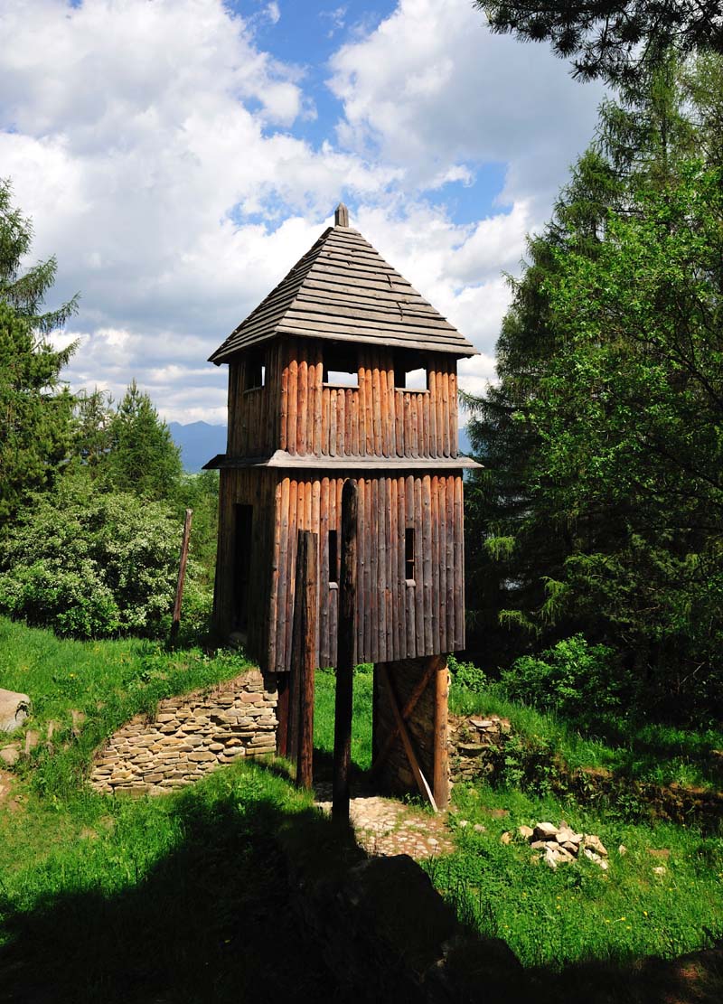
In the northern, highest part of the complex, a four-sided wooden residential tower with clay filling was erected. It had dimensions of about 9 x 9 meters, with slightly protruding corners. The walls were made of hewn logs with a diameter of about 20 cm. The tower had a double structure consisting of internal and external frameworks (wreaths) tied together. For this reason, the internal space of the tower was reduced to an area of 6.5 x 6.1 meters. Presumably, the doubling of the frame structure was used primarily for static reasons, as the log construction technique was not very well suited to the tall structures. The earth-filled log structure of the tower reached the height of the second floor. Its primary role was to strengthen the building, which had three or four residential floors. The builders could also use the earth infill and the outer frame of the tower to multiply the defensive function of the building by building a perimeter wall-walk. More or less in the middle of the interior of the tower, a hollow in the form of a passage with a total length of 9.8 meters was discovered. The passage was cut in the rocky ground at an angle of 65°, with sides from 0.8 to 0.9 meters.
Directly to the southern, outer side of the residential tower was a narrow wing measuring 7.7 x 2.5 meters, through which a paved entrance from the side of the courtyard led to the tower. This extension was also erected in a log construction technique. In addition, in the south-eastern part of the courtyard there was a smaller log building on a rectangular plan with sides of 6.3 x 7.5 meters. The inside of its ground floor was a clay floor, and in the north-eastern corner there was a stove. As there was a lot of pottery in the room, the south-eastern building most likely served as a kitchen. In the south-western part of the medieval stronghold there was a small courtyard with an area of 48 m2, paved with blocks of sandstone and limestone. The road leading to the stronghold was also paved with dry-laid stones, up to 3 meters wide.
Current state
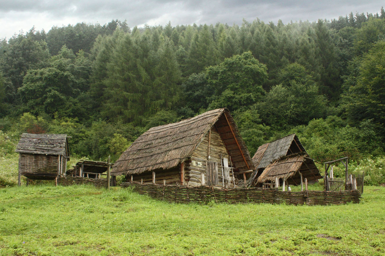
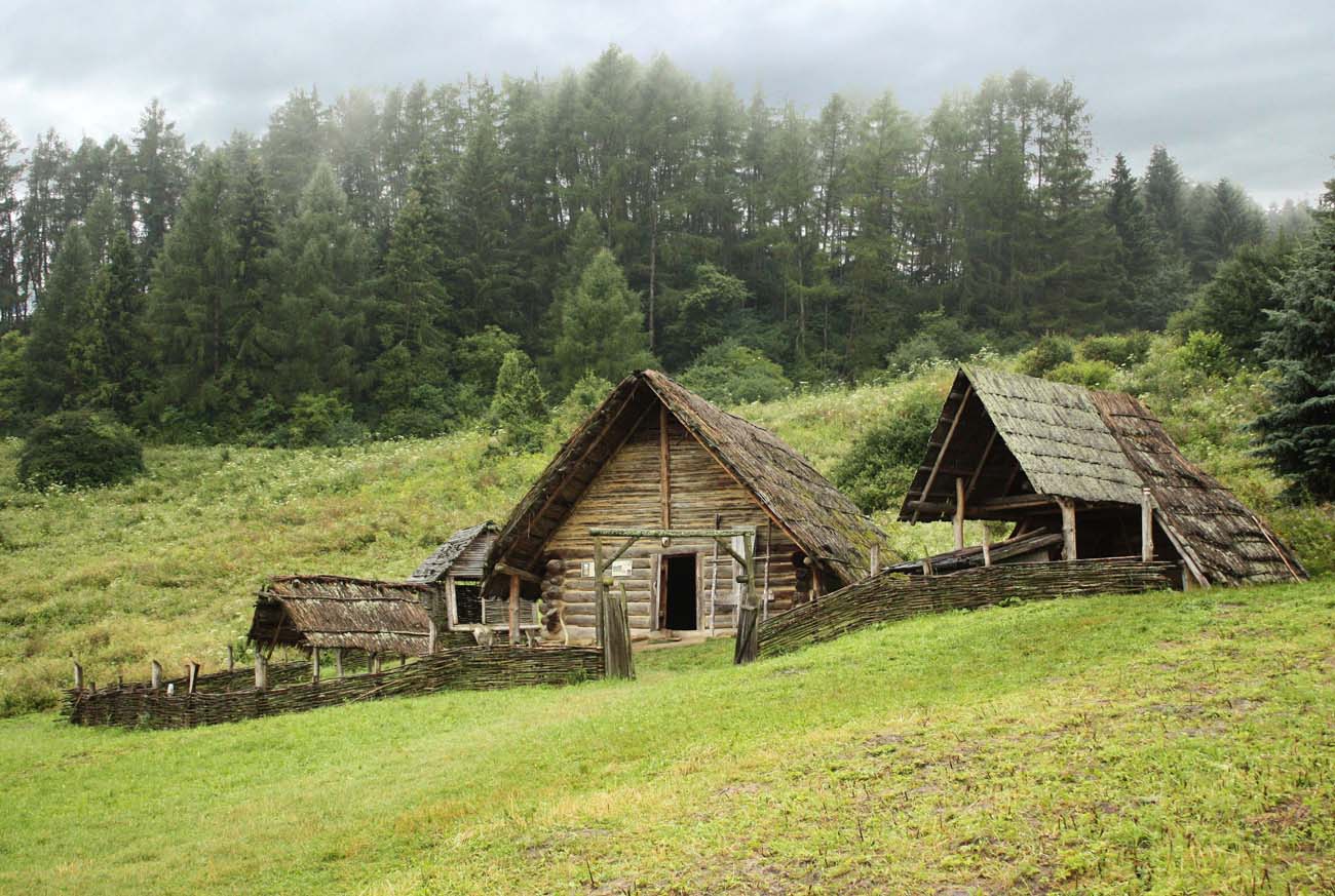
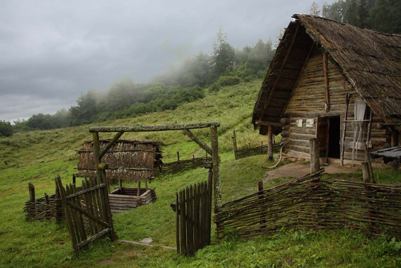
Currently, the stronghold area there is an archaeological park with a pagan temple, a watchtower, ceramic stoves and cottages from various periods. All objects visible in the village are the result of reconstructions preceded by archaeological research. During the summer season, cultural events are organized in the village, such as fencing duels, Celtic religious ceremonies and craft shows. A museum exhibition has been arranged in one of the buildings. The open-air museum is open from June to August: 8:30 – 18:30, in May, September and October: 9:00 – 17:00.
bibliography:
Hanuliak V., Malé stredoveké opevnené sídla v Liptove, „Archæologia historica”, roč. 13, č. 1, 1988.