History
In 1363, the extensive castle estate, which included over 60 villages, was divided into three smaller units: Čičva, Vranov and Skrabské. The castle itself was also divided into two parts, the southern one of which was retained by Master Ladislav, and the northern part by Master Vavrinec and the widow of Mikuláš Perese. In addition, all branches of the family agreed to jointly invest in the repairs and expansion of the castle. Thanks to this, Čičava (Hungarian: Csicsva), although it had ceased to serve as one of the main residential seats of the noble family, did not fall into neglect and the expansion of the castle probably took place at the beginning of the 15th century. The estate was still managed than by Reynold’s descendants, members of the powerful Rozgonyi (Rozhanovcy) family. In 1410, King Sigismund of Luxembourg granted their request and confirmed the validity of the document from 1270, by which Reynold acquired the village of Čičava. This document also recorded the construction of a stone castle by the ancestors of the Rozgonyi family. In 1414, the castle was mentioned again in another document as “castrum lapideum”, while in 1493 its tower and outer bailey were recorded.
In the last decade of the 15th century, all male representatives of the Rozgonyi family of Čičava died out, so the last male representative of the family and a distant relative, who owned estates mainly in other parts of Hungary, was István Rozgonyi (Štefan of Rozhanovce). In order for him to secure his share of the deceased members of the family, the Buda chapter reviewed the Čičava Castle estates in a few days in February 1493 and allocated the property to women who were heirs of deceased male members of the family. These actions could have led to further transformations of the castle soon afterwards, although István did not seek to enlarge and expand his estates, but preferred to pledge them in order to obtain funds for current expenses. For this reason, in 1500 he borrowed twenty thousand ducats from his brother-in-law František of Hédervár and left him Čičava Castle together with the estate and other property. František received the loan back after an unspecified period of time, so he had to return the castle.
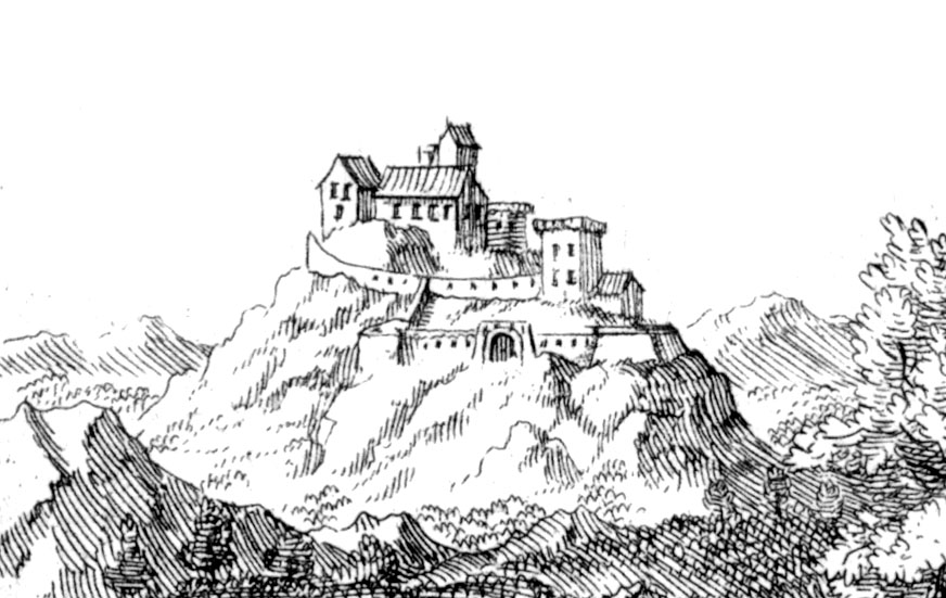
In 1523, with the death of István Rozgonyi, the male part of the family died out, and the castle was taken by István’s son-in-law, András Báthori, one of the greatest magnates in the Kingdom of Hungary. The castle also gained importance due to the meetings of the Zemplín county and the storage of the county archive. The latter burned down in 1529, when Čičava was besieged by the Habsburg troops led by Ján Kaczianer during the civil war. The castle was again captured in 1556, when the imperial troops occupied and then confiscated Čičava. Since not all of the Báthori family were on the emperor’s opponents side, he returned the castle and its subordinate estates after a year. In 1610, the estate was acquired by György Drugeth, as part of the dowry of his daughter Erzsébet Báthori. Although the Drugeths restored the castle in an early modern style, they did not live there permanently. Moreover, during the anti-Habsburg uprisings, Čičava was repeatedly invaded and destroyed, first in 1684 by Thököly’s troops, then in 1704 by Rákóczi’s troops. When in 1711 the imperial troops recapture the castle from the rebels, the buildings and fortifications were in such a bad condition that the owners did not undertake repairs and abandoned the building.
Architecture
The castle was built on a promontory of a hill, jutting out towards the south to the widening part of the valley of the Ondava River. It was protected on three sides by high slopes, the steepest in the east, where it fell in rocky escarpments towards the river. Only from the north was the approach to the castle more gentle, in a place where a narrow neck connected the promontory with the rest of the hill. This place could be cut off with a ditch, but during the development of firearms it became dangerous for defenders, due to the rasing level of the terrain towards the north.
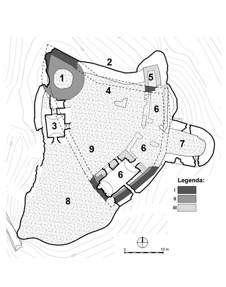
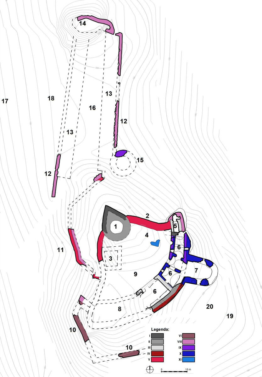
The oldest part of the castle was the perimeter of an irregular, originally triangular-like defensive wall, at least on two sides running along the edges of rocky escarpments and covering an area with maximum dimensions of 48 meters in the south-west, 37 meters in the south-east and 32 meters in the north. It was quite thick, reaching a width of 1.5-1.6 meters at the ground level. Since at the initial stage the castle did not have any tower, the defense had to be based on the wall and it had to be topped with a walk or a porch. The defenders were probably protected by a parapet with battlements. The castle’s residential buildings were grouped in the courtyard, probably in the safest southern and south-eastern parts.
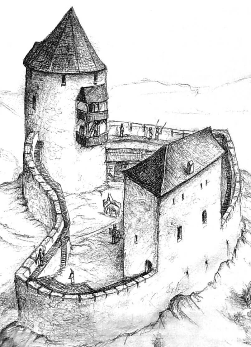
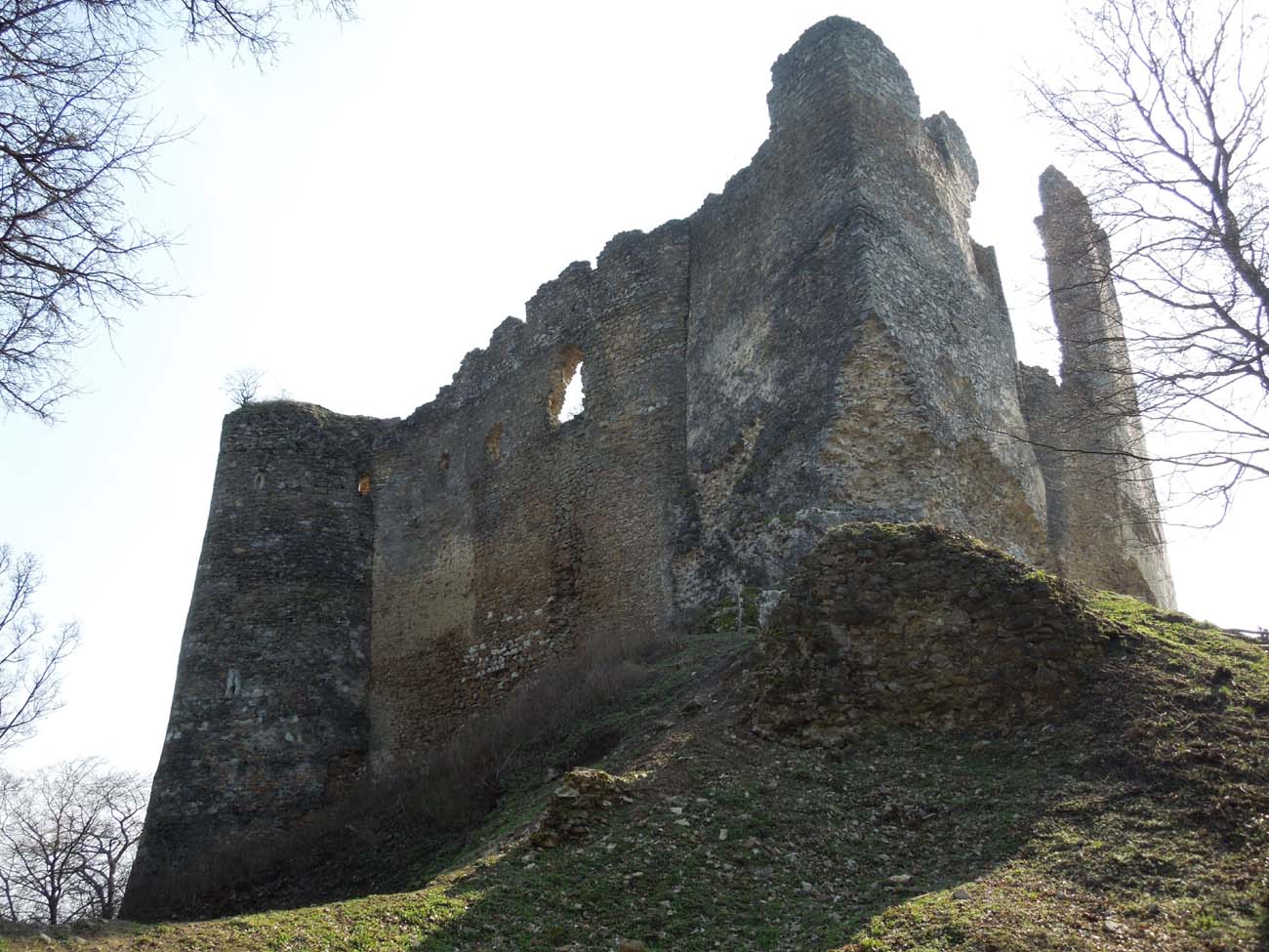
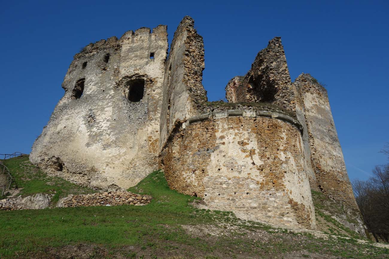
In the first stage of early Gothic expansion, a cylindrical tower was erected at the highest point of the promontory. It was situated in the north-western part of the perimeter wall, at its acute corner, embedded and copied at higher levels. The spur created in this way strengthened the tower’s structure. Its task was to slide fired missiles, so it was directed towards the access road and the section most at risk of attack. The walls of the tower were very thick. While its external diameter at the ground level was 11 meters, the length of the interior diameter was only 5.5 meters. The tower had at least four storeys, with the entrance located at the level of the second storey. It was accessible by a ladder, external wooden stairs or a footbridge from the crown of the adjacent defensive wall. The tower played the role of a bergfried flanking the entrance gate to the courtyard located at its foot. With its construction, the defensive wall was thickened to about 1.7-1.8 meters, raised, and then topped with a battlement again.
Probably around the middle of the 14th century, a small quadrangular tower-like projection was erected, placed at the north-eastern corner of the perimeter wall. It had irregular shape with external dimensions of 4 x 5 meters adapted to the form of a rock outcrop. It was was added to the external elevation of the wall, so it was completely protruding in front of the defensive perimeter. It consisted of at least two storeys with a single arrowslit from the north. Tower-like projection probably ensured the defense of the north-eastern part of the castle foreground and the adjacent curtain, which could have been flanked by the highest storey of the projection, perhaps having the same height as the defensive wall or slightly higher (the walls of the projection were thinner than the perimeter wall, so it could not have been of significant height).
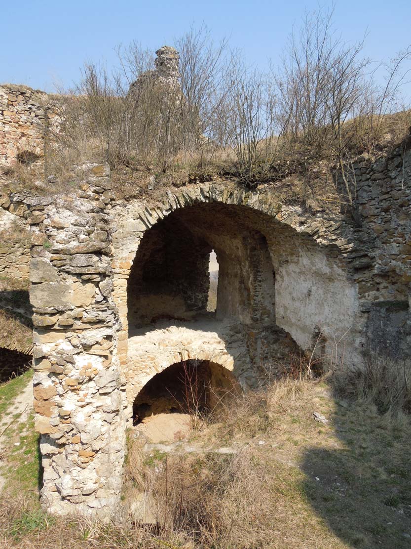
Around the second third of the 14th century, the presumed oldest residential buildings of the castle in the south-eastern part of the courtyard were replaced by a stone Gothic building, with two walls attached to the corner of the older perimeter wall. Its lowest storey, with internal dimensions of 9.5 x 5.5 meters, was originally covered with a wooden ceiling, and next with a low barrel vault. It probably served auxiliary and utility functions, while the upper floor was occupied by the main residential and representative chamber. At the end of the 14th century, the building was raised by the third and fourth storeys, and extended by additional rooms. The reconstruction was probably a response to the static disturbances of the building, as it also focused on external reinforcement of the south-eastern section of the perimeter wall, which was also part of the residential building. Along its entire length, the wall on the side of the escarpment was then thickened by 1.4 meters.
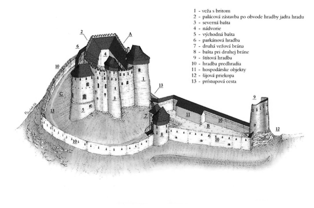
Around the turn of the 14th and 15th centuries, the castle underwent a thorough reconstruction, primarily to strengthen its old early Gothic perimeter wall and to enlarge the courtyard area by the southwestern corner of the promontory. In the northern frontal part of the castle, the new section of the wall was exceptionally massive, about 3 meters thick, about 10 meters high and 18 meters long between the main tower and the quadrangular projection. It created a kind of shield against fire from the terrain rising to the north, which was an increasing threat due to the development of firearms. On the western side, the new wall was already thinner, about 1.1-1.2 meters thick, but equipped with slit-shaped loops in the upper part. They were turned towards the access road, which led uphill and had to turn ninety degrees before the gate. In the early 15th century, this area was secured by an external wall of the zwinger or narrow neck, 6 meters high and topped with battlement with key loop holes. Along with the new defensive wall, the third storey of the tower with the spur was also rebuilt and a fourth storey was added, where a fireplace and a window recess were placed. This floor was connected to the lower levels by stairs in the thickness of the wall.
The enlargement of the castle courtyard allowed for a significant expansion of the castle’s residential and utility rooms. A new wing was built on the western side, originally of a rectangular plan measuring 10 x 8 meters. With five storeys and a height of up to 20 meters, it competed with the main tower, which was only 2.5 meters away. At least several of the rooms on the floors of the western wing were covered with cross-rib vaults. The rooms of the new south-west wing, located in the corner of the courtyard extended by several dozen meters, could also have been partially vaulted. The older south-east palace was thus incorporated into the series of buildings and rebuilt at the level of the upper floors.
In the second half of the 15th century, the northern shield wall of the castle was rebuilt. It was raised by 2-2.5 meters, with the new part partly constituting a continuation of the full, older curtain wall, three meters thick, and above it formed a 1.2-meter-thick parapet, which marked a recess from the inside intended for a defensive gallery, approximately 1.8 meters wide. In addition, the adjacent projection, exceptionally small compared to the late Gothic fortifications, was walled from the outside with a rounded mantle, through which several key loop holes were pierced, intended for handheld firearms. The plaster of the new bastion shell was covered with geometric painting decoration in the form of illusory ashlar.
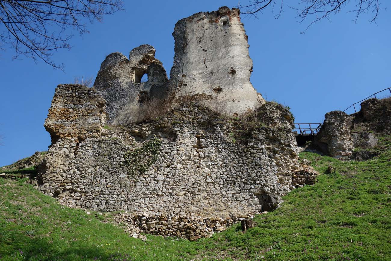
To the north of the core of the upper ward, from the 15th century there was a 63-meter-long but only 20-meter-wide outer bailey, reinforced with a defensive wall and two towers. One, added to the wall in the first half of the 16th century, flanked the outer gate on the south-eastern side, the other was formed at the far northern end, where, like a massive shield wall, it protected the castle from potential fire from the higher terrain in the foreground. The northern tower had three storeys and was about 15 meters high, with the shooting defense concentrated on the highest level. The straight sections of the bailey walls contained two levels of gun loops. The lower, larger, horizontal loops in the shape of slits were to provide a greater range. The upper ones at the level of the parapet were smaller, key-shaped, intended for handheld firearms. On the western and northern sides, a moat was dug in front of the bailey and an earth rampart was built. Along with the construction of the bailey’s wall, the older wall of the gate neck in front of the castle core was also thickened. Its superstructure, approximately 2.5 meters high, was equipped with the same key embrasures as the walls of the outer bailey.
A new residential wing measuring 9 x 6 meters was built in the upper ward at the end of the Middle Ages, placed at the eastern section of the perimeter wall and connected to the rounded north-eastern bastion (the original quadrangular projection). It was initially separated from the older building to the south by an approximately 8-meter long gap. However, around the mid-16th century, the wing was rebuilt, connected to the older building to the south and to the elongated horseshoe bastion, erected at that time on the slope on the eastern side of the castle. It is likely that a smaller late Gothic tower of unknown form had previously functioned on the site of the bastion.
Current state
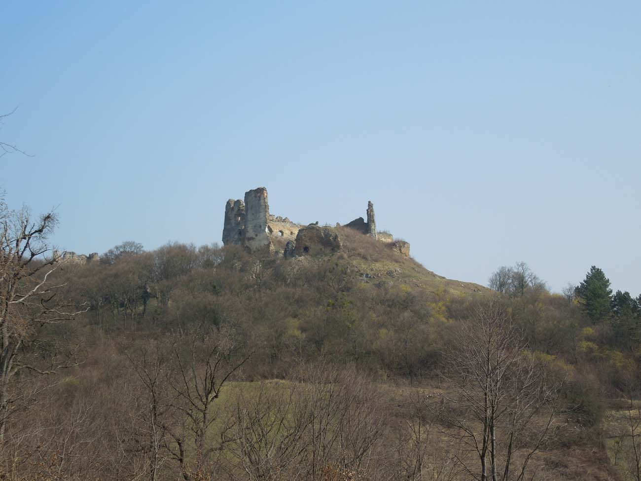
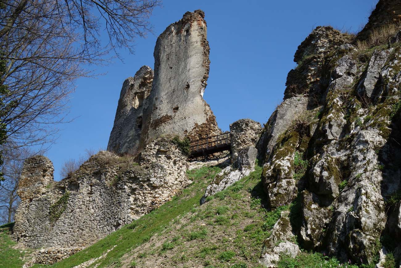
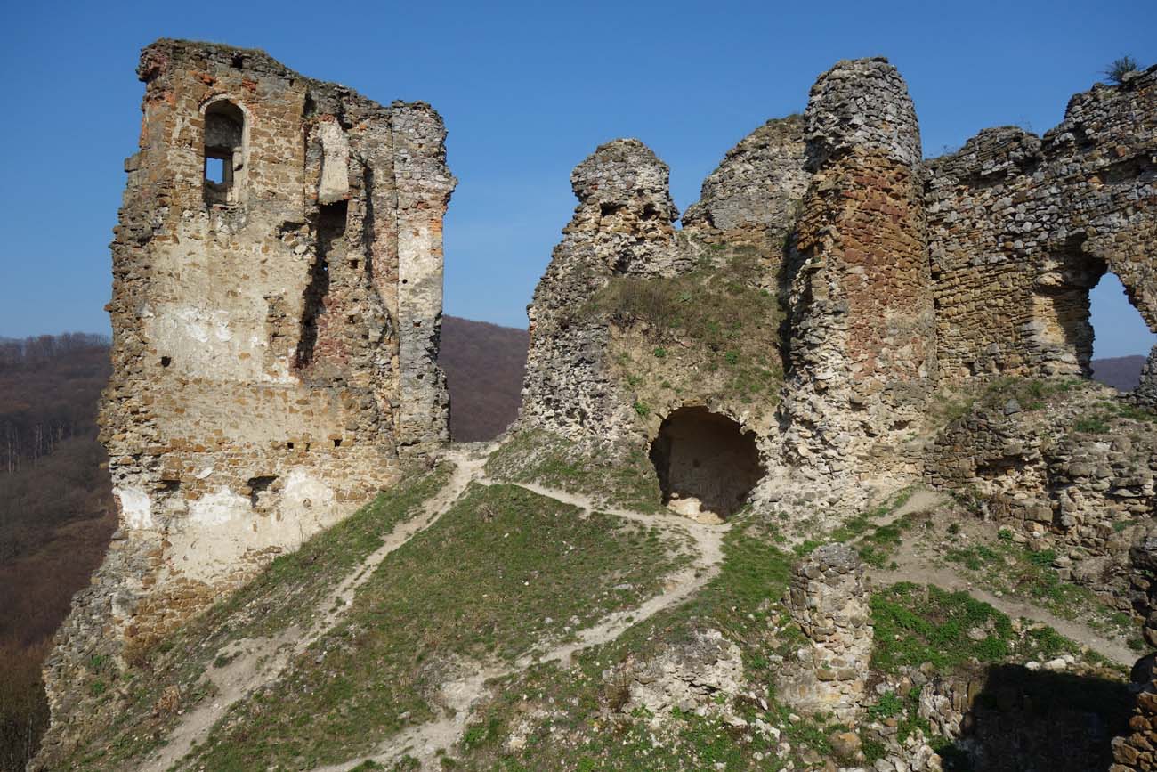
The castle ruins are visible from afar, thanks to the recent clearing of trees in their immediate vicinity. Fragments of the defensive walls, the two oldest early Gothic floors of the main tower and its later superstructure, the remains of the eastern wing of the upper ward together with the vaulted basement of the oldest residential building and the northern and eastern part of the fortifications of the outer bailey have survived to this day. Since 2014, it have been covered by gradual renovation and reconstruction works carried out by a public association “Pro futuro hradu Čičva”. Admission to the area of ruins is free. The easiest way to get there is from the car park on the main road behind the village of Sedliská, along a path marked as a green tourist trail.
bibliography:
Bóna M., Janura T., Šimkovic M., Výsledky doterajšieho architektonicko-historického a archívného výskumu hradu Čičava, „Archæologia historica”, 49/2024.
Bóna M., Plaček M., Encyklopedie slovenských hradů, Praha 2007.
Kotorová-Jenčová M., Porta Polonica – hrad Čič(a)va v sedliskách (okr. Vranov nad Topľou) [in:] Zamki w Karpatach, red. J.Gancarski, Krosno 2014.
Sypek A., Sypek.R., Zamki i obiekty warowne Słowacji Wschodniej, Warszawa 2005.
Wasielewski A., Zamki i zamczyska Słowacji, Białystok 2008.

