

History
Breznica Castle was built in the last quarter of the 13th century, on land owned by the Bishops of Esztergom. From the beginning, it was supposed to be a dispute between the archbishop and the Benedictines from the abbey in Hronský Beňadik, because the castle allowed control of the Hron valley, which was an important communication route. The first record of it was to appear in a document from 1273, which, apart from the village of Breznica, was also to mention a castle called Gersenche, but according to current research, the oldest authentic record was made only in 1311, when the name of the castle Berzenhe was used.
In 1311, the archbishop of Esztergom imposed an excommunication on the Hungarian magnate Máté Csák (Matúš Čák), which resulted in his retaliatory expedition and the capture of the castle by means of a digging. After the fall and death of Csák in 1321, Breznica returned to the archbishops, and the old disputes with the Benedictine abbey also reappeared. Conflicts lasted until 1375. At that time, no one invested in a castle of uncertain affiliation, so the building gradually deteriorated until it was abandoned. In 1411, Archbishop John promised to return the seized property to the Benedictines, including the village of Breznica and the stream near the destroyed castle (“castrum fractum”).
The castle was rebuilt in the mid-15th century, during the wars that flared up after the death of Albrecht Habsburg. It was then supposed to be occupied by the mercenary army of Jan Jiskra from Brandys. In 1457, it was subject to the Hungarian ruler, but it is not known whether only formally. At the request of the nearby mining towns, King Ladislaus the Posthumous ordered Pangrác of Svatý Mikuláš that his relatives who occupied the castle stop looting and other violence against the miners. After the coronation of Matthias Corvinus in 1464, Breznica briefly returned to the archbishops, but the castellan appointed by them, Mikuláš Bodok from Nevidziany, voluntarily handed over the castle to the post-Hussite war veterans, who started plundering expeditions from it. The most famous commander of Breznica was a certain Bartoš from Hertvikovice, who occupied the castle between 1468 and 1471.
In 1471, the Archbishop of Esztergom, Jan Vitéz, tried to conspire against Matthias Corvinus in order to overthrow him and appoint the Polish ruler Casimir IV Jagiellon to the throne. Scheming soon came to light, and the hierarch was forced to give Nitra and Breznica into the hands of the king. However, in the same year, during the Polish-Hungarian war, the garrisons of Breznica and several other castles in the vicinity (Teplica, Revište) supported the Polish king. In 1472, the captain of Breznica, Juraj Juracz, asked Casimir IV for help, but he only obtained a document of protection. Soon after, Jan Vitéz died, and the rebel commanders were forced to surrender. Breznica was handed over by Matthias Corvinus to the bishop of Eger, who had to appoint his administrator in the castle. In 1475, it was Juraj de Bessenyw, perhaps identical with Juraj Juracz.
In the years 1489-1490, Mikuláš Kovászi, the castellan of Breznica on behalf of the Archbishop of Esztergom, was supposed to conduct construction work in the castle. In the years 1492-1494, Jan of Balog and Peter of Čúz were recorded as castellans in documents, but at the end of the 15th or the beginning of the 16th century, the castle was abandoned for unknown reasons. It was mentioned in 1546 as an unused building, which was feared that it would be refortified by the robber nobility. It was planned to use the ruins for the last time during the organization of the anti-Turkish defense in the 1560s, when a guard with warning fire signals was to be stationed in the old castle.
Architecture
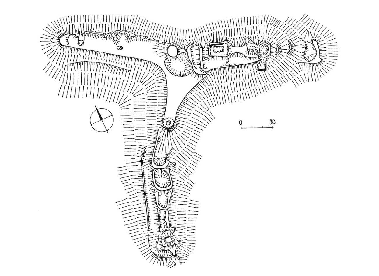
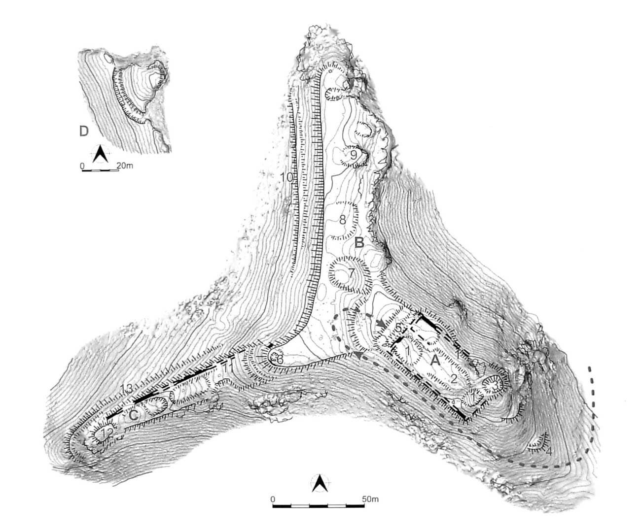
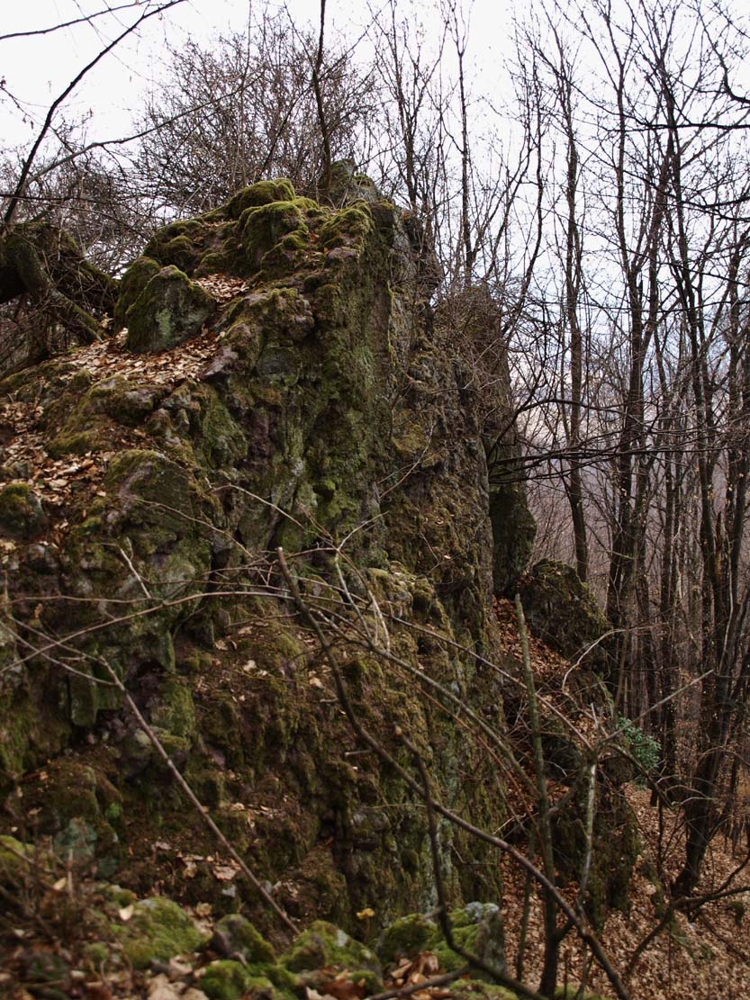
The main part of the castle was located on the top of a mountain ridge with a height of 443 meters above sea level. The end of the hill just behind the castle core was divided towards the north and west. In the north, it descended with high slopes towards a narrow, forested valley, while in the west, the slopes lowered towards the wide floodplain of the Hron River. Also in the south, the area descended with steep slopes to a small valley separating the castle hill from the next ridge. On the south-eastern side, in the place of a small pass, the castle was secured with a transverse ditch, separating the main part of the castle from the rest of the ridge. Further, at a distance of about 160 meters, on the so-called Falcon’s Rock, fortifications were created in the foreground. It had a roughly oval shape of 45 x 30 meters, protected by a rock and a ditch with a rampart from the west.
The main part of the castle, located at the highest point of the area, consisted of a defensive wall 1.5-1.6 meters thick, closing a roughly rectangular courtyard measuring 58 x 28 meters. In the north-east corner, a four-sided building was erected on a rock, perhaps in the form of a tower. In addition, in the western part of the courtyard there was a larger, defensive and residential tower, also of a four-sided form. In the south-east, in the corner, a smaller defensive tower adjoined the outer side of the wall.
At the fork of the ridge running north from the upper ward, there was an outer bailey, 150 meters long and 30-80 meters wide. The next part of the outer bailey filled the second fork on the west side, slightly shorter, about 60 meters long and 15-20 meters wide. Outer bailey was separated from the main part of the castle by a transverse ditch and an earth rampart. The entrance to the upper part of the castle led from the west through this ditch and perhaps a small foregate protruded towards the outer bailey on about 5 meters lower ground. The southern, protruding part of the outer bailey was protected by a small round tower, in front of which the ridge continued to descent and was probably occupied by the wooden and earth fortifications far into the foreground. Also, the western part of the outer bailey could have a tower building at the end, perfectly suited for the guard and warning function.
Current state
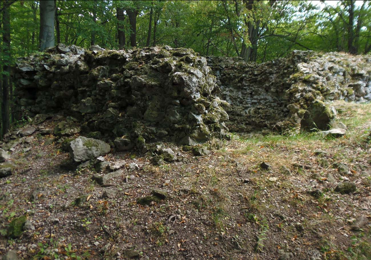
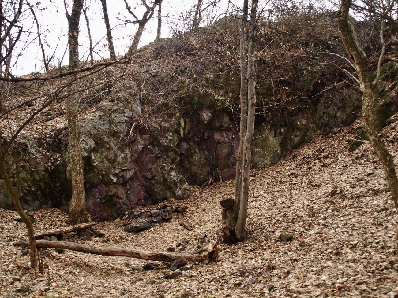
The castle has not survived to modern times, because the destruction of the ruins accelerated by the acquisition of stone for the construction of nearby houses. Only the outline of the earth ramparts, walls and ditches are visible. The main remnant is a fragment of the north-eastern wall of the castle, about 3 meters high and 7 meters long. Admission to the castle ruins is free. The path to it leads along the green trail from the nearby village of Tekovská Breznica.
bibliography:
Bóna M., Stredoveké hrady na strednom Pohroní, Nitra 2021.
Bóna M., Plaček M., Encyklopedie slovenských hradů, Praha 2007.
Wasielewski A., Zamki i zamczyska Słowacji, Białystok 2008.