
History
The castle was probably erected at the end of the 13th century by the knight Balogovcov family (Hungarian: Balog). Before 1312, in unknown circumstances, the stronghold passed into the hands of the great magnate Matthew III Csák. Thanks to his great wealth and influence, he competed with the king Charles I of Hungary himself, which ended eventually with the death of the magnate in 1321, during the siege of Trenčín by the royal army. At that time, Charles I gave Blh again to the Balogovcov family, but from 1323 until the mid-15th century the castle belonged to the noble Sečovcov family.
In the mid-15th century, the owners of Blh favored Jan Jiskra, who was fighting to regain the Hungarian throne for Ladislaus the Posthumous, son of Elizabeth of Luxembourg and Albert II of Habsburg. As a result, the castle was occupied by Jiskra’s troops, composed mainly of former Hussites. They later became the basis of the so-called Bratrzyks movement, plundering and terrorizing the surrounding lands. Because of this in 1460, István Rozgonyi took over the castle. Then he leased his capture from the king for 12,000 golds, but in 1481 the Sečovcov family returned to the castle.
In 1554, after Fiľakovo was captured by the Turks, the former commander of the castle garrison fled to Blh, where he died of wounds. At that time, the Sečovcovs were still the owners of the castle. They owned the Blh until 1646, when, by marriage, it became the property of a palatine and anti-Habsburg conspirator, Ferenc Wesselényi. Apparently, he strengthened the defense of the castle, but during the Imre Thököl’s anti-Habsburg uprising in 1677, it was conquered, destroyed and abandoned.
Architecture
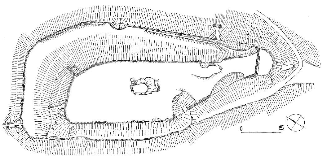
The castle occupied a fairly large area of a flattened mountain ridge with dimensions of about 150 × 70 meters. Around the small core of the stronghold, which occupied the upper part of the central small rock, there were two circumferences of stone defensive walls. The internal had a thickness of 1.8 meters, while the external, enclosing the castle on three sides, up to 2 meters thick. The outer wall may have replaced earlier fortifications in the form of an earth ramparts in the 15th century. Probably of later origin was also the south-eastern fragment of the wall with rounded corners, protruding far towards the ditch. During this reconstruction, the older fragment of the ditch was covered and the perimeter of the walls was extended. The sixteenth-century modernizations can be combined with two flanking wall projections, perhaps originally towers, on the north-west side and over the entry road in the south-east.
In the center of the castle a small residential building or tower was erected, below which there was a stone water tank. Another, poorly recognized building protruded outside the perimeter of the defensive wall on the slope was on the north side and south-west of the castle core. The access road led along the north-west slope of the hill, turned in front of the castle facade and reached the first entrance gate. Behind it, after passing a fragment of the zwinger, one had to pass a second gate to reach the main courtyard of the castle.
Current state
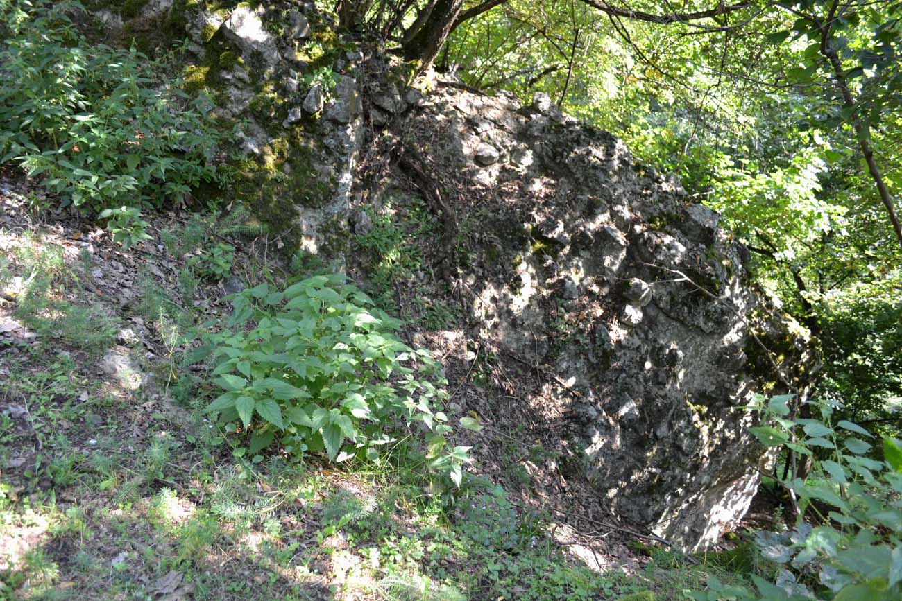
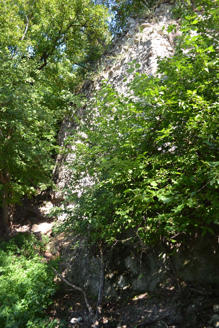
The castle has not survived to the present day, only small relics of the walls, fragments of the vaulted room or basement and densely overgrown remains of defensive walls are visible. Admission to the forested area of the castle may be difficult, as it is an area of a hunting club.

bibliography:
Bóna M., Plaček M., Encyklopedie slovenských hradů, Praha 2007.
Wasielewski A., Zamki i zamczyska Słowacji, Białystok 2008.