History
The oldest informations about the settlement of Wojciechów were created in the years 1328-1351. The first fortifications were probably built by the village heir and castellan of Lublin, Piotr Szczekocki, in the second half of the 14th century. His son Piotr may have been associated with the expansion of the brick manor house, which remained in the hands of the Szczekocki family until 1483, when it became the property of the Pilecki family of the Leliwa coat of arms. The construction of the tower house was probably carried out on the initiative of Jan Pilecki, the owner of Wojciechów, who was the staroste of Lublin from 1514. Perhaps it was related to the reconstruction of the devastated manor after the Tatar invasion of the Lublin region in 1500.
In 1534, Jan Pilecki’s nephews leased the building to the Firlej family, and then to Stanisław Spinek. From 1580, the village remained in the hands of the Orzechowski family, who at the beginning of the 17th century built a new palace next to the manor house, while using the tower for economic purposes. Both the Spinek and the Orzechowski families were Protestants, hence the name “Arian” stuck to their residence. In the 18th century, the tower fell into neglect and ceased to be used. It was only in the first half of the 19th century that it was rebuilt as a granary. It served this function until 1910, when the Society for the Protection of Monuments saved the building from demolition and began renovation the following year.
Architecture
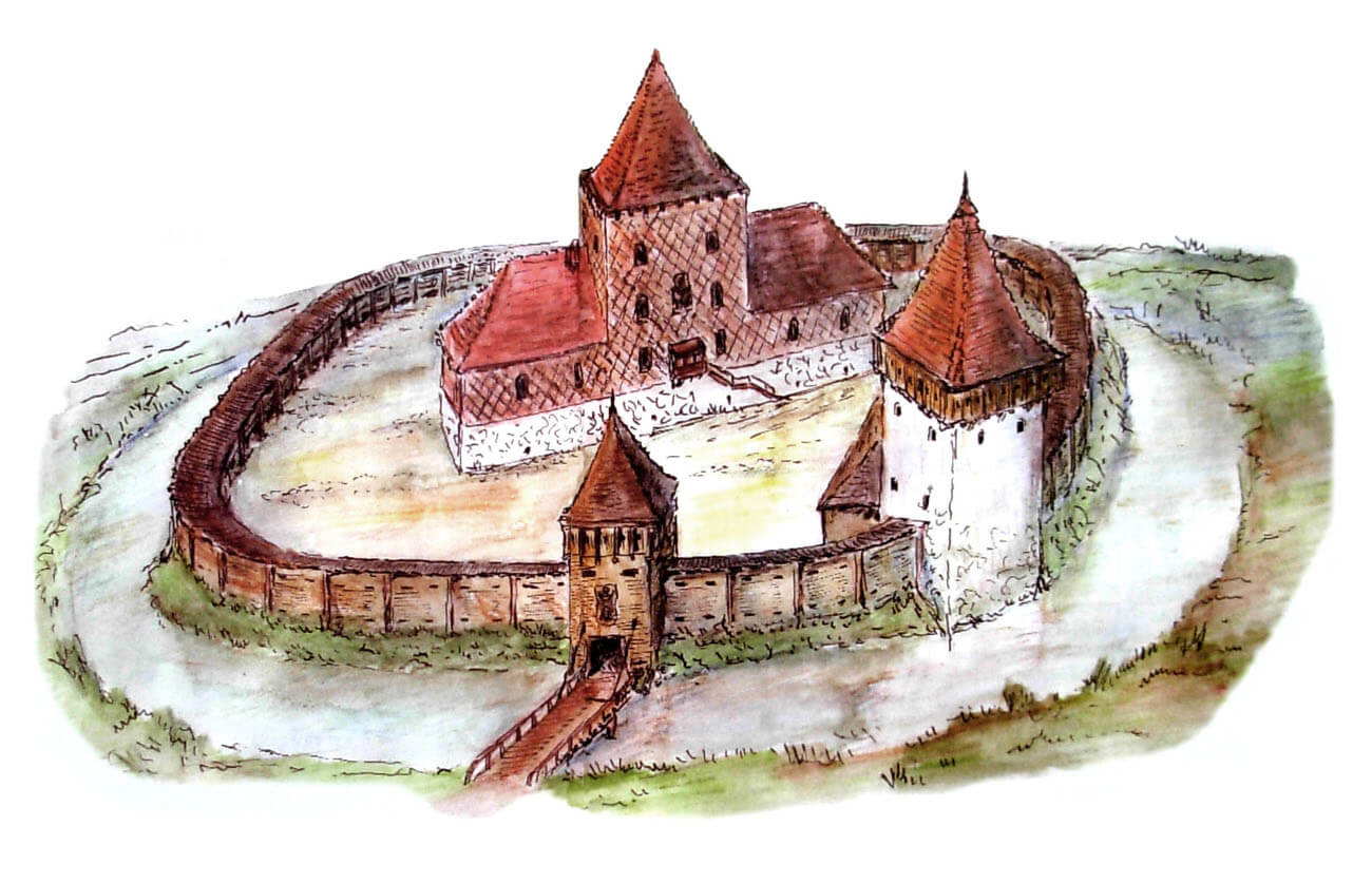
The manor and the neighboring settlement were located in an area without any major hills or outcrops. The first fortifications in Wojciechów were two circuits of earth ramparts on an oval plan, divided by a moat, supposedly built in the 13th century. The outer slope of the main rampart was reinforced with at least one row of palisade made of wooden logs about 0.5 meters thick.
A brick building from the second half of the 14th century was erected in the southern part of the inner ward. It was built of stones and bricks, had dimensions of 9.3 x 28.2 meters, walls 1.2 meters thick and a single-track system, with three rooms in the ground floor. The shorter walls of the building were facing east and west, which provided good sunlight for the long southern wall. Two of the ground floor chambers: eastern and western, had the same dimensions, which were 6.9 x 8.4 meters. The middle room measuring 6.9 x 6.6 meters, was probably a transitional entrance room. At this part there was an external annex with dimensions of 2.4 x 3.6 meters. Most probably the building was two-story, because even the partition walls were of considerable thickness, and a small annex next to the southern wall could serve as a staircase. It is also possible that the central part of the building was higher than the side ones, forming a kind of tower. The façade of the building from the courtyard side could be decorated with glazed bricks, frequently found during archeological research.
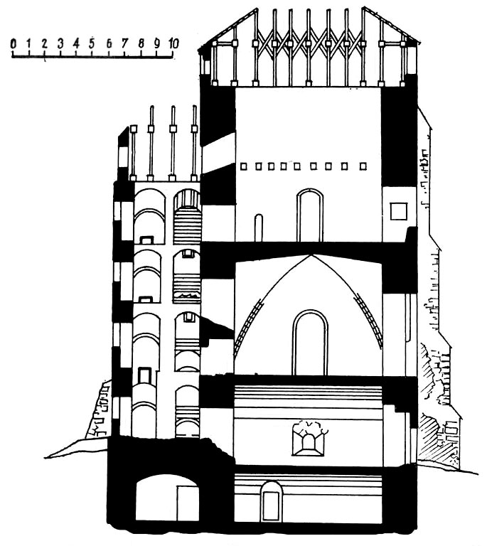
The tower house was erected in the northern part of the complex from local stones on a quadrangle plan measuring 12×13 meters. It was located on the left side of the entrance to the inner ward, probably using the hollow of the older moat for foundation of the basement level. At that time, the medieval manor had to be in ruin, because its building material was also used to build the tower. From the outside, the tower was supported from the north by two massive buttresses located at an angle. The entrance was on the north side. Above it, at the height of the first floor, there was a machicolation supported by three stone consoles. It probably had defensive functions, while the projection on the western facade probably served as a latrine, as it was located above the moat. The interior of the tower was originally single-space on each floor. It had a vaulted basement and three or four above-ground floors, the lower two of which were also covered with vaults.
In the first half of the 16th century, the entire former manor was probably surrounded by a perimeter of stone and earth fortifications with loopholes, to strengthen the defensive values of the complex. In the ring of fortifications there were three earth bastions on a trapezoidal plan, located from the south, east and west, on the outer slope of the older medieval rampart. The bastions and the earth rampart were additionally reinforced with a stone breastwork 0.9 meters wide.
Current state
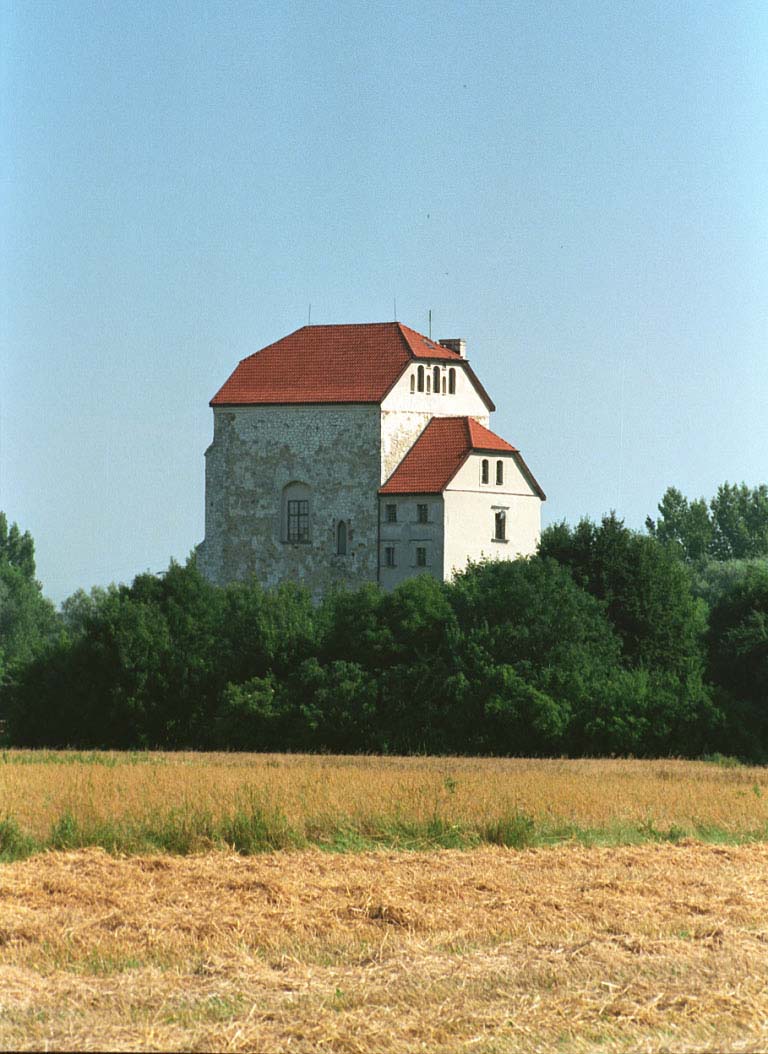
To this day, only a late medieval tower house called Arian Tower has survived from the medieval manor, rebuilt and enlarged in the early modern period by the addition of a staircase. At present, the Ariańska Tower houses the Commune Center of Culture, the Regional Museum, the Smithery Museum, the Municipal Library, the Agrotourist Information Point and the café.
bibliography:
Grochecki K., Piotrowski M., Wokół fundacji Orzechowskich w Krupem i Wojciechowie [in:] Zamki Lubelszczyzny w źródłach archeologicznych, red. E.Banasiewicz-Szykuła, Lublin 2015.
Jakimowicz T., Dwór murowany w Polsce w wieku XVI, Warszawa 1979.
Lasek P., Wieża i basteja. Z badań nad wpływem broni palnej na architekturę obronno-rezydencjonalną Królestwa Polskiego w XV-XVI w. [w:] Studia i Materiały Archeologiczne. Suplement 2 – Interdyscyplinarne badania założeń rezydencjonalnych i obronnych, Warszawa 2013.
Leksykon zamków w Polsce, red. L.Kajzer, Warszawa 2003.
Sypek A., Sypek R., Zamki i obiekty warowne ziemi lubelskiej i Podlasia, Warszawa 2009.


