
History
The development of the town and its fortifications was connected with the transfer of the castellany’s seat from nearby Ruda, which took place around 1281, when Prince Henry IV Probus appointed the castellan of Wieluń for the first time. Two years later, Wieluń was first recorded as a town, although the foundation must have happened a bit earlier. In 1311, “castrum Wilyn” was mentioned, but this could refer not to the Wieluń castle, but to the stronghold in Widoradz near Ruda. The stone defensive wall in Wieluń was built during the reign of Kazimierz III the Great, probably around the middle of the 14th century, as part of the reconstruction of the town after the fire of 1335, which destroyed the older, wood and earth fortifications. It was probably founded by the king, under whom the Wieluń castle could have been expanded, acting as the center of the royal complex and the center of the judicial district. The starost Zbigniew who held office there was recorded in 1368, while the burgrave Biel from Błeszno in 1377.
Work on the town fortifications could have continued at the end of the 14th century, because in the years 1370-1391 the Wieluń Land was ruled by Prince Władysław of Opole, who took special care of Wieluń. The town was the capital of his domain, with Władysław himself calling the Prince of Wieluń. After him, the town and the castle were managed by King Władysław Jagiełło, who captured the Wieluń Land by force. The town opened its gates to the Polish king, while the castle was captured after a short siege, using siege cannons. The destructions were probably not major, because already in 1393 the king made a grant for the chapel of St. Catherine “in castro nostro Velunensi”.
In the 15th century, Wieluń in addition to its administrative and economic functions, served as the king’s residence during his travels around the country, repeatedly hosted Władysław Jagiełło and Kazimierz IV Jagiellon. The castle was the site of events of state and international importance. It was here that Władysław Jagiełło signed an edict against infidels, and it was also here that peace treaties were concluded with Silesian princes and cities during the turbulent times of wars that took place in Silesia in the period 1432-1474. The town walls were then renovated and probably expanded. The particular need to maintain the fortifications in high efficiency resulted from the threat from Silesia. Around the middle of the century, Wieluń was attacked several times, with the last invasion by Prince Janusz of Oświęcim in 1457 ended in the capture and burning of the town. The damaged walls and castle were subsequently repaired.
In the first half of the 16th century, the starosty of Wieluń was incorporated into the private estate of Queen Bona Sforza. From that time on, the castle was visited relatively often by royal wives or sisters, which could have been related to the modernization of its interiors. There was also a significant expansion of the Wieluń fortifications, despite the end of conflicts on the Polish-Silesian border and the increased involvement of the Jagiellonian dynasty in the east. It was then that semicircular towers were probably built, attached to the wall from the outside, and a third gate was also built from the south. Work continued during the reign of King Stefan Batory, who allocated the income from the mayor’s office to the renovation of the walls.
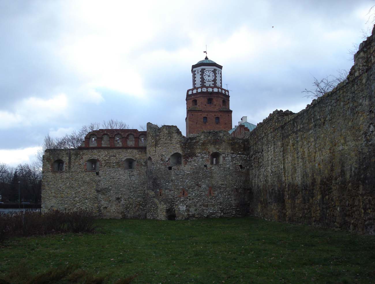
During the war of succession for the crown between Maximilian of Austria and the supporters of Sigismund III, in 1587 the defensive walls were supposedly damaged (a fragment of the curtain fell and the Dąbrowska Gate was destroyed). When the Archduke’s troops arrived at the town the following year, the deputy starost, fearing further destruction, abandoned the defense, surrendering the town and the castle in the absence of the starost Aleksander Koniecpolski. Repairs to the damages began shortly thereafter, and also included thorough reconstruction and the construction of new defensive structures. The battlements and loop holes in the defensive wall were repaired, the embrasures were inserted, the roof covering of the towers was made, and both main gates were repaired. In 1591, the tower of the Rudzka Gate was raised in the form of a double, crowning octagon. The construction of two new towers was also recorded. This modernization was the last expansion of the Wieluń fortifications. Since then, their decline has been noticeable.
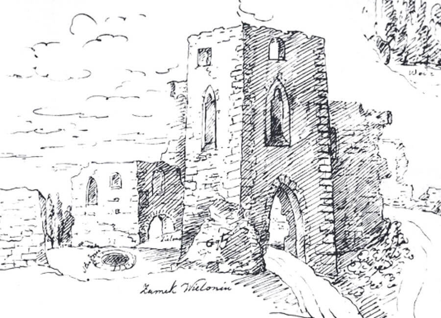
At the beginning of the 17th century, the Bernardines settled in the southwestern part of the town. The church and monastery buildings were excluded from the defense and fenced off from the rest of the town by a wall. Another factor weakening the fortifications was the breaking of a gate in the northern section of the perimeter. What’s more, in 1631 a great fire broke out in Wieluń, which consumed almost the entire town. The only elements left of the castle were the walls and two vaulted rooms serving as an archive, while the town walls probably lost most of their timber elements. The castle had to be rebuilt, because in the years 1655-1656 it was occupied by a detachment of Swedish troops, and in January 1656 it even managed to defend against an attack by Polish troops equipped with artillery, who captured the town. Before withdrawing, the Swedish troops burned the castle, which, after being rebuilt on the initiative of the starost Hieronim Olszowski, burned down again in 1727 and 1791. The last of these fires dealt the final blow to the castle. In the 1820s, demolition began, as well as the slightening of the neglected and unnecessary town fortifications. After World War II, the surviving fragments of the ruined defensive walls of Wieluń were subjected to conservation.
Architecture
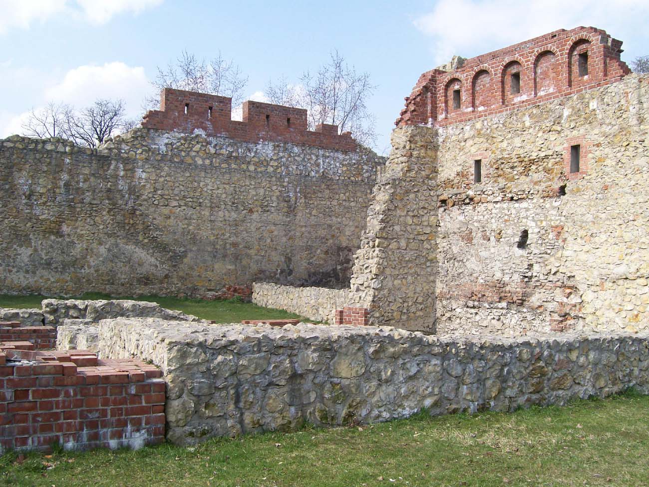
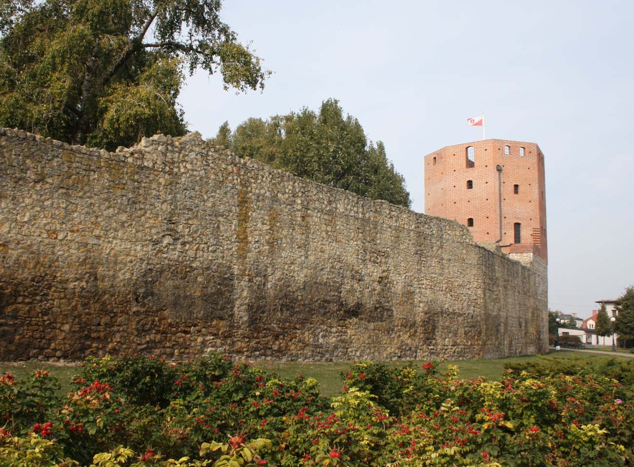
The defensive wall in Wieluń was built of unworked limestones and erratic stones on lime mortar. It was 1.8 meters thick at the ground level and at least 8-8.5 meters high. The original finial was probably a battlemented parapet, protecting the wall-walk behind it, likewise the other similar structures of that period. In the 16th century, the parapet of the defensive wall was thoroughly rebuilt. It ended with a simple breastwork decorated on the outside with a row of blendes with embrasures. In addition, larger embrasures for large-caliber firearms were pierced every certain section below the parapet.
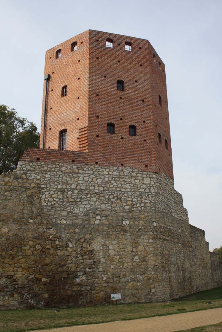
The original fortifications of Wieluń probably did not have towers in the line of the defensive wall (the existing and iconographically known structures do not correspond in architectural form and spacing to the types of towers used in the 14th century). The Wieluń wall was reinforced by several towers only as part of the expansion of the fortifications. The oldest was probably a stone and brick tower situated at the bend of the line of fortifications, in the north-eastern part of the perimeter. It had the shape of an octagon placed on a quadrangular ground part. It could serve as a watchtower and an independent point of resistance, similarly to other single towers of simple forms located in the town fortifications. The need to meet the requirements of the new war technology resulted in the construction of semicircular artillery towers typical of the 16th century, placed from the south-west, north and in the eastern section of the fortifications. The town therefore had a total of four towers. Some of them had their own names. Documents from the end of the 16th century recorded the “Swawola Tower”, the “Red Tower” and the “Torment Tower”.
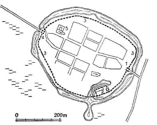
Wieluń originally had two main gates. From the east, the Rudzka Gate, also known as the Kraków Gate led into the town, and from the west, the Dąbrowska Gate, i.e. the Kalisz or Poznań Gate. Probably in the 16th century, the New Gate was built, also known as the Gaszyn Gate, situated in the southern part of the perimeter, reinforced with a tower attached to the eastern side of the proper gate. The two main gates were placed at the ends of the longer axis of the town, at the end of the streets running out of the corners of the market square, which connected just before the entrances to the town. The gates may have been closed with portcullises, while the second closure was a door. The access to the gates led through causeways and bridges over wide moats.
Current state
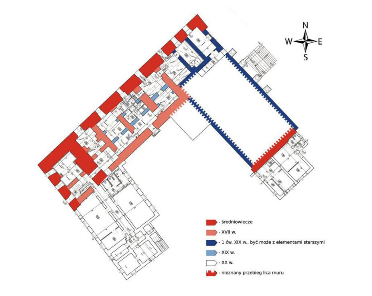
In Wieluń there are significant parts of the town fortifications. The Rudzka Gate, located in the eastern part of the circuit, was incorporated into the town hall building in 1842, while adjacent to both sides the sections of the walls formed its eastern and outer wall. Approximately 30 meters north of the Rudzka Gate, a fragment of the half-rounded tower preserved. The relics of the walls go in parallel and perpendicular to the line of the defensive wall. These are the remnants of a powder house, adjoining from the outside to the fortifications. The second object at this section is the massive tower located at the bend of the fortification line, in the north-eastern part of the perimeter. In the northern part of the district, at Palestrancka 9 Street, a semi-circular artillery tower with an adjacent section of the wall of approximately 10 meters long has survived. Another part of the stone wall survives in the south-west part of the fortifications, as an external wall of the buildings of the former Bernardine monastery. On the site of the castle there is now a 19th-century building, in the cellars of which there are still relics of the medieval walls.


bibliography:
Dudak W., Herman R., Zamek królewski w Wieluniu. Część 1: stan badań, kontekst historyczny i źródła, “Rocznik Wieluński”, tom 16/2016.
Dudak W., Herman R., Zamek królewski w Wieluniu. Część 2: zabudowa zamku w świetle źródeł historycznych i obserwacji architektonicznych, “Rocznik Wieluński”, tom 17/2017.
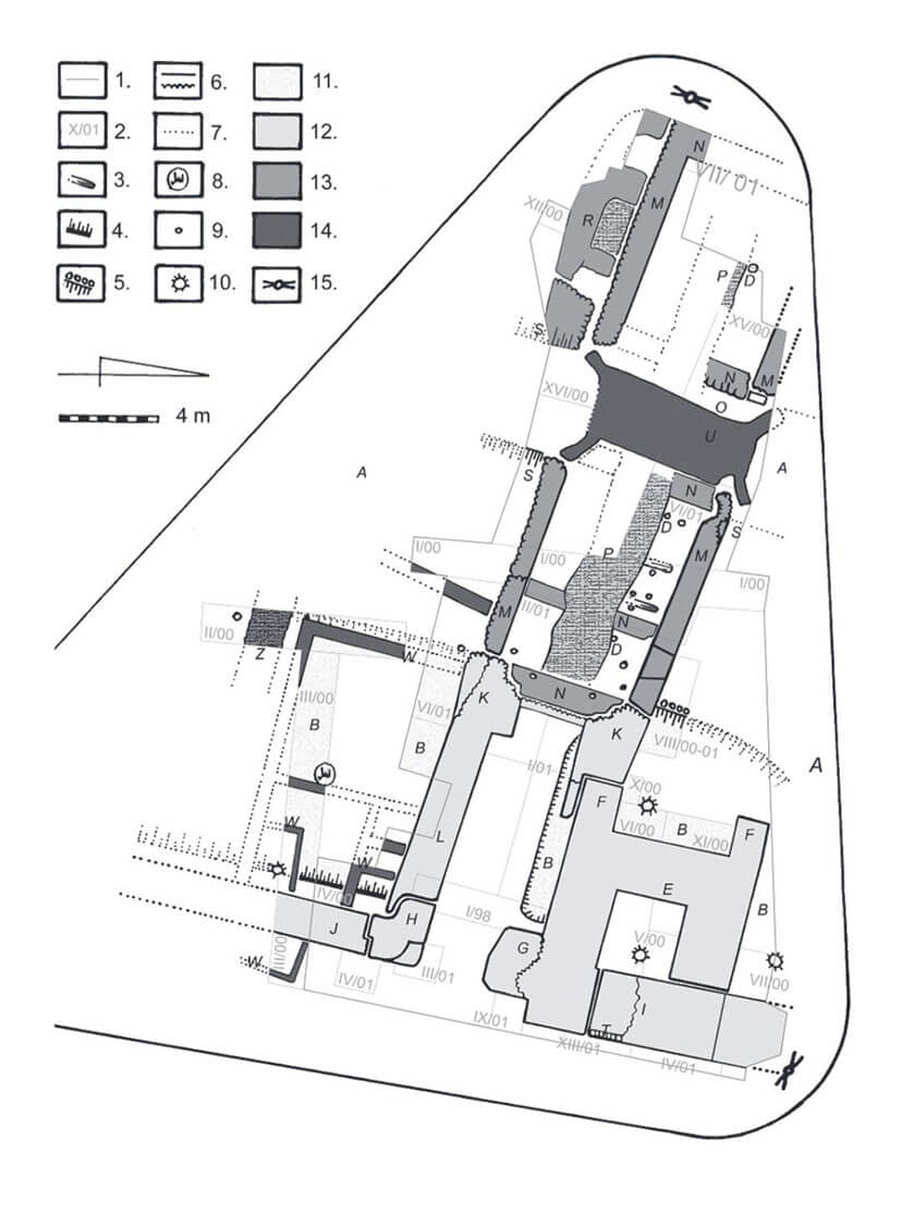
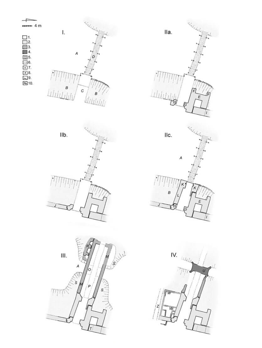
Ignasiak M., Brama Dąbrowska na Nowym Rynku w Wieluniu w świetle badań archeologiczno-architektonicznych, “Rocznik Wieluński”, tom 10/2010.
Tomala J., Murowana architektura romańska i gotycka w Wielkopolsce, tom 2, architektura obronna, Kalisz 2011.
Widawski J., Miejskie mury obronne w państwie polskim do początku XV wieku, Warszawa 1973.