
History
The castle was likely built in the early 14th century, as a fortified residence for the Syrkomla family, heirs to the nearby settlement of Biały Kościół. It likely served as their main seat and the center of administration for their extensive estates, although it was never mentioned in medieval records. Its demise may have been linked to a construction disaster in the mid-14th century, which resulted in the collapse of the western and northwestern sections of the perimeter wall. This may have occurred before 1352, as Jan of Syrokomla, a subiudex of Kraków, purchased Mount Korzkiew with the intention of building a new family castle there.
Architecture
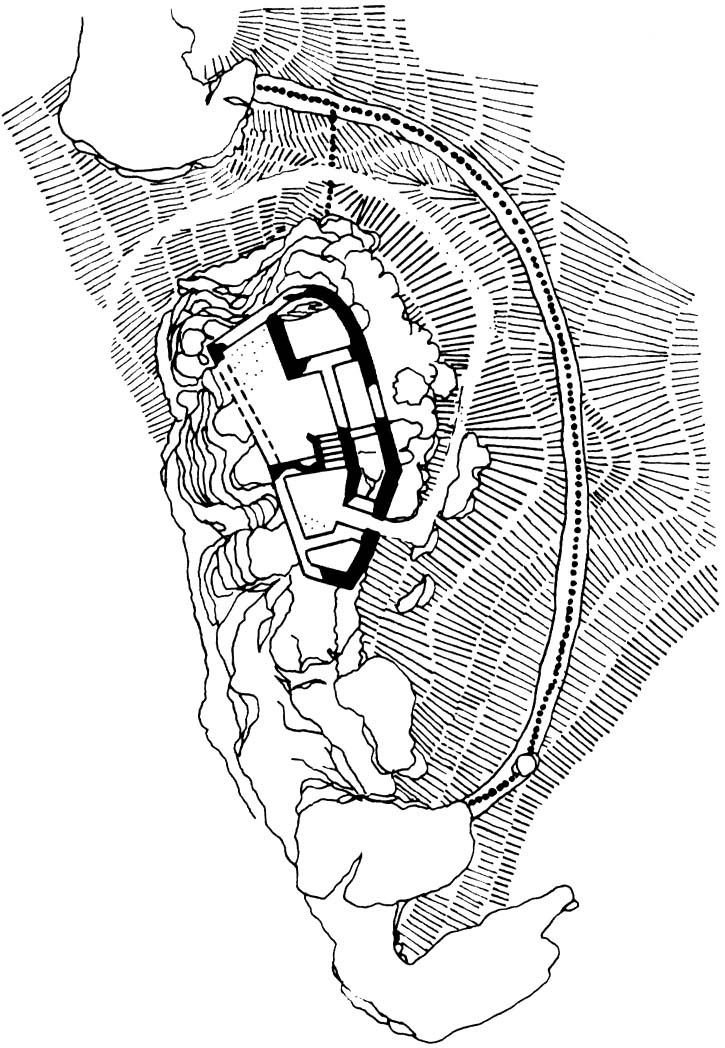
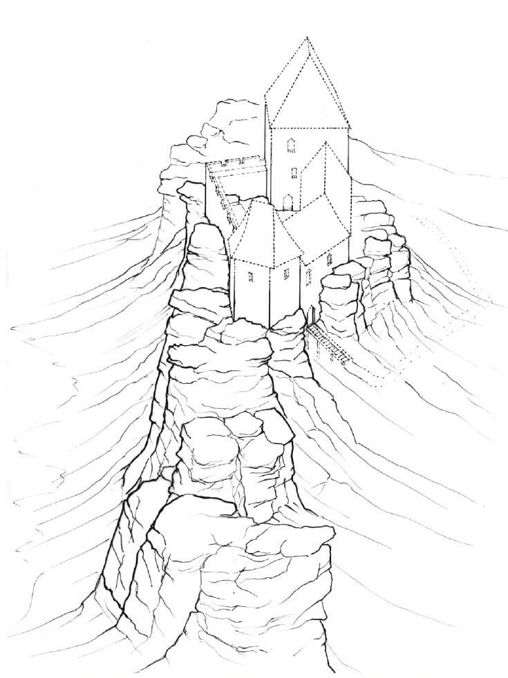
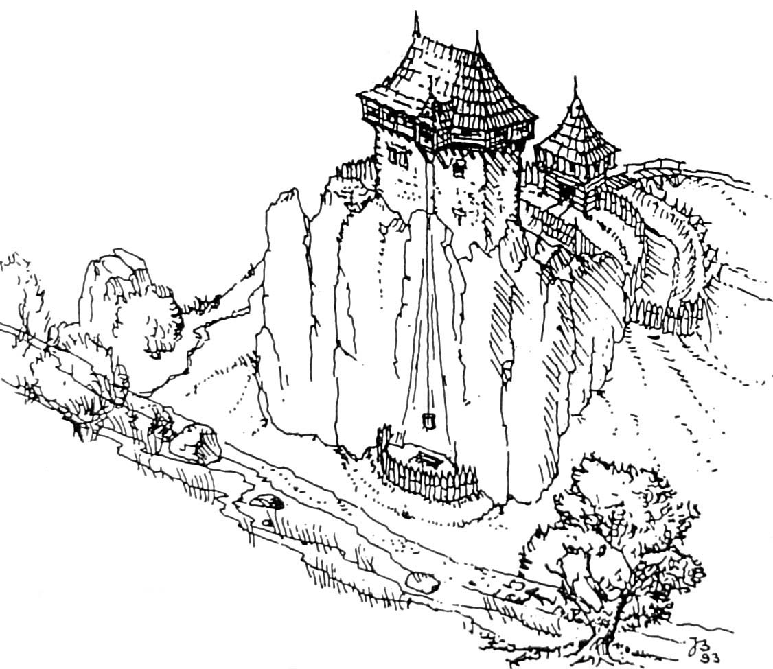
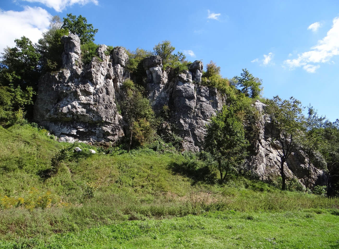
The castle was built of local limestone, atop a magnificent outcrop towering above the edge of a valley, through which flowed a stream called Kluczwoda, south into the Rudawa River. On the western side, facing the valley, nature protected the castle with a nearly vertical rock wall. The slopes on the other sides were also very steep, though much lower. The limestone outcrop was occupied by buildings on the flattened summit, shaped like an irregular, elongated oval, rising to a height of 342 meters above sea level.
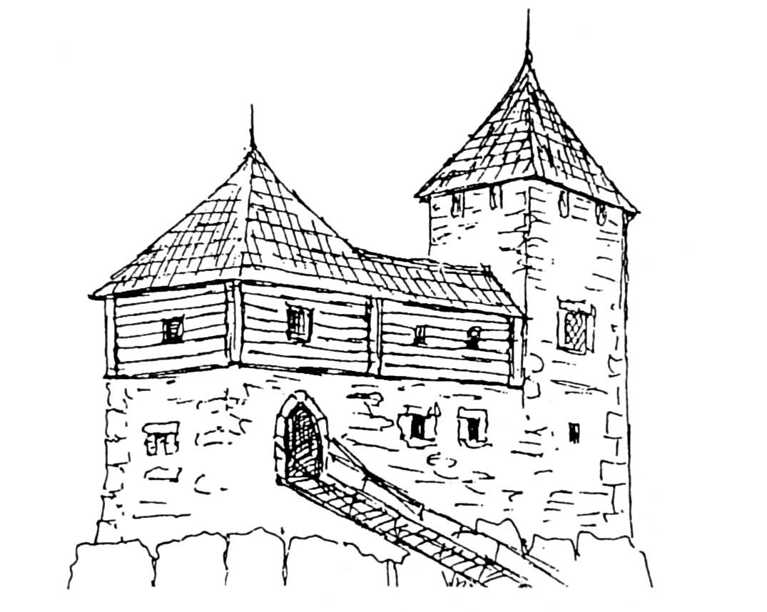
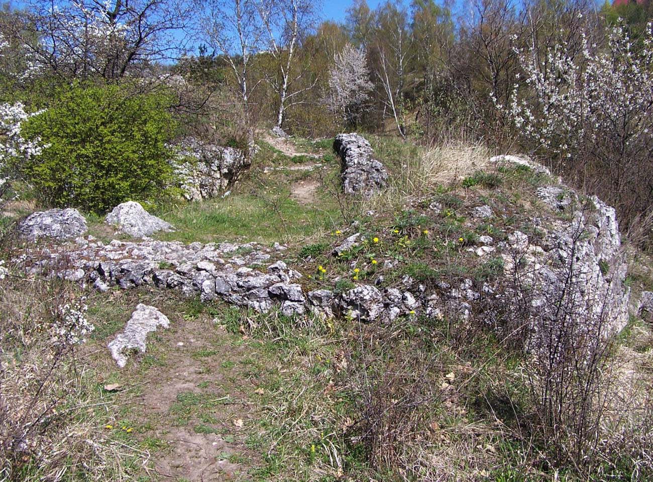
The castle primary element was a peripheral defensive wall, approximately 1.2-1.3 meters thick at ground level, running along the edges of the outcrop and enclosing an area of approximately 45 x 10 meters. The entrance was located in the southern part of the eastern section of the wall. Due to the difference in height, timber stairs or a ramp led to the gate. The main and largest residential building was a small tower (or tower house), measuring 3.3 x 3.9 meters, erected in the northeastern corner of the castle. It likely had two or three stories. In the central part of the castle was a narrow wing, adjoining the eastern perimeter wall, terminated in a polygonal building in the southern corner. Communication between the lower, southern part of the castle and the higher northern part was provided by stairs carved into the stone. The northwestern part of the modest courtyard was likely occupied by auxiliary timber structures.
At the foot of the lower part of the rock was an earth rampart, enclosing a small, horseshoe-shaped outer bailey on the eastern side of the castle core. The access road to the castle, leading from the settlement of Biały Kościół to the north, must have passed through the bailey, as well as a path that skirted a limestone outcrop and descended towards the stream. The rampart at the top was probably crowned with timber fortifications in the form of a palisade. Hypothetically, auxiliary buildings could have been located at the foot of the rock on the stream side, if transport was facilitated by hauling buckets of water with a winch.
Current state
The castle has not survived to modern times, only modest stone relics are visible on the magnificent rock known as Zamczysko or Castle Rock. It is located on the bend of the Kluczwoda stream, between Wielka Wieś and the Biały kościół villages. Admission to the castle area is free.
bibliography:
Antoniewicz M., Zamki na Wyżynie Krakowsko – Częstochowskiej, Kielce 1998.
Kołodziejski S., Średniowieczne budowle obronne na terenie Jury Ojcowskiej w świetle wyników nowszych badań, Kraków 2006.
Lasek P., Obronne siedziby rycerskie i możnowładcze w czasach Kazimierza Wielkiego [w:] Wielkie murowanie. Zamki w Polsce za Kazimierza Wielkiego, red. A.Bocheńska, P. Mrozowski, Warszawa 2019.
Leksykon zamków w Polsce, red. L.Kajzer, Warszawa 2003.