
History
In the place chosen for the construction of the Teutonic castle, there was originally a stronghold that was the seat of the Święc family, recorded in documents in 1307. The settlement was recorded even earlier in 1287, when the Archbishop of Gniezno, Jakub Świnka, consecrated the local parish church. After Gdańsk Pomerania passed into the hands of the Teutonic Knights, a commandry was established in Tuchola and a town was founded. The Tuchola commander was first recorded in 1330, and in 1346, Grand Master Heinrich Dusemer again granted Tuchola a charter document. The construction of a brick castle was probably ongoing during this period, lasting at least until the beginning of the second half of the 14th century, when in a document from 1356 Bertold, the master stonemason was mentioned, next to the Tuchola commander (however, he could have supervised the construction of the town defensive walls, completed around the beginning of the 15th century). Probably even before completion, the castle was demoted to the rank of Teutonic pfleger’s office.
In 1409, Tuchola became a base for the Teutonic attack on Bydgoszcz. In retaliation, Polish troops captured the town and castle in 1410 after the battle of Grunwald. Both centers were administered by the knight Janusz Brzozogłowy, who failed to protect Tuchola from recapture at the end of the same year. First, after a long siege, the town fell, and after the battle of Koronowo, due to false rumors about its alleged loss by Polish forces, the castle was also surrendered. A dozen or so days later, at the end of October, the Polish knights were victorious in the battle on the outskirts of the town, but the attempt to re-capture the castle failed, and ultimately under the First Peace of Toruń of 1411, Tuchola remained on the Teutonic side (in the description of the last battles Tuchola castle was called “ firmissimo”).
In 1431, Tuchola was the place of concentration of troops before attacking Kujawy, which were then defeated at Dąbki, where the Tuchola commander, Jost von Hohenkirchen have died. Two years later, Tuchola defended itself against the Hussite raid supporting the Kingdom of Poland. With the outbreak of the Thirteen Years’ War, the troops of the Prussian Union attempted to capture the castle. Although it turned out to be unsuccessful, soon the garrison capitulated and let in the Gdańsk mercenaries led by Jan Maydenburg. The Prussian Union maintained control over the castle until the end of the conflict. After 1466, under the Second Peace of Toruń, Tuchola was incorporated into Poland, and the castle became the seat of Polish starosts.
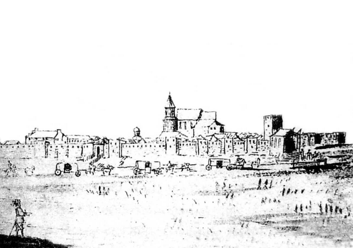
At the beginning of the 17th century, the fortifications of the castle and the town were probably in poor condition, because a petition of deputies at the Sejm in Warsaw called for strengthening the defense of Tuchola. The fortifications were probably not modernized at that time. In 1655, Tuchola was occupied by the Swedes, who left it the following year, but then unsuccessfully tried to besiege town and castle several times. As a result of the fighting, the castle buildings were to be damaged, but more serious damage was caused by the detonation of gunpowder at the beginning of the 18th century. When Tuchola was taken by the Prussian authorities after the first Partition of Poland, the castle was already heavily ruined. It was almost completely demolished after the town fire of 1781, when medieval materials were used to rebuild the town houses.
Architecture
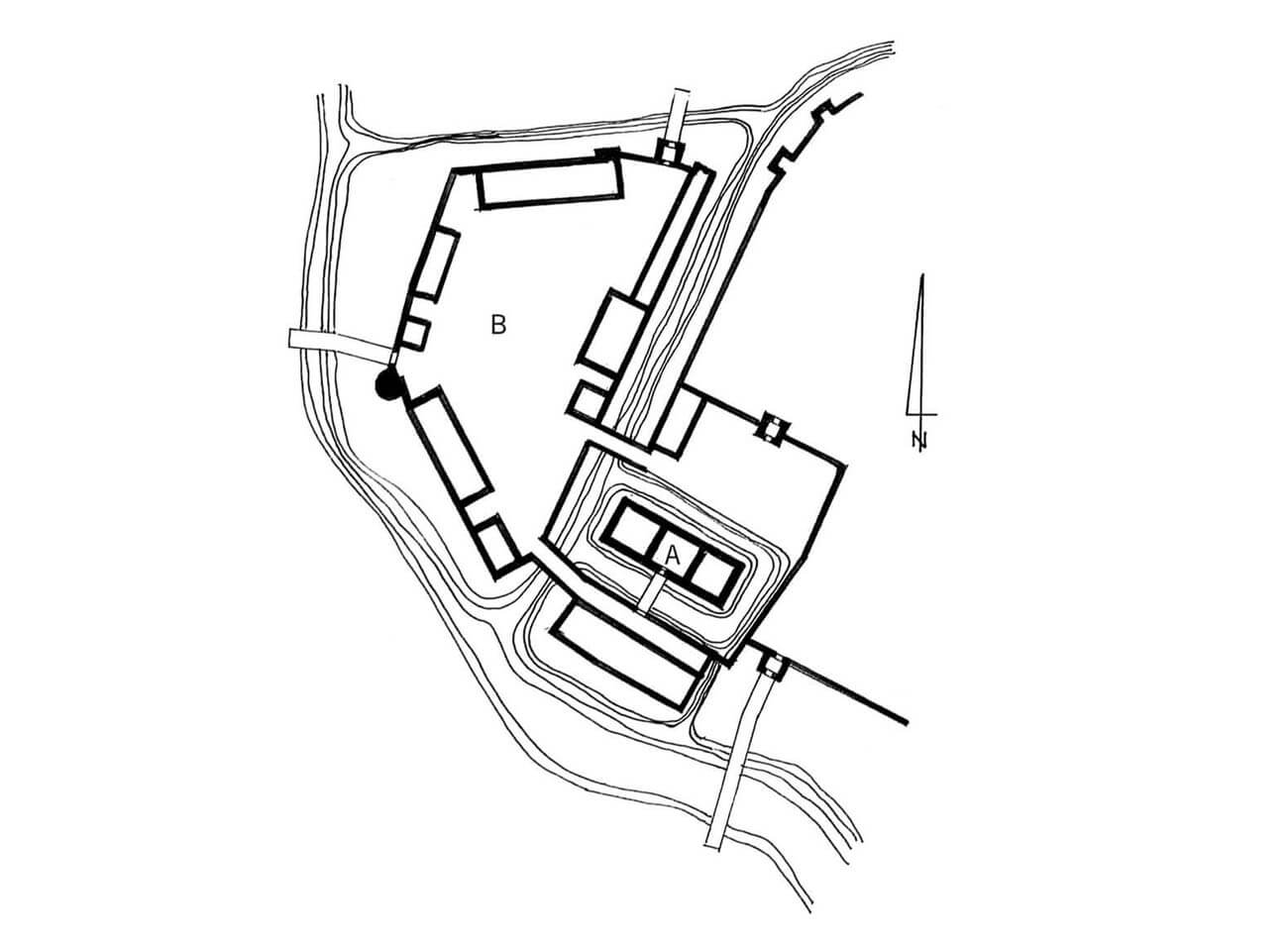
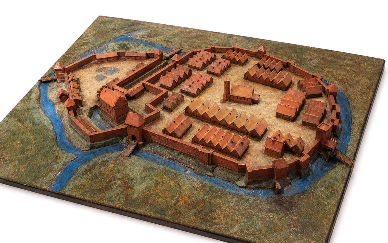
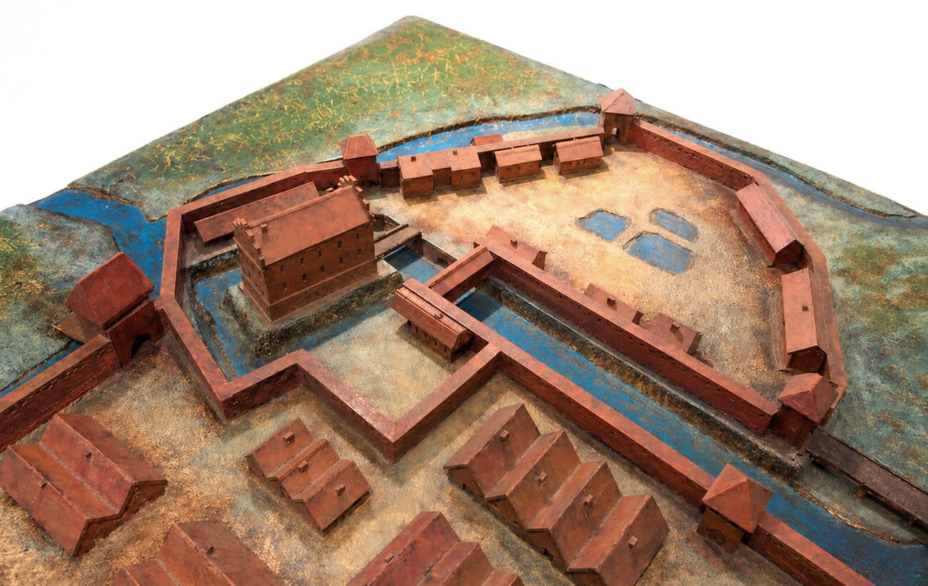
Tuchola was founded on the left bank of the Kicz River, which protected the castle and town complex from the west and south. The Teutonic castle was a vast complex surrounded by a wall and a moat, which included the main part with the commander’s house and two baileys: on the north-western side (outer bailey) and on the northern side (inner bailey). The whole was adjacent to the town from the east, also surrounded by a moat and defensive walls. The fortifications of the stronghold on a small part of the perimeter were connected with the town fortifications, but the castle remained independent because it was separated from the town buildings by a wall with a gate.
The main castle house was built of bricks on a stone foundation. It was probably a single-winged structure, on a rectangular plan with dimensions of approximately 10 x 36 meters, located in the south-west corner of the town and at the same time in the south-eastern part of the castle area. The house may have been surrounded by its own perimeter wall, additionally secured by a moat fed by the waters of Castle Lake. The ground floor of the building probably had a division into three rooms arranged in one line, typical of the Middle Ages.
The larger north-western bailey had a trapezoidal shape. It was protected from the west by the Kicz River, from the north by swamps and a canal, and from the east by a moat separating the castle wall from the town fortifications. The moat also ran between the outer bailey and the main castle house and between both baileys. The entrance to the north-western bailey area led through two gates. The Castle Gate on the western side was directed towards the farm, while the main gate was on the northern side. At least one of them had a tower form. The northern bailey also had to have its own gate. According to docuemnts, the castle had a dansker (latrine tower), a forge and granaries on the baileys.
Current state
The castle has not survived to modern times. Relics of the walls have been preserved in the basements of the current building of the Commune and District Office at Zamkowy 1 Square, where a fragment of the medieval wall is also visible on the ground floor. The wall at the basement level with two slit openings is located in the building at Szkolna 3 Street, and also at the school at Szkolna 4 Street transformed cellars with barrel vault and partly cross-rib vault have been preserved. The walls of the Municipal Cultural Center on the Zamkowy 8 Square may contain relics of a economic building from the times of the Teutonic Knights, reaching even the first floor in some places.
bibliografia:
Die Bau- und Kunstdenkmäler der Provinz Westpreußen, der Kreise Marienwerder (westlich der Weichsel), Schwetz, Konitz, Schlochau, Tuchel, Flatow und Dt. Krone, red. J.Heise, Danzig 1887.
Leksykon zamków w Polsce, red. L.Kajzer, Warszawa 2003.
Torbus T., Zamki konwentualne państwa krzyżackiego w Prusach, część II, katalog, Gdańsk 2023.