
History
The beginnings of settlement in Trzcinica date back to the early Bronze Age. A defensive village was then built, in which around 2100-1650 B.C. the people of the Pleszów group of the Mierzanowice culture lived. It was part of the Precarpathian post Corded Ware cultural circle, which experienced the greatest territorial development until the Otomani-Füzesabony culture group appeared south of the Carpathians. The population of the latter was characterized by a very high level of civilization, achieved by mediating the transmission of cultural impulses of the Aegean-Anatolian world to the north. Displaced by other cultural groups, the Otomani-Füzesabony community passed through the Carpathians and probably peacefully assimilated the inhabitants of the older settlements of the Pleszew culture, and dominated Trzcinica for the period around 1650-1350 BC. Its representatives expanded and strengthened the settlement’s fortifications, and after the fire, they rebuilt the fortifications, creating an even more extensive village.
The fall of Bronze Age cultures meant that Trzcinica remained uninhabited until the early Middle Ages. Then, around 770-780, the surrounding areas were occupied by the Slavs, who used the site of the former settlement to build one of the largest and oldest hillforts in the Western Slavic region. It was probably the seat of tribal power, with a strong economic base in numerous boroughs. The first phase of the functioning of the Slavic stronghold ended with a fire, after which it may have been unoccupied for some time or did not serve a military function. Perhaps the burning was related to the incorporation of the hillfort in the second half of the 10th century into the state of the Piast dynasty. As part of it, at the beginning of the 11th century the stronghold was located in the border zone with the Grand Duchy of Kiev and the Kingdom of Hungary.
The hillfort in Trzcinica operated until the turn of the 1020s and 1030s. Its fall could be related to the crisis of the Piast state in the late stage of Mieszko II’s rule. In 1030, the Kievan Rus’ army were to invade Belz, and a year later, as a result of the armed expeditions of Rus princes Yaroslav the Wise and Mstislav the Brave, the so-called region of Czerwieńskie Hillforts was captured. During the fighting, vast areas of land were devastated and the population was taken captive and relocated to Ruthenia. Probably for these reasons, no attempt was made to rebuild the stronghold in Trzcinica in the following years, and it was later replaced with other residential and defensive centers.

Architecture
The hillfort was founded on the edge of a valley, on a promontory-like hill at the mouth of a small stream into the Ropa River, which surrounded the settlement from the south, east and partly to the north in a wide bend. On these sides, the slopes of the hill were the steepest, while a much gentler approach led from the west and north-west, i.e. in places where the headland connected with the rest of the high ground. The stronghold was located at an altitude of approximately 255-285 meters above sea level, so it exceeded the flood terrace of the Ropa Valley by approximately 30-60 meters.
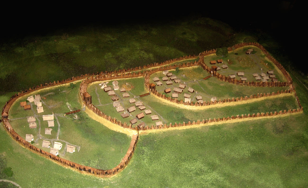
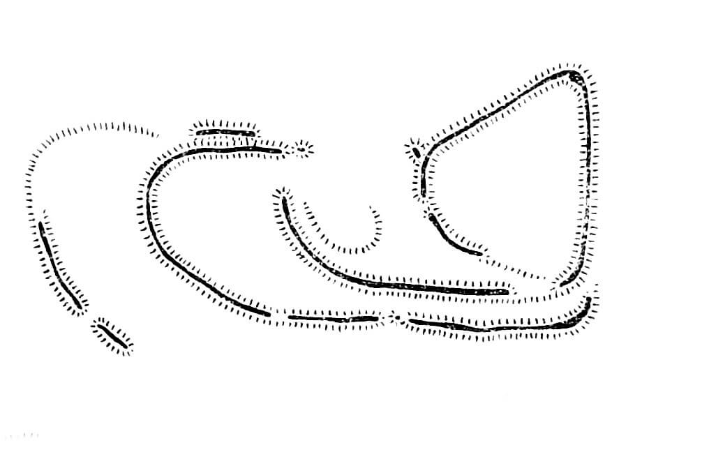
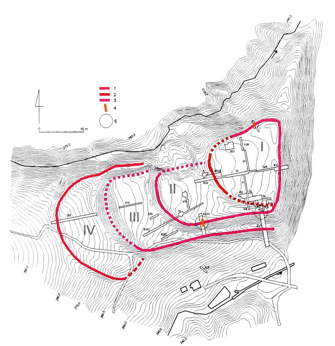
The Slavic early medieval stronghold occupied a total area of approximately 4 ha, consisting of a main part measuring approximately 100 x 110 meters, adjoined from the west by three sickle-shaped baileys, with distances between the ramparts of 60, 70 and 50 meters (the full perimeter consisted only rampart surrounding the main part of the hillfort, baileys were connected to it). The entire stronghold measured approximately 115 x 275 meters. The main part had a shape roughly similar to a triangle with rounded corners. Its fortifications on the eastern side ran straight, on the northern side they were slightly concave, and on the south-west they run along a slightly convex arc. Individual baileys were built on horseshoe shapes with rounded frontal parts and straight southern sections in the second and third bailey, with these sections running parallel to each other at a distance of approximately 15-17 meters. A similar arrangement was created by the northern sections of the ramparts of the two western baileys, where the distance between straight sections was only 10 meters. As the northern and southern lines of fortifications were located on the slopes, the inner ramparts were 7-10 meters higher than the outer ramparts. The fourth bailey of the stronghold, the furthest to the west, had a fan-shaped layout.
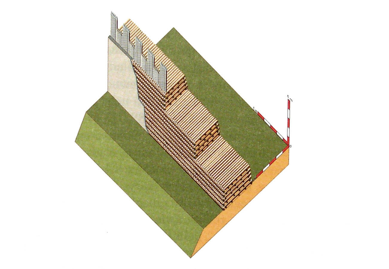
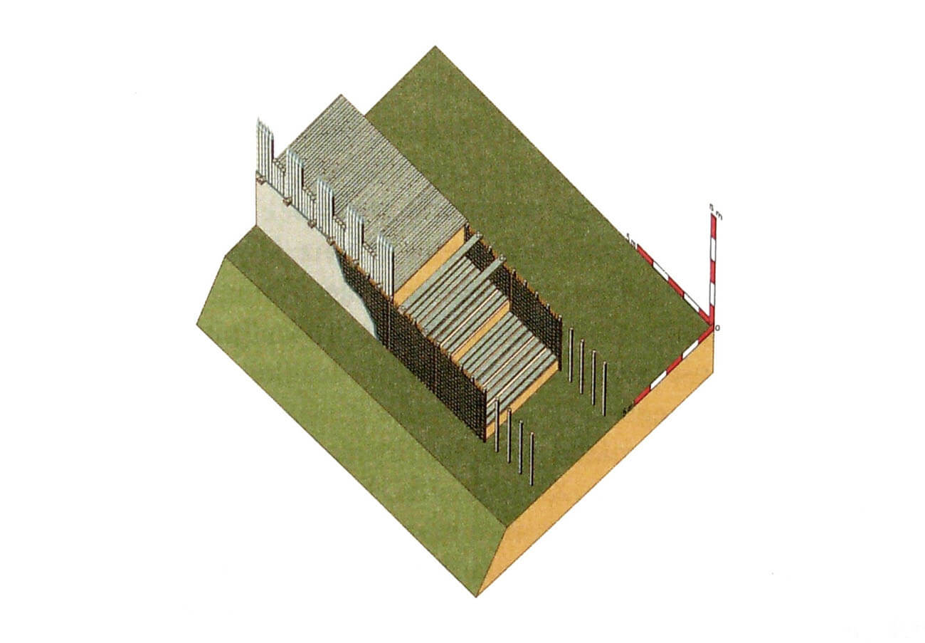
The ramparts of the main part of the stronghold were made of wood and earth, using the one-sided interleaved technique. The beams were placed in layers transverse to the rampart line, one next to the other, while only a few beams were placed in the separating layers parallel to the rampart line. The wooden elements were covered with earth, but there were no poles to support the structure from the outside or inside; alternatively, piles were dug into the ground to support the lowest elements of the grate from the outside. The rampart thus created was less than 5 meters wide at the base. As the diameter of the beams was about 15 cm, the rampart could reach about 5 meters in height. Its walls were close to vertical and were most likely covered with clay to prevent the structure from catching fire. Presumably, the rampart was topped with some form of breastwork protecting the defenders from firing.
The ramparts of the second and third bailey were built in a similar interleaved technique, with beams placed next to each other in layers transverse to the rampart line, as well as parallel to the rampart line. The rampart of the fourth bailey, 3.3-3.5 meters wide, had a different structure. Its vertical walls on the inside (from the courtyard) and outside (from the foreground) were built using the woven fence technique, based on poles with a diameter of 10-15 cm driven every 50-90 cm. The core of the rampart was earth with layers of beams stabilizing the fill, placed transversely to the course of the embankment. These rampart also had to be topped with a breastwork, although of a more modest size. Each part of the stronghold was preceded by a not very deep ditch.
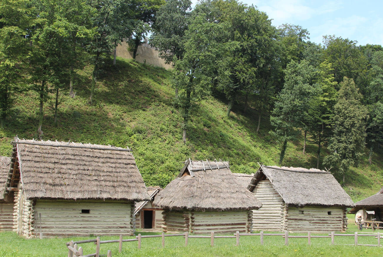
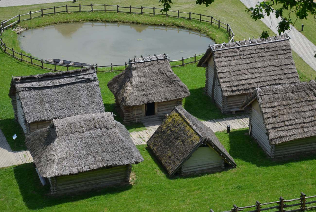
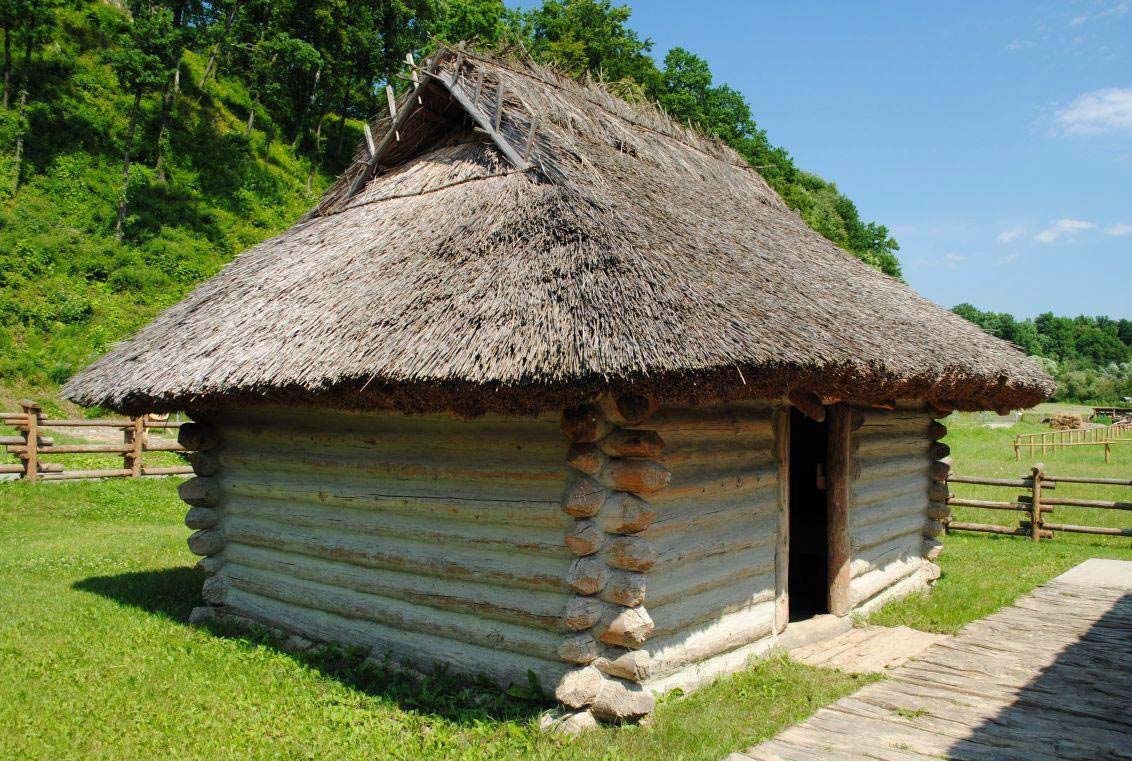
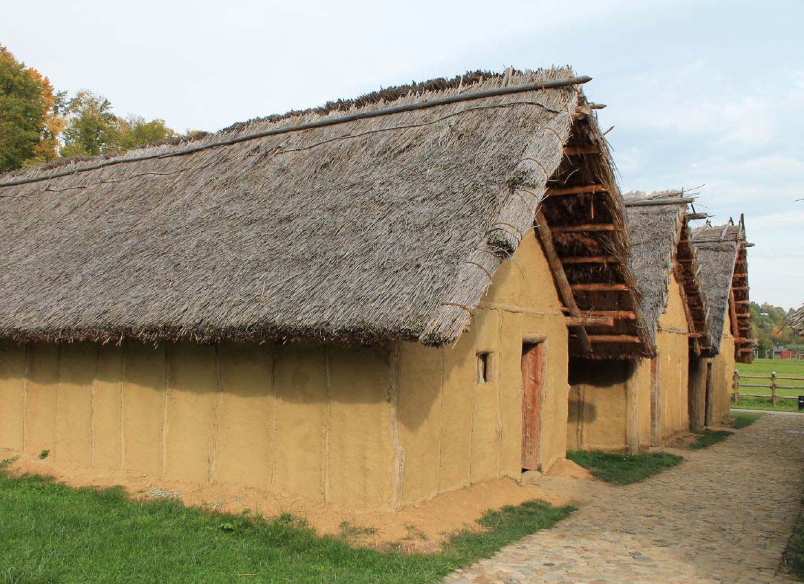
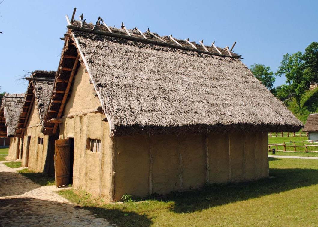
The residential development of the stronghold in the early medieval period was not intensive. Houses were built oval in shape or rectangular with rounded corners, the area of which did not exceed 10-12 square meters. In the area of the baileys it formed a row arrangement. Houses were probably semi-dugouts, so it were partially sunk into the ground. It could be built using the log technique, in which individual beams, properly hewn at the ends and placed horizontally, were connected in the corners with subsequent beams, arranged at right angles. Ends of beams protruding in front of the building outline were cut to an even surface or left. The woven fence technique could also be used, where houses were made of thin wood covered with clay on both sides. The roof was supported in half-dugouts on wooden pole forked at the top, placed in the middle of two opposite walls, or driven outside the outline of the walls. Additional insulation of houses with roofs reaching to the ground could be achieved by covering the entire house with earth. The roofs were covered with thatch made of straw or reed, mounted on poles extending from the ridge.
Current state
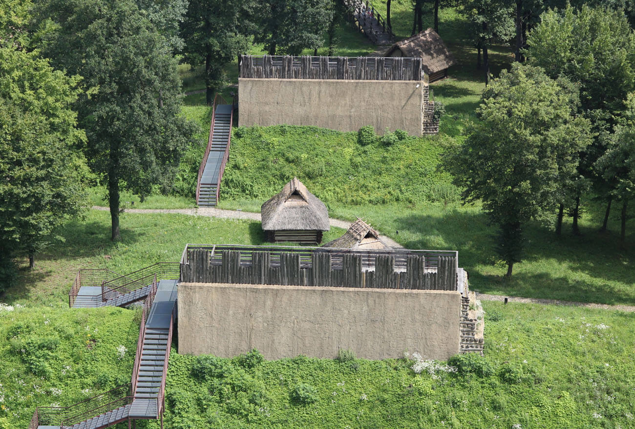
Currently, on the site of one of the most important archaeological sites in Poland, there is an archaeological open-air museum called Carpathian Troy, which is a branch of the Podkarpackie Museum from Krosno. The open-air museum complex consists of a stronghold on a hill and an archaeological park at its foot. The hillfort has preserved earthen ramparts, now approximately 10 meters high and a maximum of 20-24 meters wide at the base, on which over 150 meters of fortifications have been reconstructed in several sections, including the gate from the Bronze Age and the gate from the early Middle Ages, leading to a former courtyard occupied by several reconstructed cottages. The archaeological park also includes reconstructions of a village from the early Bronze Age and a Slavic settlement from the early Middle Ages. All buildings were constructed based on the results of scientific research and available knowledge, with the aim of reproducing historical reality as good as possible, although the visual effect is partly spoiled by pavements made of modern cobblestones and metal stairs climbing the ramparts. The open-air museum also has an exhibition pavilion with an exhibition hall, a conference room, a multimedia educational room for children, and a catering facility where food based on ancient culinary art is served. Opening times and events can be found on the official website here.
bibliography:
Dąbrowska E., Wielkie grody dorzecza górnej Wisły, Warszawa 1973.
Gancarski J., Skansen archeologiczny w Trzcinicy, Krosno 2010.
Gancarski J., Poleski J., Trzcinica, pow. Jasło – najstarsze wczesnośredniowieczne grodzisko w Karpatach polskich [in:] Wczesne średniowiecze w Karpatach polskich, red. J. Gancarski, Krosno 2006.
Kruczek Z., Skansen Archeologiczny „Karpacka Troja” – Kreacja nowej atrakcji turystycznej i ocena jej jakości, “Kultura i turystyka – miejsca spotkań”, 6/2013.
Kunysz A., Grodziska w województwie rzeszowskim, „Materiały i Sprawozdania Rzeszowskiego Ośrodka Archeologicznego za rok 1966”, Rzeszów 1968.
Śpiewla Ł., Wybrane grodziska wczesnośredniowieczne, a kwestia turystyki na terenie województwa podkarpackiego, “Raport Archeologiczny” 14/2019.
Zollówna H., Żaki A., Grodzisko w Trzcinicy pow. Jasło (Polska), „Acta Archaeologica Carpathica”, I/1/1958.