
History
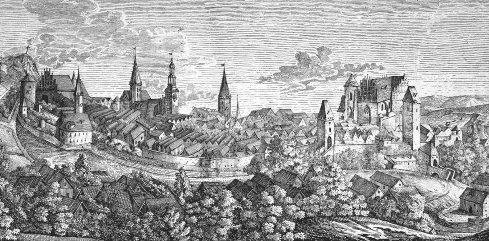
Strzegom (Ztrigoni, Strigovia, Striegau) was formed from a settlement that grew up next to the castellan early medieval stronghold. Around 1203, this settlement was given to the Knights Hospitaller, and in 1242 it received town charter. The defensive walls of Strzegom were built in the years 1291-99 on the order of prince Bolko II in place of previously existing wooden-earth fortifications. After the Hussite Wars, around the middle of the 15th century fortifications were extended by a second, outer ring. Around 1475, an extended, semicircular low towers were erected, among them a defensive chapel of St. Antoni. During the Thirty Years War the fortifications suffered damage but were rebuilt. The demolition was carried out from 1748 and finally formally liquidated after 1823. The last destruction of the relics of the fortification took place during the battle for the town in 1945.
Architecture
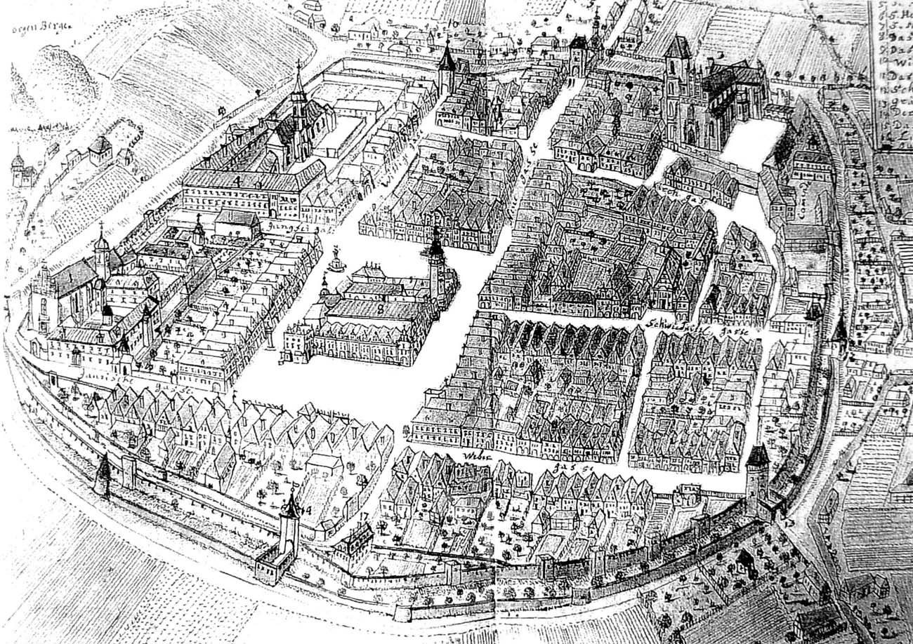
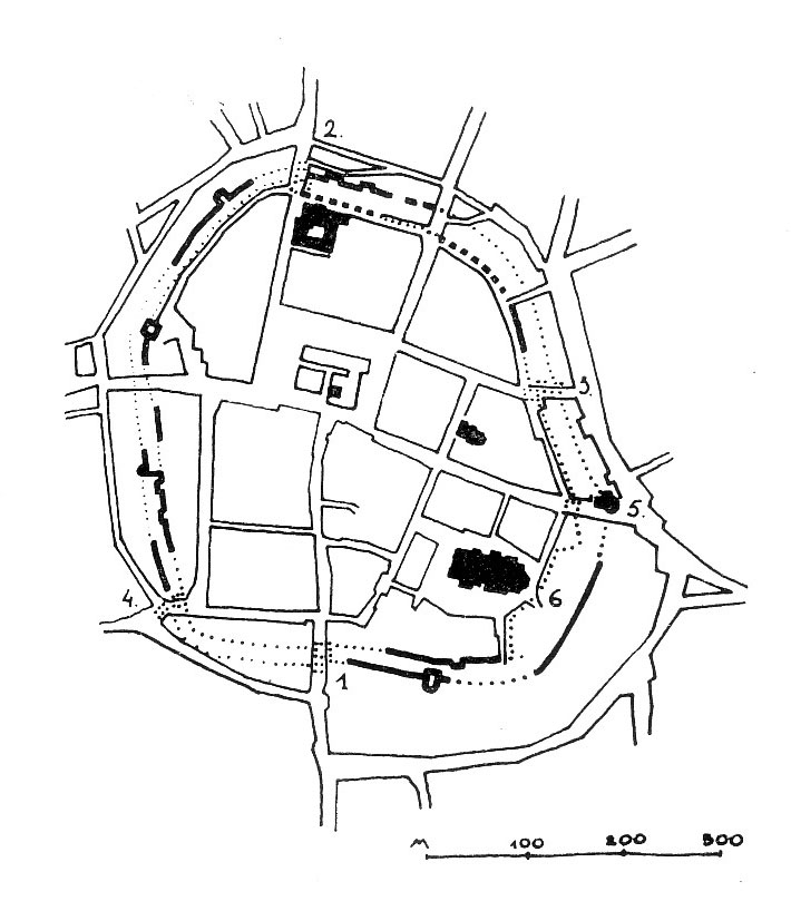
The defensive walls were built of stones combined with clay and lime mortar on a plan similar to an oval with a projection on the south-eastern side including the basilica of St. Peter and Paul. In the lower part they were about 1.2 – 2.4 meters thick, while it were high at about 8-9 meters (according to measurements from the 19th century). The crown was probably initially in the form of a wall-walk protected by a breastwork with a battlement, replaced during the period of the spread of hand firearms with a roofed porch with loop holes. The fortifications were reinforced by four-sided towers, initially open from the town side, protruding from the face of the wall. From the second half of the fifteenth century, the town was surrounded by a second, outer, lower ring of the wall equipped with semicircular bastions.
Five gates led to the town: Jaworska from the north, Wrocławska (Wittiga) from the east, New from the south, Świdnicka from the south-east and Grabińska from the south-west. They were in the form of four-sided and octagonal gatehouses with passages in the ground floors, extended since the second half of the 15th century by necks connected to the outer belt of fortifications.
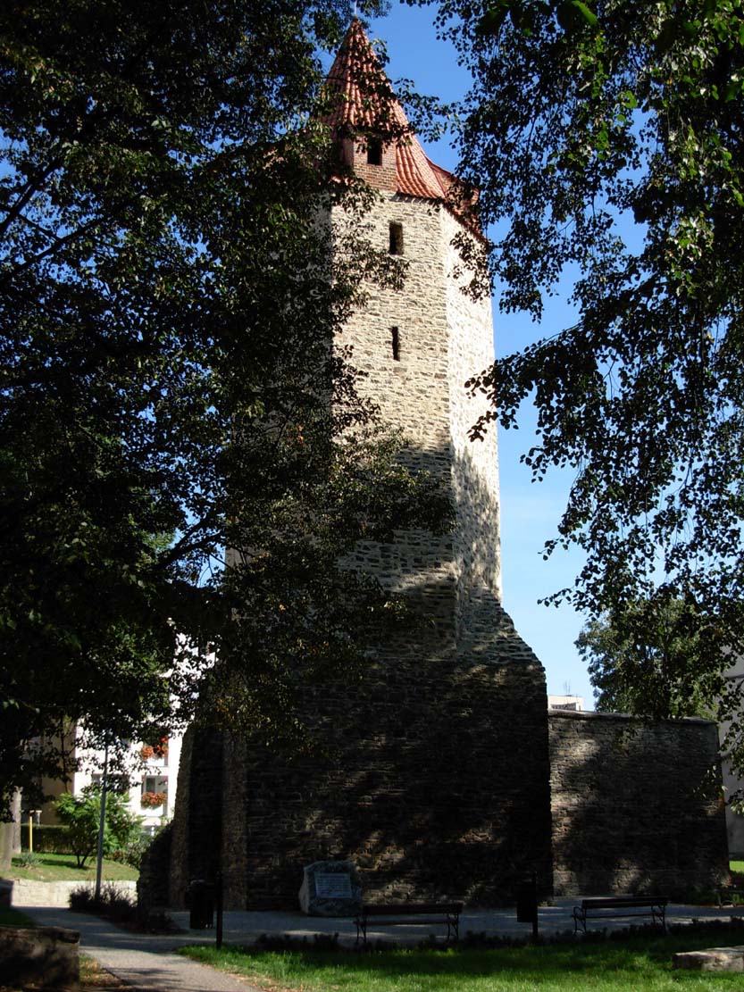
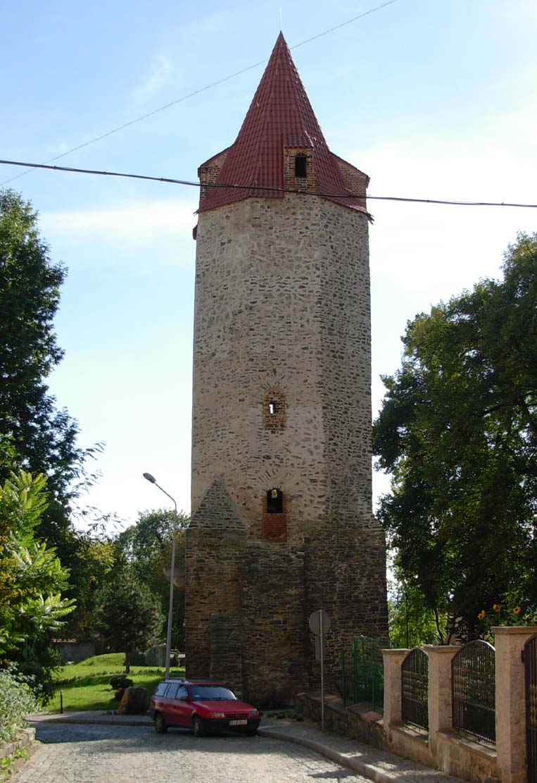
Current state
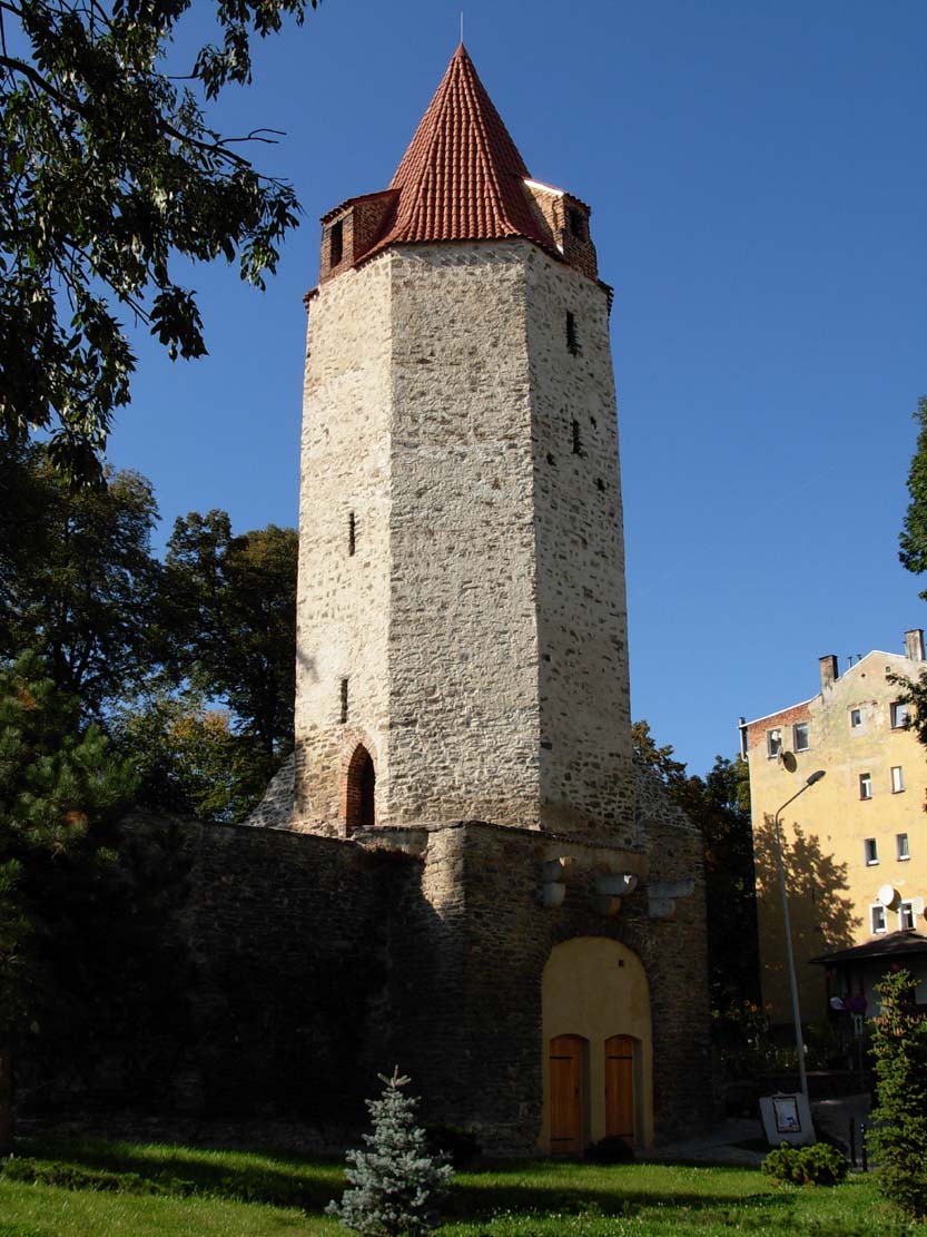
The best preserved fragment of fortifications is the Birds Tower (Bow Tower) from the second half of the fourteenth century, located in the western part of the Old Town at Kamienna street and a tower that is part of the chapel of St. Anthony. In the park between Kamienna and Parkowa streets is a low wall with the outline of the tower. Further south – west of Krótka street to St. Thomas street also retains a section of walls, partly used as a wall of buildings. The most neglected stretch is in the south and south-east of the Old Town. The lower part of the walls is located at the monastery complex where formerly was the Jawor Gate.

bibliography:
Atlas historyczny miast polskich. Tom IV Śląsk, red. R.Czaja, R.Młynarska-Kaletynowa, R.Eysymontt, zeszyt 6 Strzegom, Wrocław 2015.
Przyłęcki M., Miejskie fortyfikacje średniowieczne na Dolnym Śląsku. Ochrona, konserwacja i ekspozycja 1850 – 1980, Warszawa 1987.
Przyłęcki M., Mury obronne miast Dolnego Śląska, Wrocław 1970.