
History
The Sandomierz hillfort, built in the second half of the 10th century on the Castle Hill, was one of the main princely and royal residences. Since the 12th century it served as the castellany center, and in the 12th-13th century the capital of the principality. The basis of its economic development was the location at the intersection of trade routes of regional and international significance, as well as open settlements developing around it, initially tribal and later servile. The first record of the stronghold was in the anonymous chronicle of the so-called Gallus from the beginning of the 12th century, who mentioned Sandomierz as one of the main seats of the kingdom (“sedes regni principales”). In addition, in the same century, the Sandomierz land was recorded (“Sudumara”) in the work of the Arab geographer Al-Idrisi.
The peak period of the development of the stronghold was in the second half of the 12th and the first half of the 13th century. After the death of prince Bolesław III Wrymouth in 1138, Sandomierz belonged to the district senior, from which a section for Prince Henry was separated. Perhaps the first investment in brick buildings in the form of a representative palas was associated with the time of his rule, which fell between 1146 and 1166. After the death of Henry, the district was divided, and Sandomierz temporarily provided salaries to the wife of Bolesław Kędzierzawy, Princess Maria. Only after the death of Bolesław in 1173, thanks to another ruler of this district, Kazimierz the Just, did more intense construction activity develop. This ruler enrolled as the founder of the collegiate church, the largest temple in Sandomierz, also near the hillfort a suburban settlement began to develop. At that time, in order to expand the area of the hillfort, the first leveling of the hill was made in order to make new earth fortifications.
In 1241, the Sandomierz stronghold was captured during the Mongol invasion. In the following years, it was rebuilt, as indicated by a document from 1258 by Prince Bolesław the Chaste, which exempted the population of the Kraków bishop’s estate from construction works, with the exception of Kraków and Sandomierz. However, at the turn of 1259 and 1260, Sandomierz was once again destroyed by Tatar and Ruthenian troops, defended by the castellan Piotr of Krępa and his brother Zbigniew. This time, the siege lasted three days, and the attackers managed to breach the fortifications mainly thanks to the possession of siege machines. As a result of the destruction, massacres and abductions, most of the settlements around the stronghold disappeared, especially on the St. James and St. Paul hills. The core of the stronghold was uninhabitable for about ten years, because the prince had to stay at the nearby manor in Osiek, and the first document since the invasion was issued in Sandomierz only in 1270. After being rebuilt and strengthened, the stronghold withstood the Ruthenian-Lithuanian invasion in 1280, as well as another Mongol invasion at the turn of 1287 and 1288. In the meantime, it also provided shelter to the local population from the Lithuanian invasion of 1282.

During the times of Władysław the Elbow-high, recognized as the Prince of Kraków and Sandomierz in 1289, and the Czech King Wenceslas II, who used these titles since 1291, Sandomierz was the target of several Tatar, Lithuanian and Ruthenian raids, although the stronghold itself did not suffer any damages during these invasions. Władysław attempted to retake Sandomierz with the help of Ruthenian troops in 1302, but it was ineffective. He did not capture the stronghold until 1305, after Wenceslas’s death. The subsequent unification of Polish lands could have caused Sandomierz to lose its significance as the center of the hereditary district, which from then on served only as a temporary royal seat, used during the rulers’ travels around the country, and held by the starosts on a daily basis. In 1328, the tenant of the Sandomierz estates, Andrzej Ciołek, promised to allocate part of the income for repairs, but the stronghold’s condition was probably deteriorating. Moreover, the mostly wooden fortifications and buildings no longer met the requirements of the High Middle Ages.
The major reconstruction of the stronghold into a brick castle probably began after the great fire of Sandomierz and the Lithuanian raid of the town in 1349. The works were probably carried out on the initiative of King Kazimierz the Great, perhaps under the supervision of the then starost Sędziwoj. The castle was first recorded in the chronicle of Janko of Czarnków, covering the years 1370-1384, but written at the end of the 14th century. “Castrum in terra Sandomiriensi” was mentioned there among several dozen other castles and town fortifications built from the royal foundation. The castle was originally a separate defensive point, but after the construction of the town defensive walls in the second half of the 14th century, both formed a common fortification system. During the times of the Jagiellonian dynasty, the castle was certainly expanded, as indicated by information from 1394 about the payment of 20 fines by the treasurer Hinczka for the construction of the castle wall, as well as the frequent visits to Sandomierz by Władysław Jagiełło and the organisation of important ceremonies and meetings (e.g. the feudal homage of the Masovian princes from 1426). Repairs were also needed, including in 1480, after the slope had slipped and the corner tower at the main residential building had collapsed. On the orders of Kazimierz IV Jagiellon, the reconstruction was undertaken by the starost Rafał of Jarosław, with the help of the Sandomierz burghers.
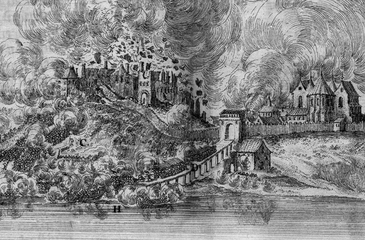
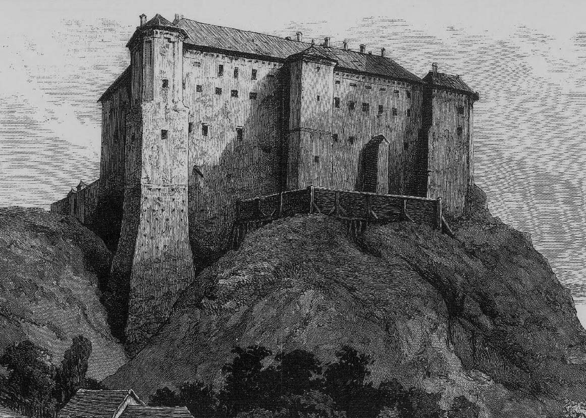
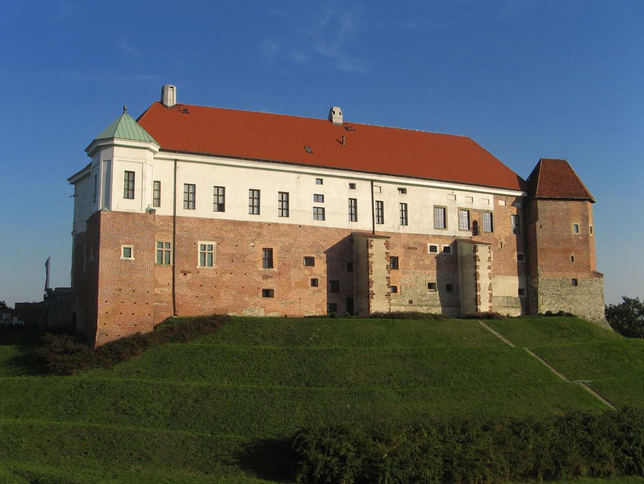
The first early modern transformations of the castle began around 1520 on the initiative of King Sigismund I the Old. Under the direction of Benedykt of Sandomierz or his associates (mason Krzysztof Ginther, master carpenter Hanusz, provost of Koprzywnica Jan of Wiślica), subsequent wings were then built or rebuilt, giving the entire complex a more regular layout. Further Renaissance works lasted in the years 1564-1566 during the reign of King Sigismund Augustus and in the years 1586-1597, initially on the initiative of Stefan Batory. At that time, other dilapidated Gothic buildings were slighted, with the main tower of King Kazimierz being the first, the demolition of which was ordered in 1564, and the gatehouse removed a year later. In 1655, the rebuilt castle was captured by the Swedes, who blew up the building when they withdrew a year later. The surviving western wing was rebuilt at the end of the 17th century. It served as the seat of the starost, the court, the archive and the treasury. In 1825, the Austrians rebuilt it into a prison and the seat of the criminal court. The prison was not closed until 1959.

Architecture
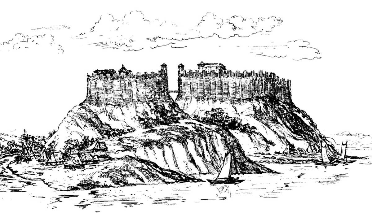
The stronghold from the 12th-13th century was located on a hill on the left bank of the Vistula. Probably at that time it covered both hills: Cathedral and Castle Hill. The latter was on the plan of an oval with a diameter of about 90 meters with a relative height of the slopes of up to 18 meters. In its immediate vicinity there was the old riverbed of the Vistula, and on the eastern side a narrow valley whose edges marked the slopes of Castle and Świętojakubskie hills. Its bottom flowed the Piszczele stream.
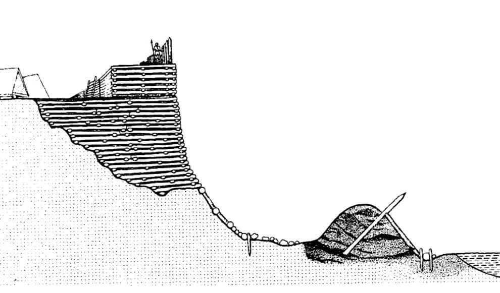
The stronghold from the second half of the 12th century consisted of a wood and earth rampart with a chest structure, preceded by a ditch on the foreground side, and a fore-embankment with made of obliquely driven piles. During the reconstruction of the rampart in the second half of the 12th century, the insufficient space inside the embankments resulted in the foundation of fortifications not at the top, but on the slope of the hill. Probably the internal buildings of the hillfort included some brick structures, e.g. a building in the form of a palas, the supposed relics of which date back to around the middle of the 12th century. In the area of the coutryard there could also be a castle church of St. Nicholas.
The rampart of the stronghold was destroyed during the first Mongol invasion in 1241, but it was quickly repaired and expanded. A second circumference of the embankments at the base of the hill was erected at that time, as well as a second, irrigated moat. In the construction of the older rampart, built on the slope, oak wood was used, in the younger phase, pine was used at the base of the hill. This could prove the lack of good raw material and the already advanced depletion of forests. The lower moat constituting the outer stage of the fortifications, located at the foot of the hill, was 5 meters wide and 2.5 meters deep.
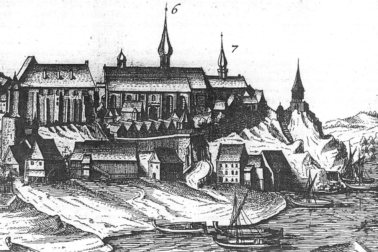
In the borough on the Cathedral Hill, with fortifications similar to the main one, before the mid-12th century a collegiate church of the Blessed Virgin Mary and the church of St. Nicholas were built. Their location is disputable, but it is most commonly assumed that the Church of the Blessed Virgin Mary had to stand near the later Gothic temple, and the church of St. Nicholas as a castle chapel perhaps on the Castle Hill. Separation of the fortifications of the Cathedral and Castle Hill followed the reconstruction of the destructions of the Mongol invasion of 1241, probably at the beginning of the second half of the 13th century, when a ditch was dug with a bridge leading over it. The Cathedral Hill was almost twice as large, but was a few meters lower than the Castle Hill. Its maximum uplift was in the northern part, where the Romanesque collegiate church built of white stone blocks and covered with shingles and later a Gothic cathedral stood. The area fell slightly towards the south-west, where there were wooden huts.
The second borough could stretch from the north on the Collegium Gostomianum, the third hill on the edge of the Vistula valley. There were found remains of palisade fortifications created from obliquely driven piles and ditches, but without an earth or wooden rampart. Inside the ward bounded by a palisade, there were densely spaced residential and utility buildings, of which only cavities and cellars have survived. During the eleventh century or the beginning of the twelfth century, the palisade was partially rebuilt, a grate-chested rampart was built and perhaps a gate tower in the north-eastern part of the hill, where the descent towards the Vistula. In the central part of the courtyard, in the place of one of the older houses, in the 11th century a wooden building was erected on a rectangular plan with dimensions of 5 x 5.5 meters. It was once identified as the church of St. Peter, is now considered a wooden residential tower. The church, on the other hand, was probably located in the western part of the borough, above the gorge, while the central and eastern parts were covered by wooden residential and economic buildings at the beginning of the 12th century. Probably already in the first half of the thirteenth century, the fortifications and the so-called a residential tower were pulled down, thus preparing a place for a new, much larger parish church around which the cemetery. Even before the invasion of 1259, there was a complete transformation of the character of the Cathedral Hill’s buildings, which at that time had primarily a sacred and burial function.
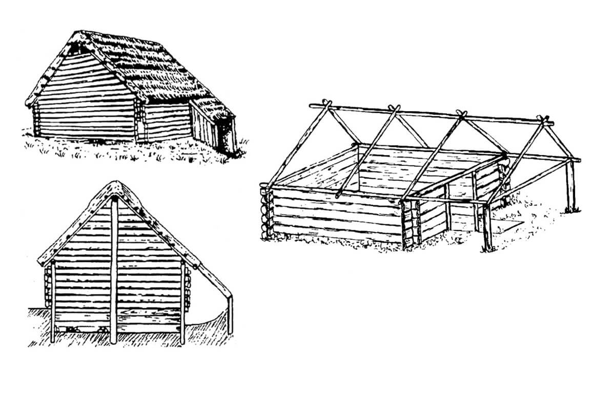
Early medieval settlement also developed on the Świętojakubskie Hill adjacent to the Castle Hill. The buildings were loose there, and the huts were located close to the edge of the Vistula embankment. The houses were built on a square plan with dimensions of about 5 x 5 meters, semi-dugouts because they were dug into less than 120 to 140 cm. A specific feature of these buildings were wooden stairs formed in the ground (in passages) leading to their interior. The walls were lined with planks, and in the above ground part they were constructed of wicker covered with clay. The gable roofs were supported on four-sided or round columns situated in the corners and in the middle of each wall. The larger huts also had a central pole. Some houses were equipped with dome stoves built outside the hut, others had clay stoves (or hearths) situated in their eastern or northern corner. Residential buildings were accompanied by utility rooms in the form of basements dig in the ground.
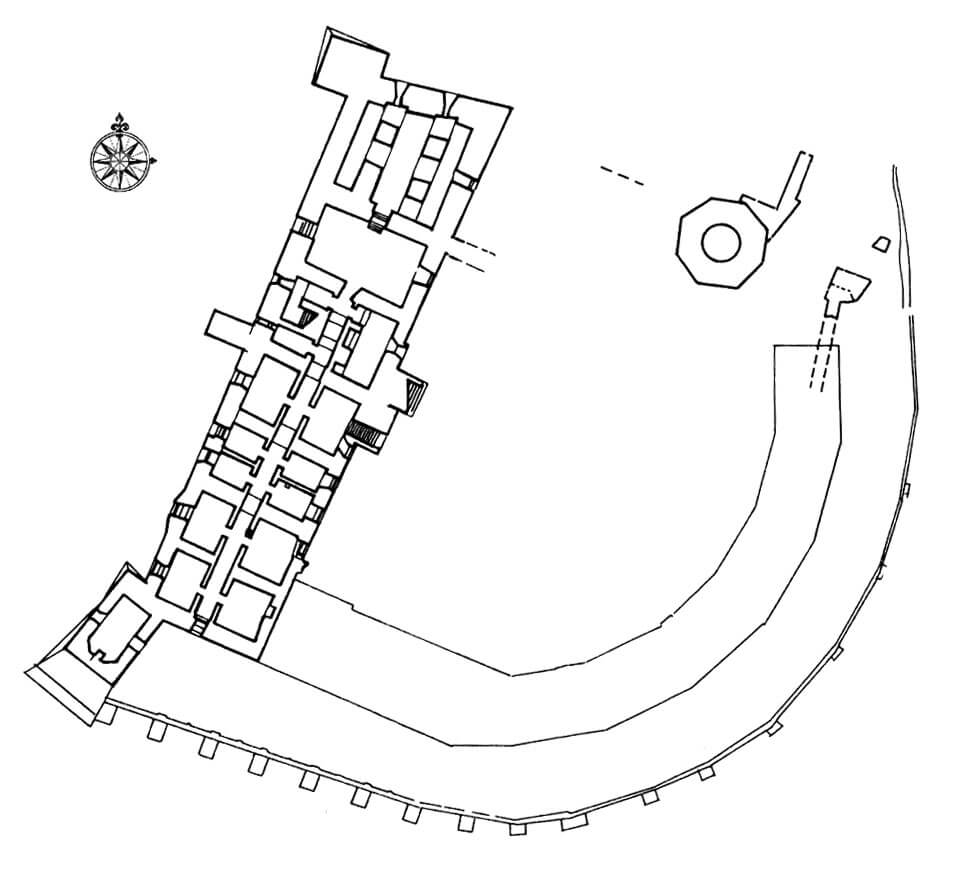
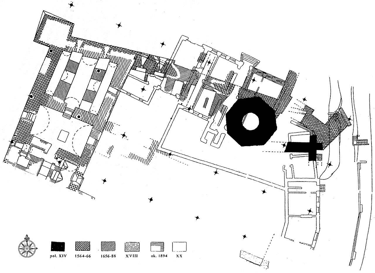
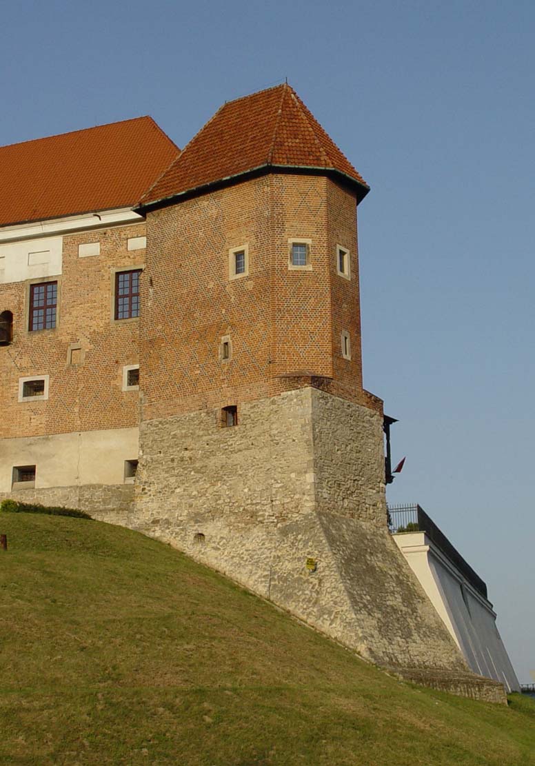
The layout of the Gothic castle due to the destructions and reconstructions is not fully explained. Its outline was probably irregular, with lines aligned to the form of the hill, wherein a part of the perimeter from the town side was probably made of timber. The entrance to the castle was located on the side of the town and was probably in the north-eastern corner. The fortifications of the original castle included an octagonal tower with walls in the ground floor 3.6 – 3.9 meters thick. It housed a small cylindrical basement with an interior diameter of 3.5 – 3.6 meters, and the length of the octagonal side was 4.1 meters. The tower was located in the north-eastern corner of the castle, next to the gate.
The earliest castle house stood on the south or east side of the site. In the inventorys it is identified as standing opposite the Vistula. Apart it, the building of the former palas was still functioning until the end of the 15th century (recorded in 1510 as “domus lapidea”), as well as the church of St. Nicholas, sometimes connected with the castle chapel, located in the southern part of the hill in the surrounding cemetery. Around 1480, a diagonal tower called the “chicken foot” was added to the southern building at the western corner. Perhaps around 1480 or a little later, the southern building was also extended to the east and west and ended with a second, small corner tower. During the reign of Sigismund I, around 1520-1526, the two-story building of the southern wing was built or rebuilt and the western wing was extended.
There were a kitchen and a brewery on the outer bailey between the castle and the outer bailey, and at the river, at the foot of the castle, an water mill and a granary. The kitchen and brewery were located on the eastern slope, in the vicinity of the Kraków Gate. Perhaps in the time of king Casimir the Great there was a connection of the castle with the brick town walls of Sandomierz, by a earth rampart crowned with a timber palisade.
Current state
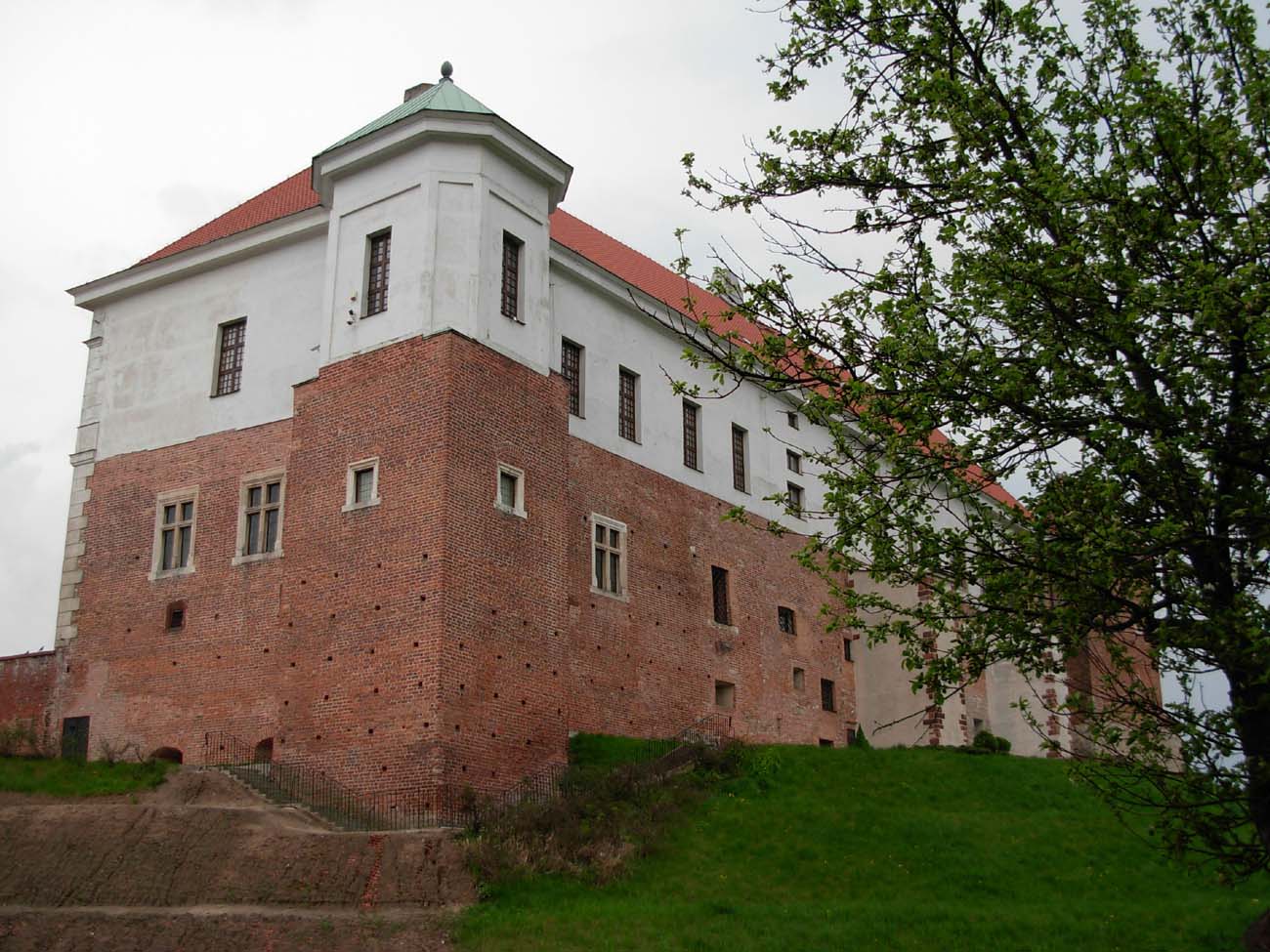
Until modern times only renaissance, west range of the castle has survived, which eastern façade additionally has a classicist style. The interesting western side is flanked by two towers, from which the south comes from the 15th century. At present, the Castle Museum in Sandomierz is located in the castle, which also offers accommodation on commercial terms and allows accommodation in hotel rooms. Prices, opening times and other information can be found on the official website of the castle museum here.


bibliography:
Buko A., Początki Sandomierza, Warszawa 1998.
Leksykon zamków w Polsce, red. L.Kajzer, Warszawa 2003.
Późnośredniowieczne zamki na terenie dawnego województwa sandomierskiego, red. L.Kajzer, Kielce 2005.
Proksa M., Fazy budowy murowanego założenia zamkowego na Wzgórzu Zamkowym w Sandomierzu [w:] Studia z historii i archeologii architektury, red. P. Kocańda, P. Gorazd-Dziuban, A. Rozwałka, Rzeszów 2021.
Widawski J., Miejskie mury obronne w państwie polskim do początku XV wieku, Warszawa 1973.
Wódz B.E., Dzieje zamku królewskiego w Sandomierzu, Sandomierz 2022.
Wróblewski S., Zamki i dwory obronne województwa sandomierskiego w średniowieczu, Nowy Sącz 2006.
Zub J., Sandomierz, Tarnobrzeg 2000.