
History
Pyzdry appeared in documents as “terras Pisdrensem” in 1232, while the first information about a settlement with town charter and a castle, or rather a timber stronghold, was recorded in 1257. The brick castle was probably built at the same time as the town walls, maybe after about 1339 on the initiative of King Casimir the Great. It replaced an older defensive structure destroyed in 1331 by the Teutonic Knights.
During the reign of Louis Anjou in 1382, Pyzdry was occupied by Hungarian troops. It was to be pledged to the royal son-in-law, a candidate for the throne, Zygmunt Luxemburg. In 1383, the town and castle and the Hungarian troops stationed there, were besieged by the knights of the Mazovian prince Siemowit IV, who took advantage of the civil war between Grzymalit and Nałęcz families, to enter Wielkopolska. The town surrendered after three or four days, the castle defended a little longer, but after a short resistance, the Hungarian crew capitulated on honorary conditions. During this siege, the use of firearms was recorded for the first time in Polish lands.
In the 15th century, Pyzdry was an important centre of crafts and trade. The town was the seat of the judicial district and the centre of the starosty, which is why the fortifications were probably maintained in good condition, especially since the castle was often visited by King Władysław Jagiełło, and later Kazimierz IV Jagiellon. From the mid-15th to the middle of the 16th century, castle was a protection of the dowry of Polish queens: Zofia Holszańska, Elżbieta Rakuszanka, Bona Sforza, and was kept by the royal governors.
In early modern times it was rebuilt several times. In the seventeenth century it was destroyed by the Swedes and has not regained its glory. After a fire in 1768 the castle was almost completely demolished by the Prussians, during the construction of a prison at the site of the eastern royal palace. A granary was built at the northern house and then a mill. The Pyzdry fire of 1814 contributed to the thorough regulation of the town by the Prussian authorities in the following years, as a result of which the town fortifications were almost completely demolished.
Architecture
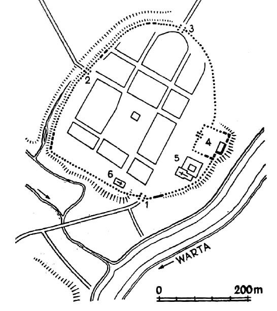
The perimeter of the town defensive walls marked the shape of an oval, slightly elongated north-south, with a less regular line from east and south, adapted to the course of the escarpment. The area of the town within the walls was about 11 ha, and the length of the fortification line was about 1250 meters. Both sacral buildings: the parish church and the Franciscan monastery complex were located directly at the town walls, but with a space allowing passage of the underwall street. It is known that the defensive wall was made of bricks, probably on a stone foundation, but unfortunately its dimensions are not known. It was probably reinforced with towers, but nothing certain is known about them either. From the south and east, the town did not have external fortifications due to the large slopes of the area. From the other sides behind the walls ran a moat, probably irrigated, as evidenced by the pond marked on the early modern plan in its southwestern part, connected to the Flis stream. Behind the moat was the earth rampart mentioned in 1383.
There were probably three gates to the town. In the north-eastern part of the perimeter, at the height of the center of the market, there was a gate leading towards Toruń. In the south-west part there was a gate leading towards Kalisz and to the crossing of the Warta River, while the third, west gate opened the road to Poznań, lying on the extension of the northern frontage of the market. Nothing is known about the architectural form of the gates. The architectural form of the gates was probably tower-like. According to chronicler Janko od Czarnków, one of them had two locks.
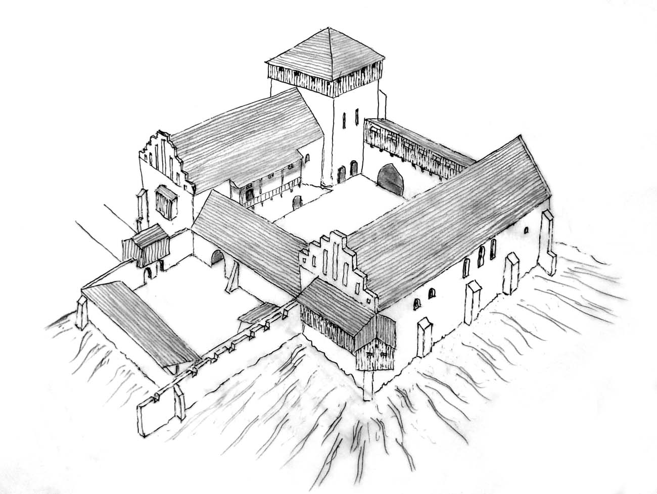
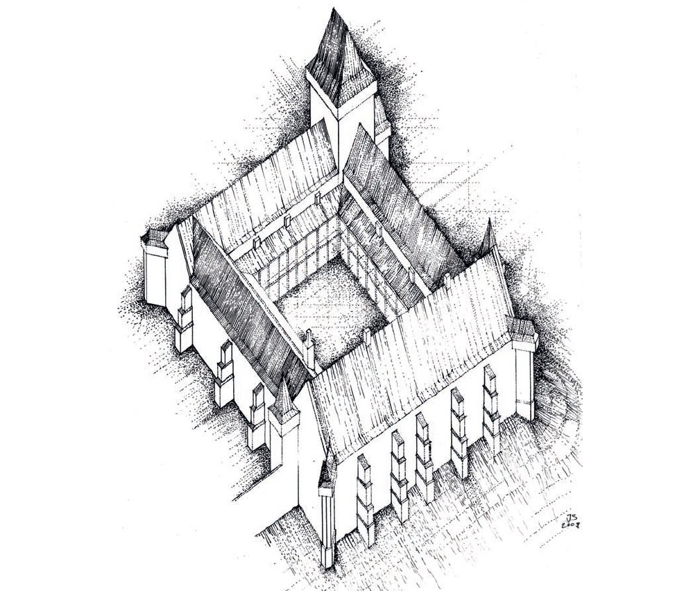
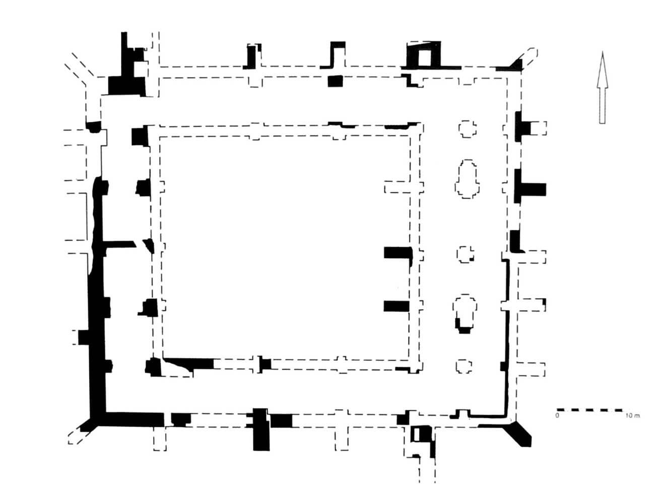
The castle was located within the town walls in the north-eastern corner of the Pyzdry, on the promontory of the high escarpment, which fell in the east towards the river Warta. It was a typical town castle with a rectangular shape and dimensions of approximately 49.5 x 60.50 meters. The thickness of the brick perimeter walls was 1.8-1.85 meters, and only the northern perimeter wall was slightly narrower, reaching about 1.5 meters. From the outside, the walls were supported by buttresses. Inside there were four wings surrounding the courtyard, of which the eastern building served as the main residential and representative building of the castle and was probably the first to be built. Also from the northwest corner, there was a quadrangular main tower with dimensions of 9.5 x 10 meters.
The west range had external dimensions of about 11 x 39.25 meters. It probably housed five rooms in a row. Next to it there was a tower chamber measuring approximately 4.5 x 6 meters. The southern house measured about 9.5 x 34.7 meters. It was a one-aisle object, probably divided into three rooms. The internal divisions corresponded to short rectangular buttresses (lesenes) protruding from the northern wall of that house, and from the south on their extension there were external buttresses. The northern building had similar dimensions and probably internal divisions. The main range of the castle, the eastern building, unlike the previous ones, was a two-aisle structure, 49.75 meters long and 15 meters wide. From the riverside (eastern), it was reinforced with buttresses, which reflected its internal divisions, while from the west side it was adjoined by a porch with a width of 3.4 meters. In its south-eastern corner was a small turret with a side length of 4.2 meters. It had a communication or latrine function. It is not certain in what period individual ranges were built, only the eastern building as the main residential and representative house of the castle had to exist already in the fourteenth century. At the northern facade of the castle there were probably two tower projections. The north-eastern one, with sides length of about 4 meters, served sanitary functions: it was equipped with a pointed chute, as well as a diagonal offset at the western wall. Inside it was a chamber measuring 1.3 x 2.2 meters. The north-west projection had a side length of about 4 meters.
The gate was placed from the town side, in the western curtain of the wall. In the 15th century or at the beginning of the 16th century it was replaced by a new gate passage in the southern wall, probably due to the outer bailey situated there. Another gate was also made in the northern wall to allow to go outside the town walls. Outer bailey between the castle and the Franciscan friary in the south probably had internal buildings of timber. From the north it was limited by the castle wall, from the east by the town wall, and from the south by the monastery wall. The western side was closed by a fence with a gate at which a small gate building and a stable stood.
Current state
Only a heavily transformed house (primary eastern wing) in which the Gothic walls are hidden, as well as the buttress in the northwest corner has survived. The basements of three castle buildings, built of bricks in a Flemish bond, also have survived. A small fragment of the town defensive wall has been preserved only in the yard of the house at ul. Kaliska 35 Street. It is made of bricks laid in the Flemish bond.
bibliography:
Leksykon zamków w Polsce, red. L.Kajzer, Warszawa 2003.
Olszacki T., Rezydencje Andegawenów po obu stronach Karpat. Wstęp do badań [in:] Zamki w Karpatach, red. J.Gancarski, Krosno 2014.
Olszacki T., Różański A., Badania terenowe zamków z obszaru Wielkopolski i Polski Centralnej w XXI wieku [in:] Gemma Gemmarum, red. Różański A., Poznań 2017.
Pietrzak J., Zamki i dwory obronne w dobrach państwowych prowincji wielkopolskiej, Łódź 2003.
Tomala J., Murowana architektura romańska i gotycka w Wielkopolsce, tom 2, architektura obronna, Kalisz 2011.
Widawski J., Miejskie mury obronne w państwie polskim do początku XV wieku, Warszawa 1973.