History
The first Teutonic Knights castle in Przezmark (Preußisch Mark) was erected in the second half of the 13th century. Its original name refers to a document from 1305 in which it was described as the Prutenicale Forum, meaning the Prussian Market. The construction of a brick building in years 1316 to 1331 was initiated by the commander of the Dzierzgoń, Luther from Braunschweig, at the same time fulfilling the duties of the obersttrappier. In the castle there was a obersttressler’s office, from 1320 a pfleger’s seat, from 1359 a vogt’s seat and finally in 1437 a commandry moved here, after the destruction of the castle in Dzierzgoń. Due to the increasing importance of the castle, it was expanded around 1359 and again in 1437.
Although the castle was located in a very convenient place for defense, in 1410 it was taken without a fight by the army of Władysław Jagiełło. The Polish king rented it to the knight Mroczko and sent him to the castle together with the writer to draw up a property inventory. On the way back, the writer and the fellowship were killed. A knight Mroczko was blamed for the desire to take over the Teutonic treasures, although the matter was never fully explained. A year later, however, the castle returned to the Teutonic Knights as a result of the First Peace of Toruń.
In 1414, during the so-called Hunger War, Przezmark was to be conquered again by the Polish army and heavily damaged, but the inventories of that time are unlikely to confirm such events (among others, the chapel’s equipment was not looted). After recapturing the stronghold, the Order significantly expanded and strengthened the castle. In 1437, the seat of the commander, who was then Walter von Kirskorf, was transferred to it from Dzierzgoń. Together with the lieutenant Ulrich von Dudelsheym, the commandry had 18 members at the time.
In 1454, when the Thirteen-year Polish-Teutonic war broke out, the terrified commander Gunter Hetzwald, secretly from the castle garrison, collected all valuables from the treasury and fled to Malbork. A week later, the castle was occupied by Elbląg troops, led by Gabriel Bażyński, newly appointed by the Polish king, the Elbląg voivode. They lasted until autumn, when the balance of power changed due to the defeat at Chojnice. This time, Bażyński escaped to Elbląg, and the left commander, burgher from Braniewo, George von Berge, surrendered the castle to the Teutonic troops in exchange for the preserving life and property. Soon, the dispersed commandry returned to Przezmark, taking action to strengthen the castle, which became a key stronghold in the region next to Malbork, guarding the route from Pomesania to Pasłęk. Finally, under the Second Peace of Toruń from 1466, Przemarkk remained within the borders of Order Prussia, and the Grand Master of the Teutonic Order became a vassal of the Polish king.
In the 15th century, armaments for Teutonic knights were manufactured on a large scale in Przezmark and in the 16th century, guns, hand firearms and ammunition were made. However, at the beginning of the 16th century, due to the deteriorating state of the Teutonic finances, Przezmark passed into the possession of the Pomesanian bishops, and then after secularization, became the seat of the starosts. Therefore, in the 80s of the 16th century, the castle underwent another reconstruction, which was to make it a residence in place of a defensive building. In new form, the building suffered damages during the Polish-Swedish fights in the 17th century. Throughout the eighteenth and nineteenth centuries, the building, although it housed the Land Office, was seriously neglected, and the process of its ruin was sealed, when at the end of the eighteenth century, the demolition of walls was begun in order to obtain building materials for the farm and Evangelical church.
Architecture
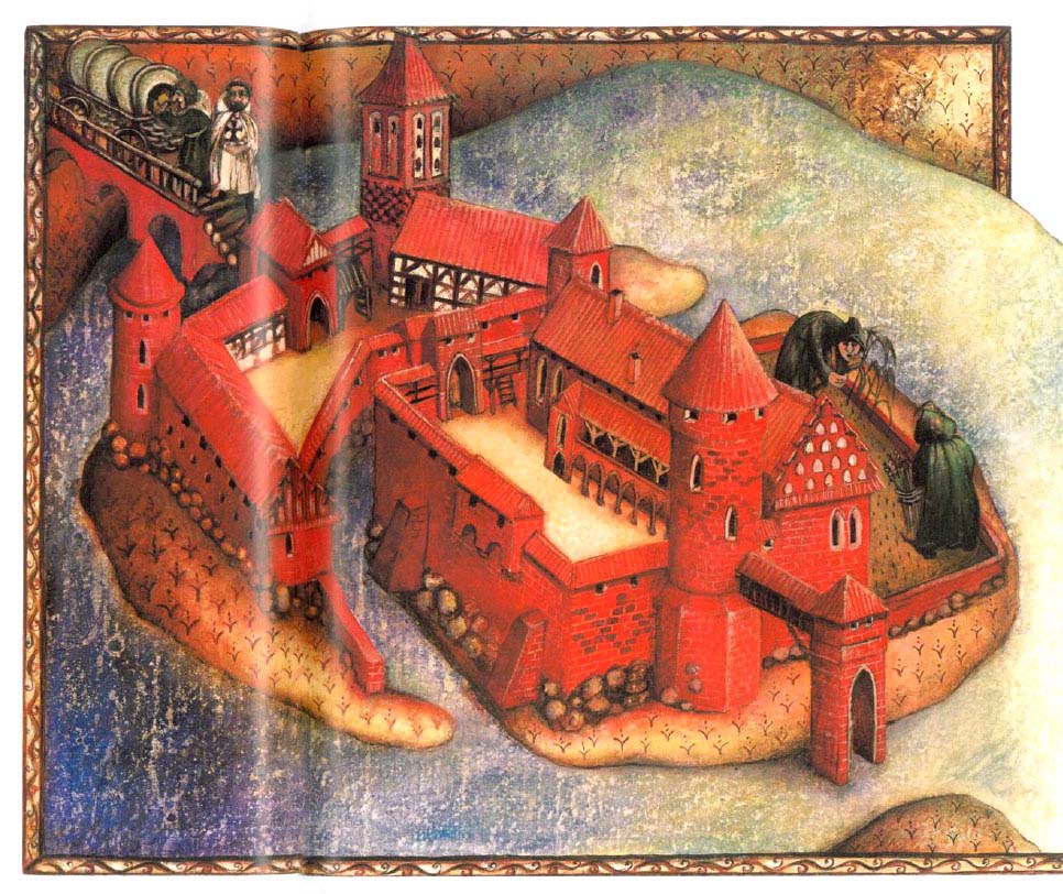
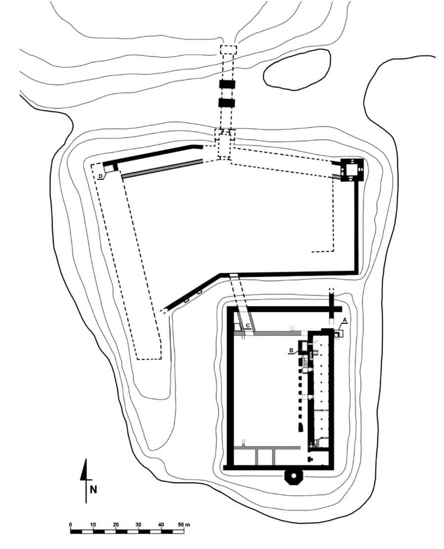
The natural conditions of terrain were used when the castle was built, placed on a peninsula, falling down steep slopes to Lake Motława Wielka. The castle acquired a three-part form, as it consisted of an outer bailey on the northern side, located at the base of the headland, a centrally located middle ward, surrounded from the east and west by the waters of the lake, and an upper ward occupying the extreme, southern part of the headland of the peninsula, protected by waters on three sides.
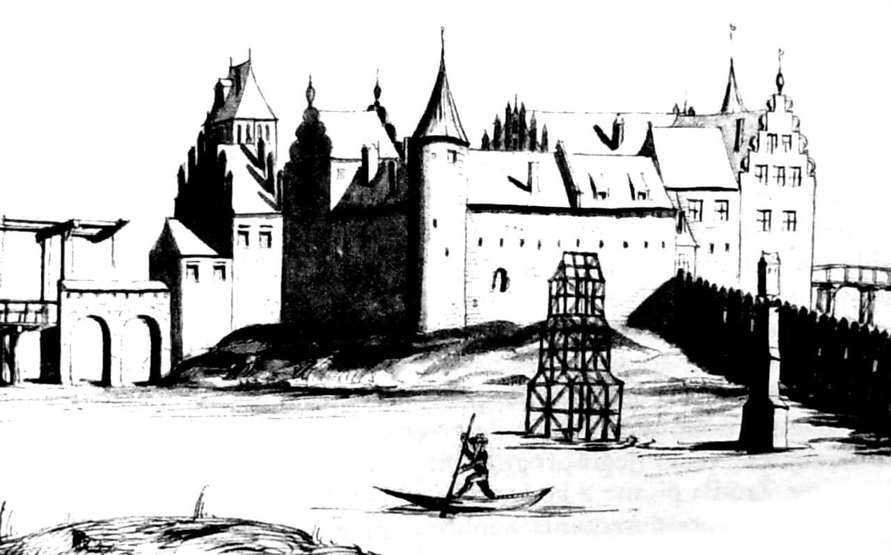
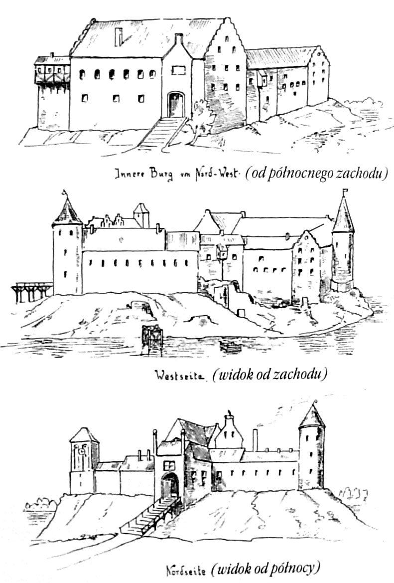
The middle ward was built on an irregular quadrilateral plan measuring approximately 115 x 60 meters, defined by a perimeter of walls ranging from approximately 1.3 meters to 1.8 meters thick and 10 meters high. It was separated from the outer bailey by a wide, irrigated moat, over which there was a bridge supported by two massive brick pillars, erected at a distance of approximately 9 meters from each other. Behind the moat there were curtains with a gatehouse and two towers: a round one from the west (it could have had a four-sided base, turning into a round upper part with squinches) and a square one, the so-called Prisoners Tower from the east. The gatehouse was topped with Gothic gables and most likely preceded by a short foregate. In the courtyard of the middle ward there were originally auxiliary buildings attached to the curtain walls. After the commandry was moved to the upper ward in 1437, all economic facilities were located in the middle ward. Among others, west of the Prison Tower there was a treadmill.
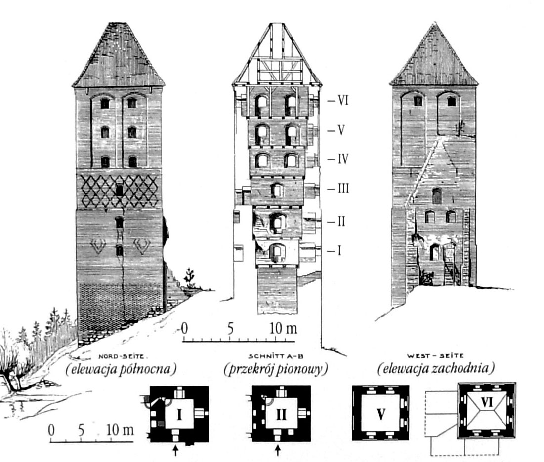
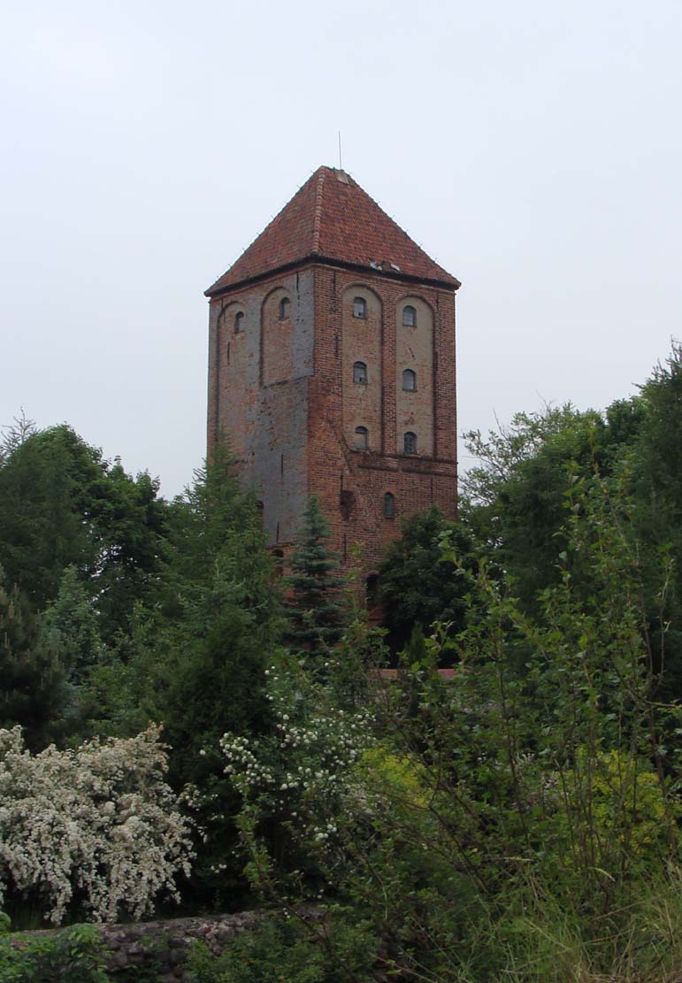
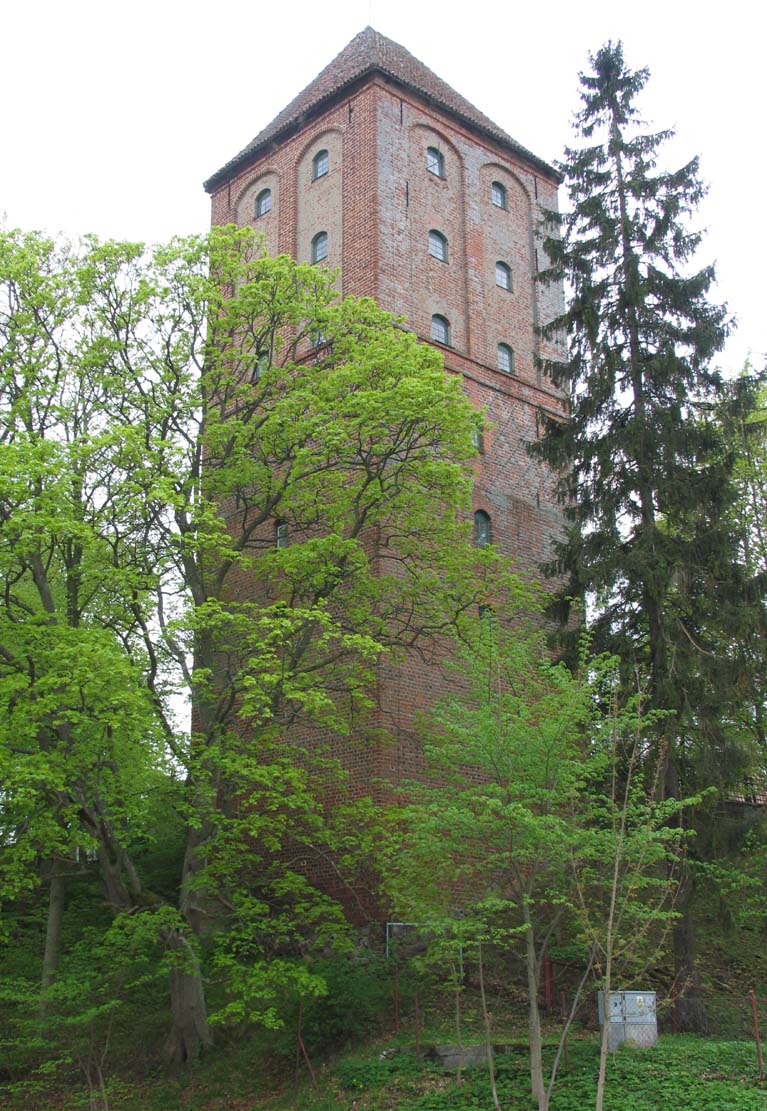
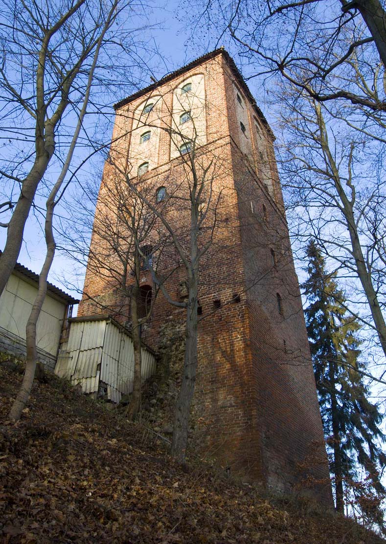
The Prisoners Tower was built around 1329 as part of the expansion of the Teutonic pfleger’s castle, when it reached a height of as much as 35 meters and six floors above the ground floor. In plan, its sides were 9.5 meters long. The tower’s facades were decorated with patterns of heavily fired zendrówka bricks and high blendes. The entrance was located from the courtyard (southern side), at the level of the second floor. The lowest floor without windows was created as higher than the others. On the upper floors there was one room lit by axial windows or windows arranged in pairs. On the lower floors, seats were placed in the thickness of the wall next to the windows.
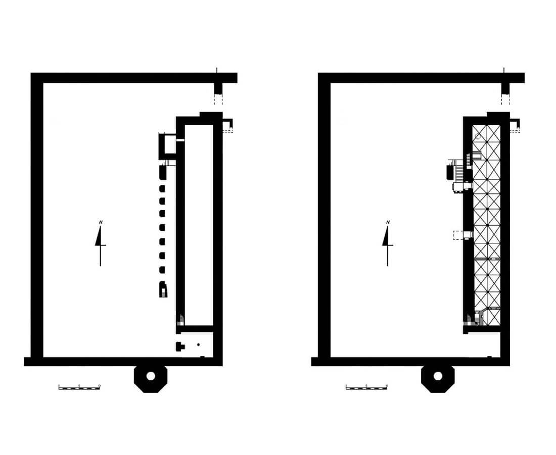
The upper ward was separated from the central part by a deep and wide, dry moat (ditch) in the shape of the letter L. The edges of its northern section were brick faced, as they were part of the walls of the middle and upper wards, while the western section probably included earth ramparts. The upper ward was surrounded by a brick perimeter wall set on a stone foundation, 73 meters long on the north-south line, 47 meters wide (on the east-west line) and of unknown height. A brick, octagonal tower with a diameter of 8 meters was adjacent to the southern side of the curtain, while the gate to the upper castle preceded by a zwinger (mantlet wall) was located in the north-west corner. Probably due to ground conditions, it was located at an angle. From the east, just like from the north, the castle was defended by an additional outer wall. The rectangular courtyard, measuring 47.5 x 28 meters, was paved with medium-sized stones.
The main castle buildings initially consisted only of the eastern house, perhaps adjacent to a four-sided tower from the north, surrounded by a quadrilateral of defensive walls with a courtyard on the western side. This extremely long house, measuring 11.5 x 63 meters, was made of bricks on a stone plinth. Together with the cloisters attached to it, it occupied almost the entire eastern part of the upper ward. Originally it was three-story and had a basement. The cloister arcades were supported by a row of seven moulded brick pillars. From the north, they were adjacent to a small room measuring 4.4 x 2.9 meters, accessible only from the inside of the building. Perhaps there was another similar room on its northern side, because the northern wall was extremely thin (only 0.3 meters). Entrances to the basement and ground floor rooms led from the courtyard, from under the cloister arcades, and to the first floor there were two staircases located at the cloister pillars.
The basement was first a single chamber, 45 meters long and 6.7 meters wide in the south to 8.1 meters wide in the north, then in the 15th century it was divided into two rooms. It was crowned with a groin vault, supported by a row of 11 granite pillars. Access to it was from the courtyard via two staircases: in the southern part and approximately 1/3 of the length of the wall on the northern side. The ground floor rooms also had vaults, at least in part, while the upper floor had only wooden ceilings. What stood out was the extreme southern ground floor chamber, measuring 7.3 x 7.8 meters, which vault was based on a single granite pillar. Access to it was through a double arcade from the cloister, and perhaps through a portal from the northern chamber. In the northern part of the wing, in the eastern avant-corps on the third floor, there was a small, narrow room measuring 1.1 x 2.8 meters, covered with a barrel vault and illuminated by a centrally placed semicircular window. There was a shallow niche in its eastern wall. The avant-corps space above and below the room was not available, but next to it, in the eastern perimeter wall, there was an entrance to a wooden latrine. This entrance could be closed with a bar beam. In the first half of the 15th century, the building was enlarged by a new storey, but it was not raised, and only the vaults were slighted to create space for a new ceiling.
The eastern building on the first floor housed the main castle rooms, such as the refectory or dormitory, but exceptionally the chapel of St. Anna was located at the middle ward. It was moved to the upper ward only after commandry being placed in the stronghold in the 15th century. The ground floor rooms, like in other Teutonic buildings, had an economic role (kitchen, bakery, pantries). If the northern part of the building was a tower, it could have housed a treasury. On the north-eastern side, under the latrine, there was a brick tank, not connected to the castle wall, measuring 2.7 x 3.5 meters and 2.7 meters high, opened from the south for regular waste removal.
In the southern part of the castle there was the octagonal tower mentioned above, adjoined by a dansker (latrine) protruding towards the lake. Access to it was possible through a wooden porch. In the 15th century, the northern wing was added, located perpendicular to the eastern house and adjoining it in the corner, although it could also have occurred in the second half of the 16th century. Gardens or orchards were apparently established on the slopes of the castle, accessed by a southern gate. It is known that in the castle, in addition to the rooms necessary for the Teutonic commandry, there was also a brewery, a granary, a malt house, a saddlery, stables, a forge and an armory. Some of these rooms, however, must have been located in the outer bailey or middle ward, due to the limited space on the edge of the promontory.
Current state
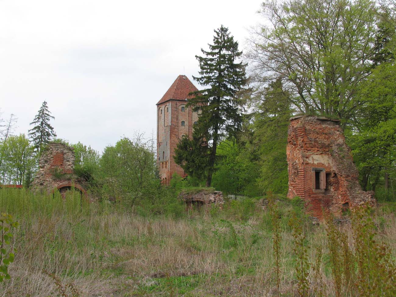
The main element of the castle that has survived to this day is the so-called Prisoner Tower, located on the former outer bailey. In addition, only small fragments of the walls of the upper ward remain, with the remains of an octagonal tower, the outline of a chamber located in the eastern wing, based on granite pillars, the north-eastern corner reaching a height of about 10 meters, and the relics of the entrance gate. The remains of the southern wing are early modern, as these part was added only in the 16th or 17th centuries. The ruins belong to a private person who allows tourists to visit the castle.
bibliography:
Garniec M., Garniec-Jackiewicz M., Zamki państwa krzyżackiego w dawnych Prusach, Olsztyn 2006.
Haftka M., Zamki krzyżackie. Dzierźgoń-Przezmark-Sztum, Gdańsk 2010.
Leksykon zamków w Polsce, red. L.Kajzer, Warszawa 2003.
Steinbrecht C., Die Ordensburgen der Hochmeisterzeit in Preussen, Berlin 1920.
Żurek M. Zamek pokrzyżacki w Przezmarku. Wstępne wyniki badań, “Archaeologia Historica Polona” tom 26, 2018.
Żurek M., Zamek w Przezmarku, gmina Stary Dzierzgoń, po dwóch sezonach badawczych [w:] IV i V Pomorska Sesja Sprawozdawcza, Gdańsk 2020.

