

History
The brick fortifications of Pasłęk (Preußisch Holland) were erected in the first half of the 14th century in place of a timber palisade. It was a consequence of receiving charter in 1297 and the progressive expansion of the town, inhabited by Dutch immigrants, developing alongside the Teutonic castle. Perhaps the brickyard recorded in Pasłęk already in 1297 was related to the construction of the walls.
In the 15th century, the town was destroyed several times during the sieges during the Polish-Teutonic wars in 1410 and 1414. However, the most significant devastation was caused by the Thirteen Years’ War in 1454 – 1466, and especially by the fire that consumed the buildings of Pasłęk in 1463. Soon after the end of the conflict, reconstruction began. Investments were made at the turn of the 15th and 16th centuries in the expansion and strengthening of the town’s fortifications, as well as the castle walls. During these works, among others, earth ramparts were built in front of the gates and towers, which was to increase the defensive value in the face of the increasing role of firearms.
In 1520, during the last Polish-Teutonic war, Pasłęk was besieged and captured by Polish troops under the command of the Crown Hetman, Mikołaj Firlej. The result was numerous fires within the town, the destruction of the castle, as well as the town walls damaged during the shelling. Pasłęk was rebuilt in the following years, but with numerous changes in the urban layout. The town walls were repaired with, inter alia, bricks from the destroyed castle.
In the 17th century, already archaic medieval fortifications were reinforced with external, early modern earth bastions. Pasłęk suffered as a result of wars with Sweden, in 1627 it was captured by the Swedish army, and during the Polish-Swedish war over the mouth of the Vistula, it was plundered several times by both sides of the conflict. In 1659, the town was besieged by the Swedish army, but despite considerable damages, it repelled the attack. In the 18th century, due to the development of firearms, the walls lost their importance completely and began to be dismantled, treated as an easily accessible source of building materials. In this way, around 1817, the Pottery Gate was pulled down, and then the upper parts of the Mill Gate.
Architecture
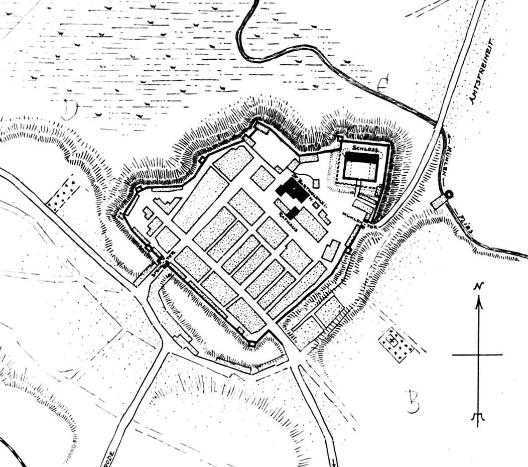
A line of walls about 1200 meters long ran along the perimeter of an irregular polygon, connecting in the north-eastern corner with the fortified walls of the castle. The fortification ring was adapted to the terrain. From the north, the town was protected by a mill canal, and from the north – west by swamps and wet, hard to reach areas. The spatial arrangement inside the fortifications was interestingly solved, where two parts were separated: the northern one with representative and public facilities (castle, parish church, town hall) and the southern one – residential and utility.
The upper, facing parts of the town’s fortifications were built of brick in the monk bond, whereas the foundation parts were made of commonly available granite stones. The wall was crowned with a covered wall-walk. The circumference of the fortifications was strengthened by numerous towers, probably open from the town side. They were most densely located in the south – western part of the town. Critical places were strengthened with closed towers: Fat Tower from the west, Gunpowder Tower from the north and the White Coat Tower from the south.
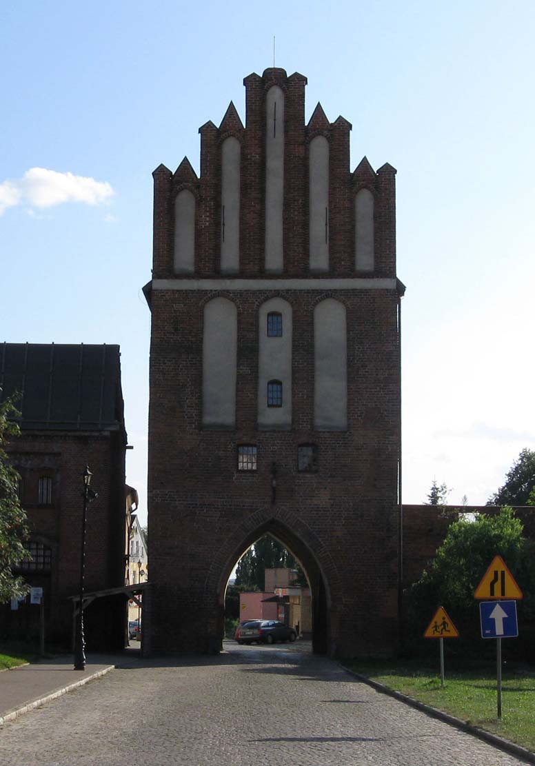
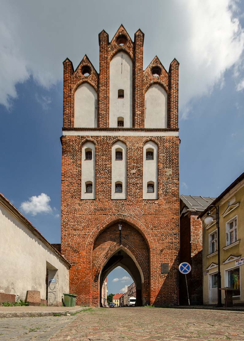
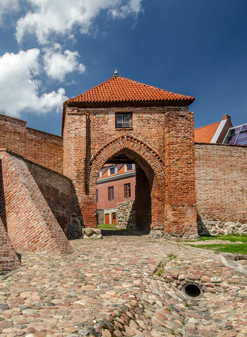
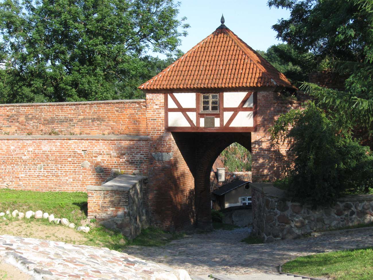
Three gates led to the town: Stone Gate in the south-western part of the circuit, Pottery Gate near the southern corner of the Pasłęk, and Mill Gate located on the eastern side, near the Teutonic castle. The gates were placed in towers erected on four-sided plans. In the ground floors it had gate passages accessible with pierced portals,, closed with portcullises, and the upper floors were pierced with small windows and arrowslits, as well as decorated with plastered blendes. Probably all gates had a gable form, with pinnacles and blendes facing the foreground and the town.
Current state
Till today, the fortifications of Pasłęk have survived on a considerable length. Unfortunately, they are significantly reduced in the vast majority and in terrible condition. The most important element is the preserved Stone Gate in the south-west part of the town. The bottom part of the Mill Gate also survived.
bibliography:
Czubiel L., Domagała T., Zabytkowe ośrodki miejskie Warmii i Mazur, Olsztyn 1969.
Steinbrecht C., Die Ordensburgen der Hochmeisterzeit in Preussen, Berlin 1920.
Wysocki J., Solecki R., Szkiłądź P., Otoczenie zamku w Pasłęku w świetle badań archeologicznych, „Archaeologia Historica Polona”, tom 26, 2018.