

History
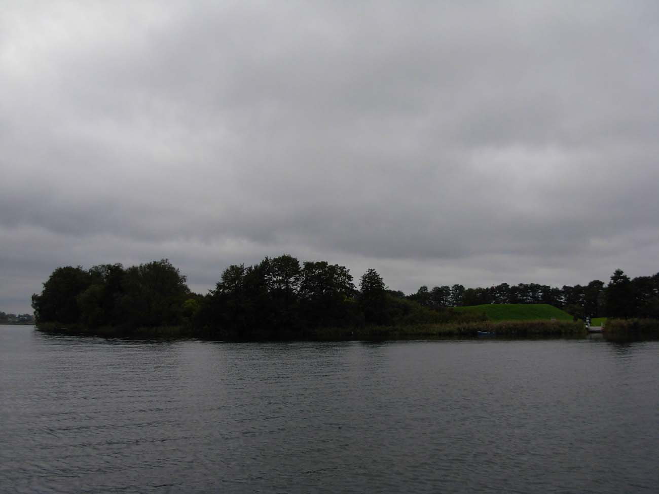
Ostrów Lednicki is the largest of the five islands on Lake Lednica. It was inhabited at the end of the 5th and 4th centuries BC. Neolithic hunters and shepherds, representatives of funnelbeaker culture founded their camps and permanent settlements on the island and at the southern edge of the lake. The community, numbering about a hundred people, dealt with agriculture, animal husbandry, hunting, fishing and gathering. At the beginning of the Bronze Age, the population of the lusatian culture settled in the south-western and northern areas of the lake. They mainly dealt with agriculture, cultivated small vegetable plots in the valleys. In the period of Roman influences, the population settled here, left traces of settlements, metallurgical furnaces and bloomeries in which iron was melted.
In the 7th and 8th centuries, new settlements appeared on the lake, but the first fortifications of the small stronghold were built in the southern part of the island only at the end of the 9th or early 10th century, probably securing the center of local tribal authority. In its place, half a century later, prince Mieszko I erected a new, large fortified hillfort with two bridges connected to the mainland. Stone buildings were built inside, probably the first of its kind in Poland. Craft and service settlements developed nearby bridges. During the reign of Mieszko I and king Bolesław Chrobry, the island was one of the main defense and administrative centers of Poland. It is possible that it was here that the baptism of the first historic ruler of Poland in 966 was made.
The end of Ostrów Lednicki’s greatness brought about the internal crisis of the state in the 30s of the 11th century and the invasion of Czech Brzetysław I in 1038, when the bridges were destroyed and the hillfort burned. After this event, the church and partially the palas with the chapel were rebuilt, and the settlement was surrounded by a new wooden and earth rampart. However, the island never regained its former function and rank, although the settlement survived until the 13th-14th centuries, and for some time Ostrów even served as the seat of the castellany. The status of the main center of power took over in this region of Pobiedziska. Later, Ostrów Lednicki was just a cemetery.

Architecture
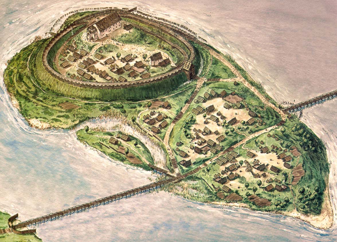
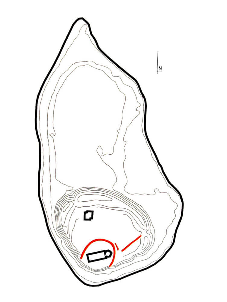
The stronghold was situated in Ostrów Lednicki, the largest of the four islands in the southern part of Lake Lednica. Nature has given it about 7.5 hectares of land, and an almond-shaped plan with a longer north-south axis reaching 470 meters and a width not exceeding 250 meters. The oldest fortifications of Ostrów from the first quarter of the 10th century had the form of a small stronghold with a horseshoe shape. It had about 2 meters wide ramparts, delimiting an inner ward with a diameter of about 50 meters, situated on a hill in the southern part of the island.
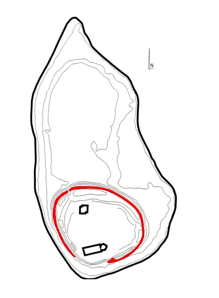
After 921 and before the mid-10th century, the stronghold was enlarged to a diameter of about 150 meters, including two hills in the southern part of the island. It was then protected by a rampart placed on a wooden grate, about 10 meters wide and about 5 meters high. In the place where the rampart of the southern elevation joined the eastern rampart, an 8-meter wide gate neck was created in the lowering of the area between the hills, along which the road led to the interior of the stronghold. It ran along a log-lined ditch. The Lednica stronghold was probably already at that time a two-part complex with a separate small hillfort in the south-west part, while the fortifications forming a regular arch of the rampart were probably not erected in the rear, steep and high part of the island. To defend this fragment, it was enough to reinforce with palisade the base about 3 meters high hill.
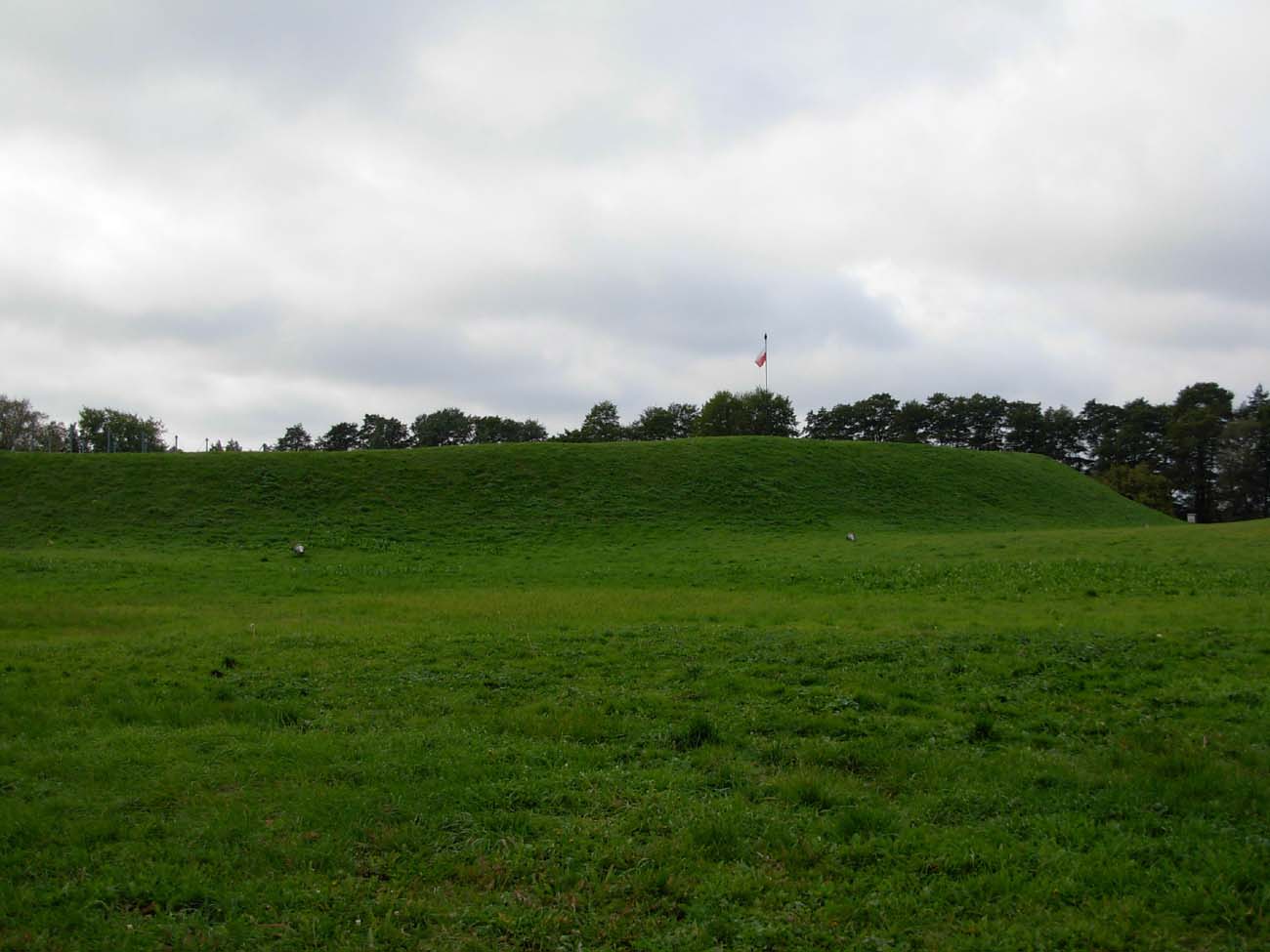
In the second half of the 10th century, the reconstruction of the stronghold’s fortifications and the construction of additional coastal fortifications on the island began. During these works, the crown of the ramparts of the inner stronghold was cut, bringing it to the level of the interior of the stronghold, as a result joining the two hillforts and obtaining the area for the planned large construction investments. The stronghold, 2.5 hectares in size, was then surrounded by a wooden and earth ramparts, approximately 500 meters long and originally approximately 12 meters high, separating an internal ward of approximately 130 x 160 meters. The structures that make up the entrance neck were buried, and the new fortifications were moved about 30 meters towards the lake and the interior of the island (mainly on the north and east sides). The entrance gate probably after reconstruction still led to the stronghold from the south. The fortification system at the shore of the island consisted of oak logs in the form of chests with sides of an average length of 2.1 – 2.3 meters, filled with earth, wood and small stones. They were accompanied by numerous piles that strengthened and stabilized the chests, and at the same time formed a multi-row barrier in the foreground. The reconstruction of the fortifications was accompanied by the modernization of the internal buildings of the stronghold. At that time, a palas with a chapel and a free-standing, single-nave church with wooden residential buildings were erected, and access to the island from the mainland was provided by two bridges.
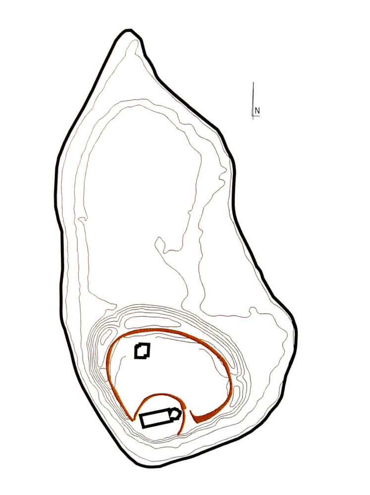
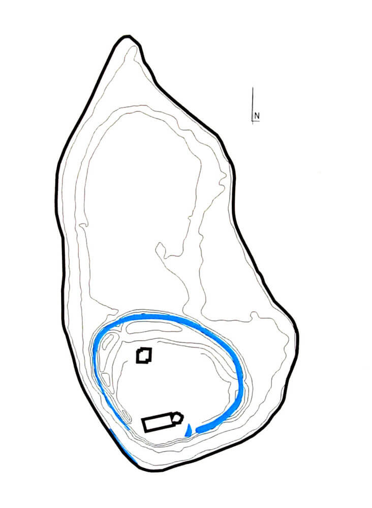
The last transformations of the fortifications took place between the second half of the 11th century and the middle of the 12th century. From the south of the island, the ramparts line was slightly shifted towards the lake, while on the north-west side a road and a new entrance gate were built. As before, the south-west part of the island was protected by the natural form of a high slope. The damaged pile and chest bank fortifications were not rebuilt, while the fortifications on the northern and eastern sides were erected on the relics of older fortifications. Additionally, they were faced with stones from the outside.
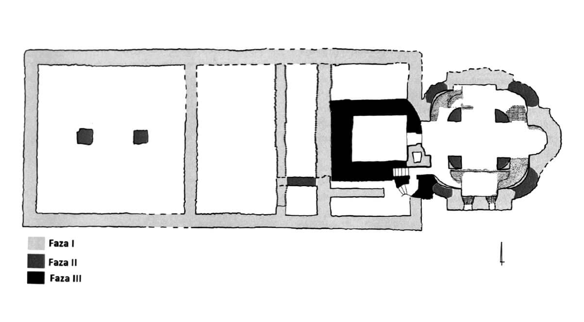
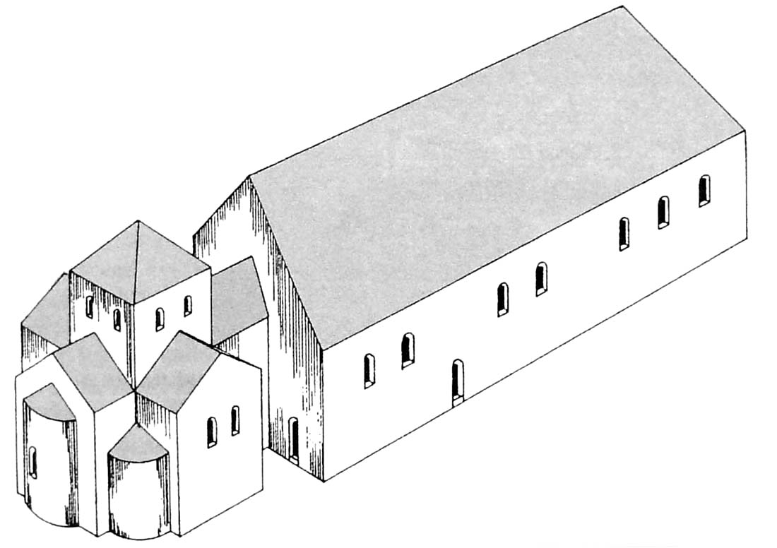
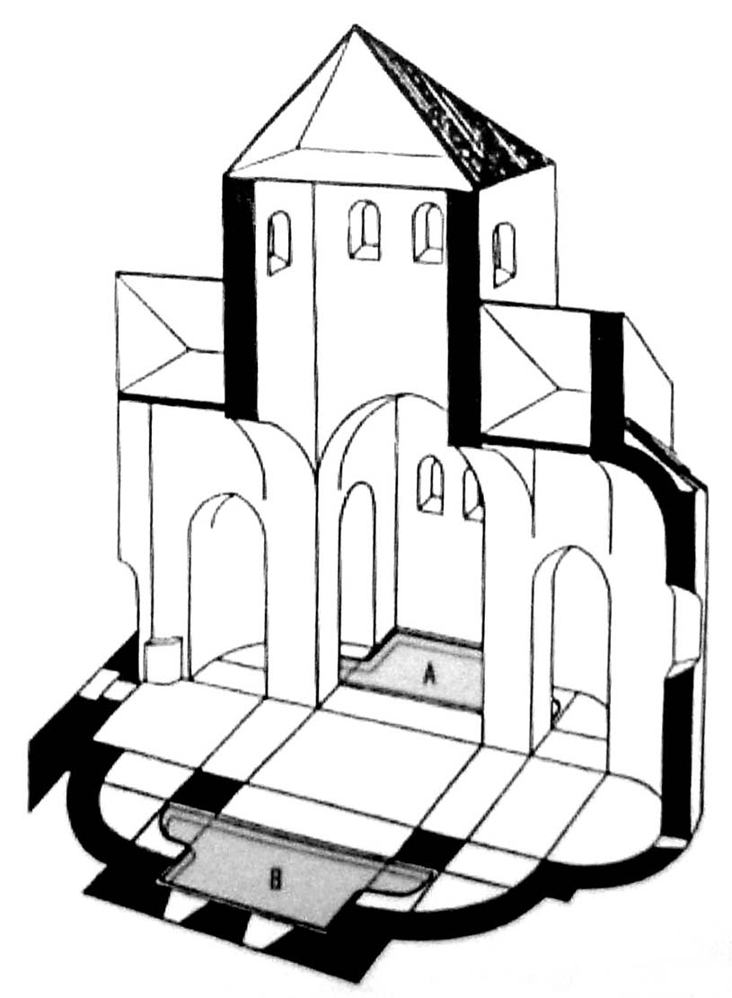
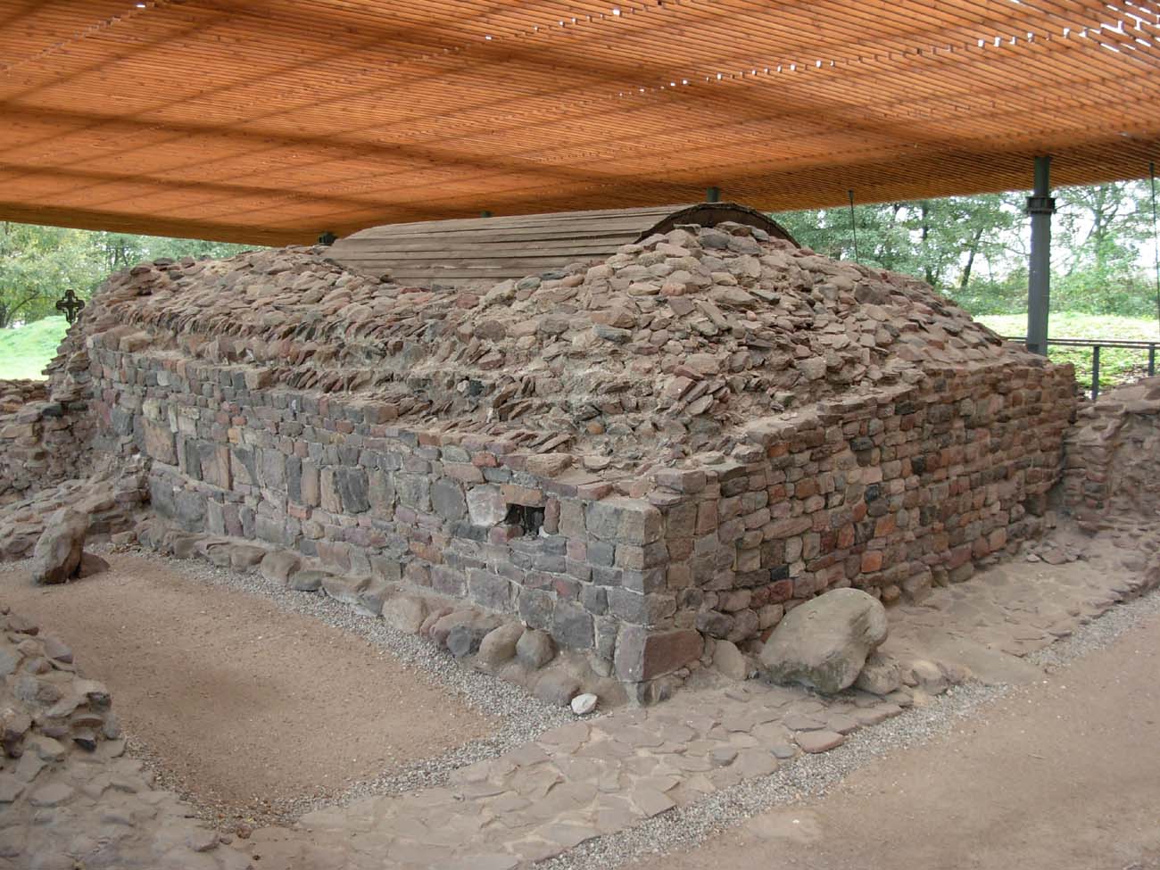
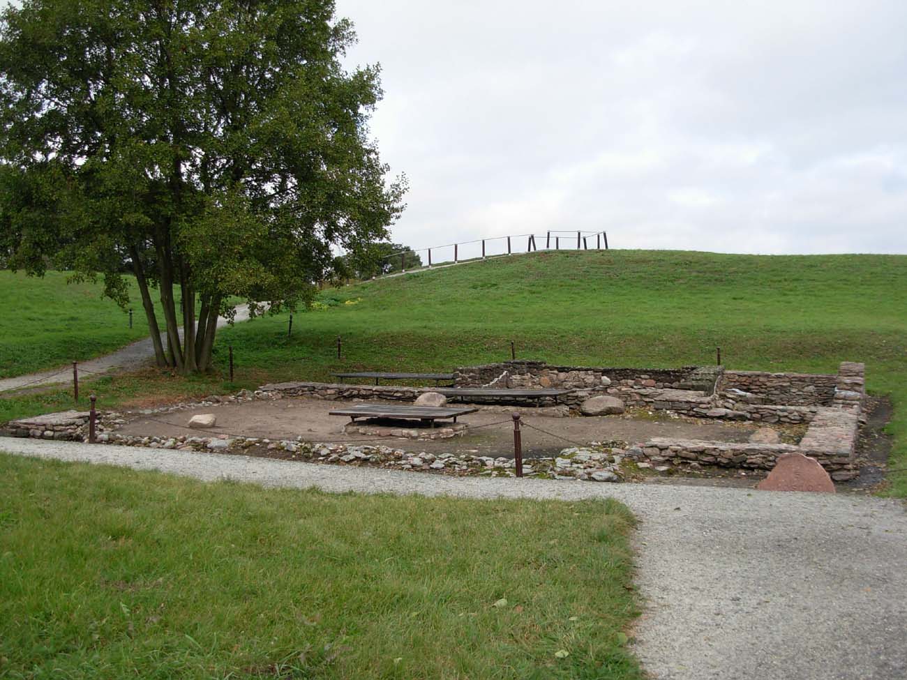
The palas and the chapel adjoining it from the east were built simultaneously, around 963-966, of local rock material, split into flat tiles and joined with gypsum mortar. The chapel was built on a Greek cross plan with interior dimensions of 7.7 x 9.7 meters. At the intersection of the aisles, four pillars were placed, each with a square cross-section, and then, after the reconstruction, a quadrant of a circle, which supported the centrally located, initially not very high tower and separated a comfortable ambulatory in the arms of the cross. The eastern wall of the chapel was closed with an apse, the apses were also filled with the corners of the building, and in the west there was an entrance to the palace. The only elements of the building that received vaults were the eastern apse and perhaps the ambulatory. In the south-west corner there was a deep hole of a timbered well. In addition, at the level of the oldest floor of the chapel, there were pools for the baptismal liturgy. The baptismal pools were probably connected with accompanying rooms: the changing room and the place where the rites preceding baptism, i.e. the renunciation of Satan and the profession of faith, were held. They could be located in a rectangular annex added to the chapel from the west, and separated from the palace by a narrow room, considered a staircase. The reconstruction of the building around 1000 led to the liquidation of the northern basin and the change of the southern one form, which served its original functions until around 1038-1039. As a result of the reconstruction at the turn of the century, the entire chapel was raised, most probably including the eastern apse (it had deep foundations).
The palace, erected on a rectangular plan with dimensions of 32 x 14 meters, received an entrance from the side of the ward (from the north) and had clearly separated rooms inside. The largest, located in the western part, measuring 12.5 x 12.5 meters, was divided by three arches based on two pillars into two aisles. Most likely, these pillars supported a wooden ceiling. This room probably served as a representative ducal hall, while the remaining three rooms of the palace served other functions, possibly related to the baptismal role of the chapel. The narrowest, in the middle part, limited by two parallel walls, served as a wooden staircase. The first floor of the palace, created as a result of the reconstruction in the second phase of the building’s functioning, essentially duplicated the division of the ground floor. The representative hall was then probably on the first floor in the western part of the palace.


During the youngest phase of use of the palace (the second half of the 11th or 12th century), a large part of it was demolished. The partition walls of the middle rooms were removed, and in the eastern part a four-sided tower was erected, probably three-story, added from the west to the chapel, which was not significantly rebuilt. A straight flight of stairs from the side of the chapel led to the upper floor of the new tower, while its lower floor in the form of a vaulted crypt was directly connected to the chapel. Nearby, the steps of a circular staircase led from the south-eastern part of the palace to the tower, providing access to the chapel’s gallery. The second part of the palace was then the western building, probably two-story, which was the former hall on the first floor. Access to it led through wooden, external stairs added to the western wall. Both parts of the palace: eastern and western, were connected by an undamaged southern wall of the original layout.
The origin of the sacral and palatial form of the Lednica complex can be found in buildings from the region of northern Italy, Dalmatia and subalpine areas (eg the San Satrio chapel in Milan, the chapel of St. Martin in Linz). After the expansion from around 1000, when the chapel became a two-storey building with the lower storey having the character of a vaulted crypt, the similarities to the chapel of the palace complex in imperial Werla became visible. In Central Europe, the oldest known building of a similar form could be the Great Moravian building in Devín, assuming that it was not entirely a church, but a palace residence axially coupled with the chapel. Despite the similarities and external influences, the Lednica palas was, however, a unique building, without direct patterns in the architecture of early medieval Europe.
In the northern part of island, on a small elevation of the area, a hillfort church was erected, possibly made of plastered wood. It was orientated, aisleless, 13,5 meters long, with a rectangular chancel and three annexes from the north. The nave had a side 9 meters long, while the chancel dimensions were 3.3 x 5.5 meters. Inside, there were six graves, including two in stone chambers, placed in the nave in the axis of the church, in a place reserved for people with the highest social status. One of them was the burial of a child near whom a gold ring was found. The other graves were placed in the northern annexes, and together a rich collection of items of Christian worship was found there: a Byzantine reliquary, a reliquary box, an ivory comb and the remains of glass candelabra which illuminated the interior, as well as window glass. This church can be included in one of the first princely necropolis in Poland.

An outer bailey, covering an area of about 5 ha, inhabited in the Middle Ages by the servants and part of the druzhina, was an open settlement situated on the northern side of the hillfort. Two bridgeheads led to it: the west “Poznań” bridge and the eastern “Gniezno Bridge”. Each of them consisted of boxes filled with earth and stones and was protected by a breakwater. Studies have shown that the “Gniezno” bridge was built in 962-965 during the period of large investments carried out by Mieszko I. It was 440 meters long and led to the west shore of the lake. Its basic structural elements consisted of two rows of supporting piles driven with bundles into the bottom of the lake, and longitudinal and transverse logs embedded on them, forming individual spans on which the planks were mounted on which it was possible to move. The width of the bridge was about 4.8 meters. The “Gniezno Bridge” bridge was shorter, about 170 meters long. It was built similarly to “Poznań” made of oak wood.
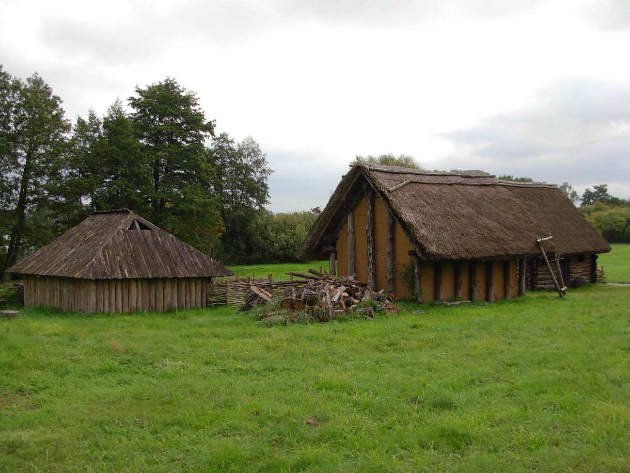
The residential buildings of the hillfort and the outer bailey had many features characteristic of the Western Slavic region. These were buildings both partially recessed into the ground and above-ground. The dugouts were located on hills, mainly in the western and central part of the outer bailey and in the hillfort. On the other hand, aboveground houses prevailed in the eastern part of the outer bailey, in the lower areas, near the lake shore. The buildings were erected of wood, supplemented with clay in the construction of floors and plastering the walls, with stones to create hearths. The houses were most often built in a log construction, less often of an in-between-pillars technique or braided technique. Apart from clay floors, they were also often made of planks. A distinguishing feature of the buildings, especially in the area of the hillfort, was the form of houses with corridors leading to them, rarely found in Poland. The sizes of the buildings were varied. The length of the walls was 2.3 to 7 meters, and the average area was 10 to 18 square meters, with much larger houses also discovered, ranging from 36 to 42 square meters. The high density of buildings was characteristic, especially in the heyday of the stronghold. The buildings were located close to each other, at short distances, from half to one and a half meters, which allowed for permanent or periodic inhabit (e.g. during the prince’s stay in Ostrów) up to about 1,300 people.


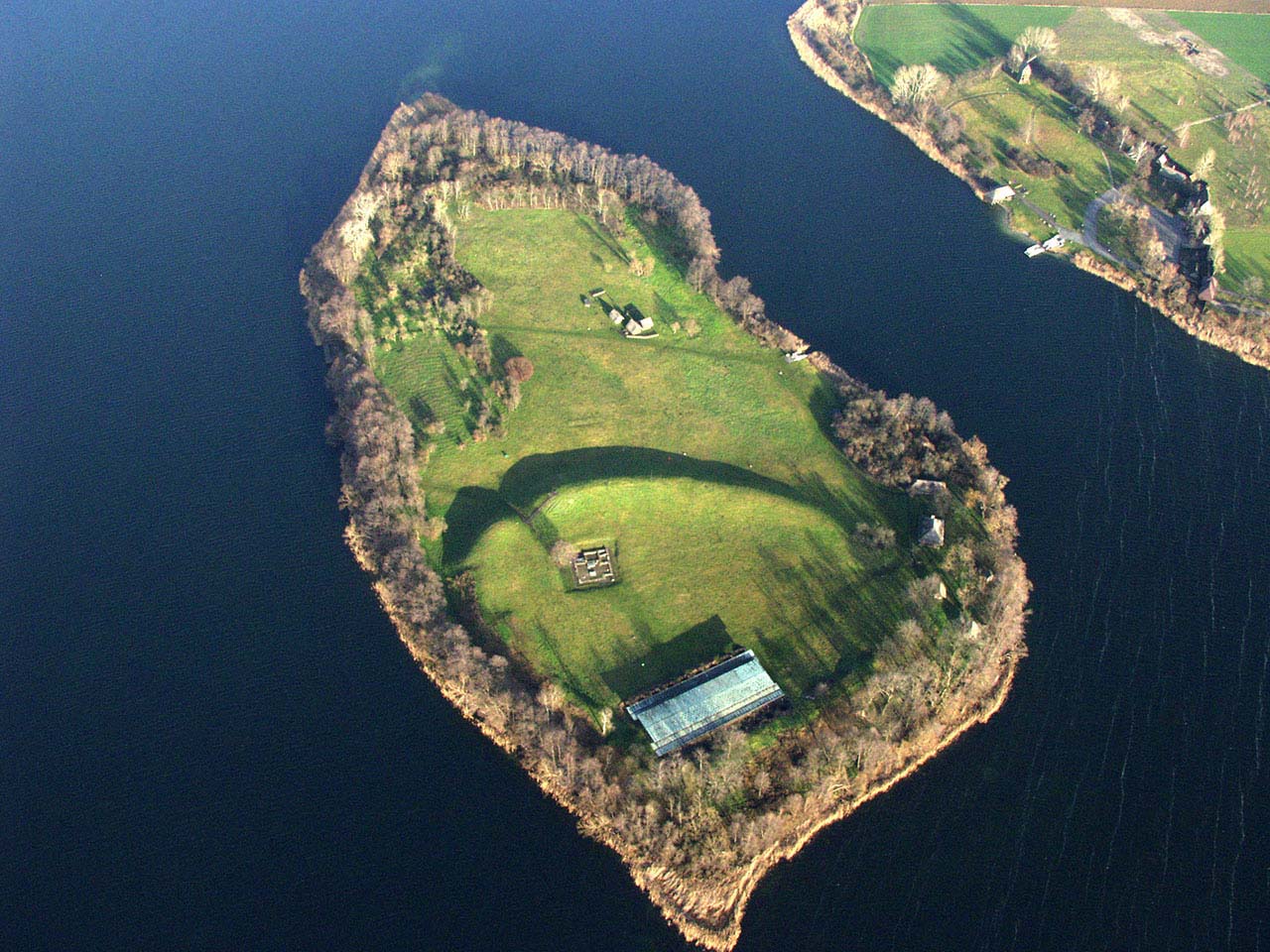
Current state
The Piast hillfort at Ostrów Lednicki is one of the most important places from the period of the beginnings of the Polish State. Currently it is managed, together with located on the onshore open-air museum and museum in nearby Dziekanowice, by the Museum of the First Piasts in Lednica. On the island survived: the remains of the princely palas up to a height of 2.5 meters, foundations of the hillfort’s church and defensive earth ramparts of the hillfort to the height of 8 meters in the highest place. There are two rows of piles driven into the bottom of the lake in the place of existence of the the west bridgehead. In the northern part of the island there is a reconstruction of a peasant homestead, referring to the remains discovered in this area. In one of the huts equipment was reconstructed, and a furnace for firing clay pots was erected near the farm. The ferry included in the price of the ticket runs to the island with a frequency of around 0,5 hours. Information on prices and dates of opening can be found on the official website of the museum here.


bibliography:
Jarzewicz J., Kościoły romańskie w Polsce, Kraków 2014.
Kara M., Wrzesiński J., Kościół nr II na Ostrowie Lednickim – kamienny czy drewniany? [w:] Początki architektury monumentalnej w Polsce, red. Janiak T., Stryniak D., Gniezno 2004.
Olejniczak K., Grody i zamki w Wielkopolsce, Poznań 1993.
Ostrów Lednicki. Rezydencjonalno – stołeczny ośrodek pierwszych Piastów, red. Z.Kurnatowska, A.M.Wyrwa, Warszawa 2016.
Świechowski Z., Architektura romańska w Polsce, Warszawa 2000.
Świechowski Z., Sztuka romańska w Polsce, Warszawa 1990.
Tomala J., Murowana architektura romańska i gotycka w Wielkopolsce, tom 1, architektura sakralna, Kalisz 2007.