
History
The castle was not recorded in medieval records, which has given rise to unverifiable speculation that it was built at the initiative of King Kazimierz the Great, as a watchtower on the western borders of the kingdom, or that it was founded by Prince Władysław Opolczyk in the late 14th century. Alternatively, it may have been built at the initiative of one of the local knightly families, although their funds were likely insufficient for such a large structure. To the north and northwest, the estates were held by the Szreniawite and Jelitczyk families; to the east the village of Trzebniów was held by the Jelitczyk family and later by the Kobyło family from Żarki, while to the south the estates were held by the heirs of Niegowa. Only to the southwest a narrow strip of royal property reached Ostrężnik, in the form of a forest belonging to Olsztyn Castle.
According to archaeological research, it seems most likely that the castle was built in the early 14th century, probably at the initiative of Jan Muskata, bishop and starost of Kraków on behalf of Wenceslaus II. During the period of Czech rule, fortified seats in the Kraków region were often built without seeking the consent of local elites and were manned by mercenary garrisons. The lack of later cultural layers suggests that the castle was either unfinished or was used for a very short period. This would correspond to the fall of Jan Muskata’s territorial governorship after the entry of the troops of Prince Władysław the Elbow-high into the Kraków region in 1304, and the subsequent deaths of the last two Přemyslid kings shortly thereafter.
It is possible that Ostrężnik was the seat of robber knights, prowling the route from Żarki to Potok. It was recorded that at the turn of 1305 and 1306, Niegowa and Przybynów, two settlements located near Ostrężnik, were destroyed by robbers. After Władysław the Elbow-high finally conquered the region and Kraków in 1306, and increased internal security, the castle may have been captured and destroyed. Alternatively, it was abandoned due to the inability to continue the illegal activity or due to the withdrawal of troops loyal to the Přemyslid dynasty and Jan Muskata. The castle remains may have been briefly reused in the first half of the 15th century, when Mikołaj Siestrzeniec engaged in robbery in the surrounding areas.
Architecture
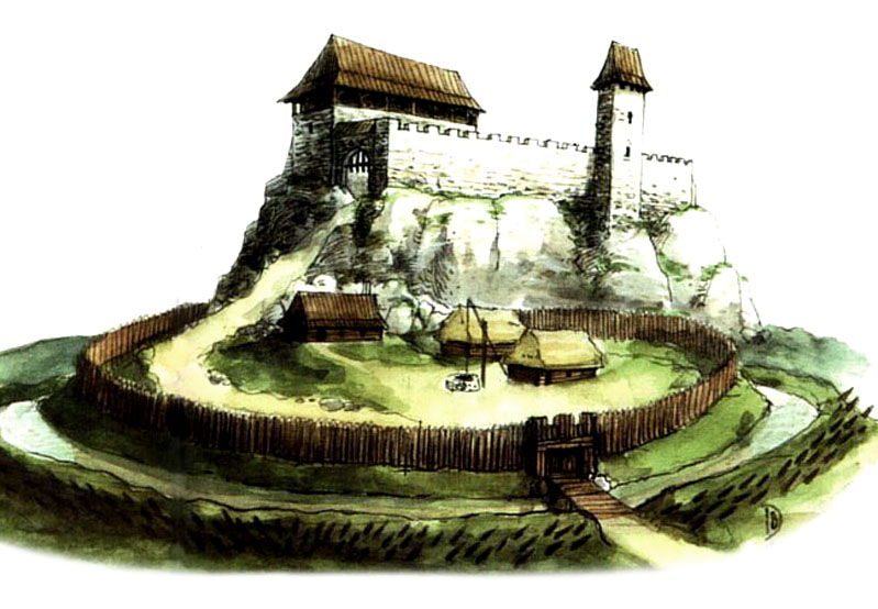
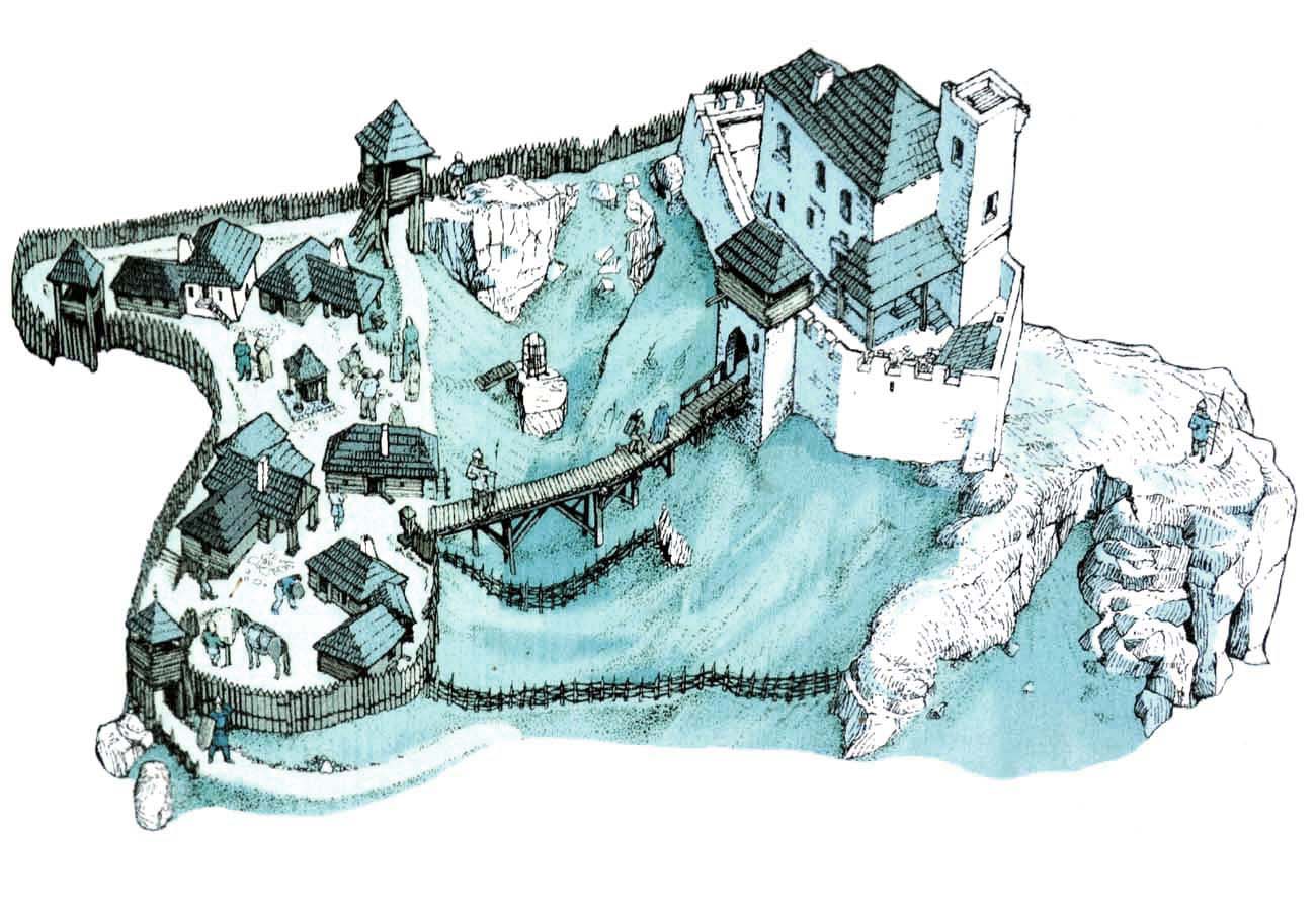
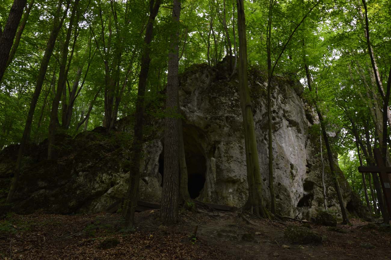
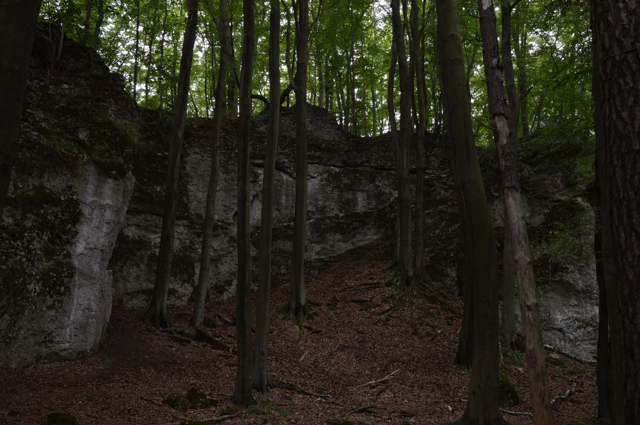
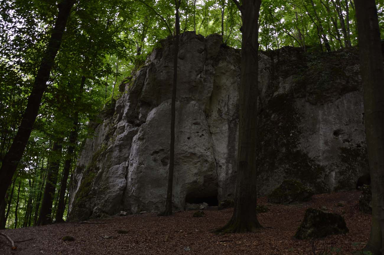
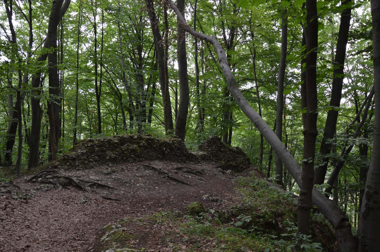
The upper ward of the castle was situated on a rocky outcrop, rising approximately 40 meters above the surrounding terrain. Due to steep escarpments, it was inaccessible from the north and east. Steep slopes also bounded the hill from the south, though the height difference was somewhat smaller in this section. The most convenient approach was from the west, where the terrain was least covered with rocks and the least steep. Under the rock outcrop that formed the castle’s base, nature had formed a cave, consisting of several passages and chambers of varying sizes. It was accessible through a main opening on the north-east side and by several smaller openings on the north and northwest.
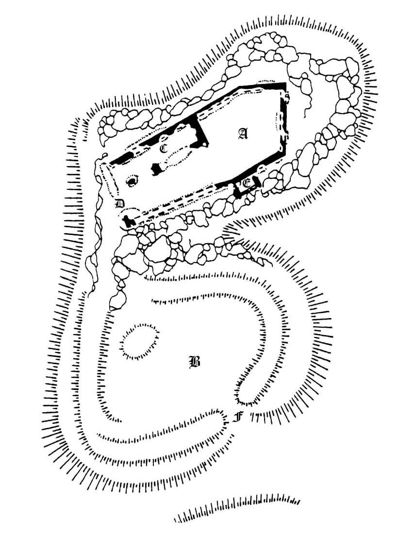
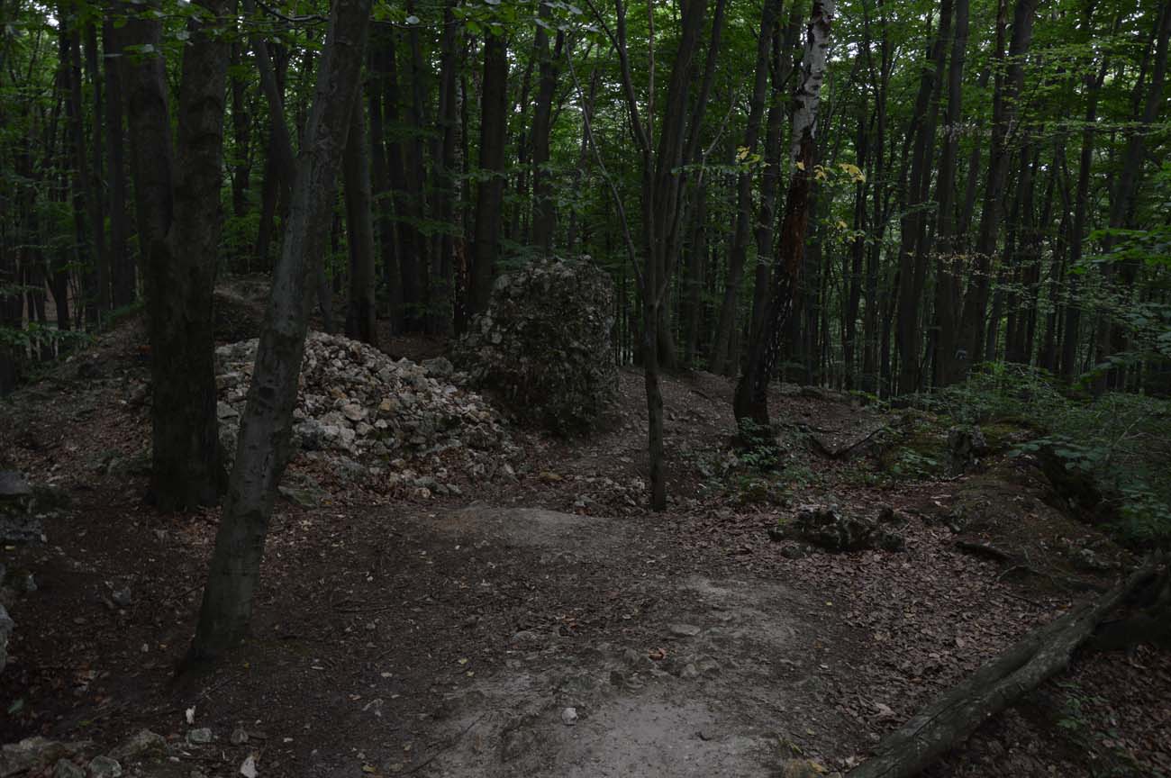
The upper ward was protected by a perimeter wall, approximately 2.2 meters thick and 144 meters long, running along the edge of the outcrop, which outlined an elongated polygon with an area of 1,200 square meters, terminating in angular form on the eastern side. Inside, the residential building, rectangular in plan, measuring 10 x 30 meters, adjoined the northwestern section of the perimeter wall. A rectangular tower, measuring 6 x 9 meters, adjoined the southern section of the perimeter from the outside. It is unknown whether it served as a gateway or whether the entrance was from the west. If the tower was also a gate, the entrance (bridge) would have had to be spanned over the extensive chasm separating the upper part of the castle from the outer bailey. An alternative access route on the western side would have traversed a gentler slope, from where it would have reached the corner of the outer bailey.
The outer bailey, approximately 7,000 square meters in size, was located on the southern side, below a rocky hill. It was surrounded by an oval-shaped ditch and an earthen rampart, likely originally topped with timber fortifications. The entrance gate was located on the southeastern side, in a gap between the ramparts. The internal buildings of the outer bailey were most likely entirely of wooden or half-timbered construction.
Current state
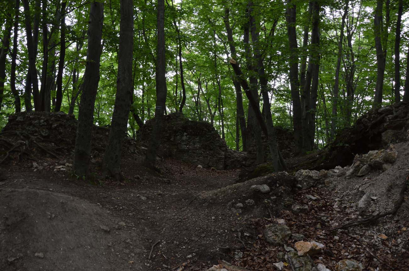
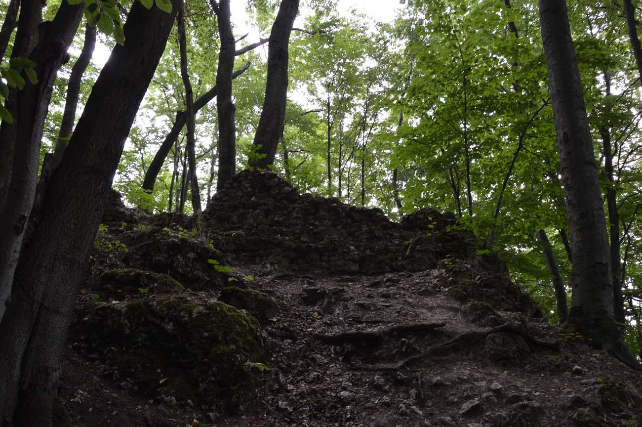
Until today, only the foundations of the perimeter wall, the residential building and the gate tower with a height not exceeding one meter, have survived at the edges of the rock. The earth ramparts and ditch surrounding the outer bailey ground are also visible. The whole area is covered with dense forest and publicly available. Inside the rock on which the stronghold was erected, there is the Ostrężnicka Cave with passages about 90 meters long.

bibliography:
Antoniewicz M., Zamki na Wyżynie Krakowsko – Częstochowskiej, Kielce 1998.
Guerquin B., Zamki w Polsce, Warszawa 1984.
Kołodziejski S., Średniowieczne rezydencje obronne możnowładztwa na terenie województwa krakowskiego, Warszawa 1994.
Laberschek J., Na tropie rycerzy z [Złotego] Potoku i rozbójników z Ostrężnika, “Almanach Częstochowy”, Częstochowa 2002.
Leksykon zamków w Polsce, red. L.Kajzer, Warszawa 2003.
Sypek R., Zamki i obiekty warowne Jury Krakowsko-Częstochowskiej, Warszawa 2003.