
History
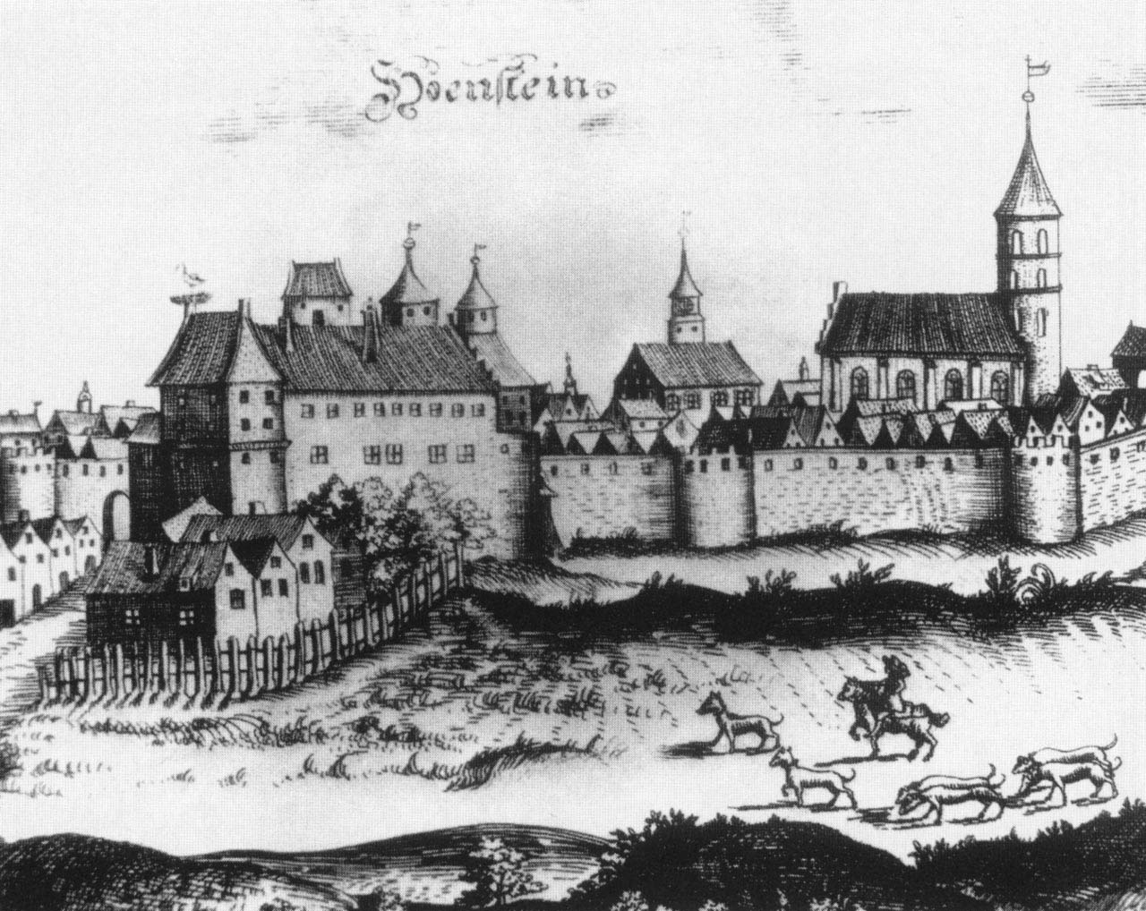
Olsztynek (Hohenstein) obtained town charter in 1359, but the construction of defensive walls began only after 1414, i.e. after the so-called the Hunger War, when Polish army severely destroyed the town and its surroundings. The last time fortifications were in good condition was during the Thirteen Years’ War in the second half of the 15th century. In the 17th century, the entire town was severely damaged by the Swedes and the walls were no longer an effective defense against early modern artillery. After a fire in 1685, the towers were adapted for housing. As a result of another fire in 1804, the German Gate located near the castle was destroyed, and the subsequent years of the 19th century caused further damages to the town’s fortifications, which were treated as an easily accessible source of building materials. The moat surrounding the town was filled in and turned into gardens.
Architecture
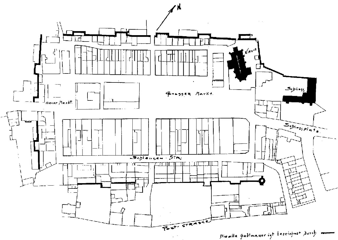
The town was founded on the bank of the Jemiołówka River, in the vicinity of the Teutonic Knights castle, which was located on the north-eastern side. The line of fortifications ran along a rectangular perimeter, with a quadrangular market square in the middle, through which the main street of the town passed. The northern corner of the town was occupied by the parish church (an aisleless structure with a polygonal chancel and sacristy), located right next to the defensive walls, so that its tower could be used for observation function (although it was never completed).
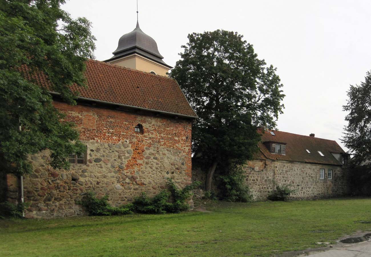
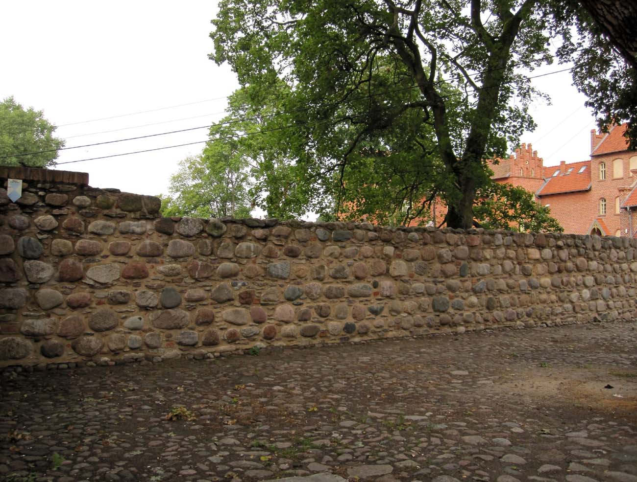
The length of the entire wall was about 1000 meters, the height was up to 9 meters, and the thickness at the widest point at the base was up to 2 meters. Erratic stones were used to build the foundations and the plinth, while the upper parts of the walls were faced with bricks. Presumably, they were crowned with a wall-walk and battlements made of bricks, later replaced by a straight parapet with arrowslits.
The curtains of the defensive wall were reinforced with half towers, opened from the town side, of which there were 13 in total. The south-eastern corner was reinforced with a round corner tower. The eastern part of the perimeter had six half towers, spaced every 20-30 meters, i.e. at distances allowing for an effective shot from a crossbow. There were three half towers in the south-west line, and five half towers in the north-west and west line. In the north-eastern section, apart from the gate and castle fortifications, there probably was not a single tower.
Two gates led to the town: High Gate, also known as the German Gate, located next to the castle, and Nidzica, also known as Polish Gate, located in the southern part of the walls. Both were located on the town axis, on opposite sides of the market square, at the outlets of short streets leading to it. The bridges over the moat on the outer side of the fortifications had to lead to them. The moat was fed by the waters of the Jemiołówka River.
Current state
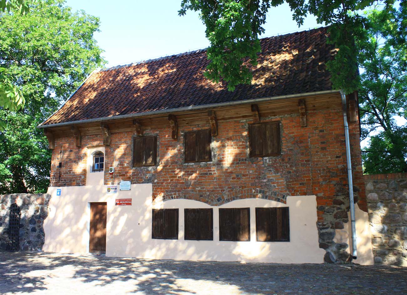
To this day, the defensive walls in Olsztynek have survived on a large part of the original perimeter, unfortunately in a strongly reduced form, partially integrated into the modern buildings. The town gates have not survived. Among the towers in the best condition is the so-called House of Mrongowiusz, i.e. a halftower later transformed into parish house.
bibliography:
Czubiel L., Domagała T., Zabytkowe ośrodki miejskie Warmii i Mazur, Olsztyn 1969.
Herrmann C., Mittelalterliche Architektur im Preussenland, Petersberg 2007.
Mackiewicz H., Badania archeologiczne a rewitalizacja Olsztynka, “Warmińsko-Mazurski Biuletyn Konserwatorski”, nr 6, Olsztyn 2014.