
History
Nowe was recorded in documents for the first time in 1266, during the war which Prince Mestwin II, who fought for power, shortly after the death of his father, Świętopełk the Great. As a town, Nowe first appeared in a document from 1301. In 1308, along with the entire Gdańsk Pomerania, it was captured by the Teutonic Order. The construction of the Neuenburg castle in Nowe started by the Teutonic Knights in 1350, and the work continued until around 1404. A Teutonic official subordinate to the vogt of Tczew resided there. Along with the construction of the castle, fortification works were carried out on the town, wchich walls were erected around 1336 – 1375.
In 1410, after the Battle of Grunwald, the castle and the town were not captured, and the Hussites also bypassed them during the armed expedition of 1433. During the Thirteen Years’ War, in 1458, the mercenaries of the Teutonic Order, led by Pritz von Rabeneck and Jörg von Schliewen, managed to capture Nowe, which from that time took an active part in the defense of the Order and, together with the Gniew garrison, made expeditions around the Świecie. Eventually, it had to surrender about a year later, when all the Teutonic funds ran out and the garrison of Gniew capitulated. From 1465, Nowe was the seat of the starosts of Polish kings, but the capture of the castle probably did not cause any major transformations. The castle was devastated only in the 17th century during the wars with Sweden.
After the first partition of Poland in 1772, Nowe was under Prussian rule, and the castle was largely demolished by the authorities at the end of the 18th century. The preserved main building was transformed into an Evangelical church, which was why it was thoroughly rebuilt in the years 1787 – 1789. Among other things, all partition walls, vaults and ceilings were demolished, and large windows were pierced in the walls. Later, the building was used as a warehouse and fire station, and in 1905 it was even threatened with demolition.
Architecture
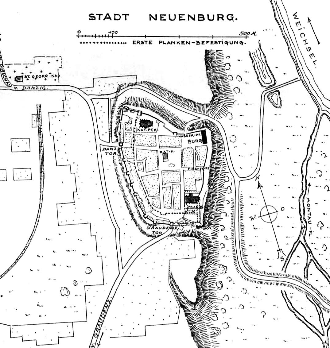
The castle was located in the north-eastern corner of the town and connected with the town fortifications, with the main castle house placed in their line. From the east, it was protected by a wide Vistula bed and the Mątawa River flowing into it from the south. It is not known whether it was separated by the ditch, or only by the simple curtains of the wall. The town itself was situated on a high slope of the Vistula, the steep hillside of which protected it against the approach of the enemy from the east. Also on the north side it was protected by a wide and deep ravine, while from the south-west and at the north-west corner by a 30-meter-wide ditch that could be fed with water.
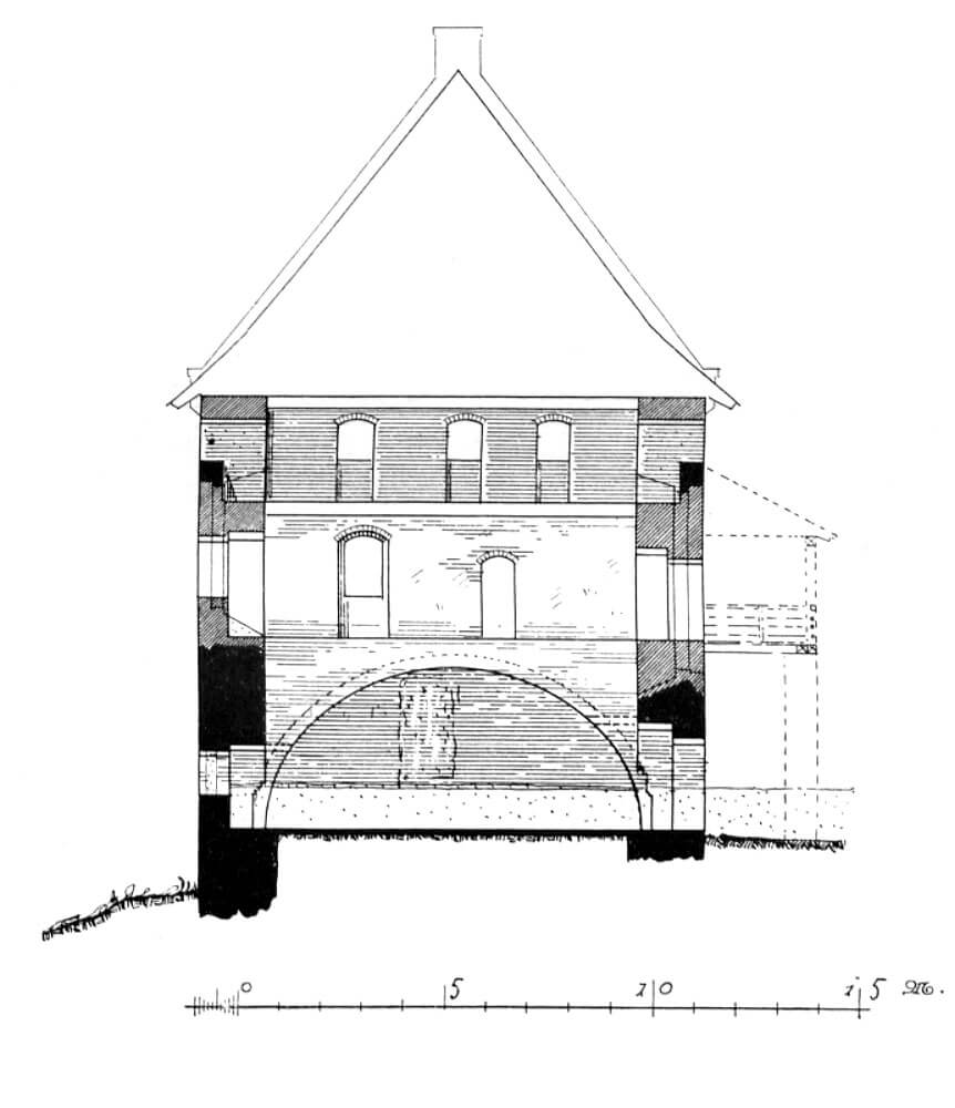
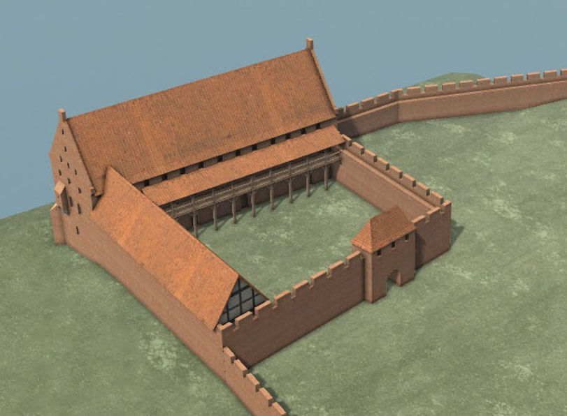
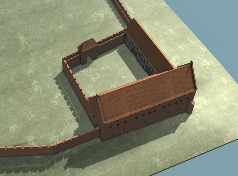
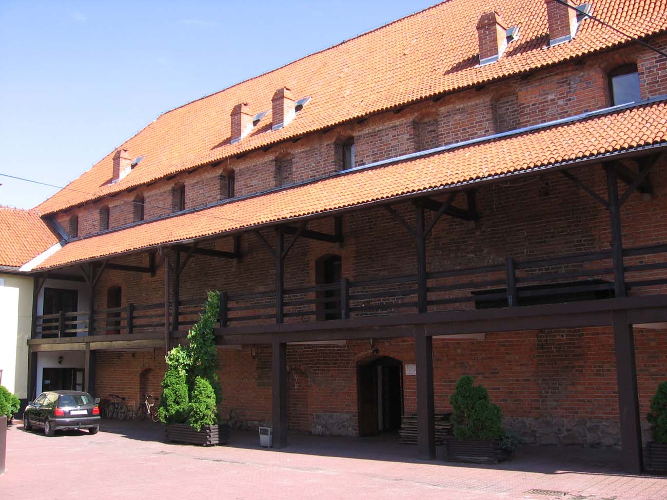
The former castle’s main house was brick, three-story building with the dimensions of 12,3×39 meters and a height of 9 meters. In the vaulted ground floors there were utility rooms set in one line. On the first floor, there was a pfleger’s lodging room, a refectory and a guest room. These chambers were covered with wooden ceilings, and the refectory, serving as the main representative room, was decorated with paintings in 1404. Above them was a granary storey, equipped with a defensive porch. The façade from the courtyard side was provided with timber cloisters, which provides vertical and horizontal communication between the rooms.
A lower wing, probably an economic one, adjoined the main house from the north at right angle. To the west, there was a small courtyard surrounded by a wall with a gate leading into the town. The town fortifications consisted of a wall topped with a battlement and half towers located at different distances, omitted only from the safest eastern side. The towers were extended in the foreground in front of the adjacent curtains, of which they were higher by one storey or equal to them. From the town side, the towers initially remained open, which lowered the construction costs, accelerated the work and made it impossible for the attackers to barricade themselves after a possible breakthrough.
Four gates led to the town: Grudziądz Gate in the south, Gdańsk Gate in the west, Fisher Gate in the east and Water Gate in the north. The gates erected in the east and north could only be auxiliary gates, posternes, as they led to steep slopes, but the two main gates, Gdańsk and Grudziądz, were connected with the main communication roads. Both were built as towers with passages in the ground floor, closed with a portcullis and a drawbridge over the ditch.
Current state
The only preserved element of the castle is the rebuit former main house. It currently houses the seat of the “Zamek” Cultural Center. The town’s defensive walls have survived only for a length of several dozen meters, in a lower condition than the original appearance. They are mainly visible near the parish church.
bibliography:
Die Bau- und Kunstdenkmäler der Provinz Westpreußen, der Kreise Marienwerder (westlich der Weichsel), Schwetz, Konitz, Schlochau, Tuchel, Flatow und Dt. Krone, red. J.Heise, Danzig 1887.
Dzieje Świecia nad Wisłą i jego regionu, red. K.Jasiński, t. 2, Warszawa 1980.
Leksykon zamków w Polsce, red. L.Kajzer, Warszawa 2003.
Steinbrecht C., Die Ordensburgen der Hochmeisterzeit in Preussen, Berlin 1920.