
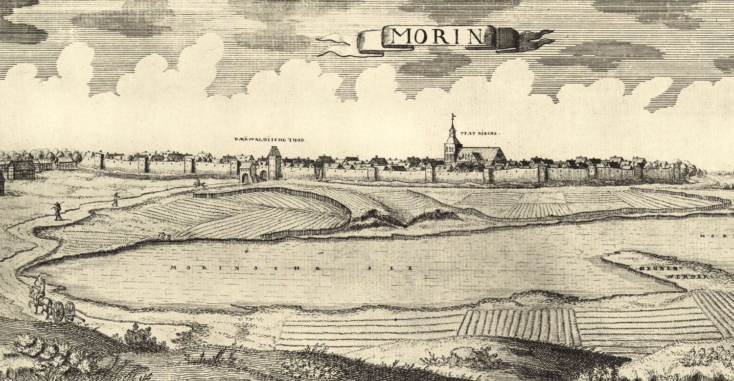
History
In the early Middle Ages, on an island on Lake Morzycko, there was a Pomeranian stronghold, captured in 1263 by the Brandenburg margraves. On their initiative, at the turn of the 13th and 14th centuries, the town of Moryń (Mohrin) was founded, which was surrounded by stone defensive walls during the first half of the 14th century. Works probably began around 1306, when Moryń was first called civitas.
In 1320, Moryń became part of the New March, and in the 15th century it was the property of the Teutonic Knights Order. During thier rule, in 1433, the fortifications of the town did not fulfill their role, because Moryń was destroyed by the Hussites during the Polish-Czech expedition to the lands of the Order, which reached the Baltic Sea through the New March. The condition of the fortifications was so deplorable at that time, that even their complete demolition was considered, but after 1442 the walls were repaired and raised. Perhaps during these works they were adapted to the use of hand-held firearms (parapet with arrowslits).
In the 17th century, during and after the Thirty Years’ War, the town and its fortifications were destroyed by fire three times. In 1755, the foregates were demolished and the moats were filled in, in place of which gardens were created. The embankments were completely leveled in 1819, when a walking alley was created in their place, and the gates were demolished at the end of the 19th century. In 1870, a significant, about 100-meter long section of the wall on the west side was demolished. Renovation works on part of the preserved circuit were carried out in the 1990s.

Architecture
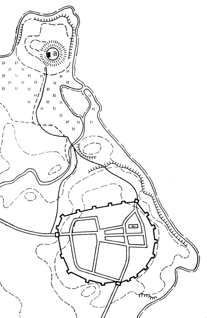
The defensive walls surrounded the town with an irregular oval with a diameter of 300 meters and an area of about 15 ha. The town plan was somewhat circular, but the northern section was straight. From the east and south, Moryń was protected by the waters of Lake Morzycko, and from the north by the wetlands of the Słubia stream, connecting Morzysko with a smaller lake on the west side. Behind the stream, on an elevated area, there was a castle, not connected to the town fortifications. The central part of Moryń was occupied by a market square with a parish church in the north-eastern corner, distant from the fortifications. On the inside of the walls, there was probably an underwall street running around the town, facilitating communication in the event of an danger.
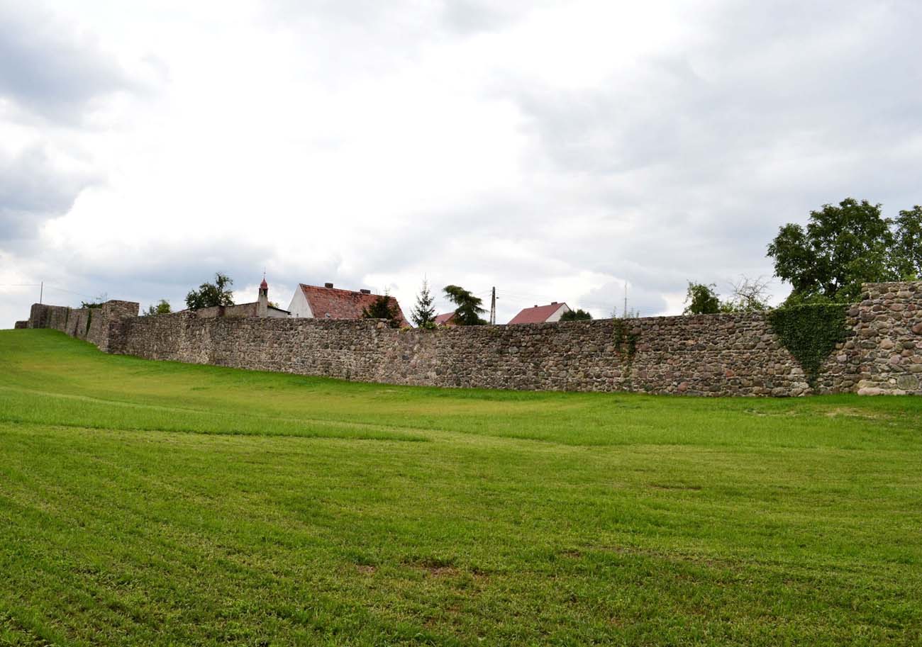
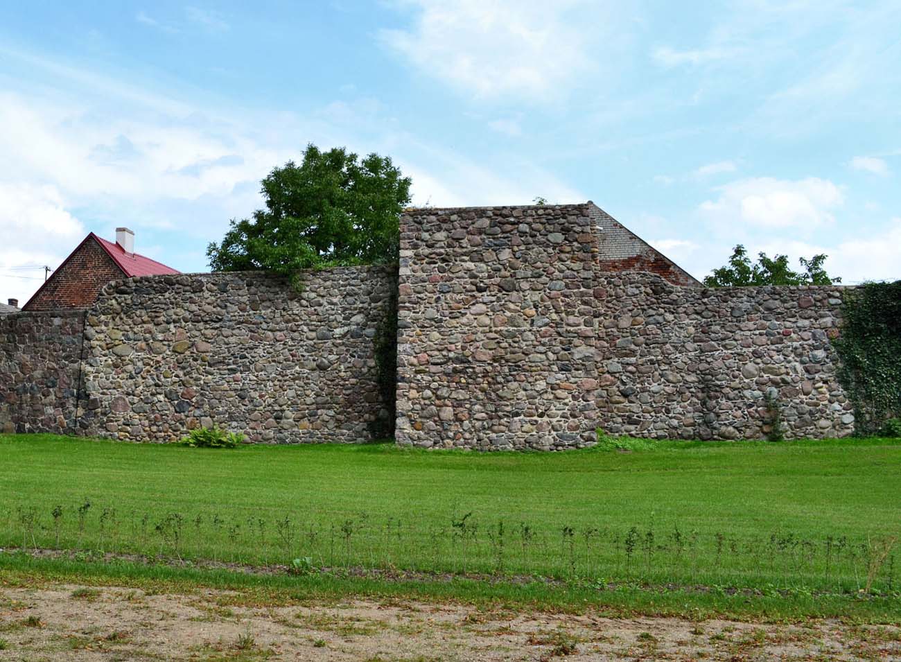
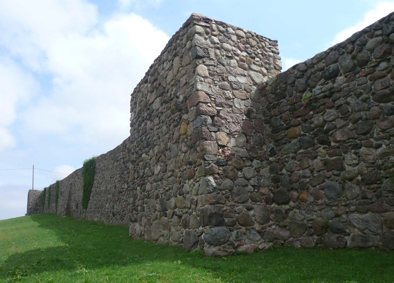
For the construction of the defensive walls, granite stones of various sizes were used, arranged in layers, leveled with smaller pebbles. The stones were connected with lime and clay mortar. The length of the circuit was originally about 1420 meters, and the height of the walls reached 6.5-7 meters. In the ground floor, they had a thickness of 1.2 meters. It is not known how were originally topped. In the late Middle Ages, it had simple parapet pierced with loop holes. In front of them, the outer zone of fortifications was a moat.
The walls were reinforced with 40 rectangular half towers, located around the perimeter, but at uneven intervals of 25 to 40 meters. The towers were opened from the town side and 1.7 – 2.1 meters protruded in front of the neighboring curtains. From the inside were in line with the walls. It were one storey taller than the walls. Their varied width ranged from 5.2 to 6.1 meters. Towers were probably divided by wooden ceilings into the ground floor and two upper combat floors. Most, if not all, had no roof.
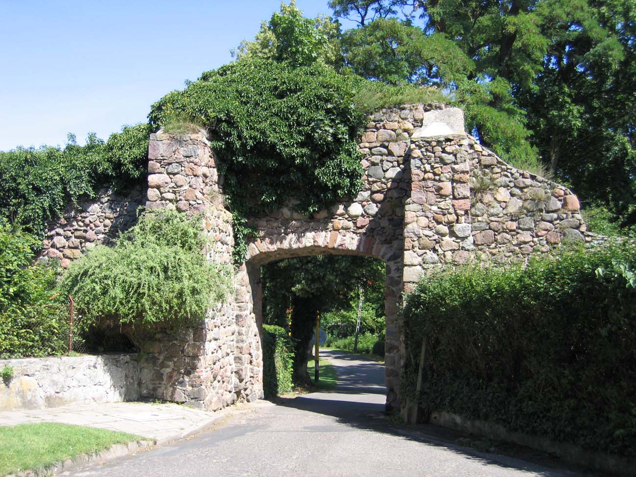
Within the walls there were two town gates: Mieszkowice Gate from the south and Mill Gate (also called Chojeńska) from the west. In the north-eastern half tower there was a smaller Lake Gate, also called Water Gate, leading to the castle. Probably in the 15th century, and certainly before 1500, a new passage was made next to the Mieszkowice Gate. The previous one was bricked up, and a foregate was erected in front of the building. Perhaps the same was done in the case of the second gate.
Current state
Almost a complete line of defensive walls, approximately 1,325 meters long, has survived to our times, with the exception of a demolished section in the western part of the perimeter. There are also no gates with foregates, but a postern and 27 half towers are visible (some preserved in the form of ruin). The height of the walls is not full, today it reaches 4.5 meters in some places. The crown is lowered especially on the inside, due to the elevation of the town since the Middle Ages.
bibliography:
Biała karta ewidencyjna zabytków architektury i budownictwa, fortyfikacje miejskie – mury obronne, K.Kalita-Skwirzyńska, nr 4204, Moryń 2001.
Kuna M., Średniowieczne mury miejskie w powiecie gryfińskim na tle sieci miast warownych Pomorza Zachodniego i dawnej wschodniej Brandenburgii, “Rocznik Chojeński” nr 7, Chojna 2015.
Pilch J., Kowalski S., Leksykon zabytków Pomorza Zachodniego i ziemi lubuskiej, Warszawa 2012.