
History
The construction of defensive walls in Lubawa started at the beginning of the 14th century on the initiative of Bishop Herman, as the town was the seat and administrative center of episcopal estates. The fortifications did not protect Lubawa from the capture of the town by Polish army in 1410, but the seizure took place by way of capitulation. It was only in 1422 that the town withstood the siege of the royal army for four days. During the Thirteen Years’ War it fell after a long siege of the Teutonic Knights. Under the Treaty of Toruń of 1466, Lubawa was incorporated into the Kingdom of Poland, to which it belonged until the First Partition of Poland in 1772. Most of the medieval fortifications were slighted in the 19th century. The walls were also seriously damaged during World War II.
Architecture
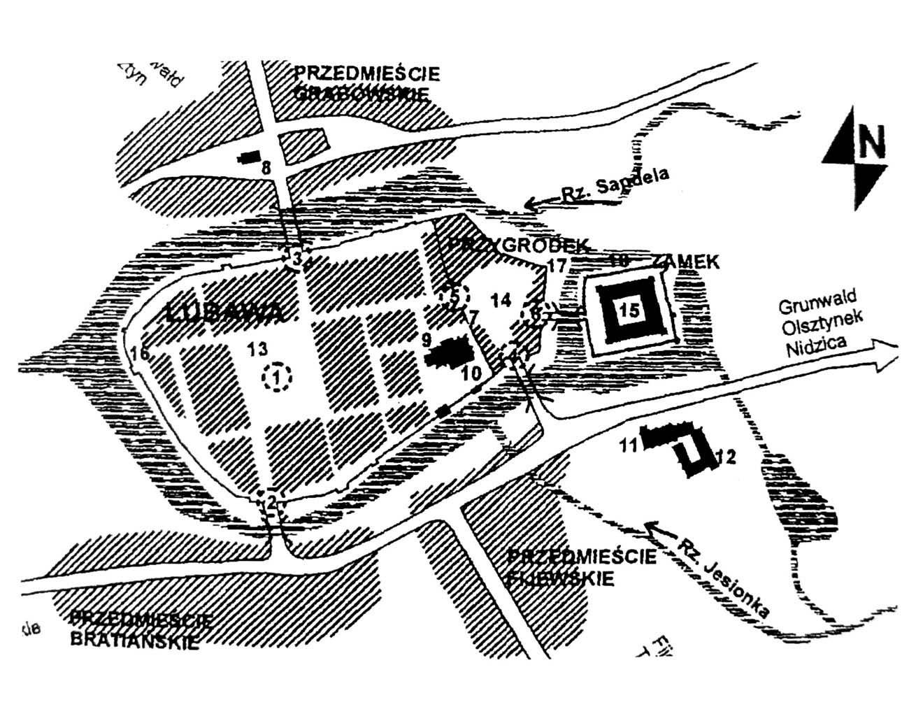
The town was founded on a moderate hill, located between the rivers Jesionka in the south and Sandela in the north, which fed the moat surrounding Lubawa, while the moat could in some places create larger water reservoirs on the west side of the town. At the confluence of both rivers, below the town in the north-west corner, there was a mill whose locks could, if necessary, dam up the water in the moat and reservoirs. The safety of the mill and the lock was one of the most important points in the town’s defense.
The fortification ring had a form similar to the oval elongated on the east-west line. On the eastern side, Lubawa was bordered by the outer bailey integrated with the town and the bishop’s castle, which was already an independent defensive work. Inside the town fortifications, Lubawa had a regularly planned layout with a spacious market square from the corners of which streets began. The eastern block, as a larger one, additionally had two utility streets, and the whole was connected by an under-wall street running around the fortifications.
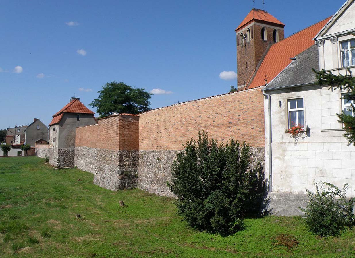
The total length of the town walls had about 1000 meters. Due to the small number of half-towers, probably around the entire perimeter wall was crowned with a battlement and a wall-walk. The half-towers were rectangular, protruding in front of the adjacent curtains, open from the inside. They were arranged irregularly, probably with a greater density on the most endangered northern and southern sections. In front of the main wall there could also be an outer zwinger wall, but probably not around the entire perimeter, but only from the north or south, where there was a place to built it in the foreground.
Two gates led to the town: from the north the German Gate, also called Iława Gate, and from the south-west, Bratian Gate. There was also a Polish Gate or postern, which led from the south to the bishop’s castle outer bailey, and from there through another passage on the northern side of the parish church to the town. All gates were placed at the outlets of the main streets crossing Lubawa, which were connected with the corners of the centrally located, four-sided market square. The two main ones probably consisted of a double complex: the outer gate with a drawbridge over the moat, possibly with flanking round towers on the zwinger wall line, and the proper gatehouse in the line of the main defensive wall.
Current state
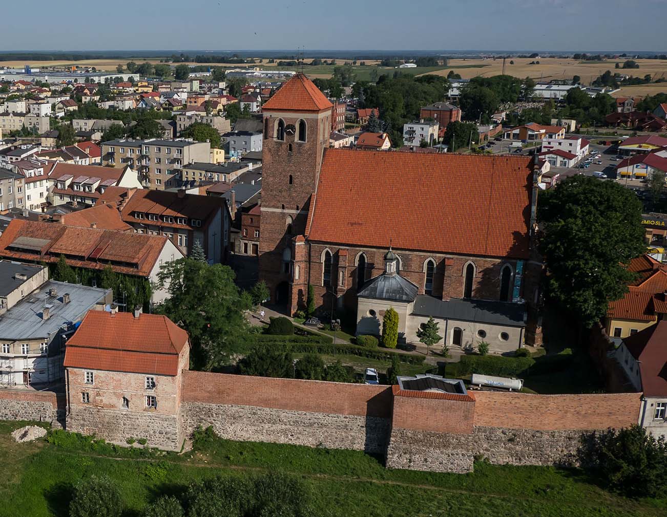
Fragments of the inner defensive walls and partly two half-towers have survived to our times, which in the 18th and 19th centuries were rebuilt into residential houses. This section is located on the south side of the St. Anna’s church. No remains of the three town gates have survived, but their location is still clearly marked by three streets leading to Lubawa.
bibliography:
Czubiel L., Domagała T., Zabytkowe ośrodki miejskie Warmii i Mazur, Olsztyn 1969.
Die Bau- und Kunstdenkmäler der Provinz Westpreußen, der Kreis Löbau, red. J.Heise, Danzig 1895.