
History
The wooden stronghold was built in the second half of the 13th century, perhaps shortly after 1257, when Lubawa (Lubavia, Löbau) became the property of the bishops of the Chełmno diocese, although the first mention of the Lubawa land in documents was recorded in 1216, therefore, an important settlement must have already functioned there. The first Lubawa stronghold was destroyed quite quickly by the Prussians, probably during the uprising in 1260-1274.
The construction of a brick castle was started by Bishop Herman of Pryzna in the years 1303-1311, and his successor, Mikołaj Afri, continued building after a nine-year vacancy on the bishop’s seat. In 1326 another bishop, named Otto, issued “in castro nostro Lubow” a new privilege for a neighboring town. After being destroyed by the Lithuanian army in 1330, the works were continued and their first stage was completed in the years 1363-1385 under the rule of Wikbold Dobilstein. The final Gothic form of the castle was obtained at the beginning of the 15th century, during the times of Arnold Stapil, who, as it was recorded, died “in castro novo Lubaviae”, although before the mid-15th century the defensive system of the castle was slightly modernized by erecting a semicircular corner cannon tower.
After the Second Peace of Toruń from 1466, Lubawa was incorporated into Poland. Her first bishop appointed by the king was Wincenty Kiełbasa. In 1545, the building was destroyed by a fire, and after 1624, at the initiative of bishop Jakub Zadzik, it was rebuilt into a baroque residence, surrounded by early modern earth fortifications. The political and economic regression at the end of the 18th century led to the gradual fall of the castle. Abandoned by bishop Jan Hohenzollern in 1815, it burnt down. In 1826, it was finally demolished.

Architecture
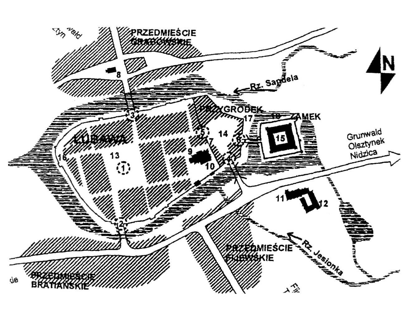
The castle was built of bricks laid in the monk bond on a plinh made of erratic stones. It was situated on the southern side of the Sandela River and at the same time on the northern side of the Jesionka River, which joined a small lake. From the west, a settlement was formed, and then a fortified town, separated from the castle core by the outer bailey.
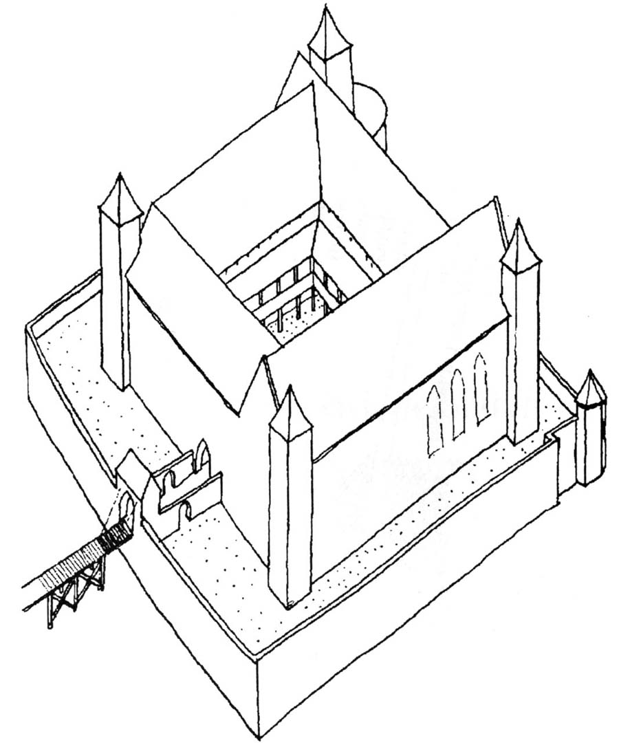
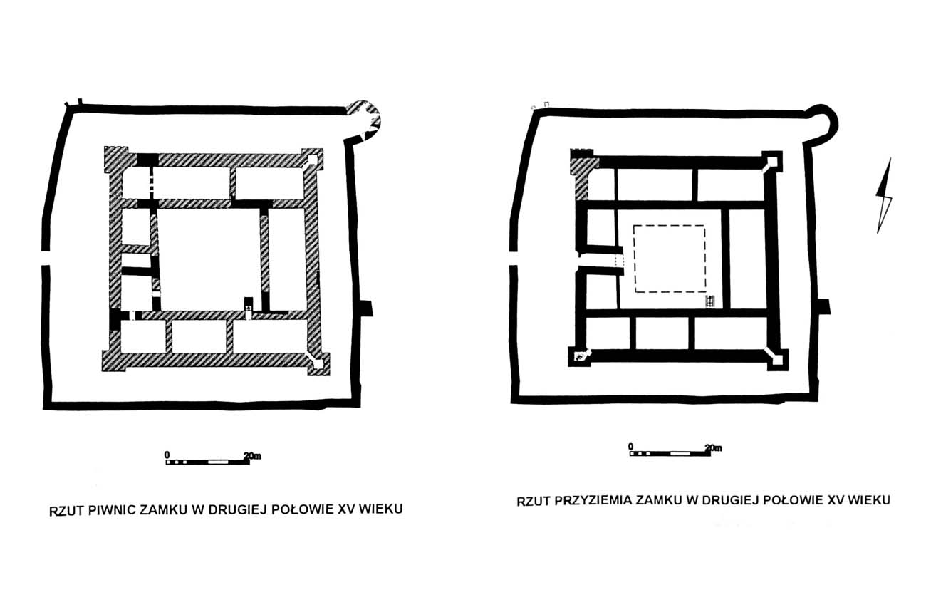
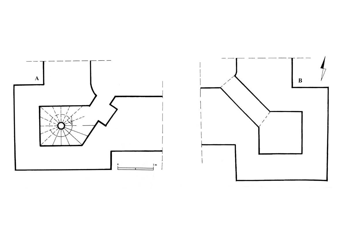
The castle consisted of external walls, forming a quadrangle measuring 71×74 meters, zwinger and four-winged internal buildings with sides of about 50 meters. Four wings surrounded the inner courtyard, referring to the regular commandry castles of the Teutonic Order. Slightly older, formed until about 1385 were the northern, eastern and southern wings, while the western one, although planned from the beginning, was built only at the beginning of the 15th century. The entrance led through the western part, i.e. from the town and the outer ward. The corners of the castle were reinforced by slender, four-sided turrets, protruded from two sides in front of the adjacent walls of the wings.
According to early modern accounts, the ground floor of the castle housed, among others, a kitchen, a brewery and a bakery, while on the representative and residential upper floor there was a refectory and a chapel, probably located in the eastern part of the southern wing (divided into three rooms). Similarly to other buildings of this type, the cellars and the attic probably served as storage facilities. The corner towers were connected to the wings with diagonal passages from the basement or the ground floor. There was a well in the courtyard, surrounded by wooden cloisters.
On the west side of the main castle there was an outer bailey, separated by a wide moat over which a drawbridge was placed. It had an irregular arrangement surrounded by a brick defensive wall. From the side of the town, the fortifications of the outer ward were not protected by a ditch, and the wicket gate in the wall led directly to the cemetery and to the parish church. The outer bailey was made up of numerous, but mainly wooden and half-timbered economic buildings and a well.
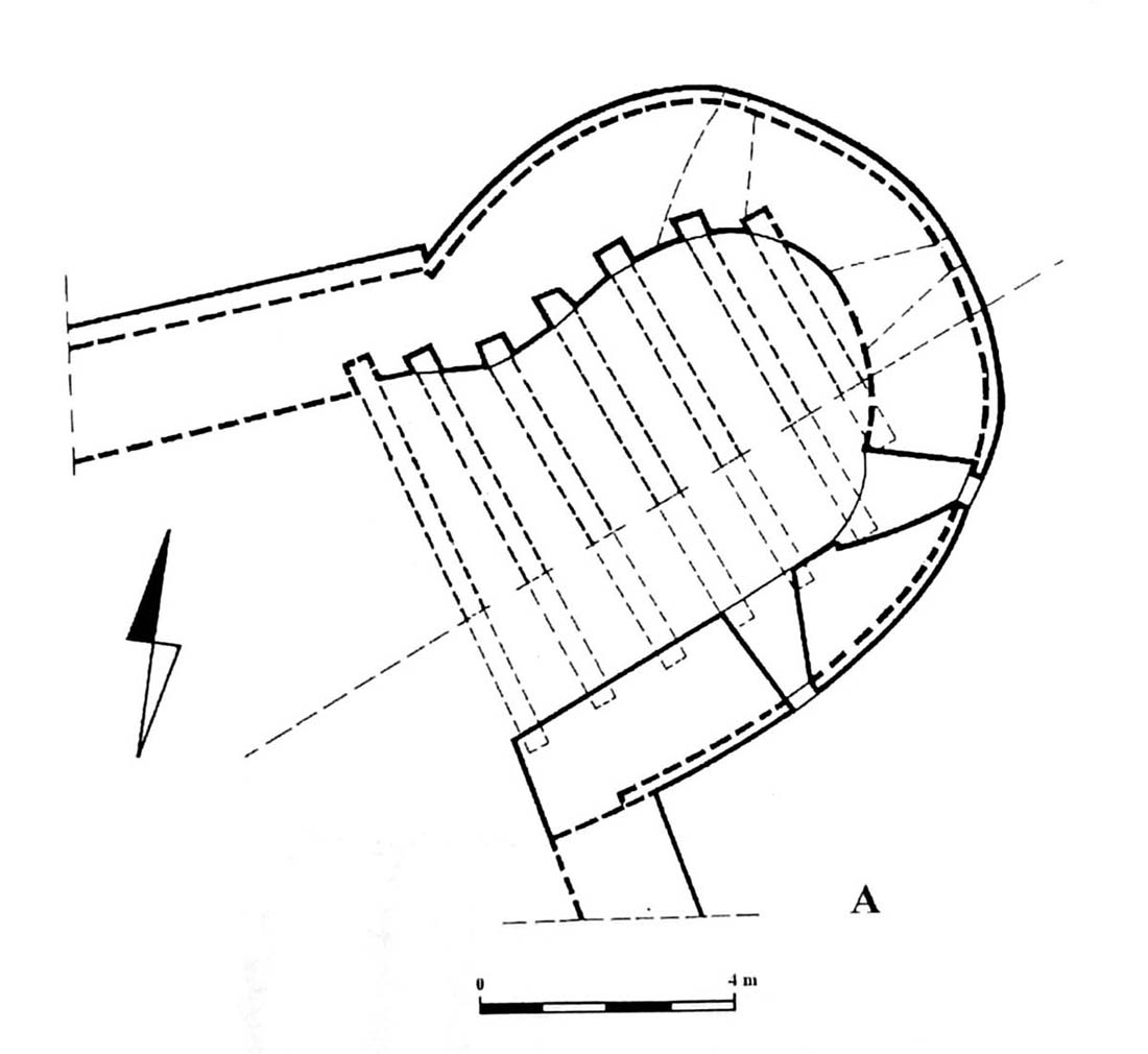
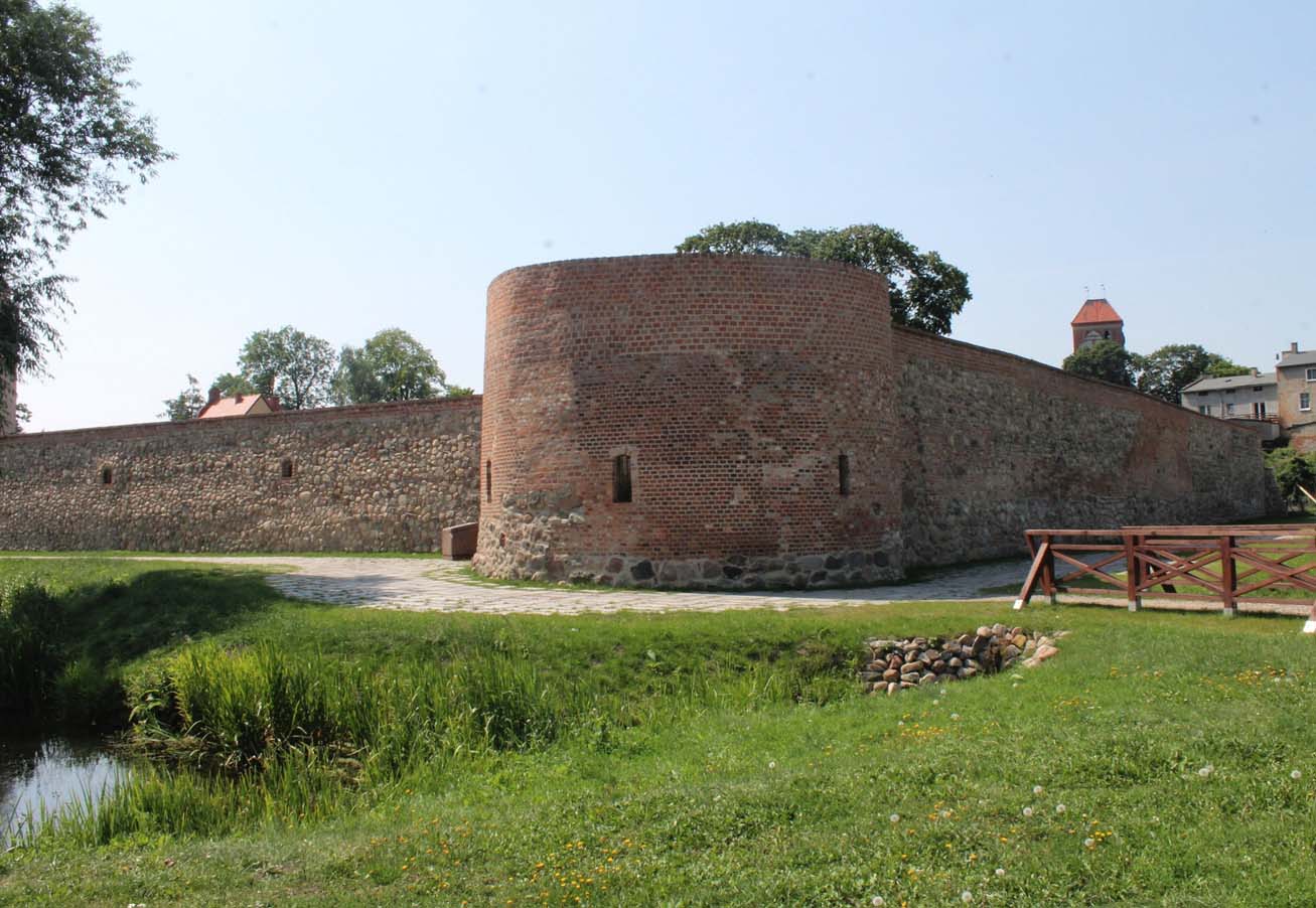
In the mid-15th century the castle was adapted for artillery defense. A semicircular cannon tower was erected then in the north-east corner of the outer perimeter of the walls and perhaps also a three-sided defensive work in the south-west corner. The cannon tower was squat, equipped with radially spaced loop holes and an upper terrace supported by timber beams.
Current state
Up to now, retaining walls of the main castle corpus, extending from the outside to 4 meters high, cellars and the portal of castle’s gate have been preserved. For some time, work has been underway on securing and managing the ruins. Unfortunately, it is also planned to build a contemporary pavilion at the castle grounds.
bibliography:
Herrmann C., Mittelalterliche Architektur im Preussenland, Petersberg 2007.
Leksykon zamków w Polsce, red. L.Kajzer, Warszawa 2003.
Wasik B., Budownictwo zamkowe na ziemi chełmińskiej od XIII do XV wieku, Toruń 2016.
Zamek w Lubawie, red. L.Kajzer, Lubawa 2001.