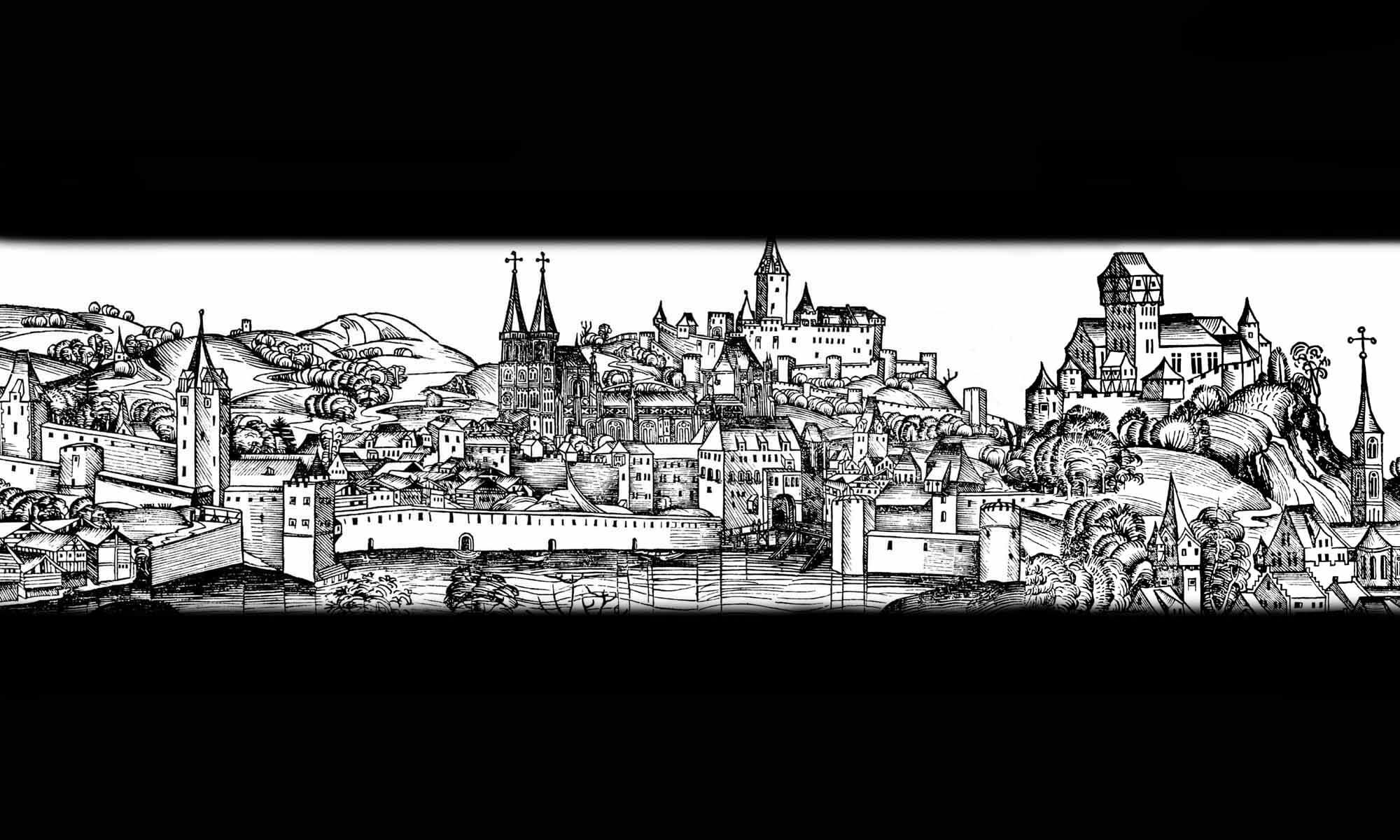

History
The oldest fortifications in Kwidzyn (German: Marienwerder), likely in the form of a wood and earthen watchtower, were built around 1233 by Teutonic Knights under the command of Land Master Hermann Balk. According to the chronicler Peter of Dusburg, “Quedin” Hill was chosen for their construction, and a town was founded nearby a year later, presumably under Magdeburg Law. Both the settlement and the watchtower were destroyed in 1242-1243 during the first Prussian uprising against the Teutonic Knights. The town was likely abandoned for a long time at that time, with new settlers arriving only in the 1250s. During the second Prussian uprising of 1260-1273, the town was burned down twice more. Following this event, at the end of the 13th century, the decision was made to build brick defensive walls. By around 1336, the main construction work on them was completed.
The division of Prussia and Chełmno Land into four bishoprics, made by Pope Innocent IV in 1243, resulted in the Teutonic Order being obliged to cede one-third of the territory of each diocese to the bishops’ endowment. Kwidzyn was chosen as the seat of the Pomesanian bishopric, which influenced the decision to build a bishop’s castle and a cathedral. The latter, not without resistance from the townspeople, was built within the town in the 14th century and connected to both the town walls and the Pomesanian chapter castle, which had been under construction since the turn of the 13th and 14th centuries.
During the Polish-Teutonic War of 1409-1411, the town was not attacked by Polish forces, as the Pomesanian Bishop, Johann II Ryman, submitted to the authority of King Władysław II after the Teutonic Knights’ defeat at Grunwald. In 1414, when Polish forces attempted to capture Kwidzyn, its inhabitants took refuge in the castle, setting fire to the buildings beforehand. The town suffered severe damages during the Thirteen Years’ War of 1454-1466. Due to its location on the road from Toruń to Malbork and Gdańsk, the town and castle served as an important base for military operations conducted by the Teutonic Order’s mercenaries. In 1460, Polish forces burned the town, but after a failed attack on the castle, they quickly withdrew. Under the terms of the Second Peace of Toruń in 1466, Kwidzyn was granted to the Teutonic Knights, but the Pomesanian bishopric was ceded in perpetuity to the Polish Bishop of Chełmno, Wincenty Kiełbasa. After his death, the Teutonic Knights attempted to occupy the bishopric, with the support of the cathedral chapter. This led to the intervention of Polish troops, known as the Pope’s War, during which Polish forces captured Kwidzyn in 1478. The town and castle were captured again in 1520, this time following a surrender after a day of shelling.
In the 17th century, Kwidzyn’s medieval defensive walls, like those of most other urban centers, became completely unsuitable for early modern military operations, due to the rapid development of military technology. The town was repeatedly captured without problems during the Polish-Swedish wars. First in 1628 and 1629, and then three times in the 1650s. A period of longer, approximately one hundred years of peace was brought only by the Treaty of Oliwa in 1660. In the second half of the 17th century, the Malbork and Grudziądz gates were reinforced with brick and earth bastions, but in the following century the dilapidated and neglected town wall began to be gradually dismantled and absorbed by the urban development, so that by the end of the 19th century it had been almost completely removed from the town architecture (the Lowland Gate was the first to be demolished, the Malbork Gate between 1743 and 1755, and the Grudziądz Gate in 1758).

Architecture
Kwidzyn was situated on the eastern bank of the Vistula River, atop a moraine plateau, at the edge of a broad glacial valley. The terrain of the town’s elevation sloped gently from east to west and from north to south. On the southern side a deep ravine with a stream separated the town from a slightly higher hill, on the promontory of which the castle of the bishops of Pomesania originally stood. To the west, Kwidzyn was bounded by fairly steep slopes descending toward a small river known as the Liwa, while to the north, the town adjoined the complex comprising the castle of the Pomesania chapter and the cathedral, structures that separated the urban area from the lower-lying outer bailey and a range of hills extending beyond. The site chosen for the town was so naturally advantageous for defense that a moat was required only on the eastern side.
In the 14th century, a defensive wall forming an irregular pentagon, enclosed a town covering approximately 6 hectares. The circuit was elongated along a northwest-to-southeast axis, with its shortest section facing the latter direction. On the northern side, the wall connected to the castle and the wall surrounding the cathedral, though it remains unclear whether these structures were separated from the town by a ditch or an additional section of wall. Kwidzyn’s perimeter wall was initially topped by a wall walk with battlement, which may have later been replaced by a simple parapet featuring loopholes. The curtain walls were reinforced by several or perhaps a dozen or so quadrangular towers. Initially, these were likely opened on the inner side and either level with the defensive wall or one story higher (though the three corner towers may have had a closed form). The distribution of towers along the perimeter was likely uneven; they were probably more densely spaced along the most vulnerable eastern side and near the gates.
Three town gates provided access to the town. The most impressive was the northeastern Malbork Gate, situated near the cathedral and the outer bailey. Its passageway was flanked by two towers, and the approach crossed a drawbridge over a water-filled moat, in front of which stood the hospital of the Holy Spirit. Another gate, erected along the shortest section of the circuit in the southeastern part of the town, was the Grudziądz Gate, also known as the High, Upper, or Chełmno Gate. Together with its foregate, it faced the Grudziądz Suburb and the hospital of St. George. The third town gate known as the Lowland, Water, or Gniew Gate, led out of the town toward the Kwidzyn Lowlands on the southwest side, passing through the oldest suburb, documented as early as 1336 under the name Podolice. All three of these gates connected to streets that followed the typical pattern of converging on the corners of the market square. A fourth gate was cut through the northwestern corner of the defensive wall, but it was blocked in the early 14th century, following the construction of the chapter castle.
Current state
The best-preserved fragment of the town defensive wall to the southwest of the castle, on the side facing the Liwa River, is a several-dozen-meter-long section. This fragment had a steep slope unsuitable for urban development or a for a road, which likely saved the wall from demolition. Its current battlements are the result of contemporary or 19th-century reconstruction. Furthermore, remnants of the defensive wall have survived on the eastern section, in the yard of the residential buildings, and on the southern side, on the edge of the ravine that once separated the town from the bishop’s castle, where it runs between modern residential buildings, between Górna and Batalionów Chłopskich streets. Unfortunately, none of the towers or gates have survived.

bibliography:
Atlas historyczny miast polskich, tom III Mazury i Prusy Książęce, red. R.Czaja, R.Golba, zeszyt 5 Kwidzyn, Toruń 2024.
Die Bau- und Kunstdenkmäler der Provinz Westpreußen, der Kreis Marienwerder, östlich der Weichsel, red. J.Heise, Danzig 1898.
Garniec M., Garniec-Jackiewicz M., Zamki państwa krzyżackiego w dawnych Prusach, Olsztyn 2006.
Leksykon zamków w Polsce, red. L.Kajzer, Warszawa 2003.