
History
The stone castle was built around the middle of the 14th century, probably after 1331 when the Lithuanian raid took place, and certainly before 1361, when at the castle officials managing the goods of the Chełmno chapter were mentioned. It was located in a strategically important place, near the ford on the Drwęca River.
In 1410 near Kurzętnik, the Teutonic Knights tried to organize defense against Polish army, but Polish scouts at the last moment realized the situation and king Władysław Jagiełło decided to march up the river in search of a more convenient and safe crossing. After the Grunwald victory, the castle and the town were captured without fight by Jan Kretkowski, the Radom staroste, but the Toruń Peace signed in 1411 returned Kurzętnik to the Teutonic Knights. The castle was badly damaged during the Polish-Teutonic Hunger War in 1414. It is true that the garrison commander surrendered the castle to the knights of Janusz Dobrski and Jacek Święty, but both the stronghold and the town were burned.
During the Thirteen Years’ War in 1454, the city council of nearby Kurzętnik signed an act of belonging to the Prussian Union and the castle was garrisoned by the union’s crew, and naxt by a Polish troops. For this reason, mercenary knights fighting on the Teutonic side under the command of Ulric von Kinsberg captured and burned it. The Second Peace of Toruń in 1466 gave the damaged castle to Poland. Further destruction was caused by the Swedes in 1656. Since than the decayed buildings were systematically demolished.
Architecture
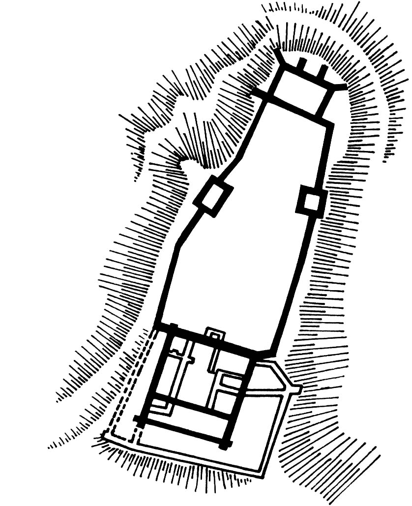
The castle was built on a promontory of a lofty mountain cutting into the Drwęca valley. It included a multi-storey main house located in the southwestern part, with an adjacent courtyard surrounded by a defensive wall. This complex had dimensions of 25×28 meters and was built mainly of erratic stones, bricks were used only to a limited extent. The entrance to the upper ward was located on the north-eastern curtain axis. The opposite, south-west curtain of the wall was secured by a ditch separating the headland from the rest of the hill.
In the north there was a trapezoidal outer ward about 60 meters long, not separated by a ditch from the main part of the castle. By its short northern curtain, on a promontory of a hill overlooking the surrounding area, was a rectangular tower house 8×13 meters, reinforced from the outside with massive buttresses. According to tradition, it housed the chapel of Holy Cross. Two towers were erected along longer sections of the walls. The economic outer ward’s buildings were located at the inner faces of the perimeter walls, while the location of the main entrance is uncertain. It might have been from the south, but the most convenient approach was from the west. The layout of the castle was quite unusual because the outer ward was located in the theoretically safest place of the area, and not in front of the inner (upper) ward. For this reason, the upper ward was the first to take on the assault of attackers and somehow protected the economic outer bailey.
The extension made at the turn of the fourteenth and fifteenth centuries reduced the inner courtyard of the upper castle, blocked by another two residential wings. It also received an external defensive wall from the south and west, as well as a small four-sided foregate protruding towards the outer ward. In the eastern part of the zwinger area there was a trapezoidal building of unknown purpose, perhaps it served as a gatehouse or foregate.
Current state
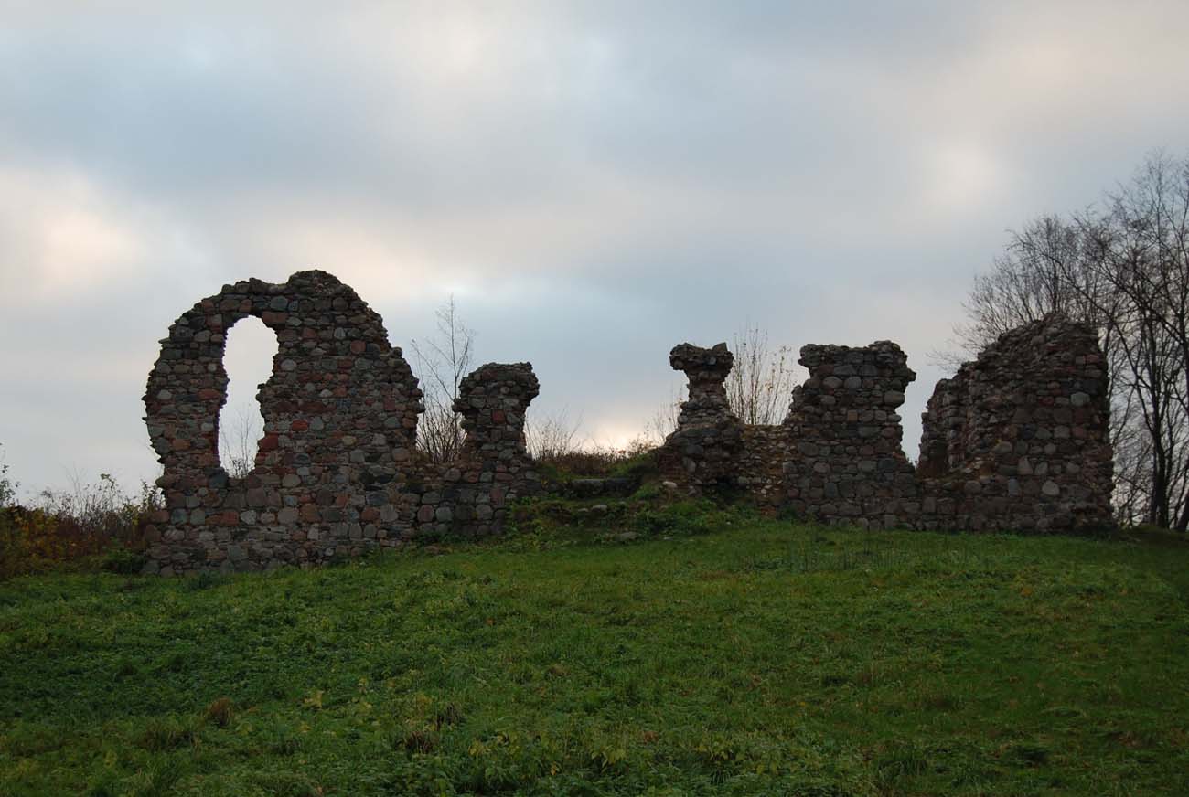
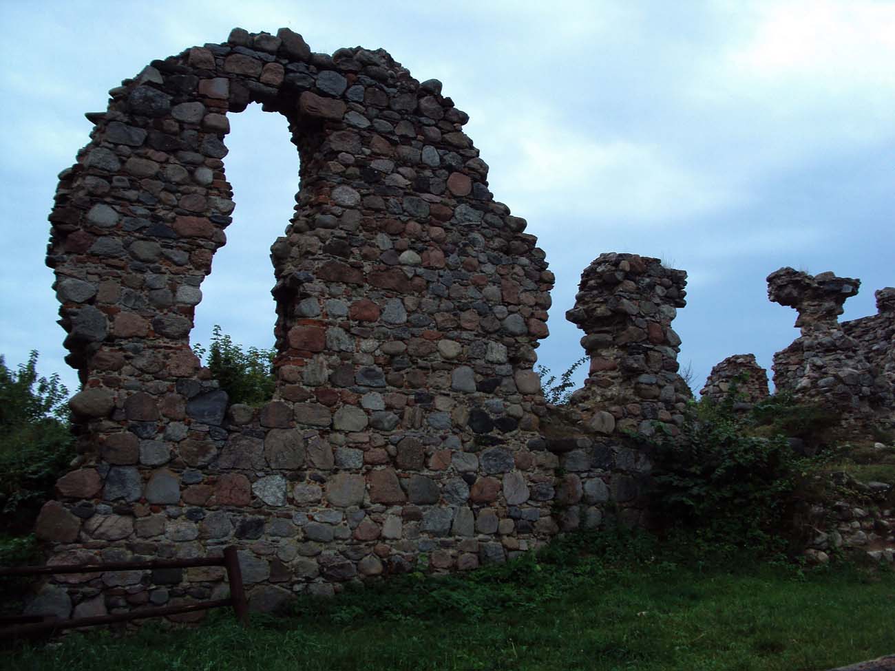
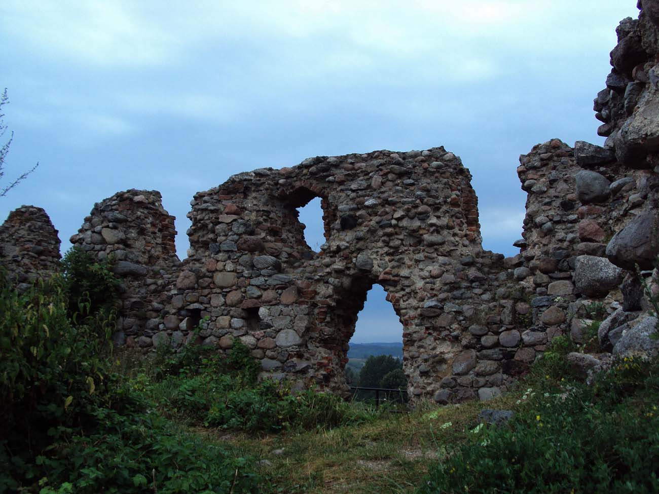
Until today only partial walls, reaching up to 5 meters in height and foundations have been preserved. Admission to the castle area is free.
bibliography:
Leksykon zamków w Polsce, red. L.Kajzer, Warszawa 2003.
Wasik B., Budownictwo zamkowe na ziemi chełmińskiej od XIII do XV wieku, Toruń 2016.