
History
The first record about Kożuchów (Latin: Kosuchovia, German: Freystadt) comes from 1273 and it is known thanks to it, that already twenty years earlier the town had timber and earth fortifications, built in the process of transforming the early medieval stronghold into a market settlement and then a town. The reason for its building was the rapid enrichment of the townsfolk, and therefore the desire to protect against assault. Also the Silesian princes saw in the fortified towns a strengthening of the defense of their lands. In 1283, the town received a permit for the construction of stone fortifications. Their construction was very expensive, and thus the process of its formation was very long. They were erected from the end of the 13th century to the beginning of the 14th century. The first mention of town gates appeared in 1311, while the moat was reported in 1321.
The turn of the 13th and 14th centuries was the period of the reign of prince Henry III, who focused in his hands apart from the Duchy of Głogów, also part of Wielkopolska and applied for the crown of Poland. While pursuing an ambitious policy, he also strengthened his hereditary duchy economically and militarily. His successors: Henryk IV the Loyal and his son Henryk V the Iron, also conducted an active policy. The loss of the capital of the duchy, Głogów town, in 1331, forced strengthening of the defense of other cities, including Kożuchów. In 1378, the duchy was divided by the sons of Henryk V, of whom Henryk VIII, called Sparrow, chose Kożuchów as his seat. From that time, the town benefited from a number of privileges, which was reflected in the expansion of the castle and the constant modernization of the town walls.
The first half of the fifteenth century brought about major changes in the technique and tactics of warfare in relation with the spread of firearms. Its widespread use during the Hussite wars showed ineffectiveness of the existing defense systems. Soon after the end of hostilities in the second half of the 15th century, in the times of the Turkish threat and unstable situation of Silesia, the process of strengthening the town walls was started, consisting in the reconstruction of the wall finials, introducing shooting holes, and especially building the second, outer belt of fortifications, which was strengthened with low towers. These works began in the second half of the fifteenth century and were completed at the beginning of the sixteenth century.
The strength of Kożuchów fortifications was confirmed by the War for the Głogów Succession from 1476-1482. The town occupied by the forces of prince Jan II of Żagań, in 1477 tried to conquer the Brandenburg army, but the assault was unsuccessful. During the conflict of Jan II with the Hungarian king Matthias Corvinus in 1488, Kożuchów played the role of a base for besieged Głogów. After its fall, before the Hungarian army arrived, a great fire broke out in Kożuchów, caused by Czechs, supporting prince Jan. It certainly helped Hungary later siege the town, which lasted only eight days. After the fights and the fire, the condition of the town fortifications was probably not the best, therefore, along with the reconstruction of the town, they were repaired and modernized. These works could have been accelerated during the Jagiellonian rule in the Duchy of Głogów in the years 1492-1506. Some attribute this credit to Hans von Rechenberg, who in 1516-1537 was the owner of the castle fiefdom in Kożuchów, but the process of rebuilding the fortifications was of a long-lasting character and probably ended only in the mid-sixteenth century.
In the 17th century, during the Thirty Years War, the medieval fortifications no longer met the standards of early modern war art. The town could protect only against marauders and robbers. After the great fire of 1637, the town was occupied several times by imperial and Swedish troops. As a result, after the war Kożuchów was in ruins, and the town authorities did not decide to rebuild the damaged fortifications. After another great fire of 1764, a decision was made to demolish part of the walls with the purpose of building materials for the reconstruction of burned houses. The walls and towers were lowered to about 3-5 meters and adopted into storage rooms, adding new walls and roofs to them. Total demolition of the town walls was probably not carried out due to the type of building material used, because then the stone was only sporadically used in urban buildings. In the 19th century, urban gates were demolished to improve communication.

Architecture
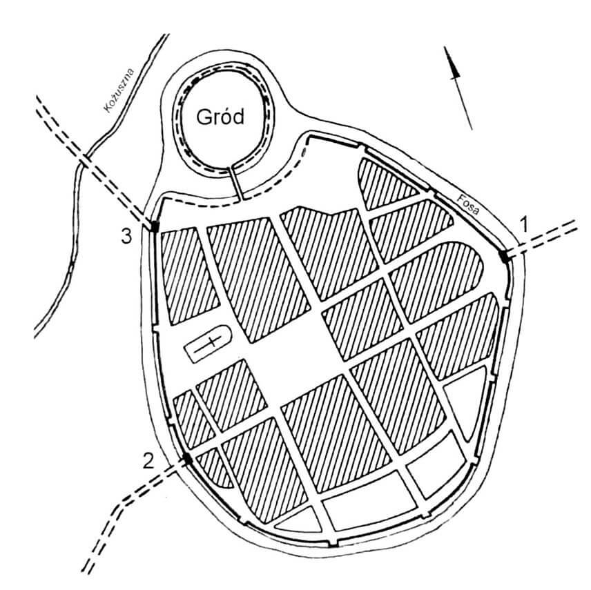
The town was located on a flat area, with natural defense conditions only from the north, in the form of a backwaters and wetlands of the Kożuszna river. It flowed through a narrow, small valley towards which the town area gently sloped to the north and west. In the lowland strip of the valley there was a hill, a site of an early medieval stronghold, which was then used for a castle, connected to the town fortifications. The defensive circuit had the shape of an elongated oval with a slight bulge towards the east. The length of the fortifications was about 1050 meters, and along with the castle fortifications 1300 meters. The area of the town, enclosed by walls, occupied an area of almost 11 ha, which made Kożuchów a medium-sized town.
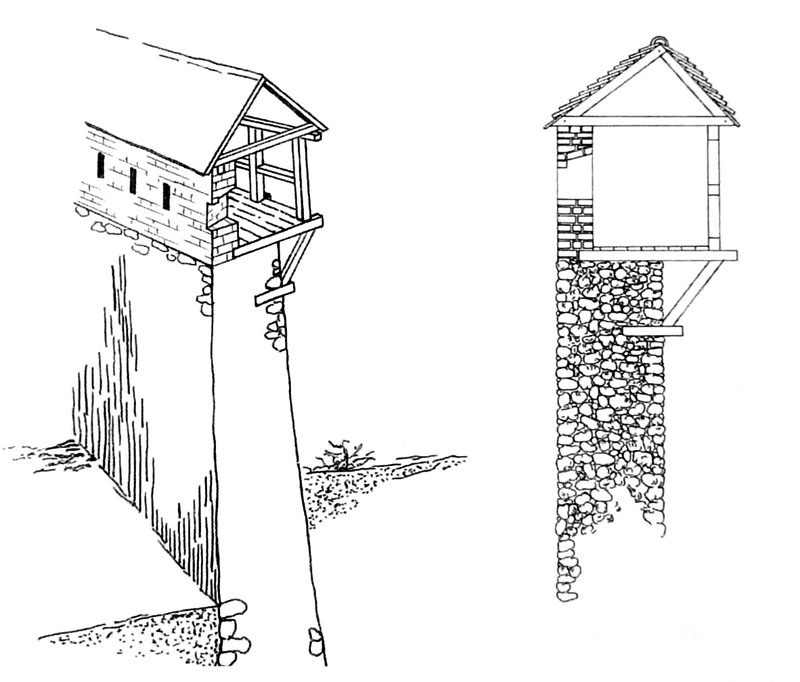
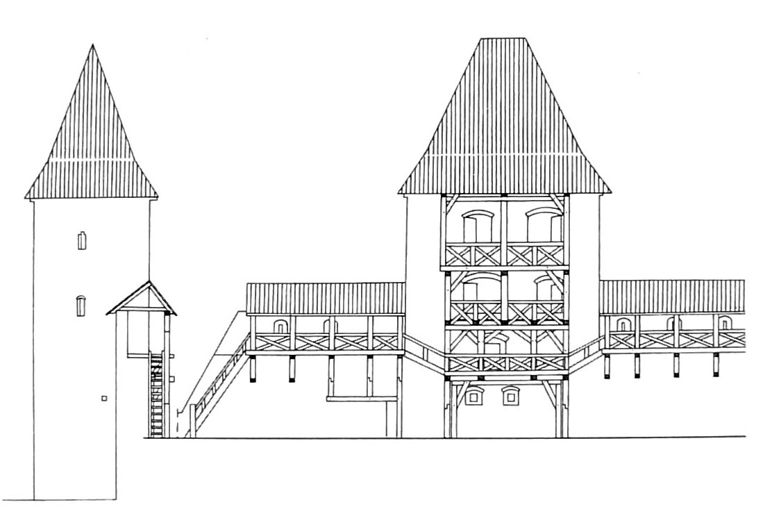
The Kożuchów defensive walls were built of layered glacial erratic stones and granite slate. The largest stones were joint with lime mortar and laid in the foundation part. Every few tens of centimeters level was leveled with a layer of small and flat stones, obtaining a regular structure with a width of 1.9 to 1.5 meters. Originally, in the highest parts, the wall reached 8 meters in height. Such a height was in the north-eastern part of circuit, which was additionally protected by swamps, and the construction of a high wall made it possible there to give up the defenders porch. In other parts, the wall reached 6-7 meters in height. The wall’s culmination consisted of an inner, meter-wide porch for defenders, and from the outside of the parapet, which could have a form a crenellation or some parts of the hoarding. The porch for the defenders was abandoned in the part of the wall adjacent to the castle, so that it would not be able to use the attackers to strike the castle in the event of conquering the town. Modernization of the defensive wall in the fifteenth century consisted of its elevation and reconstruction of the parapet, which was replaced with a brick and in which the embrasures from the inside were placed. The porch of the defenders probably obtained a wooden roof.
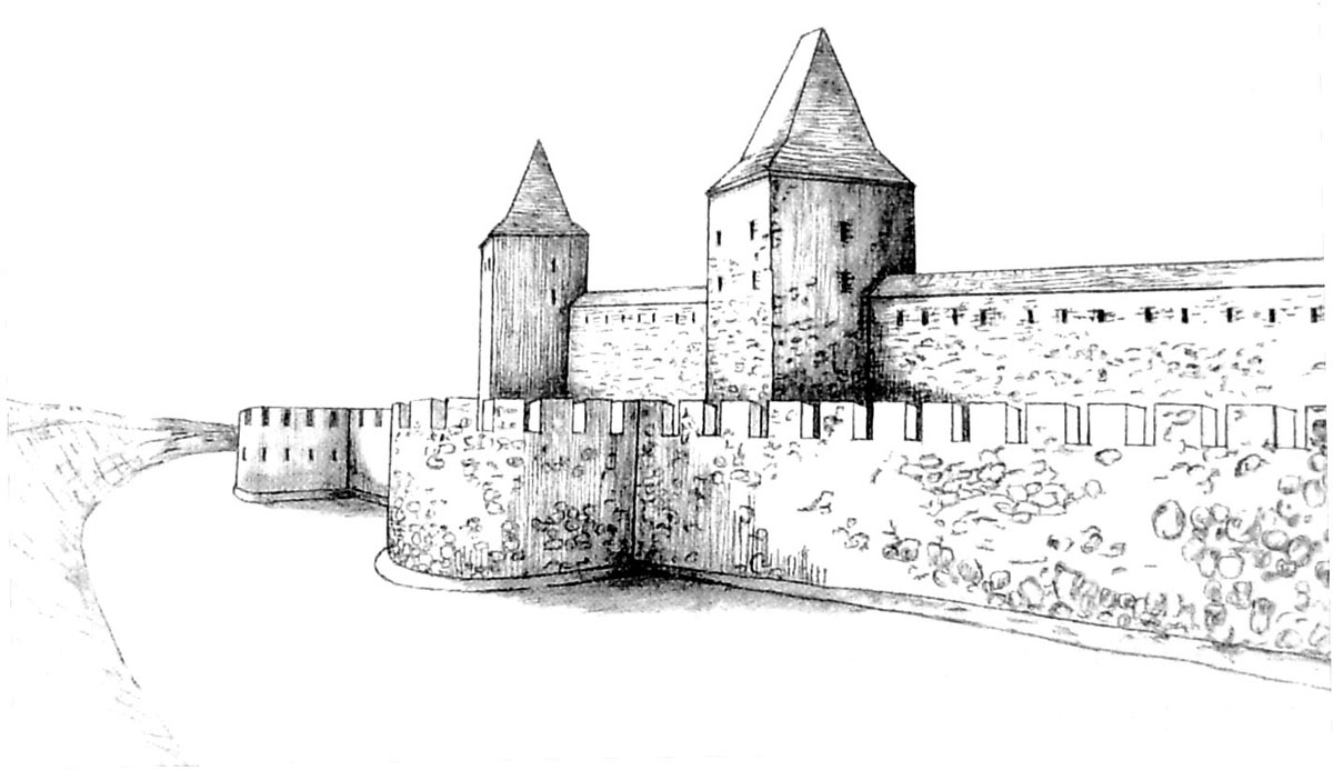
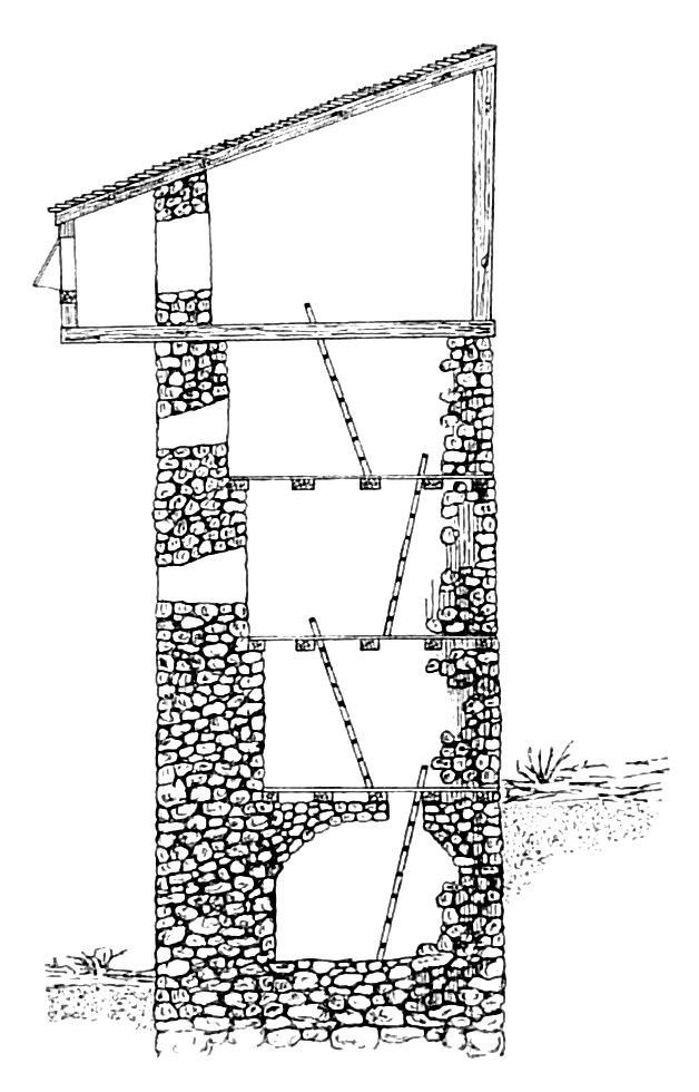
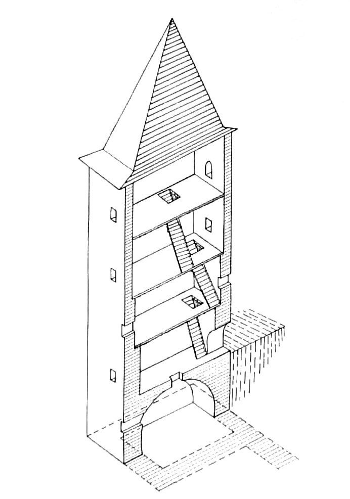
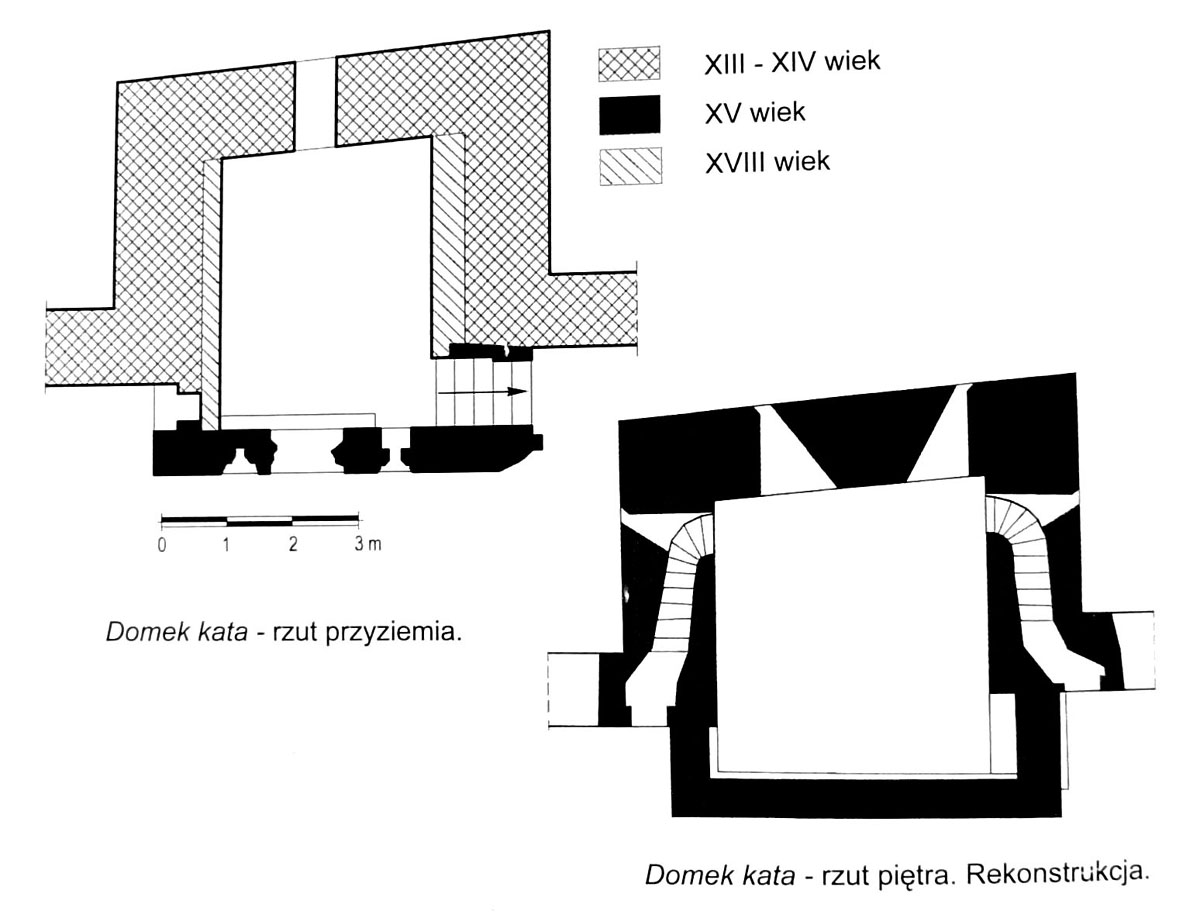
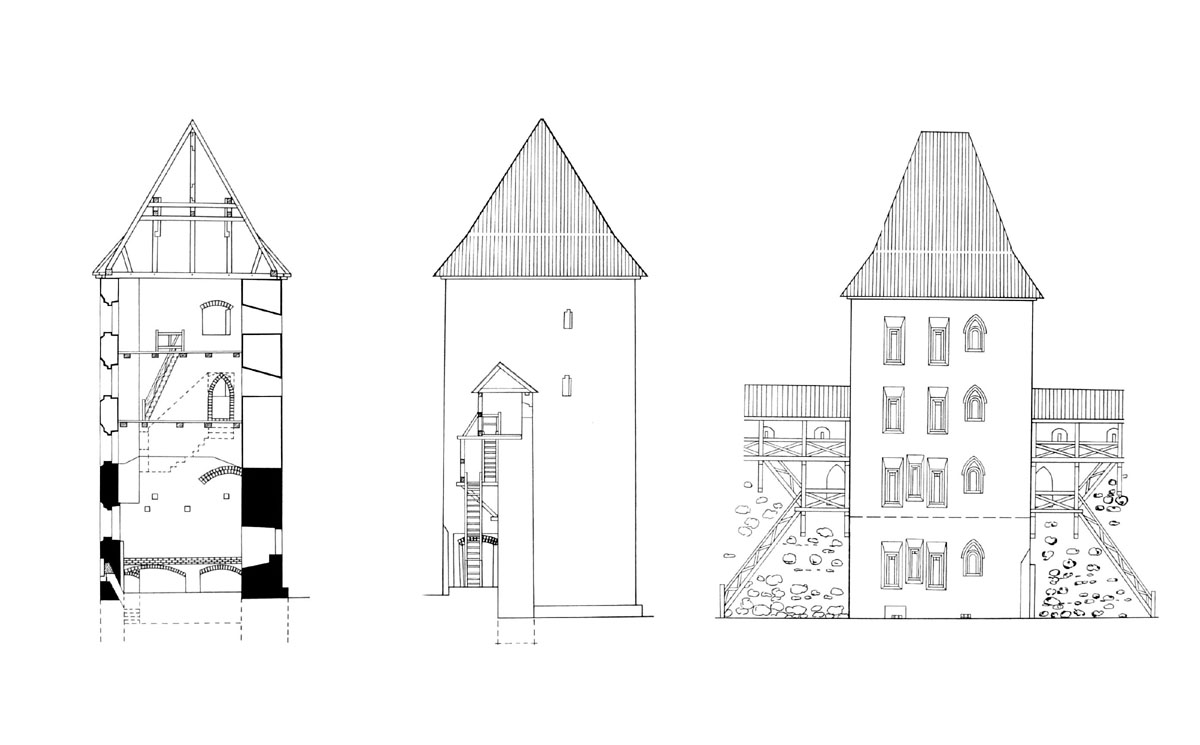
The wall was reinforced with 11 rectangular half towers, open from the town side. Their size was varied and practically each had different dimensions in the base. The width varied from 5 to 6.5 meters, and the depth from 2.5 to 5 meters. The largest tower was erected east of the castle and had dimensions 8×5 meter in the plan. The original height of the towers was about 10-12 meters. They had from 3 to 5 storeys, with internal piers made of timber beams. Communication between particular floors was provided by ladders. On the upper floors, the piers were connected with the defenders porch of the defensive walls. Most of the towers were probably covered, at first it could be hoarding, which enabled the front and side firing of the enemy. In the 14th-15th centuries they were replaced with tall, wooden gable roofs. In the 15th-16th century, the towers received new shooting holes, they were also built up by adding the rear walls. In this way, they were able to perform not only military functions.
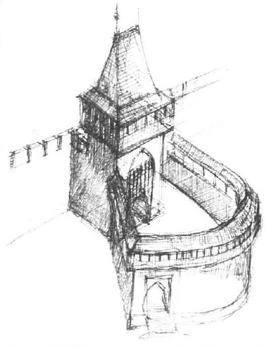
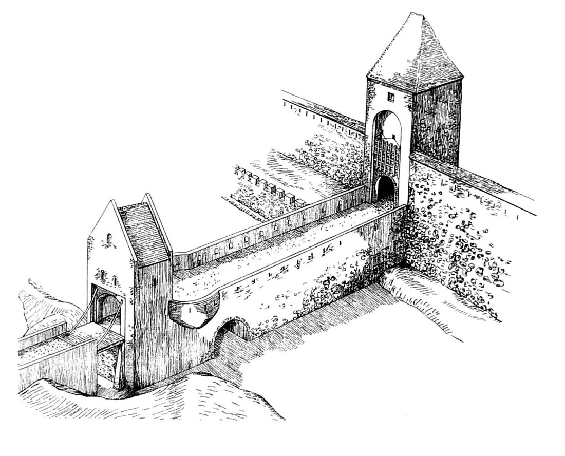
Three gates led to the town: from the eastern side Głogów Gate, from west Żagań Gate and from north Krosno Gate. In addition to communication and defense functions, they also played a fiscal role, because transport and commercial fees were collected next to them. Originally, they consisted of single, four-sided towers, with 5-6 meters width passages at the bottom, closed by gates or portcullis. On the first floor there were most often rooms for the guards, some of them could also have an underground floor. They were crowned with ordinary battle platforms or hoarding. The communication through the moat was provided by drawbridges. In the fifteenth and sixteenth centuries, they were expanded by adding foregates.
At the end of the Middle Ages, the Głogowska Gate consisted of a gate tower with dimensions of 9.5 x 9.7 meters in plan and a foregate building, which were connected by a brick neck, placed over the moat on the arcaded bridge. The gate tower was exceptionally pulled inside the defensive circuit, probably due to the wet and unstable area. In the façade of the tower, at a distance of about 1 meter from the edge of the gate opening (made of carefully worked blocks of bog iron), there was a recess in which the portcullis was lowered. In addition, the passage was secured by a drawbridge and two-leaf door. The gable was crowned with a hip roof with a short ridge, mounted on the battlement of the highest storey. The foregate building also had a door or a portcullis. The neck next to it had a circular shape, creating a kind of gallery hanging over the bridge.
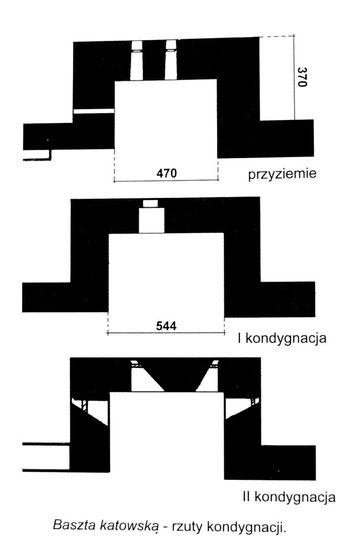
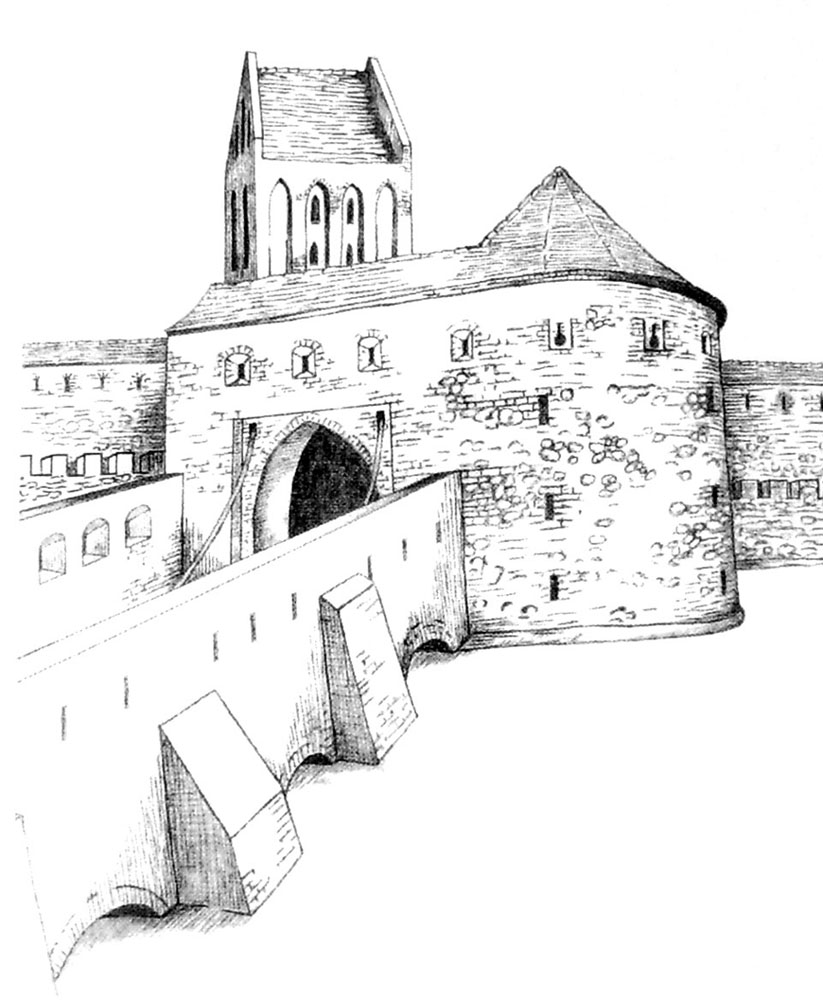
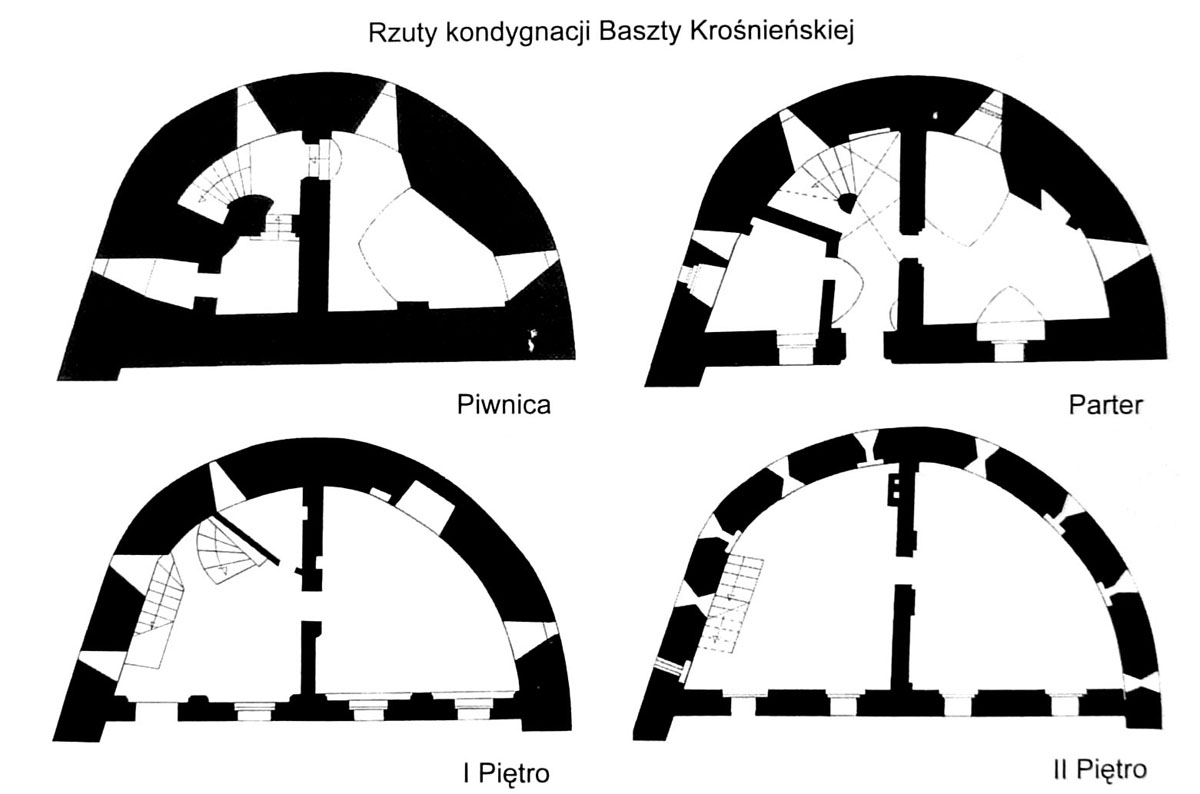
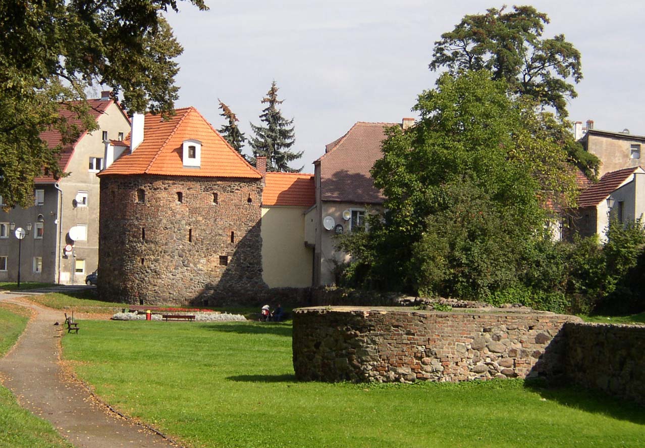
The modernization of the Krosno Gate was solved differently. It also consisted of a gate tower, but protruding in front of the face of the defensive wall, and the foregate located to the west eventually obtained a form similar to a barbican. Its walls from the south were added to the curtain of the defensive wall, and from the north to the corner of the gate tower. The axis of the entrance to the town was slightly bent towards the north-west, and the gate opening itself was preceded by an arcaded drawbridge over the moat. Initially, the foregate had walls pierced with slit openings and topped with battlement. From the outside, its upper storey was reinforced with hoarding, on the west side there was also a latrine bay. At the end of the Middle Ages, the main element of the foregate was a stone and brick semi-circular bastion (today called the Krosno Tower), erected in front of the wall of the second defensive circuit. Its radius was 8 meters and the wall thickness was 1.65 meters. Its straight wall faced the gate’s neck, creating a covered passage. Originally, it had three floors separated by wooden ceilings, another was added at the beginning of the 16th century.
In addition to the gates in the perimeter of the defensive walls, there were small passages called wicket gates (postern gates). These were openings no more than 1.5 meters wide, which served only for pedestrian communication. In 1418, princess Catherine of Opole issued a permit to build a wicket gate near the parish church and put a wooden bridge over the moat. Later, this passage was called the Plague Wicket Gate, which indicates the deportation of the deceased to a nearby cemetery during epidemic times. The second gate was located in the southern part of the circuit and probably came from the turn of the 15th and 16th centuries.
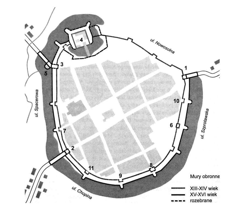
From the 15th century, the construction of a second, external belt of fortifications began. It was erected on the section from the western wing of the castle to the Głogów Gate, resigning from securing of the boggy areas east of the castle. The distance of the new wall from the first wall was uneven and ranged from 10 to 17 meters. It was lower and narrower, it has now been preserved up to a maximum of 2.5 meters high, with a width of up to 1.1 meters. The new ring of defense was intended for the use of artillery, but the wall probably was crowned with a crenellation, which, with narrow distances between merlons, served rather as a handgun. Its circumference was reinforced with low towers about 4-5 meters high, 7-8 meters long and 6-8 meters wide. The exception was the large bastion at the height of the evangelical church of much larger dimensions. Some of them could have two floors.
An irrigated moat surrounding the entire town was the outer defense zone. Its creation was associated with the construction of the earliest fortifications, when land was dug for the construction of the embankments. It was fed by the waters of the Kożuszna river, from which a canal was dug at the height of the Krosno Gate. The original width of the moat was about 10-15 meters, but later its widest section was almost 25 meters. During the construction of the second ring of fortifications, the old moat was filled up and a new one was dug in front of the outer ring of the walls.
Current state
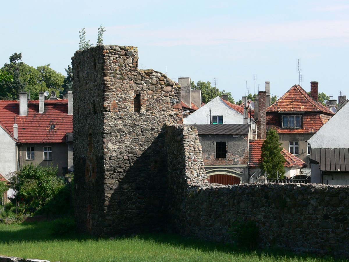
To this day, fragments of the main wall have been preserved on a large part of the former perimeter, the remains of six half towers, and the tower of the foregate of the Krosno Gate. Most of the walls is significantly lowered, in some places they survived to a height of about 3-5 meters, and only at the clergy house remained in their original height. In addition, sections of the outer wall (except for the northern and north-eastern sections) with five bastions have survived. The preserved 15th-century tower of the Krosno Gate now houses a regional museum, while the remaining towers and bastions are not used.

bibliography:
Andrzejewski T., Szukiełowicz Z., Mury obronne Kożuchowa, Kożuchów 2008.
Andrzejewski T., Szukiełowicz Z., Mury obronne Kożuchowa w świetle nowych ustaleń [in:] Budownictwo obronne Środkowego Nadodrza. Powiat nowosolski, Nowa Sól 2003.
Legendziewicz A., Średniowieczne fortyfikacje Kożuchowa, “Lubuskie Materiały Konserwatorskie”, 9/2012.
Pilch J., Leksykon zabytków architektury Dolnego Śląska, Warszawa 2005.
Przyłęcki M., Miejskie fortyfikacje średniowieczne na Dolnym Śląsku. Ochrona, konserwacja i ekspozycja 1850 – 1980, Warszawa 1987.
Studia nad początkami i rozplanowaniem miast nad środkową Odrą i dolną Wartą (województwo zielonogórskie), red. Z.Kaczmarczyk, A.Wędzki, tom 2, Zielona Góra 1970.