


History
Kętrzyn (Rastenburg) was surrounded by walls around 1350-1378, after the invasions and damages sustained during the Lithuanian invasions of 1344 and 1347. Initially, it were wood and earth fortifications, which were gradually transformed into brick ones. The foundation privilege of Kętrzyn from 1357 already recorded two town gates, mentioned as existing (“the gate from the Sątoczno side”, later called the High Gate, and the “gate from the mill’s side”). In 1374, the town’s defensive wall was recorded for the first time. The town was probably planned in advance as one compact defensive complex, integrated with the castle and the fortified church of St. George.
Kętrzyn took care of the good condition of the fortifications for a long time. In addition to their obvious military function, they also helped with the collection of customs duties on goods imported into the town. The ability to protect the town from strangers was also important, as various epidemics appeared in Prussia at that time. In 1646 and 1648, the walls at the Mill Gate and the brick bridge in front of the High Gate were repaired. In 1653, the roofing on the porches at the top of the walls was replaced and a drawbridge was repaired over the moat in front of the Mill Gate. In 1698, the breach in the walls was patched with a palisade, and in 1700 the tower and a large part of the wall near the High Gate were rebuilt, which had collapsed in the previous year. Thanks to this care, it was possible to effectively protect the town against the plague epidemic that havoc in the years 1708-1711. Only three people died in the Kętrzyn at that time.
The second half of the 18th century brought destruction to the town’s fortifications. The great town fire of 1761 caused the demolition of defensive walls, which became a source of cheap building material for the reconstruction of the destroyed city. Both town gates were demolished in the first quarter of the 19th century.
Architecture
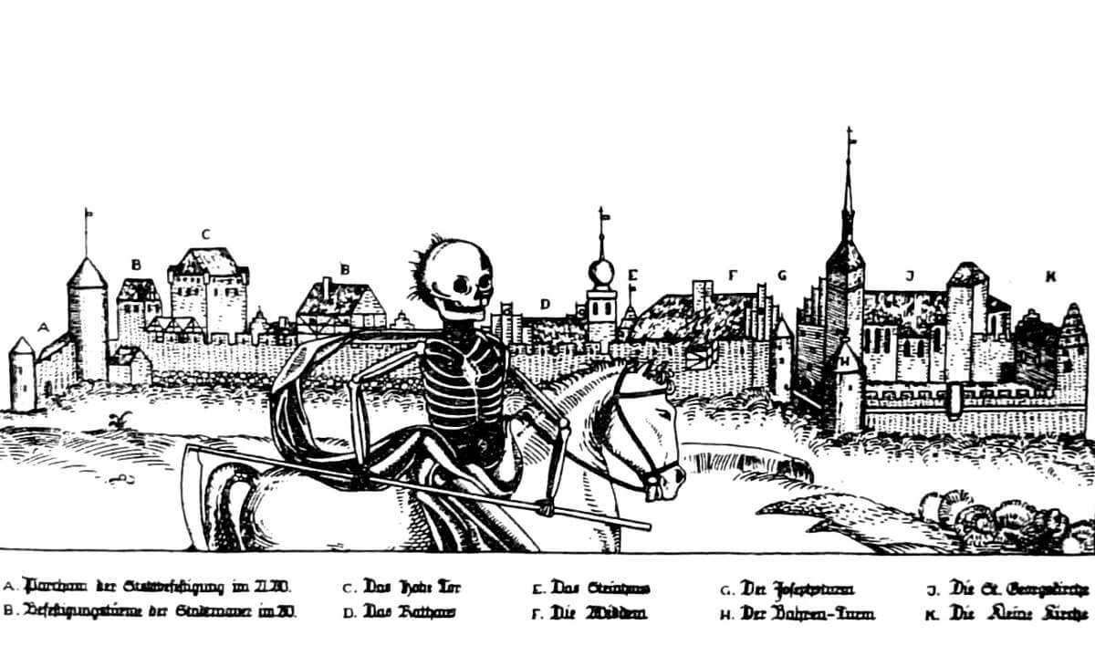
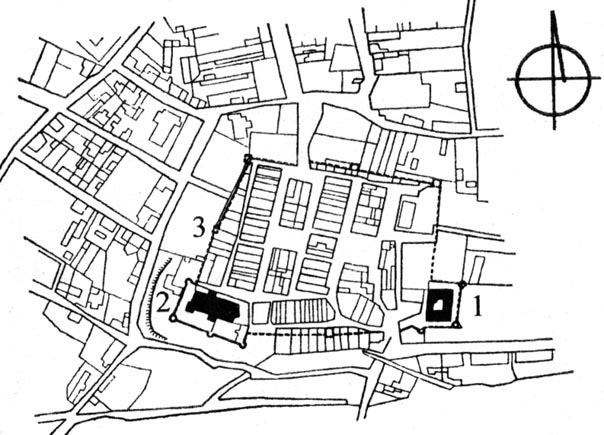
The defensive wall was erected on an irregular quadrilateral plan, slightly elongated on the east-west line. In the south-west corner, the church of St. George, and in the south-east of the Teutonic Order castle performed defensive functions in connection with town fortifications. From the south, Kętrzyn was adjacent to the Guber River, the bed of which ran along the east-west line, and in the north-east, near the town, there was Lake Górne.
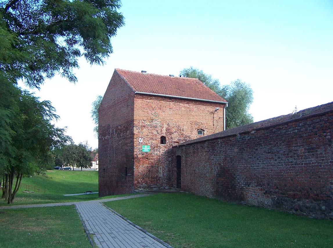
The town wall was built of bricks on a stone pedestal over 1 meter wide. Its height was up to 10 meters. Later, wall was topped with a roof above the defenders wall-walk, but probably earlier it had only battlement with an open wall-walk. Judging by the iconographic records, it had arrowslits pierced in the merlons of the battlement. The circuit was reinforced with about 13 towers, but their layout is not exactly known today. It is known that they were certainly located in the north-east and north-west corners, and two were in the curtain at the church of St. George. There was also at least one bartizan on the wall.
Two gates led to the town: High Gate and Mill Gate, located on the north-south line, and additionally, a Water postern at the church. There, the road led to the mill pond, which was, among other things, a source of water for extinguishing frequent fires. The Mill Gate was placed near the castle, in the southern fragment of the defensive walls. It was protected both by the backwaters and the vicinity of the castle itself. The High Gate, also known as Königsberg Gate, was created in the western part of the northern section, at the end of the street connecting to the market square.
Both main gates were placed in the gatehouses, and the entrance to the High Gate was additionally secured with two towers protruding from the face of the walls. On the outer side, there was a fairly wide zwinger, behind the strip of the second, lower wall with an additional foregate. Each of the gates was preceded by a moat and a drawbridge. The High Gate defense system was probably dictated by the poor defensive qualities of the terrain, which was relatively flat on the north side.
Current state
To this day, the best preserved fragment of the town wall are at the back of the church of St. George, in the north-west part of the town and on the north-east side of the former perimeter, where the rebuilt corner tower is visible. Unfortunately, the wall has not survived to its full height, and has been heavily rebuilt in many places.
bibliography:
Czubiel L., Domagała T., Zabytkowe ośrodki miejskie Warmii i Mazur, Olsztyn 1969.
Herrmann C., Mittelalterliche Architektur im Preussenland, Petersberg 2007.
Rzempołuch A., Przewodnik po zabytkach sztuki dawnych Prus Wschodnich, Olsztyn 1992.
Webpage jerzysikorski.pl, Historia miasta Kętrzyn.