
History
The first wooden defensive building on the site of the Bierzgłowo Castle (German Birglau) was built in 1242. These oldest fortifications were partially destroyed by the Lithuanian raid of 1263 led by Trojnat, of which only an unidentified, possibly brick tower survived. The construction of a new brick seat of the Teutonic Knights took place after 1260 or 1270, during the times of commander Arnold von Kropf. By around 1280, the perimeter walls of the upper ward and the north-west wing were built. It was therefore a modest castle compared to later Teutonic castles, because in the second and third quarter of the 13th century in Prussia there was no possibility of developing monumental brick architecture. This was due to the lack of local masonry tradition and specialists (builders, architects, masons), as well as almost constant warfare and the lack of a properly developed economy and income.
Construction works related to the expansion of the castle took place in stages from the end of the 13th century to the beginning of the 14th century and then in the second quarter of the 14th century, when the zwinger of the upper ward was created. In 1368, Bierzgłowo was recorded on the occasion of donating the relics of Saints Vitalis and Pankratius from the castle chapel to a Teutonic priest from Hitzkirch in Alsace. In 1410, the castle, or at least its outer bailey, was ravaged by the knights of the Chełmno land. Perhaps these events influenced the decision to degrade the rank of the building, which in 1415 lost its commandry function, transformed from the seat of the commandry into the place of office of the Teutonic pfleger (“Ouch worth in desim jare der komthur von Birgelow des amptes dirlosin”).
In the first year of the Polish-Teutonic Thirteen Years’ War, the forces of the Prussian Union captured the Bierzgłowo castle and, by order of the Polish king, carried out its partial demolition. After the war, Bierzgłowo passed into Polish hands. Despite its partial destruction, the castle was still used by councilors from Toruń, but its rooms were ravaged by fires in 1520, 1580 and 1590. Subsequent fires in the 17th and 18th centuries led the castle to ruin, which was recorded in the survey from 1733. The fire of 1782 meant that the dilapidated building received attention only in the second half of the 19th century, when renovations in the neo-Gothic style were undertaken. Further construction works were carried out in 1911 and in the interwar period, when the monument was taken over by the Chełmno diocese. The last renovations took place in the years 1992-2001, after the castle was acquired by the Toruń diocese.

Architecture
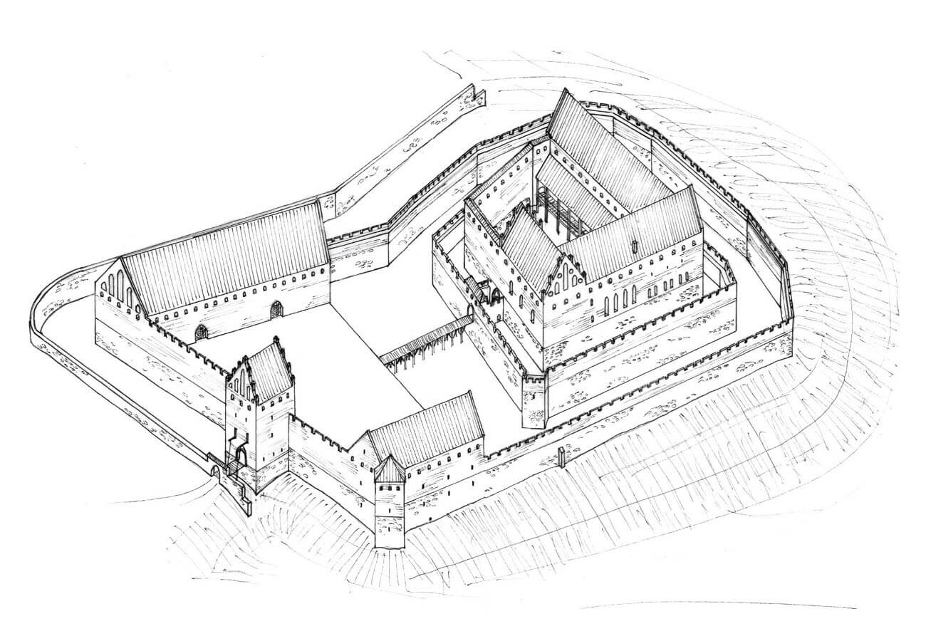
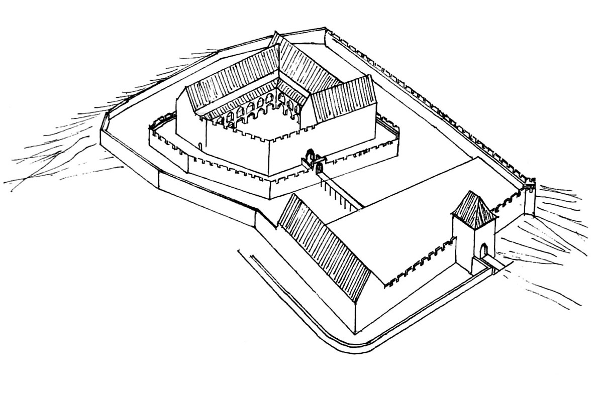
The castle was founded at the intersection of the routes between Toruń and Chełm, in the area bounded from the south by the escarpment of the Vistula ice-marginal valley. On the western side, the building was protected by a ravine cutting across the escarpment. Convenient access was from the east and partially from the north, where the castle was protected by a moat. It consisted of two parts: the upper ward, irregular in plan, surrounded by a double perimeter wall, and the outer bailey with an outline similar to a trapezoid, measuring 70 x 90 meters. Both parts were separated by a 15-meter-wide ditch, limited on both sides by a high retaining wall, which also served as a defensive wall. The irregular layout of the castle resulted not only from the fact that it was built on the foundations of an older wooden and earth stronghold, but also from the layout of the area, which had not been transformed by earthworks before the end of the 13th century.
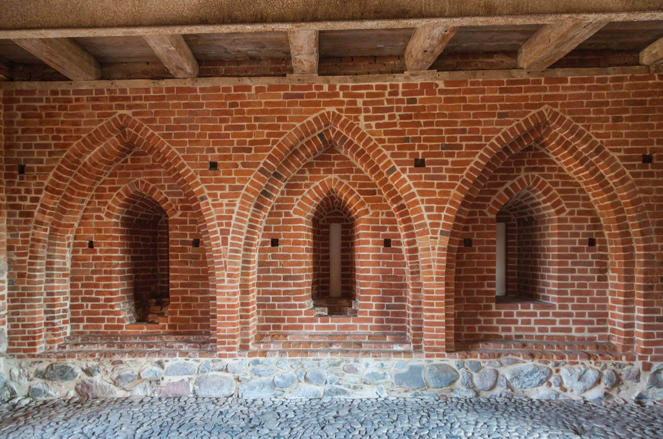
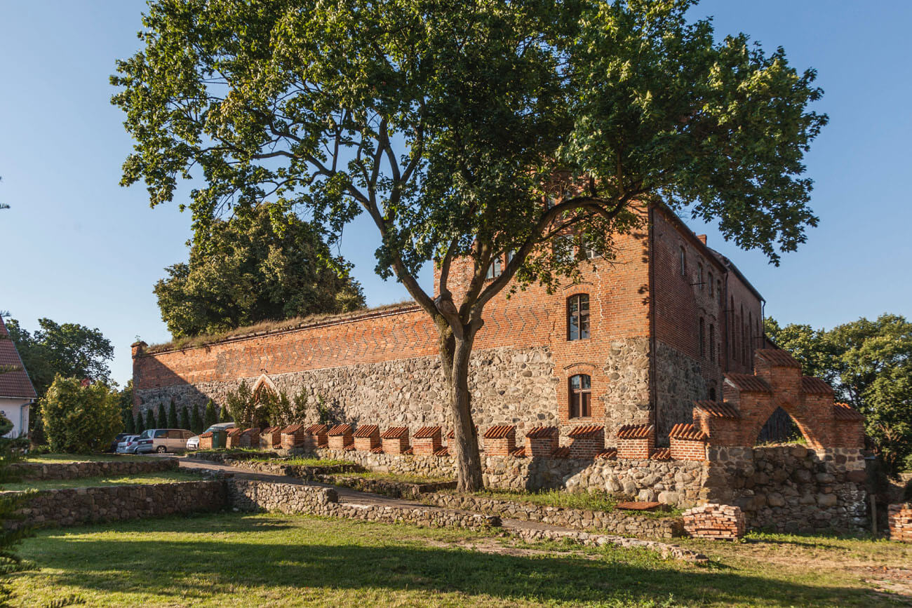
The castle’s fortifications and buildings were built of precisely matched erratic stones in the plinth part and of bricks in the monk and Flemish bonds, the former also using a specific variety creating a chevron pattern of zendrówka bricks. Architectural details were made of limestone, dried and modeled clay (tympanum of the gate portal) or granite. The monk bond was used in the first stages of construction (e.g. the main wing of the upper ward, the perimeter walls of the upper ward, the walls of the outer bailey, the lower parts of the gatehouse), while the Flemish bond was used in later elements (e.g. the economic building in the outer bailey, the wall of the western part of the outer bailey).
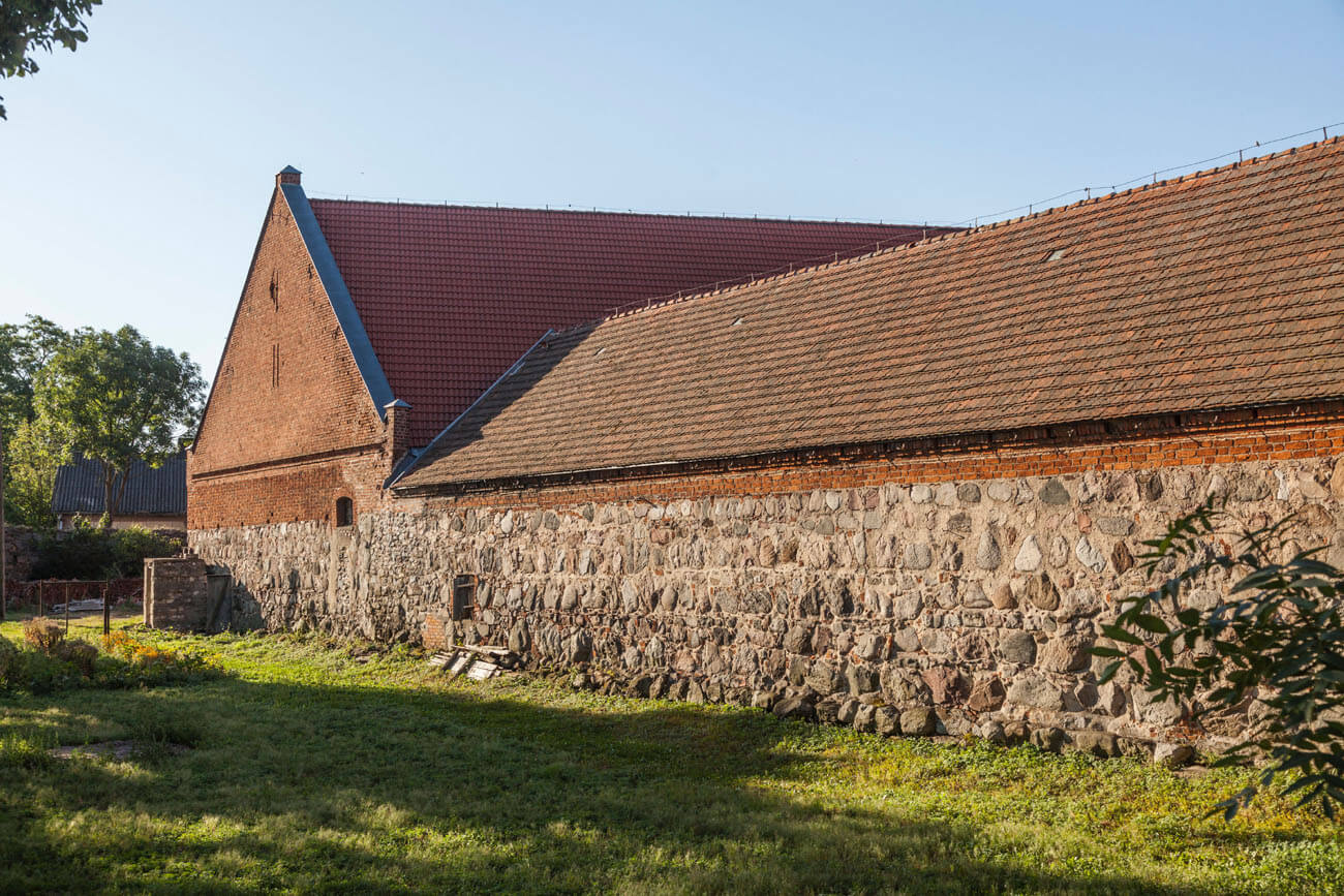
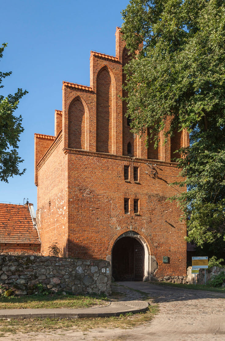
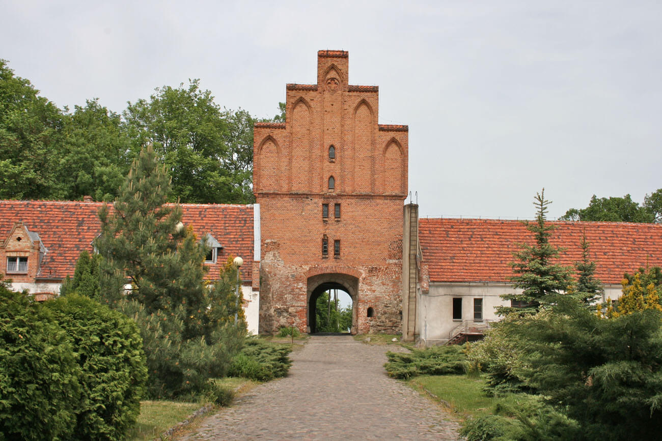
The main entrance to the outer bailey led through a bridge over the outer moat and through an impressive gatehouse protruding in front of the bailey walls, probably topped with stepped gables. In its passage, on both sides, there were three stepped and ogival wall recesses with four-sided loopholes, and from the north and south were small single openings facing the courtyard and the foreground of the castle. On the first floor there must have been a guard’s room with a mechanism operating the drawbridge. In the north-west corner of the outer bailey fortifications, there was a diagonal half-tower, opened from the inside, protecting the sections of the wall not preceded by a moat. It was built on a quadrilateral plan and was probably of the same or similar height in relation to the neighboring curtains. A massive economic building stood out in the courtyard next to the eastern wall. Perhaps it served as a coach house recorded in documents. Another, slightly smaller building was located on the opposite, north-west side of the courtyard of the bailey.
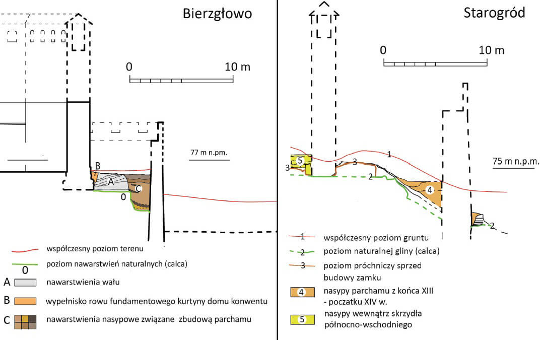
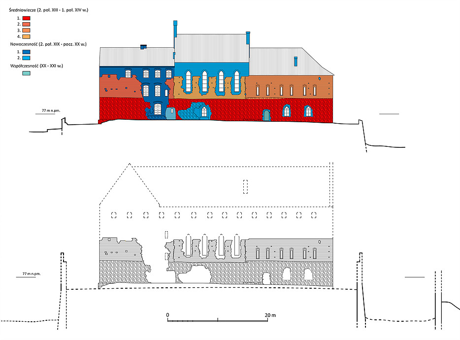
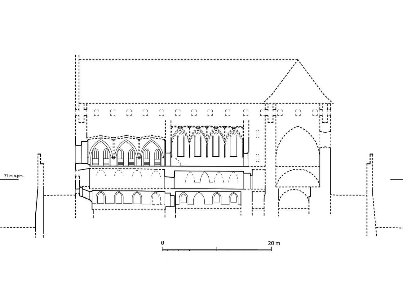
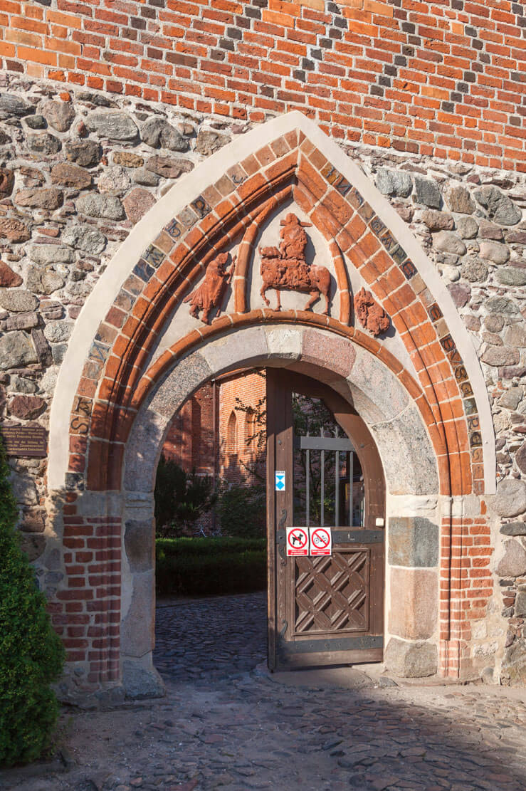
The upper ward was built on an irregular pentagonal plan, defined by the perimeter of the walls and three residential and representative wings built at different stages. The oldest northern building was located not along the entire length of the side, but between the corner and the entrance gate to the courtyard, while the second wing occupied most of the western side. The southern wing was placed in the free space between the western wing and the eastern curtain. Communication between the rooms of the three wings was provided by a brick and vaulted cloister. The entrance to the courtyard of the upper ward was located in the center of the northern curtain, in a unique semicircular portal set in a pointed niche with figural decoration and an inscription made of glazed tiles (perhaps it had no content, but was only a decorative element). Three knights were depicted on the portal’s tympanum, with the central figure on horseback distinguished by a pointed arch frame. The upper ward, at a distance of about 5.5 meters, was surrounded by an external wall (zwinger wall) and additionally from the east, west and south by a wall surrounding the entire castle complex. In the north-west corner of the zwinger there was a tower, probably similar to the half-tower in the outer bailey wall.
The main castle house was the western wing, built on a rectangular plan with dimensions of 12 x 46 meters. Its lowest part consisted of basements, the chambers of which had separate entrances from the courtyard. The ground floor was traditionally intended for utility rooms, including the kitchen located in the southern part. The four-bay refectory with dimensions of 7.6 x 14.2 meters was located on the first floor of the northern part of the wing. It was separated from the chapel in the northern wing by a narrow room, typical of the layout of many Teutonic commander’s castles. In the southern part of the west wing there was another representative room of unknown purpose, 7.6 x 13.2 meters in size, probably with three bays. Perhaps there was also a dansker (latrine) in this part, as indicated by the presence of the arcade on the western facade, but it could also be located on the eastern side of the upper ward, in the gable wall of the southern wing. The porch leading to the latrine had to have a light, wooden structure, due to the lack of corbels and the small thickness of the zwinger wall.
The building at the southern curtain had dimensions of approximately 50 x 9 meters. It is possible that there were living quarters and a commandry bedroom on the first floor, and a kitchen, bakery or brewery on the ground floor, as indicated by two chutes discharging waste into the moat. This wing probably did not have a basement, unlike the short northern wing. It was probably built in the first phase of construction, as the oldest house in the castle. It measured 11 x 22 meters and housed a vaulted castle chapel on the first floor, which, due to the location of the building, had a presbytery orientated to the east.
Current state
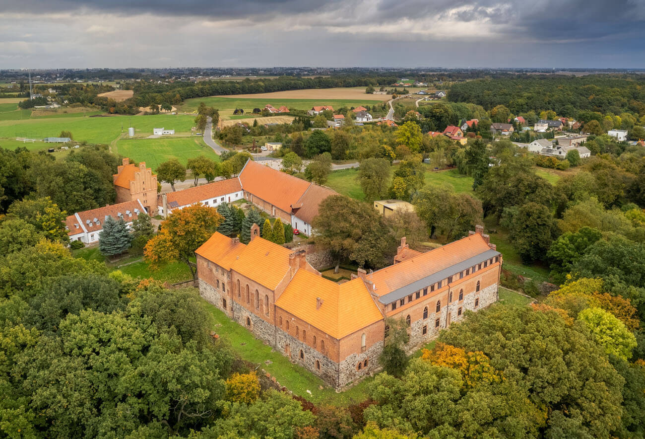
The castle’s present-day appearance is largely the result of 19th and 20th century reconstructions, although the original layout of the entire complex remains visible. The best preserved are the building of the upper ward (western wing) and the economic building in the outer bailey. The gate tower of the bailey has also survived, but its current appearance is the result of 19th-century regothization (the wall facing the courtyard and the gables were largely reconstructed). Originally, the tower was probably higher. The northern wing of the upper ward did not survive; it was demolished in the 19th century. The southern wing was thoroughly rebuilt. The defensive wall of the upper ward is visible along its entire length on the northern and eastern sides, including the gate and a unique portal from the end of the 13th century. Currently, the castle houses the Diocesan Cultural Center and is open to visitors.
bibliography:
Leksykon zamków w Polsce, red. L.Kajzer, Warszawa 2003.
Torbus T., Zamki konwentualne państwa krzyżackiego w Prusach, Gdańsk 2014.
Torbus T., Zamki konwentualne państwa krzyżackiego w Prusach, część II, katalog, Gdańsk 2023.
Wasik B., Budownictwo zamkowe na ziemi chełmińskiej od XIII do XV wieku, Toruń 2016.
Wasik B., Zamki krzyżackie w Starogrodzie i Bierzgłowie na tle innych komturskich siedzib nieregularnych w świetle nowych badań, “Archaeologia Historica Polona” tom 26, 2018.