
History
The first record of Biecz appeard in 1184, in a document in which the Bishop of Kraków, Gedko, granted tithe to the collegiate church of St. Florian in Kraków, from “terra sive districtibus Byeczensi et Szmigrodensi”. At that time, Biecz functioned on the site of an older castellany stronghold, and later a castle, while the foundation of town took place during the reign of prince Bolesław the Chaste, in the 50s of the 13th century. Probably the first wood and earth fortifications were built soon after, because the development of the town was based, among other things, on the military factor. It was a border defense point on the main road from Hungary, crossing in Biecz with the road in the latitudinal direction. The first mention of Biecz as a town was recorded in 1361, and two years later Casimir the Great confirmed the town privilege under the Magdeburg Law.
The date of construction of the defensive walls in Biecz is unknown. The works were probably started before the reign of Casimir the Great, perhaps during the reign of Wenceslas II or Władysław the Elbow-high, as chroniclers Jan Długosz and Janko of Czarnków do not mention them among the Casimir’s foundations. As the construction process was expensive and lengthy, the construction of the walls could be continued until the second half of the 14th century, when the least important southern section was erected (preferably protected by riverside slopes). In 1395, the Lower Gate was mentioned in the document of Queen Jadwiga, recorded in connection with the construction permit for the nearby Holy Spirit hospital. The first mention of the defensive walls themselves, included in the document of King Władysław Jagiełło from 1399, already recorded the need to repair the fortifications. These works, however, were insufficient or took a long time, because in 1461 Kazimierz Jagiellończyk ordered the repairs to be completed. During them, the fortifications were gradually expanded by more towers, and the royal court was moved from the south-eastern headland of the town to the eastern suburb. The next serious works were carried out at the beginning of the 16th century due to the growing Turkish threat. Both stages of the modernization works led to the complete transformation of the old walls and the construction of new towers and reconstruction of the gates. An important investment was also the erection of the mayor’s court near the fortifications, completed in 1506 by Jakub Sieklucki. The scale of the works carried out in Biecz was evidenced by the fact that in 1535 as many as two masonry masters worked there, who were then brought to Tarnów.
In the years 1568-1569, the town walls were in a very bad condition. A Renaissance-style rebuilding, including the reconstruction of the destroyed gate, was completed in the years 1610 – 1611. Works on maintaining the fortifications in proper condition lasted until the end of the 17th century. At that time, the town still made serious investments. In 1655 the walls were thoroughly renovated in connection with the Swedish war, and in 1657 the Lower Gate was rebuilt. At the end of the 18th century, the demolition of the badly damaged fortifications began with the removal of both main gates.

Architecture
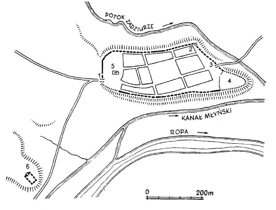
The town was founded on a hill on the northern side of the valley where the meandering Ropa river run. The stream flowing into it, surrounded Biecz from the north and east, while in the south, in front of the river, a mill canal was dug in close proximity to the town. On the south-west side, on the neighboring hill, there was a royal castle, which was a completely independent building. Due to the terrain, Biecz had external earth fortifications (an embankment and a ditch) on three sides, while from the south steep slopes were sufficient protection. Additional earth ramparts were created in the west and north in the 16th century, along with the growing importance of firearms.
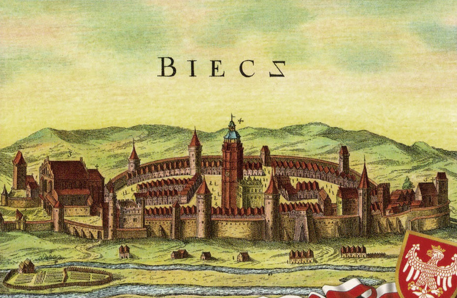
The circumference of the defensive walls in Biecz was irregular, elongated, depending on the form of the town hill. Its eastern part formed an extended headland, on which the royal court was located first, then the hospital with the church of Holy Spirit, and nearby, from the beginning of the 16th century, the mayor’s court. On the opposite side, the town was dominated by the parish church. The length of the fortification line was about 1200 meters, covering about 7 ha. The layout of buildings and the network of streets was regular, with a large four-sided market square in the center, from the corners of which there were roads leading to the gates. The town probably had an underwall street along most of its perimeter.
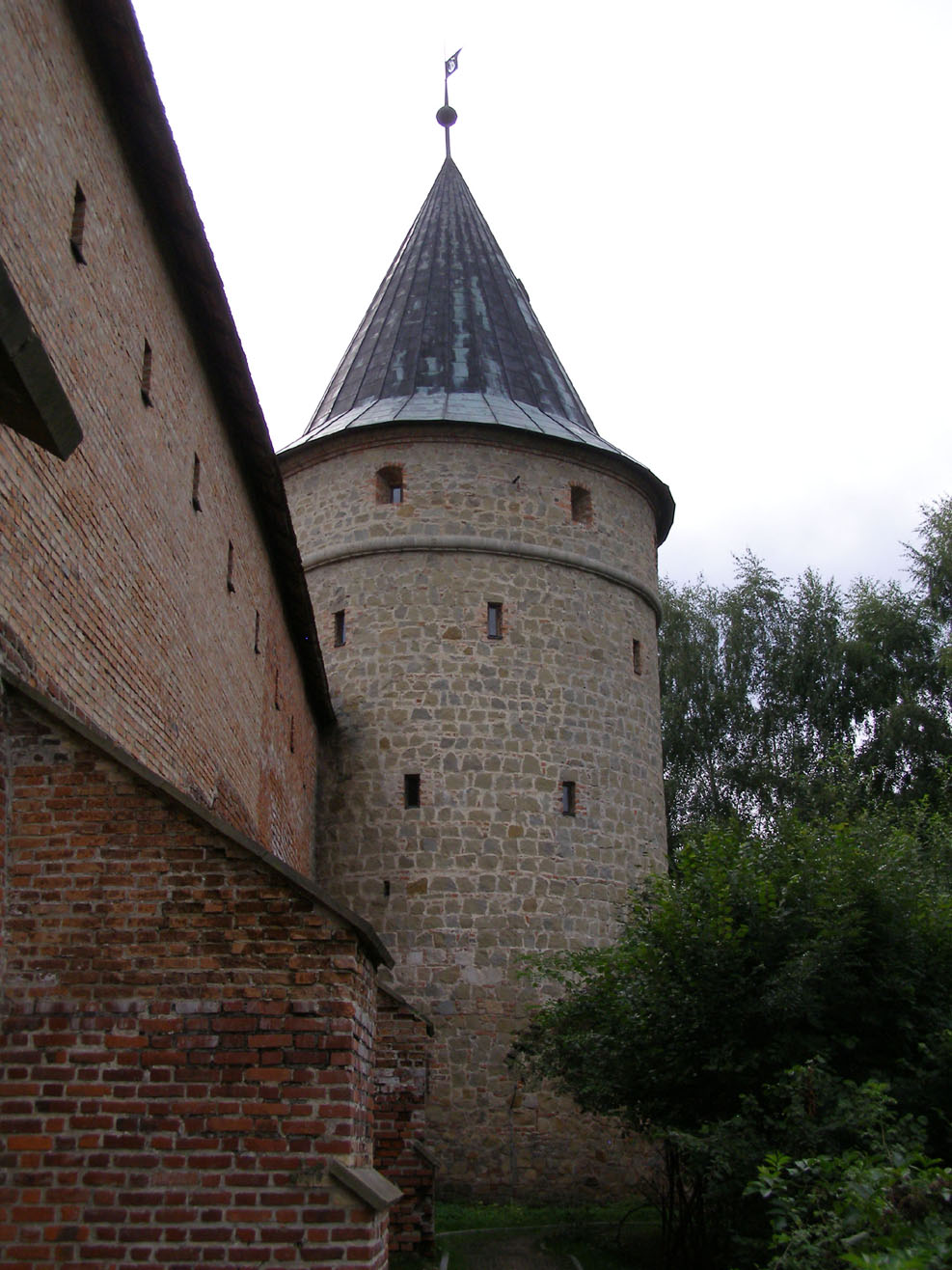
Originally, the curtains of the defensive walls were probably built mostly of sandstone, in some sections supplemented with bricks, with thickness being between 1 and 2 meters. The sandstone was processed into large, irregular slabs and cubes-like blocks, arranged in horizontal layers, with carefully matched stones in the face part. In the parts erected at a later date, the stones were laid less carefully, but with equalizing layers. Initially, the curtains were probably topped with an open wall-walk and battlement. After late medieval reconstructions, the wall had a straight parapet with loop holes and was equipped with a timber, covered porch.
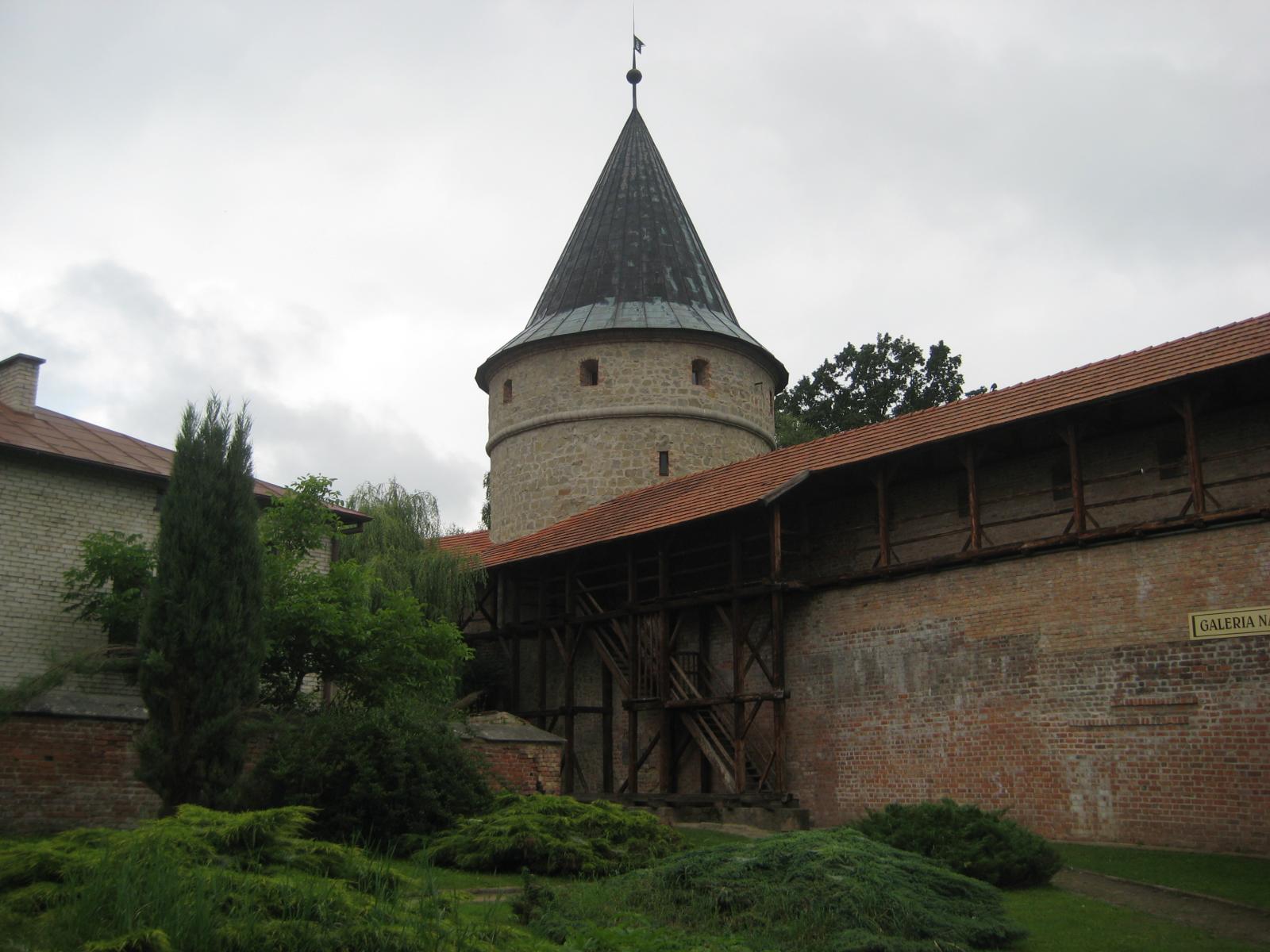
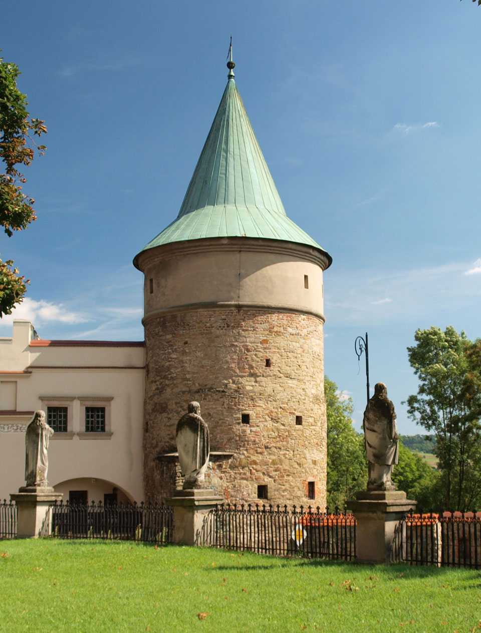
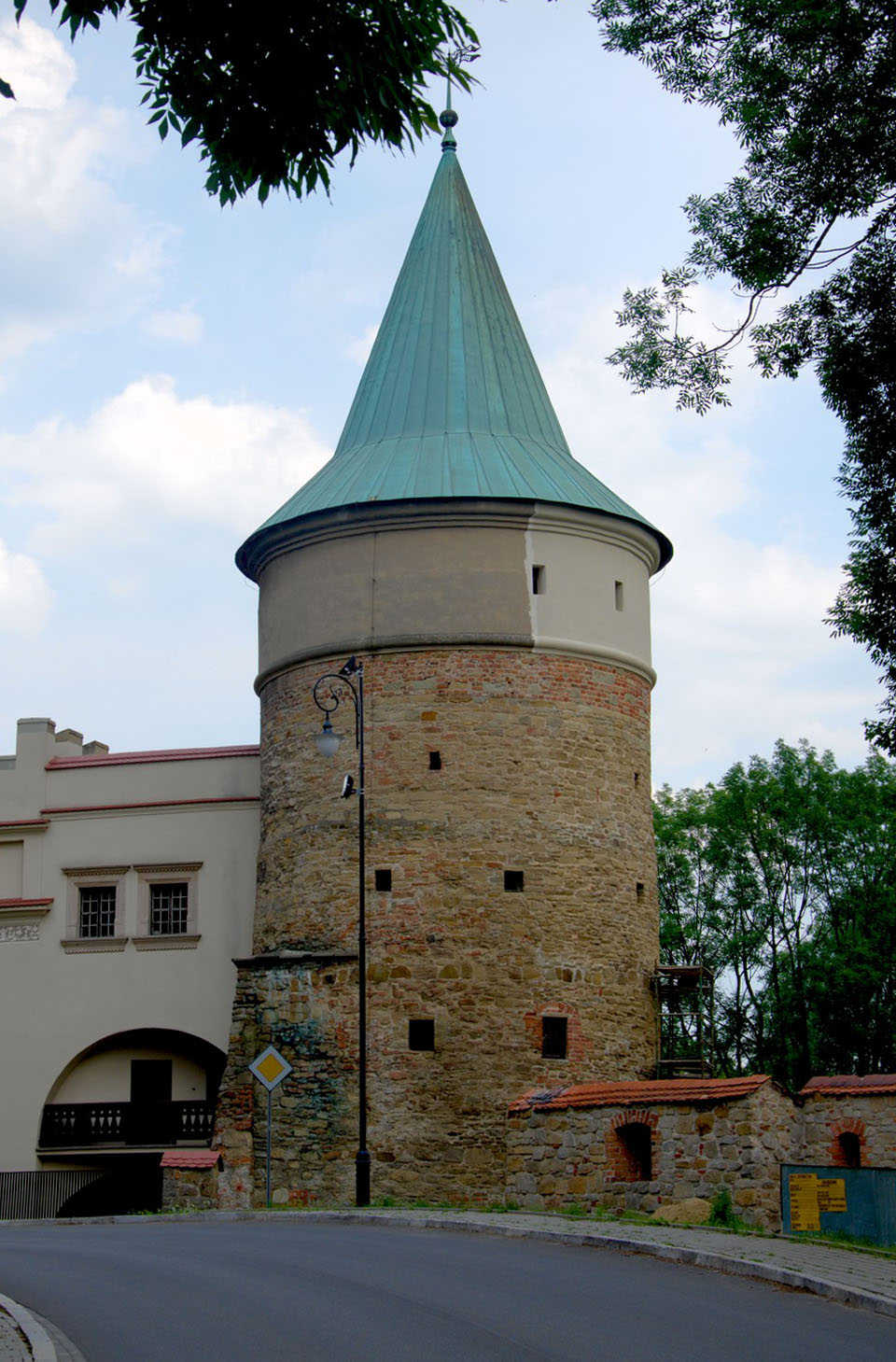
The original defensive circuit from the turn of the 13th and 14th centuries was probably reinforced with towers, although records of them did not appear until the beginning of the 16th century. Initially, they probably had a four-sided form, opened from the town side, protruding in front of the adjacent curtains, with a height equal or slightly higher than the wall, and the interior separated by timber ceilings. This is how the Executioner’s Tower looked like, erected in the second half of the fourteenth century, situated in the south-eastern part of the perimeter, measuring 8.3 x 6.5 meters in plan (interior 5.6 x 4.4 meters). The towers located in critical places for defensive reasons could be closed, as it is considered the oldest four-sided tower in the north-east corner. At the end of the Middle Ages, the town had about 16 towers, most of them on a circular and semicircular plan. Some of the old towers were rebuilt when its backs were closed with walls. This is how the Executioner’s Tower was transformed, also at the beginning of the 16th century connected with the building of the mayor’s court. Probably all towers were adapted to the use of firearms at that time.
The town had two gates: from the west the Upper Gate, facing the road to Kraków and Sącz, and from the east, the Lower Gate, sometimes called Plzeň Gate. In the 16th century, the foregates of both gates were strongly expanded, especially the western ones, the defense system of which included four more, entrances. Through the first, external one, you entered a drawbridge, raised towards the two small, oval towers lying on the opposite side, which flanked the second gate. Behind it, two parallel walls formed a short section of the neck, reaching the third gate, defended from the south by the tower. Behind the third gate there was a courtyard surrounded from the north by a church wall and defended from the south by a town wall and a Council Tower. In addition, the western foreground in front of the parish church was also strengthened, where a slightly bent bastion or barbican was located. Communication at the end of the Middle Ages was facilitated by four posterns: two from the south, one from the west and one north.
Current state
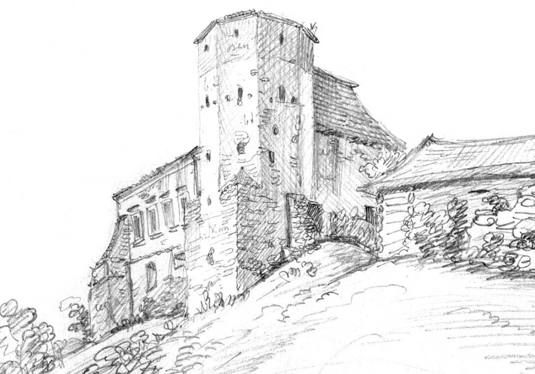
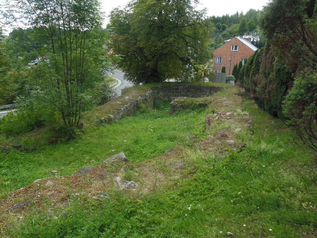
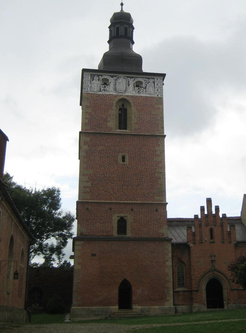
To this day, fragments of the wall near the parish church and the remains of the walls with the ground part of the square tower near the Holy Spirit hospital, have been preserved. Only three out of seventeen towers are preserved in their entirety: the Smith Tower, also called Clergy Tower, and the Council Tower. In both museums are located. In addition, there is a belfry that used to function as a tower, called the Butchery Tower. Also near the church there are foundations of barbican.
bibliography:
Atlas historyczny Polski. Województwo krakowskie w drugiej połowie XVI wieku, część II, red. S.Trawkowski, M.Wilska, Warszawa 2008.
Gorazd-Dziuban P., Kocańda P., Nowak D., Gród starościński i baszta zwana Katowską w Bieczu w świetle źródeł archeologicznych i historycznych [w:] Studia z historii i archeologii architektury, red. P. Kocańda, P. Gorazd-Dziuban, A. Rozwałka, Rzeszów 2021.
Sypek A., Sypek R., Zamki i obiekty warowne ziemi krakowskiej, Warszawa 2004.
Widawski J., Miejskie mury obronne w państwie polskim do początku XV wieku, Warszawa 1973.