History
The town walls in Będzin were probably built in the 1360s, following the town’s privilege under Magdeburg Law in 1358, on the site of wood and earth fortifications, the outline of which they likely repeated. This was a period of particularly intensive development for the town, evidenced by the construction of other masonry structures. The investment coincided with the end of the reign of King Kazimierz the Great. The construction of the town fortifications and the thorough reconstruction of the castle were linked to the defensive policy of the ruler, who was likely the founder and investor of both structures.
There was no record of whether construction work on the town walls was still ongoing in 1364, when the Emperor and King Charles IV of Bohemia visited Będzin. After completion, the fortifications were maintained by the town guilds, to which the town council assigned individual sections, along with towers and gates. The Będzin mayor (“advocatus”) was responsible for overseeing the town’s defenses, while the burgraves and starosts residing in the castle were responsible for the entire Będzin defense complex. In 1456, the castle garrison was to be supported by four infantrymen, two cannoneers, and a cart. According to the charter document, the mayor himself was responsible for defending the town and armed expeditions. In 1549, the castle and town garrison was to number 23 armed men.
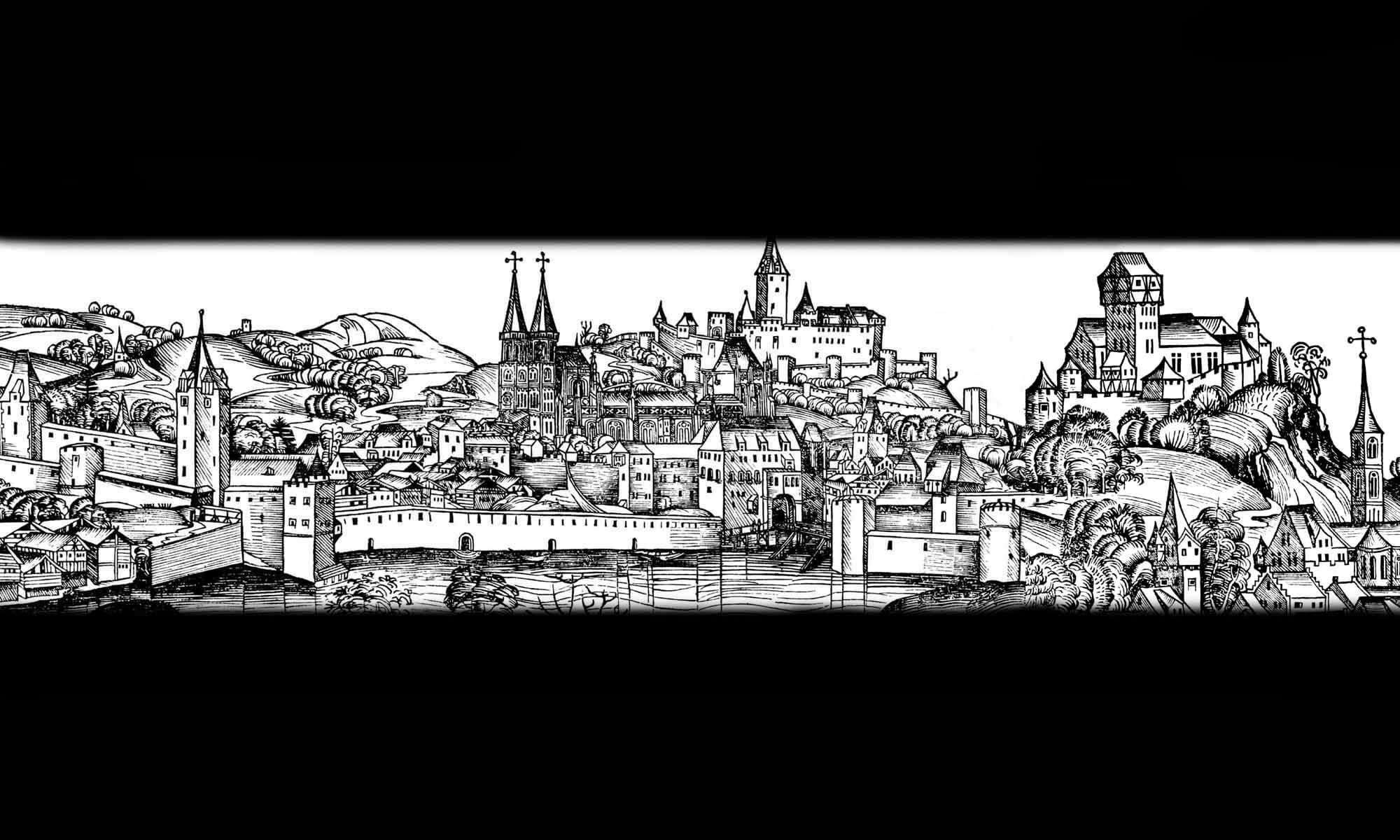
No records have survived of the modernization of the fortifications in the late Middle Ages, which would have strengthened them in connection with the development of firearms. Repairs had to be carried out, especially after successive periods of destruction, but also resulting from regular, long-term use. Repairs had to be made to the walls especially after the town was burned by the Swedes in 1655. In the 18th and 19th centuries, they ultimately lost their military significance. Most of them were demolished and some were absorbed by the expanding urban development.
Architecture
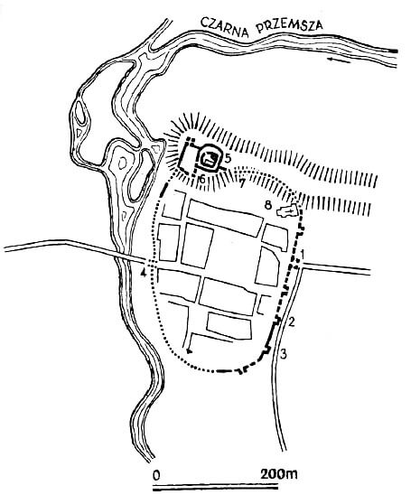
The circumference of the defensive walls marked the shape of a fairly regular oval elongated in the meridional direction, flattened slightly from the east. On both sides, the town wall led to the castle, situated on a hill in the north-west outskirts of the Będzin. The north-eastern corner on the hill was occupied by the parish church, atypically situated probably due to the building before the town was founded. From the west, the town adjoined the Czarna Przemsza River, so the most endangered section, apart from the short south side, was the eastern part of the town. The total length of the fortification lines closing the area of about 7 ha was about 1000 meters.
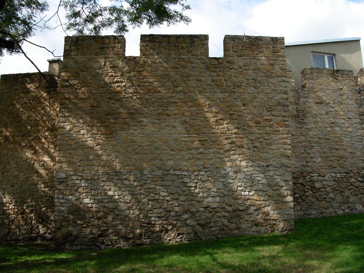
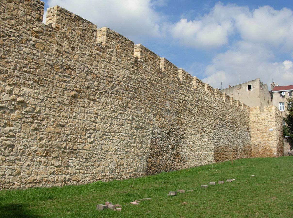
The defensive wall in Będzin was a massive structure, built of unworked stone and lime mortar. It was topped at a height of approximately 8 meters by a crenellated parapet (battlement) and an open (unroofed) wall-walk. The considerable dimensions of the wall placed Będzin among the well-fortified Polish towns of the 14th century. The width of the defenders’ wall-walk, 1.2-1.3 meters, generally did not require widening with a wooden porch. However, the entrances to the crown of the wall were probably made of wood. A moat ran in front of the wall, likely created on the most vulnerable eastern and southern sides.
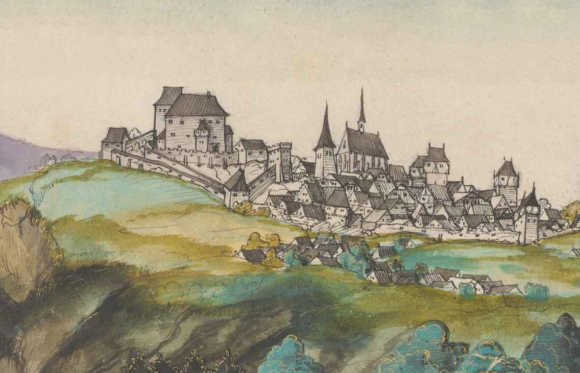
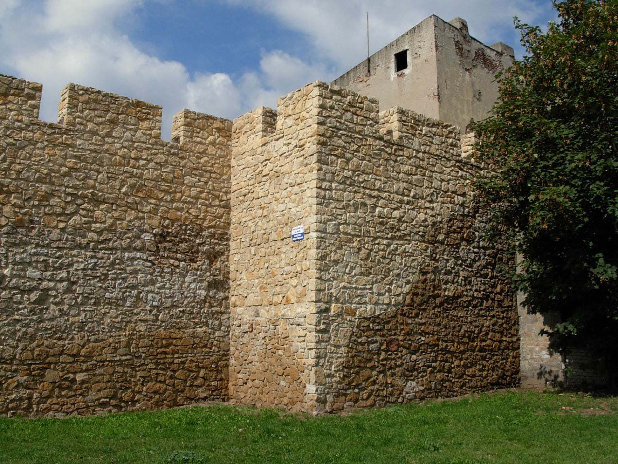
The curtain walls were reinforced with towers of unknown original location and number, likely ranging from 13 to 18. They were constructed according to a uniform principle and had similar dimensions of approximately 8 x 5.5 meters. It were spaced fairly regularly every 50-60 meters, but were probably absent or sparsely spaced on the western side, facing the river, and the northern side, facing the castle hill, and more densely on the eastern and southern sides. It were rectangular half-towers, typical of Polish fortifications of the period, protruding entirely in fron of the the wall and opened to the town interior. The towers were equal in height to the wall or one storey higher. It featured a defenders’ wall-walk and battlements running at the same level as the wall, with merlons approximately 2.4 meters wide and 0.7 meters gaps between them. In the Late Middle Ages, the towers could be raised with additional stories of half-timbered construction, as shown in a veduta from the first half of the 16th century. It did not have embrasures on the lower level.
Two gates led into the Będzin: the eastern one, known as Sławkowska or Krakowska, and the Bytomska Gate, also known as Wrocławska or Czeladzka, situated on the western side, opposite the river crossing. A customs house, known from historical records, likely stood near the Bytomska Gate leading to Silesia. The gates were not directly opposite each other. Streets branched off from each, oriented towards opposite corners of the town square. Both gates were likely quadrangular towers with passages at the ground floor, with Sławkowska Gate measuring approximately 6 x 6.4 meters, with walls approximately 1.7 meters thick, projecting entirely in front of the adjacent curtains. It is possible that the Sławkowska Gate had a foregate.
Current state
Significant parts of the defensive walls have been preserved in the southern and eastern parts of the perimeter. They have recently been renovated and partially reconstructed. Within the wall, two reconstructed half towers and the lower part of the third tower have been preserved. None of the town gates have survived, the appearance of which remains unknown. Before the Sławkowska Gate was demolished in the 19th century, only basic measurements were made.

bibliography:
Błaszczyk W., Będzin przez wieki. Dzieje miasta i jego rozwoju urbanistyczno-przestrzennego od średniowiecza do połowy XX w. na podłożu osadnictwa w starożytności i wczesnym średniowieczu, Poznań 1982.
Krajniewski J., Będzin, początki miasta, Będzin 2008.
Widawski J., Miejskie mury obronne w państwie polskim do początku XV wieku, Warszawa 1973.