
History
The castle in Bardo (German: Wartha) was built at the end of the 13th or at the beginning of the 14th century, probably in connection with the liquidation of the older castellan stronghold. Bardo was first recorded in 1096, when it was destroyed during the expedition of Břetislav II. In the following years it was rebuilt, as it was mentioned as a border stronghold in 1155 and 1245 (“Gradice Barda”). In 1203, a local castellan named Sobiesław was first recorded, in 1261 Bogusław Jarosławowic, in 1269 Jan, son of Żerzuch and in 1283 Jarosław Mroczkowic from Owiesno, from the Pogorzel family.
In 1301, Prince Bolko I the Strict sold his estates on the site of the former stronghold to the abbot of the Kamieniec Abbey, allowing him to fund six stalls. The construction of a stone castle was probably already planned at that time, or perhaps even advanced, associated with the town founded in the same year under German law and the customs chamber, recorded in documents in 1310 and 1317. On the one hand, the castle could have protected the border zone, and on the other the rights of the princes to collect fees. Like other defensive structures in the region, around the middle of the 14th century it could have passed through sale, pledge or as a fief into the private hands of Silesian knightly families, or into the ownership of the monastery in Kamieniec.
Castle in Bardo functioned until the first half of the 15th century. It was most likely destroyed during the Hussite Wars, perhaps in 1425, when a Czech invasion burned down the church in the settlement located at the foot of the mountain. The abandoned ruins have almost completely disappeared over time. The walls may have finally collapsed and fallen down the slopes during the 1598 earthquake, or it may have been treated as a source of free building material (no significant amounts of rubble have been found in the area of the tower and residential buildings).

Architecture
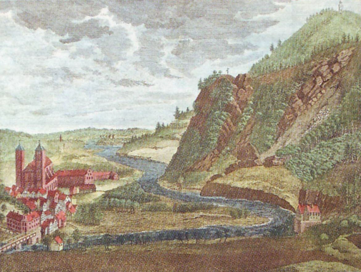
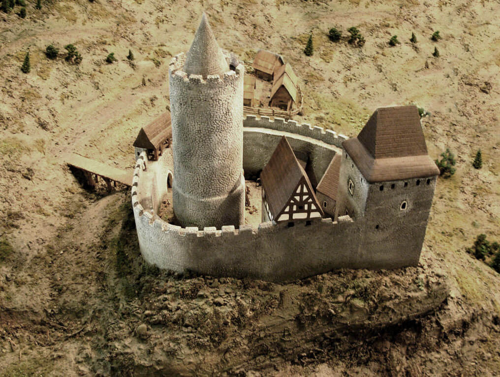
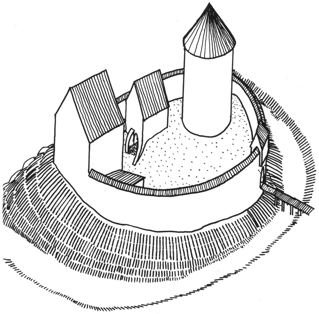
The castle was built on a rocky, protruding, promontory-like slope of a mountain, at an altitude of about 350 meters above sea level. It was situated in a bend of the Nysa Kłodzka River, surrounding the base of the hill from the north and west. It dominated the trail running through the valley and the river crossing, where the castellan stronghold was originally located nearby. It consisted of an oval, stone upper ward and a bailey located about 30 meters to the south of it, probably mostly of timber construction. The two parts were separated by a ditch carved in the rock, 2 to 6 metres wide and 3 metres deep, which cut off access to the promontory. The castle was built using chipped stone, joined with lime mortar, sometimes processed on the face side.
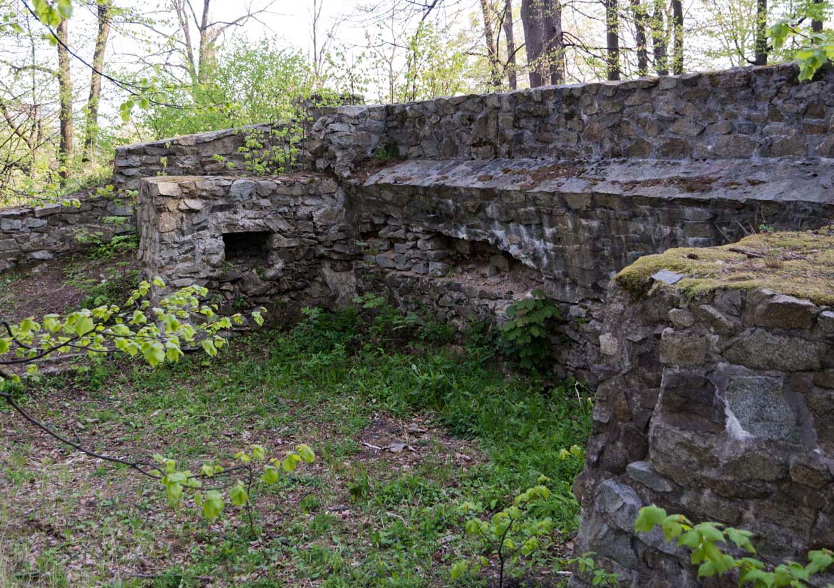
The upper ward occupied an area of about 36 x 30 meters, marked by the perimeter of a massive defensive wall about 2.2 meters thick. In the eastern part of the small courtyard there was a tower – bergfried with a diameter of 10.1 meters, freestanding, but located close to the eastern section of the wall. To the west of it, three residential and economic buildings adjoined the defensive wall. The gate to the castle was placed on the south-eastern side. It was an opening in the wall, 1.8-1.9 meters wide, perhaps closed by a drawbridge over a ditch, serviced from a wall-walk or a hypothetical bartizan.
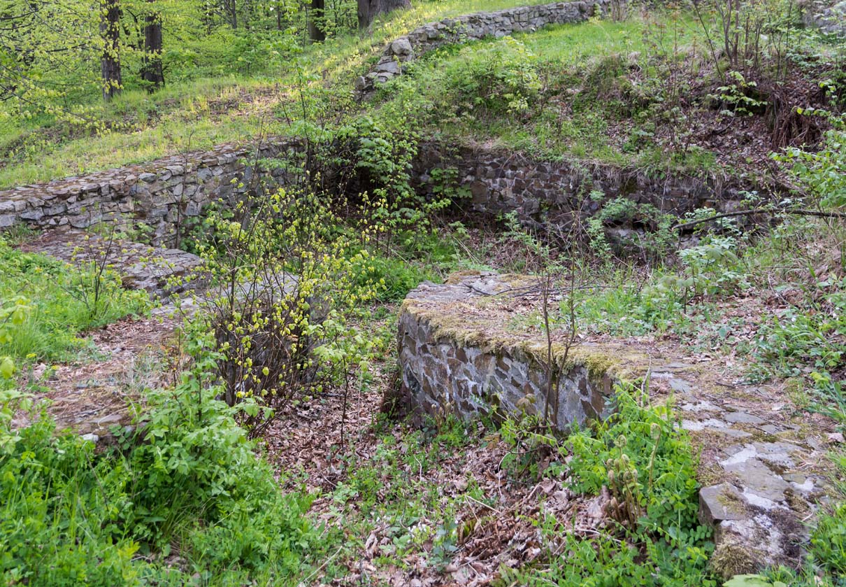
The building in the north-west corner of the courtyard had 1 metre thick walls that do not form a defensive perimeter, and may have had a tower-like character. It probably had a quadrangular form. The entrance to it, about 1 meter wide, led from the courtyard level. The building attached to the central section of the northern curtain had a basement, measuring 4.3-5 x 6.9-7.3 meters. From the courtyard side, it was limited by 0.7-meter-thick walls. A 6.2-meter-long descent led to the basement topped with a ceiling, most likely equipped with wooden stairs. The third building at the south-west section of the perimeter wall had at least two storeys. Its trapezoidal basement had dimensions of 3.5-3.7 to 5.1-5.9 meters, covered with a barrel vault. There were niches in both of its shorter walls.
The castle outer bailey was created partly by raising a hill of sand and rock rubble. It was probably fortified with a stone and earth rampart, built of stones laid without mortar, in a plan that formed a triangle with rounded corners. No stone inner development of the bailey compound was discovered, but the existence of layers of lime mortar and pure lime were found, interpreted as remains of a construction site that functioned there.
Current state
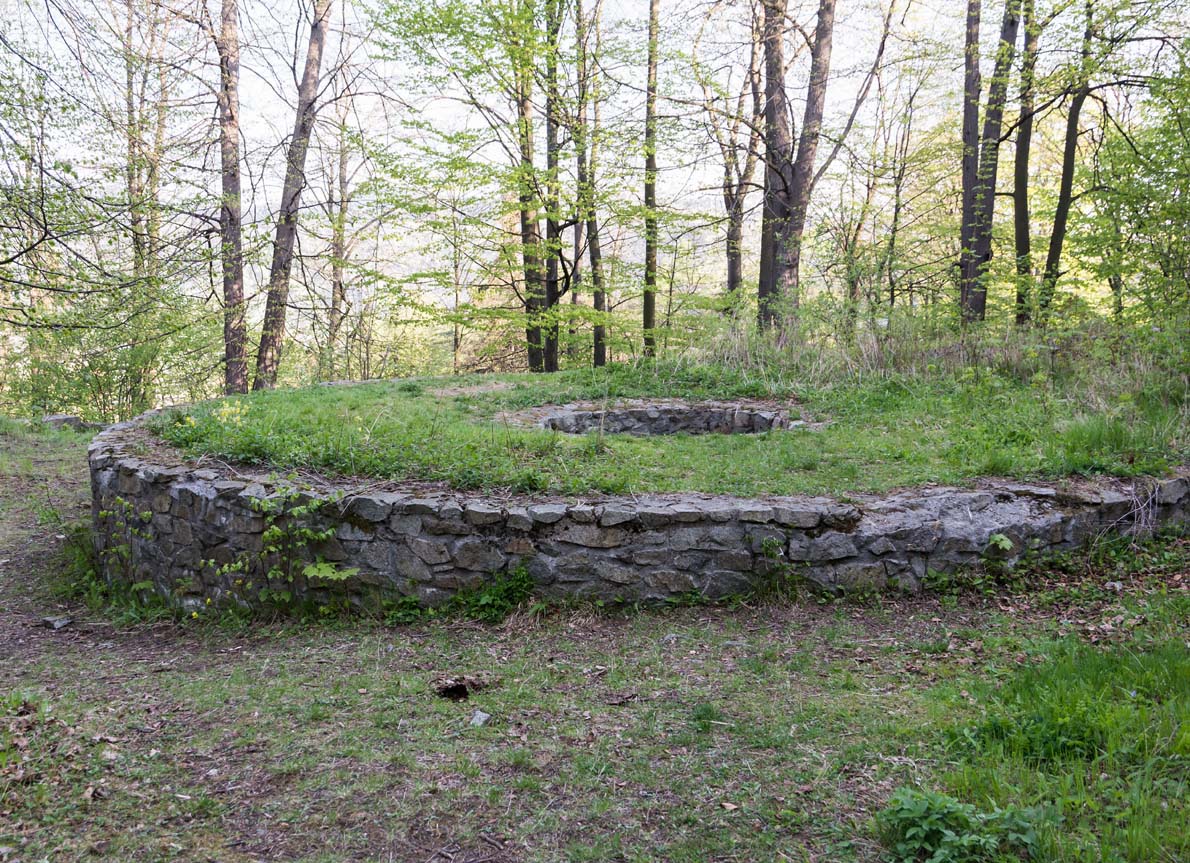
To this day, only the outline of the castle’s foundations and ground floor walls remain, raised on during conservation works (in some of the mounds, the height of the preserved walls reached about 3.5 meters). During the conservation works, the original structure and layout of the walls were interfered as little as possible. All additions were made using local materials, stones from excavations and previously demolished walls. The stones were placed as tightly as possible, and the gaps between them were carefully jointed. The joints in the old sections of the walls were not filled, which makes easy to distinguish the original fragments. Entry to the area of the castle relics is free. It is accessed by a path turning east from Krakowska Street.
bibliography:
Boguszewicz A., Corona Silesiae. Zamki Piastów fürstenberskich na południowym pograniczu księstwa jaworskiego, świdnickiego i ziębickiego do połowy XIV wieku, Wrocław 2010.
Chorowska M., Rezydencje średniowieczne na Śląsku, Wrocław 2003.
Leksykon zamków w Polsce, red. L.Kajzer, Warszawa 2003.
Lodowski J., Relikty zamku rycerskiego odkryte w Górach Bardzkich koło Barda [in:] Nie tylko zamki: szkice ofiarowane profesorowi Jerzemu Rozpędowskiemu w siedemdziesiątą piątą rocznicę urodzin, Wrocław 2005.