
History
The history of the castle began around 1224, when the Order of Livonian Brothers of the Sword erected the first, probably wooden building, around which merchants soon began to settle. The stone fortifications of the castle were probably built at the turn of the 13th and 14th centuries. It was then that a settlement developed nearby, first recorded as a town in 1323. In the 14th and 15th centuries, the castle and town of Wolmar were the second largest Teutonic center in northern Latvia, after Wenden (Cēsis). The importance of the town, a member of the Hanseatic League, was emphasized by the construction of stone defensive walls around the mid-14th century.
In the sixteenth century, during the invasions of the troops of Ivan the Terrible, the castle twice, in 1560 and 1562, repulsed the enemy attacks, yielding only in 1577, after the town representatives were sent to the Moscow troops camp for peace talks and cut down. In the second half of the 16th century, the castle became the target of fierce Polish-Swedish fights, including in 1601, 1622 and in 1659. Finally, it was destroyed during the Great Northern War in the early eighteenth century by the Russian army. Unfortunately, from that moment it started to serve as a source of free construction material.
Architecture
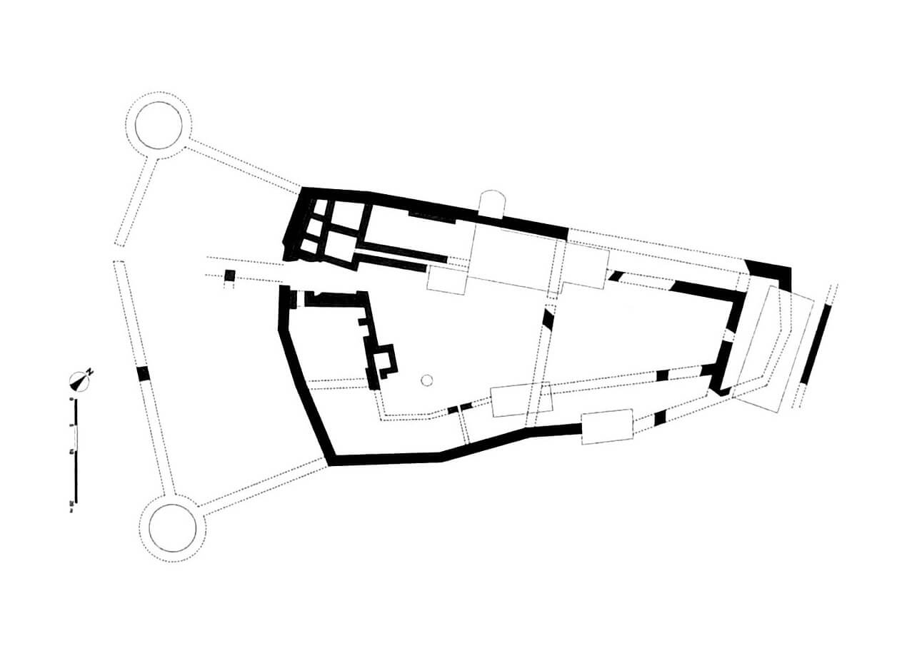
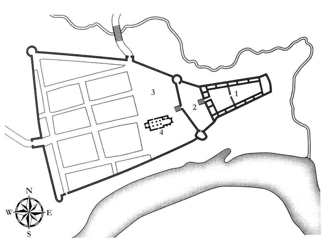
The plan of the castle was similar to an elongated quadrangle with a courtyard clearly expanding towards the west. This shape may have been influenced by the form of the terrain on which it was built, bounded on the south by the Gauja River and on the north and east by a smaller stream flowing into it. The residential and defensive complex consisted of an upper ward on the eastern side and a small outer bailey located on the western side, in front of the town, reinforced by two corner cylindrical towers.
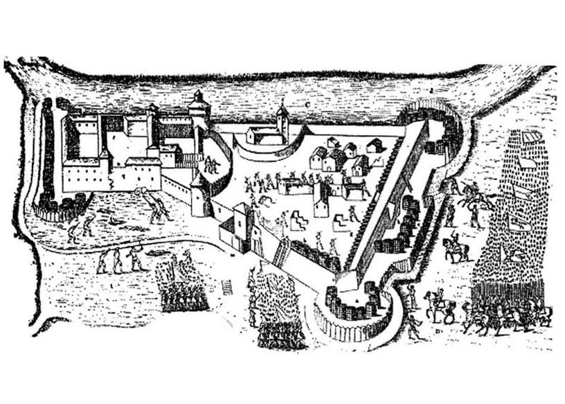
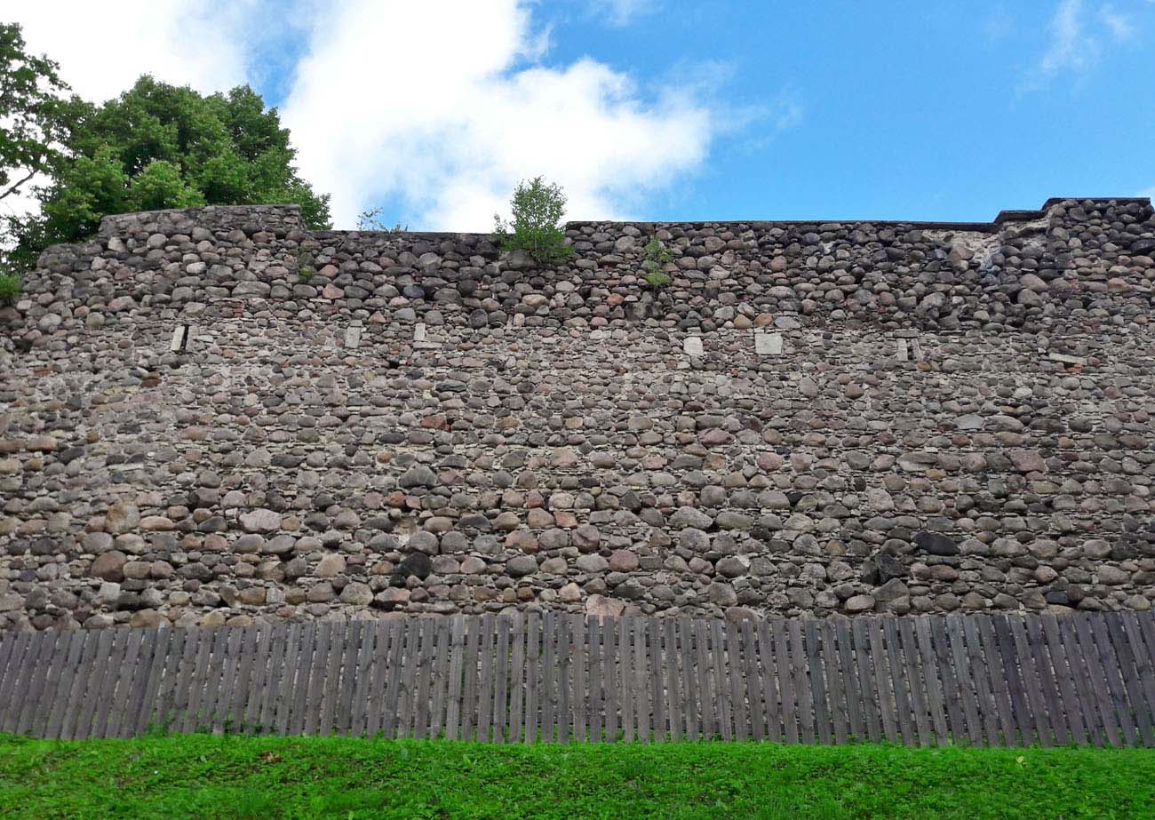
The castle’s defense system was connected to the town fortifications, which were connected to the above-mentioned towers of the bailey. The town defensive wall, approximately 500 meters long, surrounded an area of approximately 4.5 hectares on an irregular polygon plan. From the west it was protected by a dry ditch, and from the north by a short moat connecting two artificially created water reservoirs, one of which was located at the castle. On the southern side, about 6 meters away, there was a river bed. To get to the castle, you had to enter the town, which was achieved through two gates: northern and western one. The thickness of the town wall, built of erratic stones and brickss, was from 1.3 to 1.6 meters, but in the most endangered western section it was greater, from 2 to 2.2 meters thick.
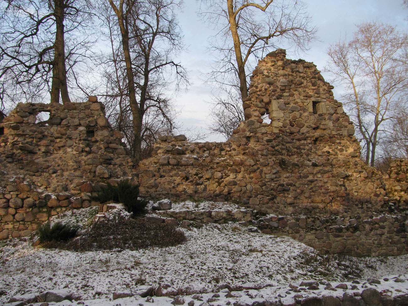
The thickness of the castle walls was 2.25 meters, the length was about 100 meters, and the width was from 30 to 50 meters. Inside the walls of the upper ward there was a courtyard with residential and economic buildings added to the inner facades of the walls. The main representative and residential rooms were probably located in the safest, narrowed eastern part, where the large hall with a vault based on the central pillar, recorded in the sources, could have been located.
Current state
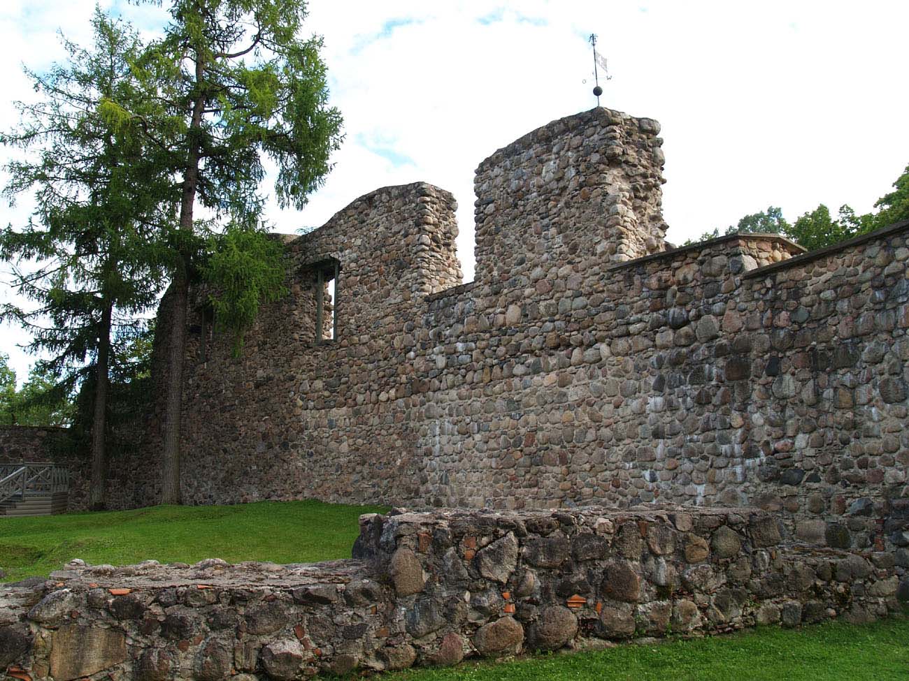
A several-dozen-meter-long fragment of the southern and western castle wall and numerous smaller sections have survived to this day. Admission to the castle is free, only entry to the rooms with museum exhibitions may be charged. Unfortunately, they were placed in a glass and concrete building erected over the historic walls of the castle foundations. The remains of the town’s defensive walls were discovered during archaeological works. Only small fragments on the northern side are visible on the ground surface.


bibliography:
Bernotas R., New aspects of the genesis of the medieval town walls in the Northern Baltic Sea region, Turku 2017.
Borowski T., Miasta, zamki i klasztory. Inflanty, Warszawa 2010.
Herrmann C., Burgen in Livland, Petersberg 2023.
Tuulse A., Die Burgen in Estland und Lettland, Dorpat 1942.