
History
The castle was built around 1285 on the site of an older stronghold of the Balts, on the initiative of the Land Master of Livonia, Wilhelm von Nindorf. It was the seat of the Teutonic vogts, administratively subordinated to the commandry in Dünaburg, the first of whom, confirmed by records, was Otto Paschedag, who was in office in Rēzekne (German: Rositten, Polish: Rzeczyca) around 1288. The castle guarded Latgale, the south-eastern region of Livonia, and due to its central location, it was also an important administrative center.
The castle remained in the hands of the Teutonic Knights until 1559, when it was pledged and later permanently incorporated into the Polish-Lithuanian Commonwealth. In 1577, the stronghold was captured by the troops of Ivan the Terrible, who burned the nearby settlement. The victorious campaign of King Stefan Batory regained the castle for the Polish-Lithuanian state, within whose borders Rzeczyca remained until the Partitions.
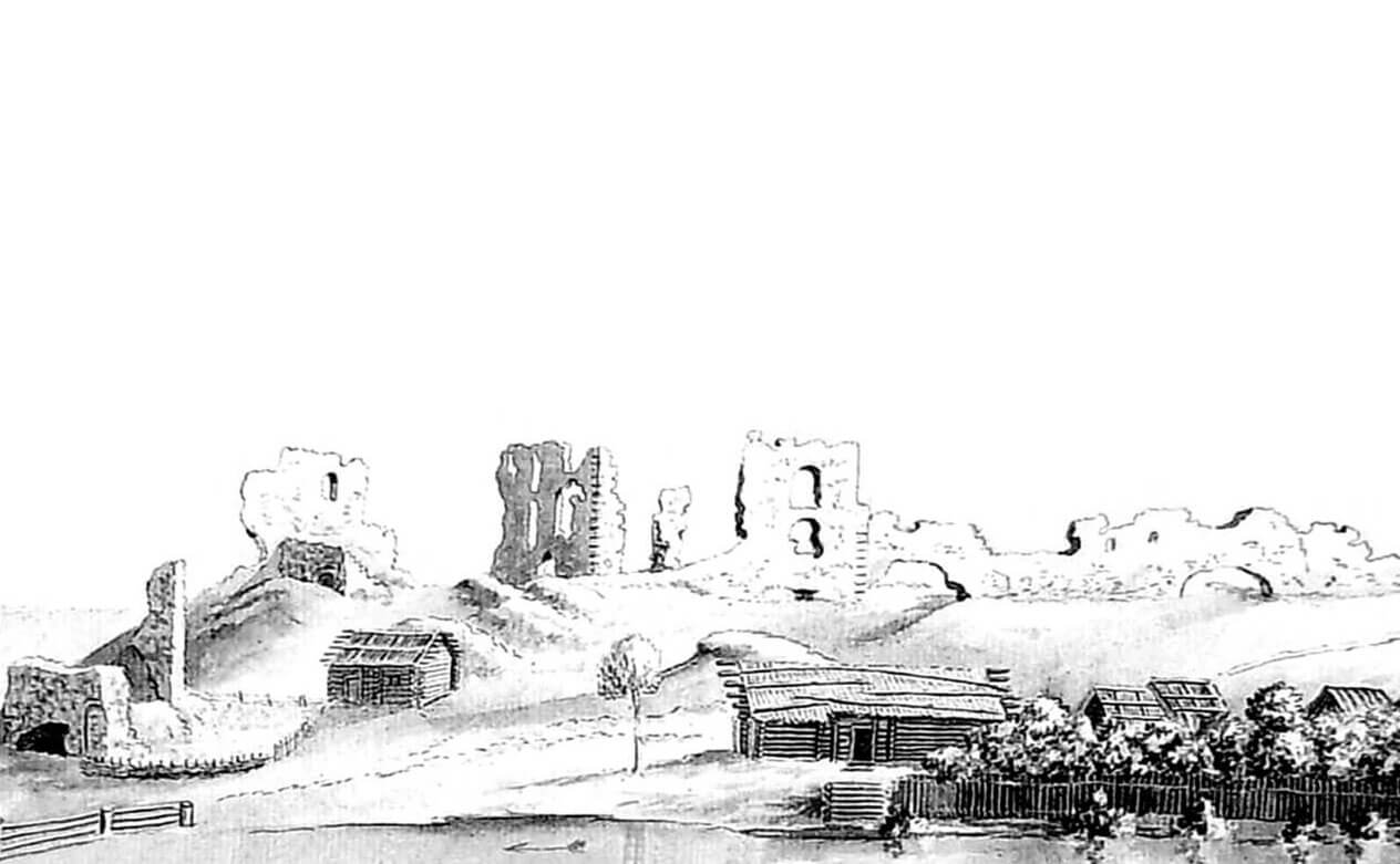
In 1590, according to records, the castle was in poor condition. However, for a long time it retained military importance and took part in the Polish-Swedish struggles in the 17th century. Its final destruction was caused by fighting between 1656 and 1660. From that moment on, the uninhabited castle ruins unfortunately served as a source of building material for the developing town.
Architecture
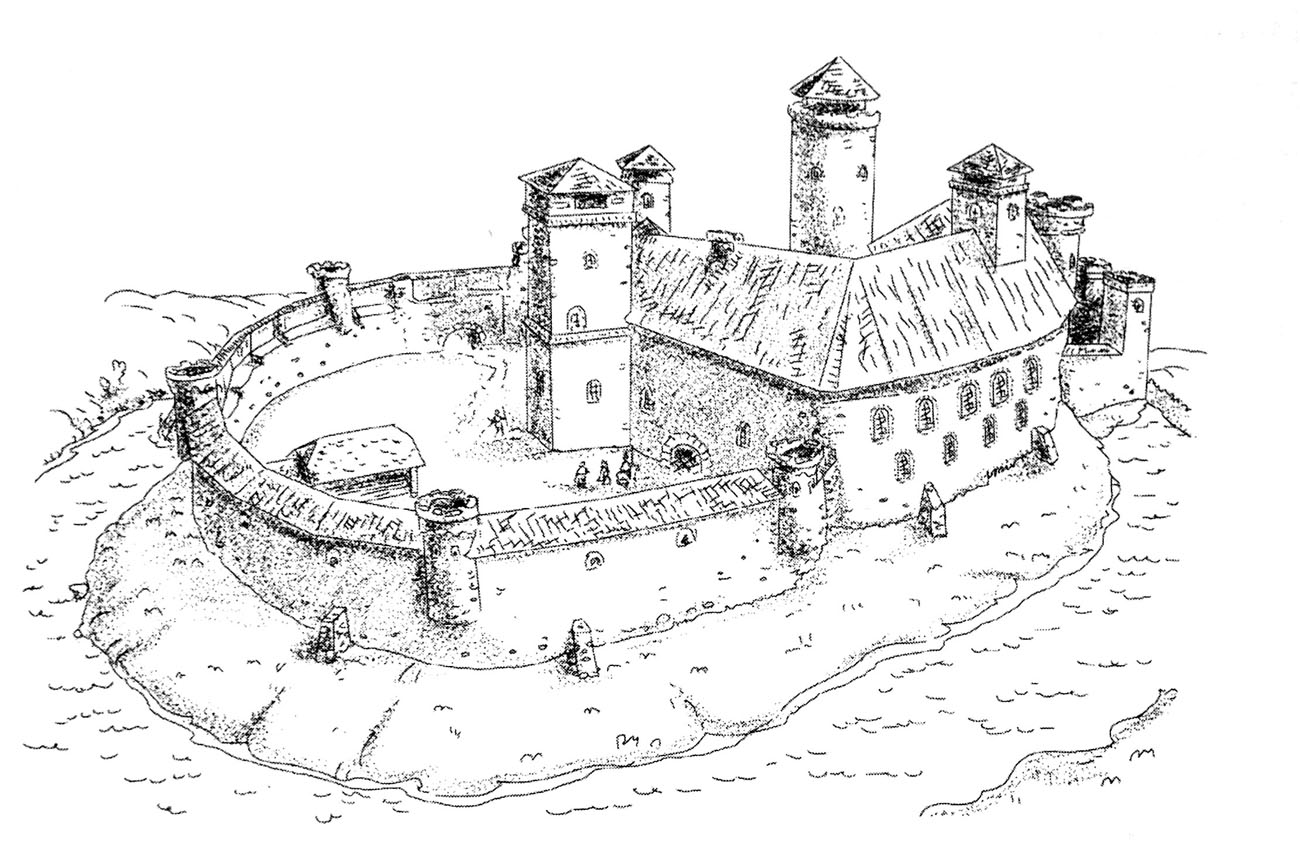
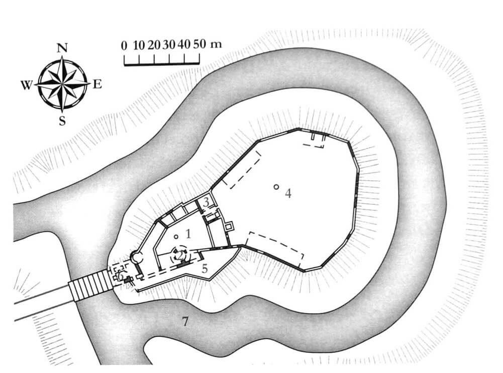
The castle was built on a hill, in the bend of the river flowing around it from the south. The plan of the castle depended on the terrain and the earlier wood and earth fortifications of the pagan stronghold. Therefore, unlike most Teutonic castles, it was similar to an oval, within which the upper ward was separated in the western, highest part of the hill. From the east, the upper ward was protected by an economic outer bailey, and the entire complex was surrounded by an irrigated moat, over which a drawbridge was placed from the west. What was characteristic was the connection of the upper ward with the eastern bailey, which was not separated by any ditch. The location of the outer bailey was also unusual in the rear part of the complex, and not in the front part.
The upper ward was about 60 meters long and about 30-35 meters wide. It was protected by a massive cylindrical tower, located in the southern part of the courtyard, free-standing or located close to the wall curtain. Perhaps it served as a bergfried. In the courtyard there were also the most important rooms attached to the inner walls of the defensive walls: the vogt’s chambers, a chapel and perhaps a refectory in the eastern wing. In addition, the castle was equipped with two more towers: the eastern one, built on a quadrilateral plan, protruding towards the outer bailey, and a cylindrical one from the west, both of which protected the gates.
The castle’s fortifications were not built as part of a single construction campaign, but were probably the result of subsequent transformations and modernizations. The expansion may have resulted in particular a second, lower defensive wall, separating a zwinger in the south. This inter wall passage was probably the entrance road to the castle, starting in the western gatehouse or foregate, then going around the upper ward along the slope from the south and reaching the courtyard of the outer bailey. The entrance from the bailey to the upper courtyard was through a gateway through the ground floor of the eastern wing.
The spacious courtyard of the outer bailey was protected only by a defensive wall, consisting of many straight, short sections, roughly oval in plan. The bailey wall was not reinforced with any towers. The economic buildings, consisting of at least three houses, were attached to the internal facades of the defensive wall. There was a well in the center of the courtyard.
Current state
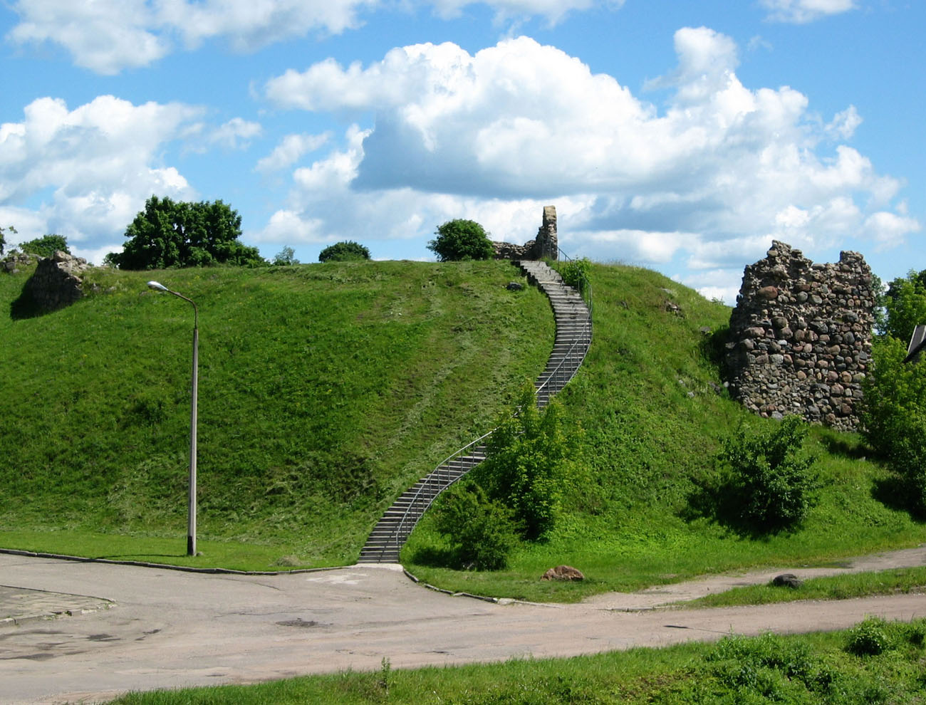
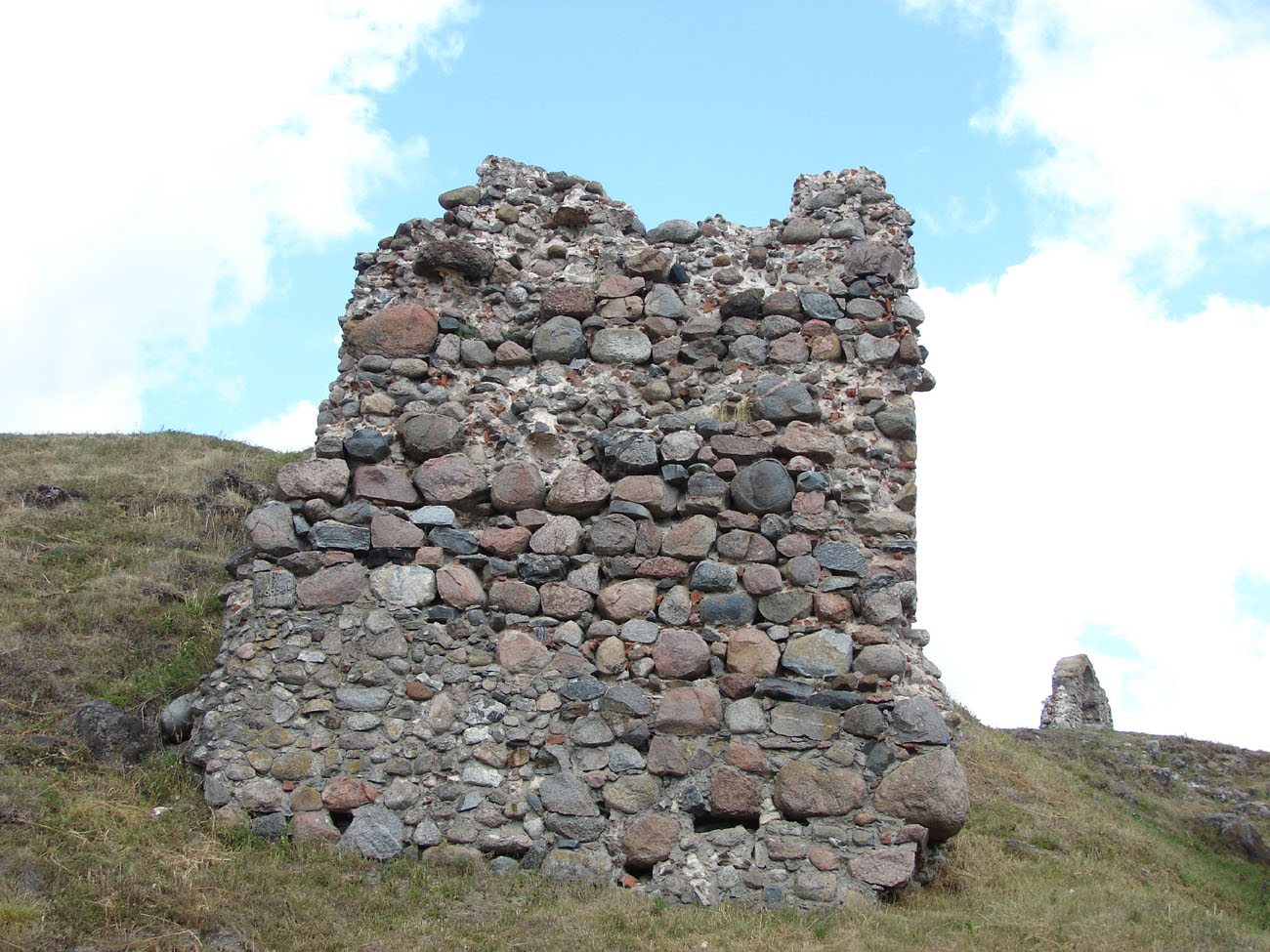
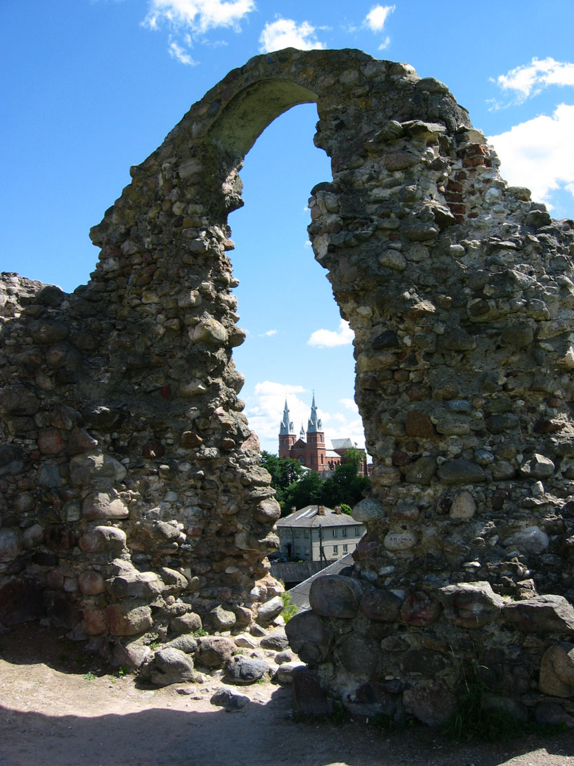
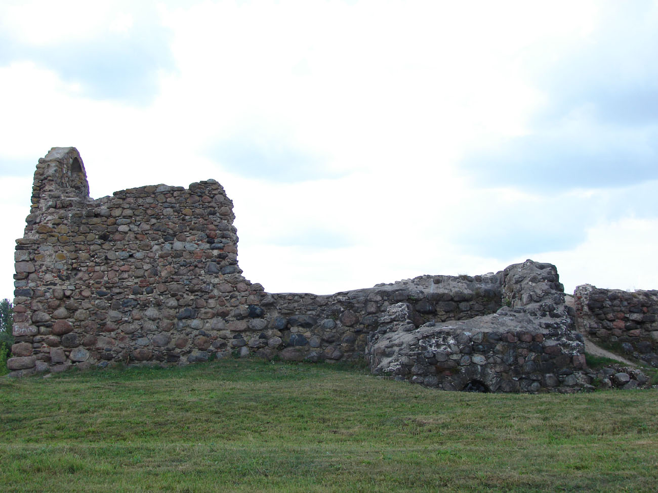
Currently, only small, scattered fragments of the castle walls remain on the hill with steep slopes, reaching a few meters in height in the highest parts. The base of the eastern tower of the upper ward and the south-eastern corner of the upper ward are especially visible. On the southwestern slope, there is a section of the wall near the former gate. Admission to the ruins is free.


bibliography:
Borowski T., Miasta, zamki i klasztory. Inflanty, Warszawa 2010.
Herrmann C., Burgen in Livland, Petersberg 2023.
Tuulse A., Die Burgen in Estland und Lettland, Dorpat 1942.