History
The castle in Piltene (Polish: Piltyń, German: Pilten) was built around 1295 by the bishops of Courland. Initially, the bishops’ residences were built in Memel and Hasenpot, but it quickly turned out that these areas would not be safe for long time, so the bishops, looking for a better source of development, moved to Pilten on the Venta. The castle there was first recorded in documents in 1309 (“castro nostro Pilten”).
The castle was the largest and richest of the bishopric’s defensive and residential seats. The strength of its fortifications was confirmed by the fact that it repelled Lithuanian raids at least twice: in 1309 and 1330, although in the latter case the settlement at the castle (“suburbium”) was completely burned down. The frequent visits of the bishops to the castle were evidenced by numerous documents issued in Pilten in the first half of the 14th century. The castle served as the main bishop’s seat until 1583, when the Danish prince Magnus died in its chamber, who held the title of bishop of Courland.
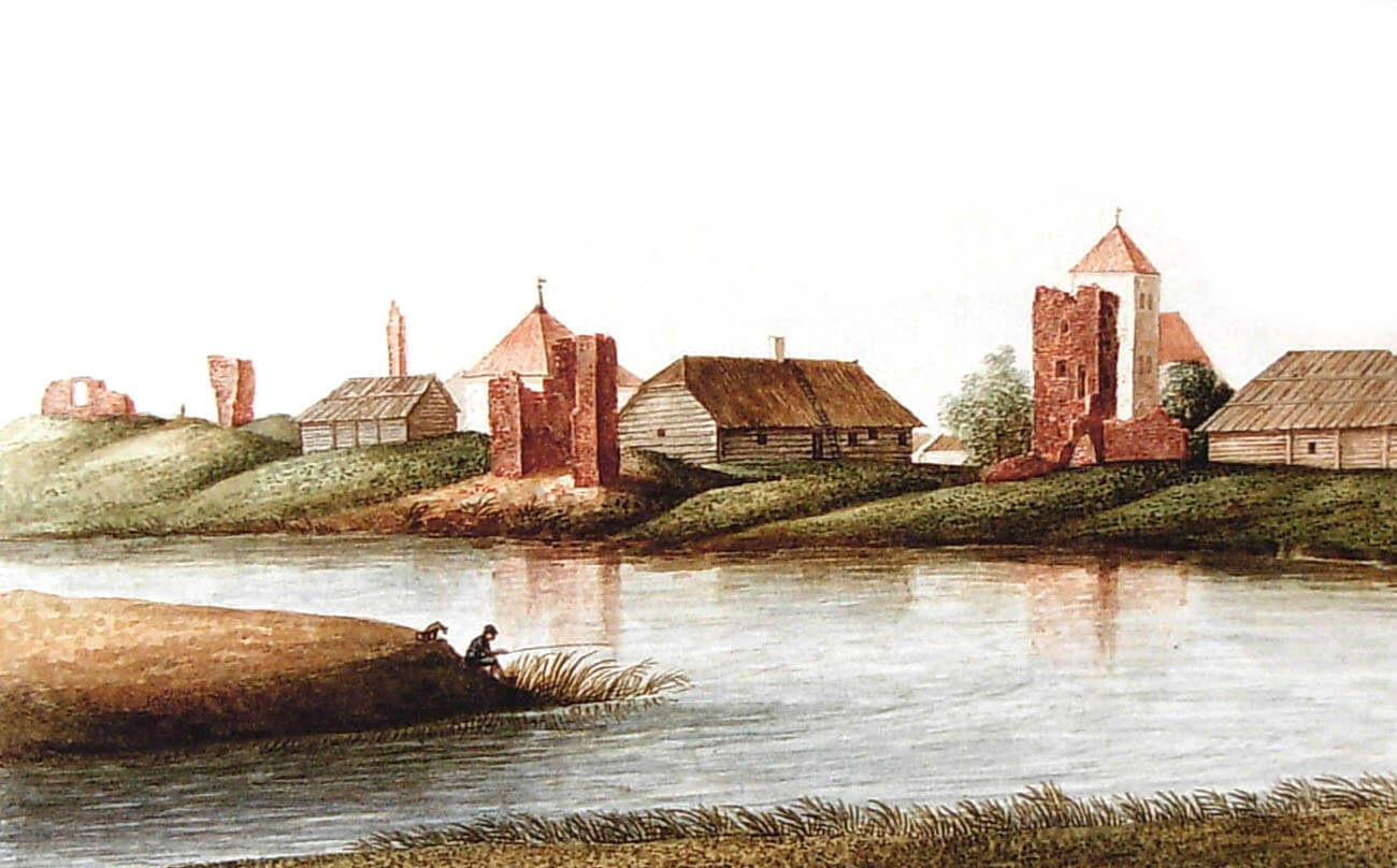
From the end of the 16th century, the castle and the town constituted a semi-autonomous region that was not part of the newly established Duchy of Courland, but was directly subordinate to the Polish-Lithuanian Commonwealth. The castle’s decline was brought about by the Polish-Swedish wars of the 17th century. After the third partition of Poland in 1795, the town was occupied by the Russians, but the castle was already a ruin by then. Its rapid degradation was contributed to by its treatment as a source of building materials for the town.
Architecture
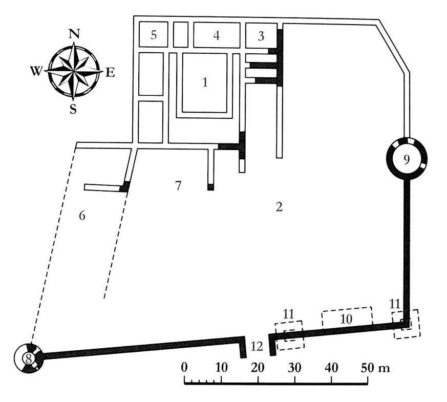
The bishop’s castle in Piltene architecturally met the requirements of the Teutonic model of a commandry castle. It was a two-part structure, consisting of a spacious outer bailey and an upper ward on a square-like plan measuring approximately 40 x 45 meters. The whole was located on the flat but marshy eastern bank of the Venta River. The buildings were built of bricks with a Flemish bond on foundations of errratic stones. Architectural details and the castle’s rich sculptural equipment were to be made of Ösel stone.
The upper ward consisted of three or four wings arranged around a rectangular courtyard, with the most important being the western and northern ranges, which at the same time constituted the outer part of the castle’s defensive perimeter (the eastern and southern parts were directed towards the outer bailey). Communication between the rooms was provided by a brick cloister located in the inner courtyard. The ground floor was probably intended for auxiliary and utility rooms (e.g. kitchen, pantries, brewery), while the main residential and representative chambers were located on the first floor. It included a chapel and a spacious hall, probably a refectory, in which in the 15th century there were supposed to be effigies of all the previous bishops of Courland. There was no dormitory or infirmary in the castle, as it was not the seat of a commandry.
The outer bailey was shaped similar to the letter L. Its defense was provided by a defensive wall about 4 meters high and two cylindrical towers from the 15th/16th century, adapted for the use of firearms. The eastern tower with a diameter of 14.2 meters was particularly impressive, placed along the length of the wall, not in the corner, which was a rather rare solution. The second, smaller, also round tower with a diameter of 8.6 meters, was located in the south-west corner. The entrance gate was located on the southern side, probably near two quadrangular towers from the 14th century. The entire complex was surrounded by a watered moat 3 meters deep and 5 to 30 meters wide.
Current state
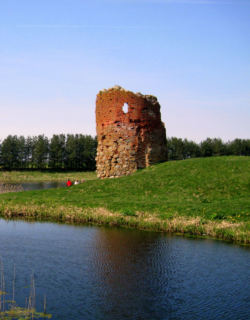
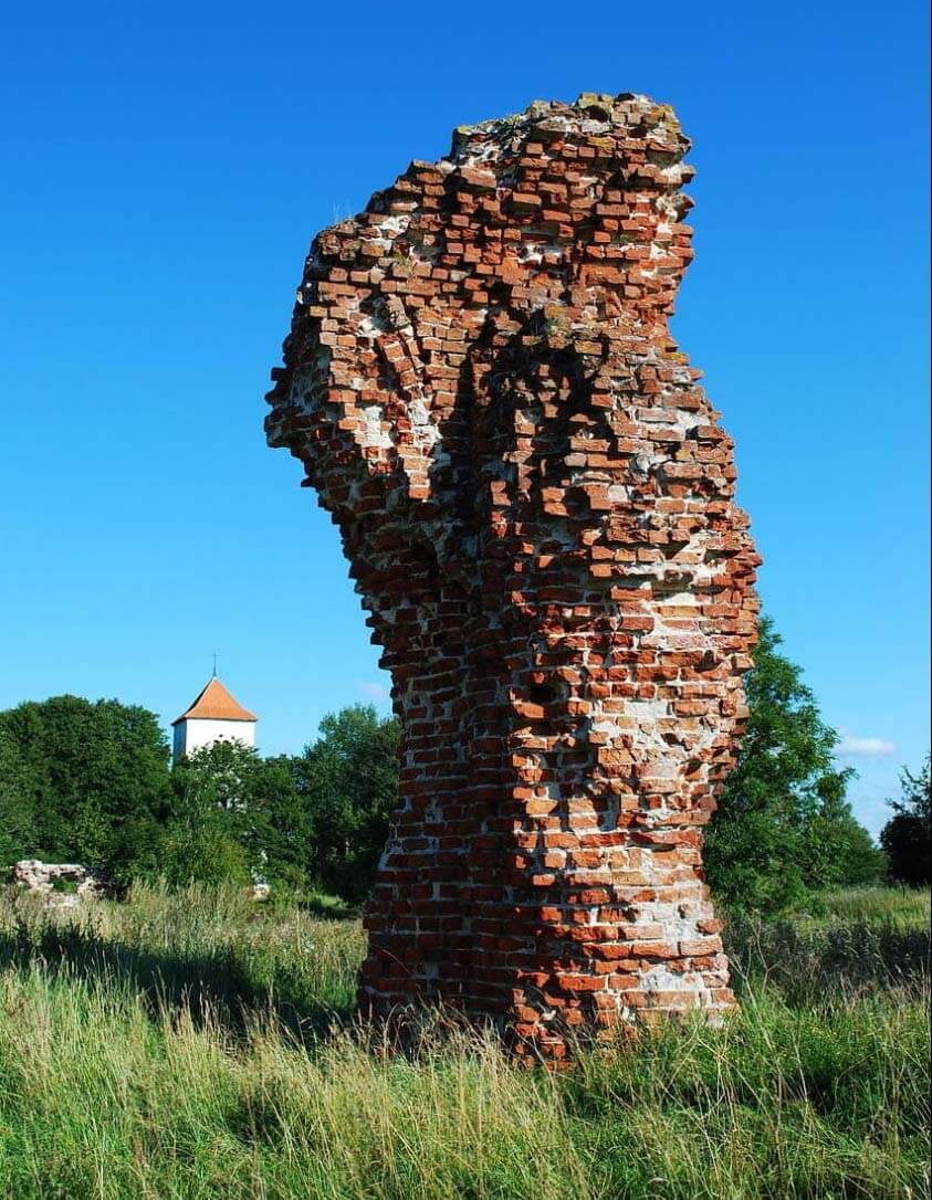
Half of the late Gothic south-western corner tower, reaching 11 meters in height in its highest parts, has survived to the present day, as well as the much more degraded walls of the eastern tower. The remaining parts are only individual fragments of the walls of the outer bailey and the upper ward. Traces of the defensive wall and its battlements are visible on the external elevation of the corner tower. Due to the shifting of the Venta riverbed, the ruins are currently located on the shore of an elongated lake. Admission to the castle grounds is free.
bibliography:
Borowski T., Miasta, zamki i klasztory. Inflanty, Warszawa 2010.
Herrmann C., Burgen in Livland, Petersberg 2023.
Tuulse A., Die Burgen in Estland und Lettland, Dorpat 1942.


