
History
The first record of Kuldīga (Pol. Gołdynga, German: Goldingen) was in 1242, when the Teutonic Land Master of Livonia, Dietrich von Grüningen, and the papal legate William of Modena issued permission to build a castle, initially called Jesusborg. It was built next to or on the site of a burned pagan stronghold. Construction works probably progressed quickly, because three years later the castle was mentioned in documents, although it was probably not completed yet.
The Teutonic Knights wanted to make Goldingen a base for further expansion south and to strengthen its power in Courland. Although the Teutonic Order was never able to secure direct communication between Prussia and Livonia, Kuldīga remained of great importance as the center of the region. The first known commander was the order knight Bruno, witnessed in 1252. He was also a member of the informal council of the highest order dignitaries in Livonia who advised the land masters. The sources of income were subordinate lands, trade on the Venta river and a castle mill.
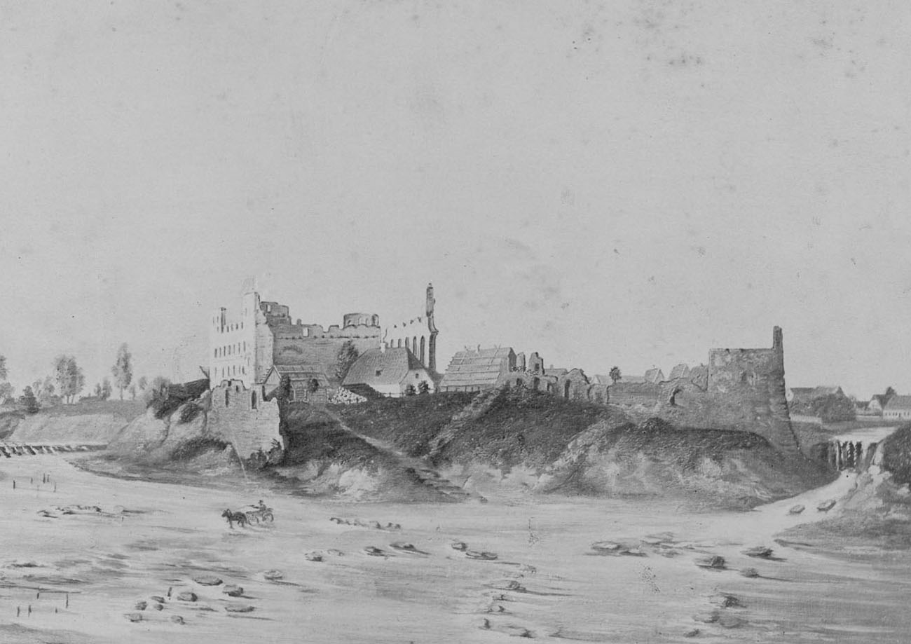
Throughout the Middle Ages, the castle has remained meaningful and has not been damaged in any way, being in the second half of the fifteenth century one of the few commandry that still had the required by rule number of 12 members. After the fall and secularization of the Livonian branch of the Teutonic Order, Kuldīga became one of the main residences of the dukes of Courland and Semigallia. At that time, the town experienced a period of economic prosperity during which the castle was rebuilt. Its total destruction took place at the beginning of the 18th century, when during the Great Northern War it was destroyed during the Swedish-Russian battles. The remaining ruins were demolished at the beginning of the 19th century.
Architecture
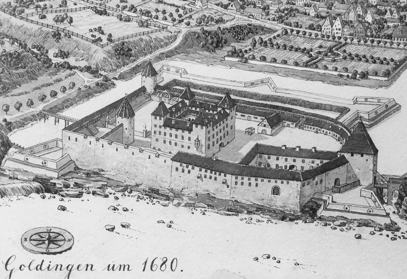
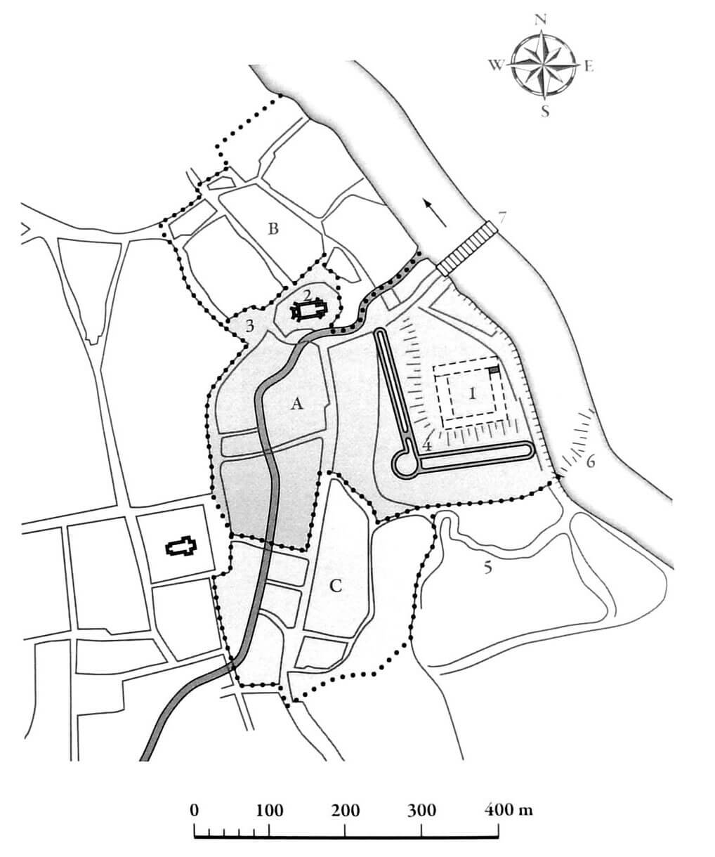
The castle in Kuldīga was located on the southern bank of the Ventspils River, which protected it from the north and east. On the northern side, a town with the church of St. Catherine was located and two suburbs. From the west, the originally wet floodplains were intended for orchards and gardens. The castle itself consisted of the order’s house and surrounding economic outer bailey. The four-wing upper ward was built on a square-like plan with sides about 50 meters long. It was probably equipped with four corner, four-sided towers, surrounding, together with the adjacent wings, an internal courtyard with cloisters. The outer bailey could have had an elongated form with an axis parallel to the river. Its protection was provided by at least three towers, one of which was located on the northern side and two on the southern side. The economic buildings of the outer bailey were adjacent to the inner side of the perimeter wall.
Current state
The castle has not survived to this day. Now in its place there are modern buildings and a small park. The medieval foundations are buried in the ground, and the only accessible element is a single fragment of the castle basement.
bibliography:
Borowski T., Miasta, zamki i klasztory. Inflanty, Warszawa 2010.
Herrmann C., Burgen in Livland, Petersberg 2023.
Tuulse A., Die Burgen in Estland und Lettland, Dorpat 1942.