
History
The first information about Doblen was recorded in 1254, when it was granted to the Teutonic Knights under an agreement dividing the areas of southern Latvia between the order and individual bishoprics. At that time, in Doblen there were only wood and earth fortifications built by the pagan Balts, probably still outside the real power of the order, because between 1279 and 1289 there were fierce battles in the region, during which the Crusaders besieged Doblen. In 1288, according to the chronicler Hermann von Wartberge, the Semigal stronghold was destroyed by the Master Cono de Hattensteen, and the resistance of the local tribes was broken at the beginning of the last decade of the 13th century.
The construction of the stone Doblen castle was to be started in 1335 by Master Eberhard von Monheim (“Anno 1335 idem magister construxit castrum Grundriss Dobbeleen in carnisprivio contra infideles”). After 1345, during the times of Goswin von Herike, master of the Livonian branch of the Teutonic Knights, the castle was expanded (“Doblen muravit et melioravit preter alia castra et munitiones”). The work was completed no later than 1376, when the first commander of Doblen, Dietrich Holtey, was recorded in documents. The commandry functioned continuously until 1562, although already in the 15th century it did not have the required number of 12 brothers.
After the secularization of the Livonian branch of the Order, a dispute arose between the last commander, Mathias von der Recke, and Gotthard Kettler, as a result of which the castle became the property of the latter after a few years. Then in 1566 Doblen became part of the Duchy of Courland and Semigallia. Even at the beginning of the 17th century, the castle was rebuilt to increase living comfort, and the castle’s settlement was developing. To the fall of the town and the castle led only the Polish-Swedish wars, during which in 1658 and 1701 Doblen was captured by the Swedes. After the last invasion, the population was decimated by the plague, while the ruined castle was abandoned around the mid-18th century.
Architecture
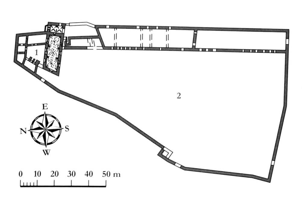
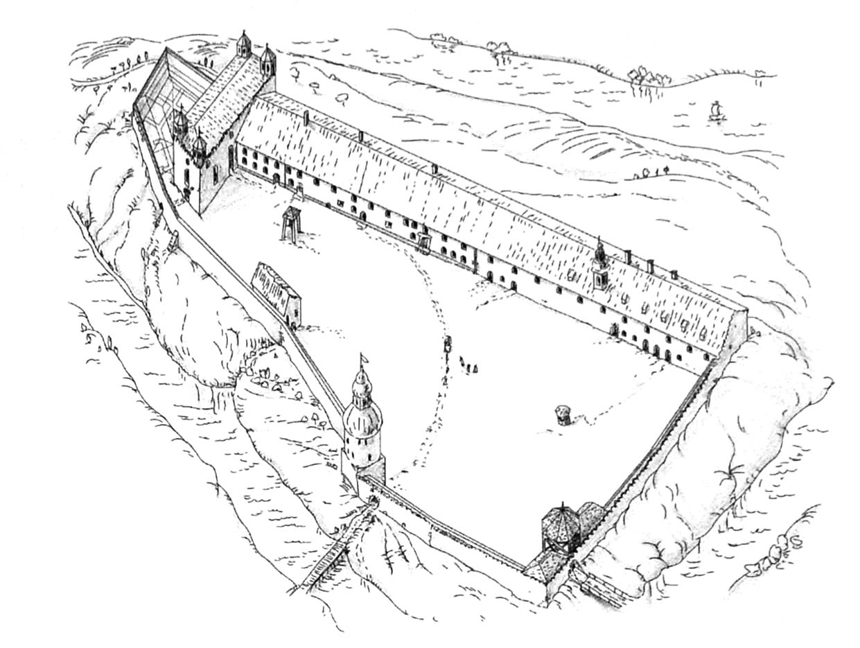
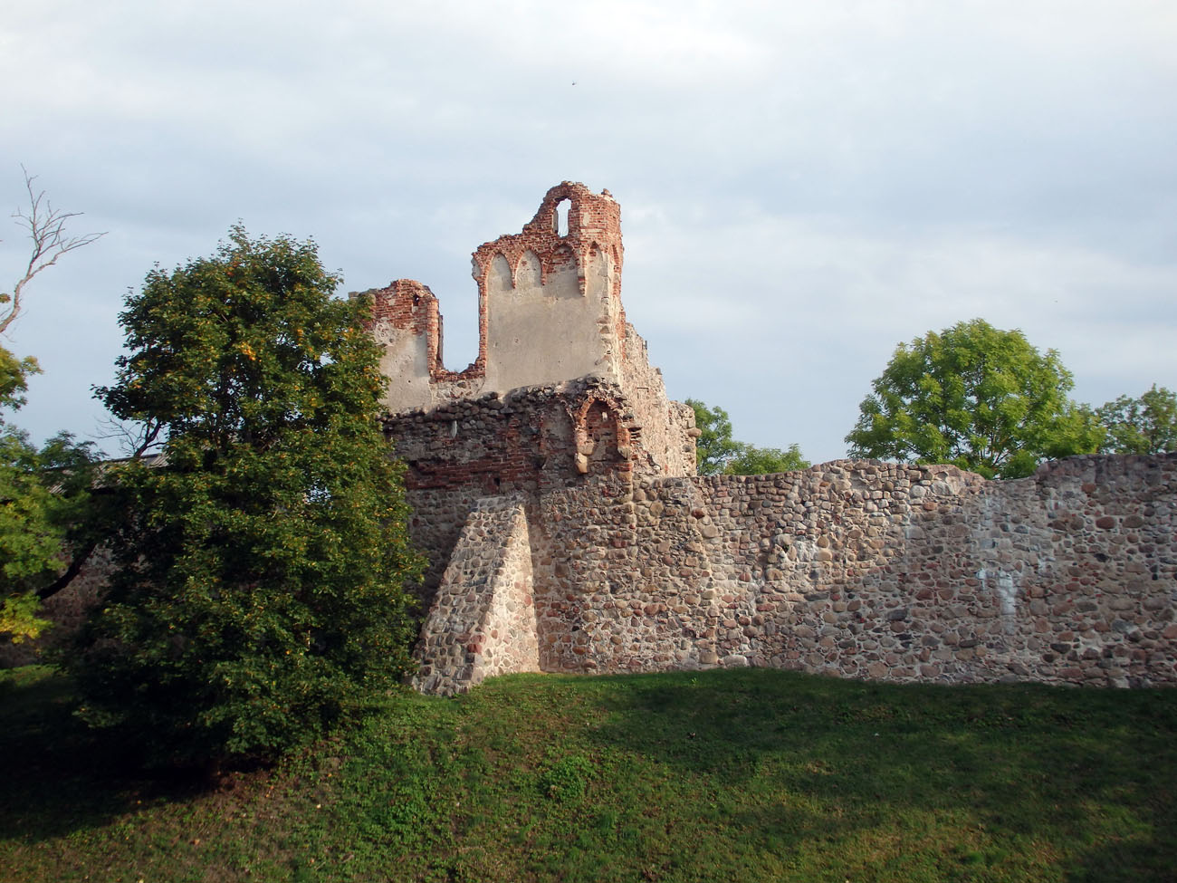
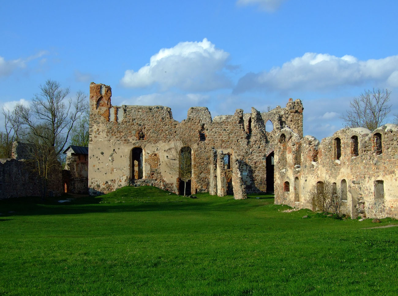
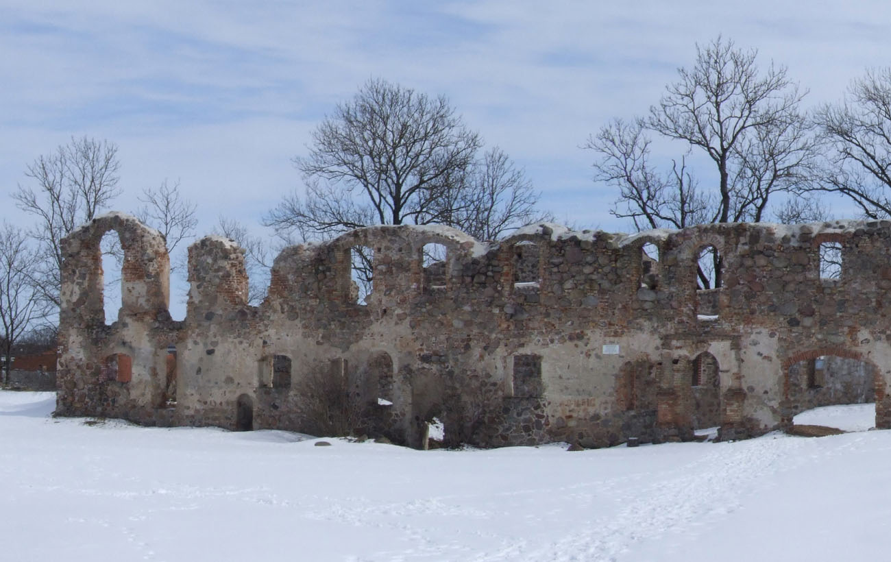
The castle was built on a hill, on the high, western bank of the Bērze River. It was protected by high slopes on three sides, but a moat was made on the south and west, which could connect with the Bērze riverbed on the northern side. Castle had an irregular, spacious, walled courtyard, unusual for Teutonic strongholds, formed asymmetrically probably due to the shape of the hill and the earlier wood and earth fortifications. Over the course of 180 meters in length, it narrowed towards the north from 94 to 18.5 meters, where on the very promontory, in the corner, the upper ward was located, built on a trapezoidal plan, 32 meters long and 18.5 to 37 meters wide. The buildings and fortifications of the castle were built of erratic stones, bricks were used for architectural details.
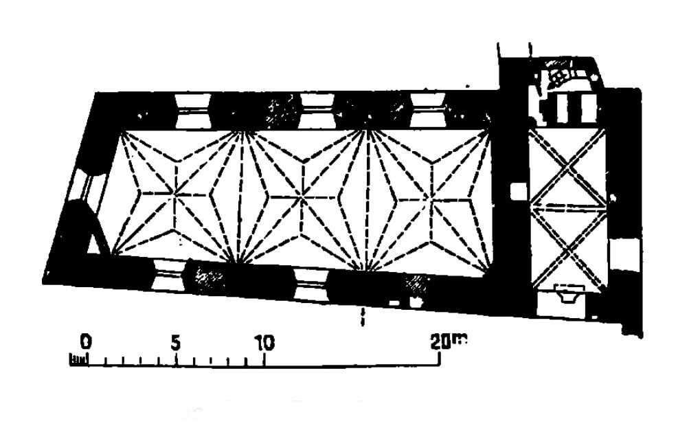
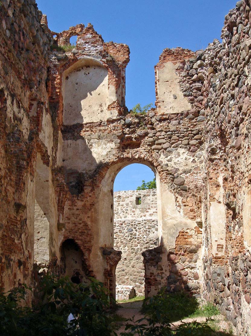
The main, representative rooms of the upper ward were located in the southern wing (33.6 x 11 meters). Its massive structure protected the small courtyard of the north side. The southern wing had walls up to 2 meters thick and protruded about 6 meters in front of the line of the walls of the upper ward in the east. There were basements, probably for storage purposes, the ground floor and first floor, divided on each floor into two rooms: larger three-bay rooms measuring 22 x 7 meters and smaller two-bay rooms measuring 4 x 9 meters. On the ground floor, in a larger room, there was a Gothic stellar vault. This room was transformed into a chapel in the 16th century, so the original chapel had to be located in a different place. In the upper ward there had to be also a refectory and a dormitory required by the order’s rule. An interesting element were small turrets, relatively rare in Livonia and more common in Prussia, placed in the corners of the southern wing.
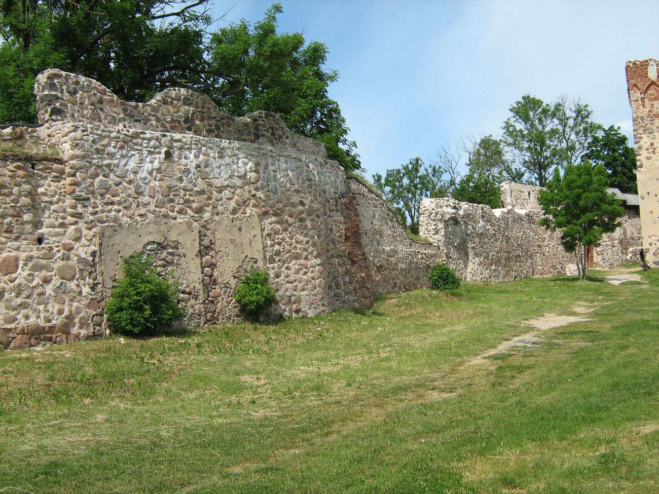
The outer bailey, located south of the upper ward, served economic functions and could also be a place for troops to camp due to the exceptionally large courtyard. The buildings consisted of a series of rooms near the eastern curtain, as long as 142 meters and 15 meters wide, but in the Middle Ages the buildings may have been less unified or did not occupy the entire length of the curtain. The entrance to the castle area was originally located in a pointed portal near the south-west corner. The entrance was also pierced on the western side near the bend of the defensive wall, which was filled from the courtyard side with a tower with a four-sided base, turning into a cylindrical part at the top. The long wall of the outer bailey was massive considering the fortifications of the economic courtyard, about 2.5 meters thick.
Current state
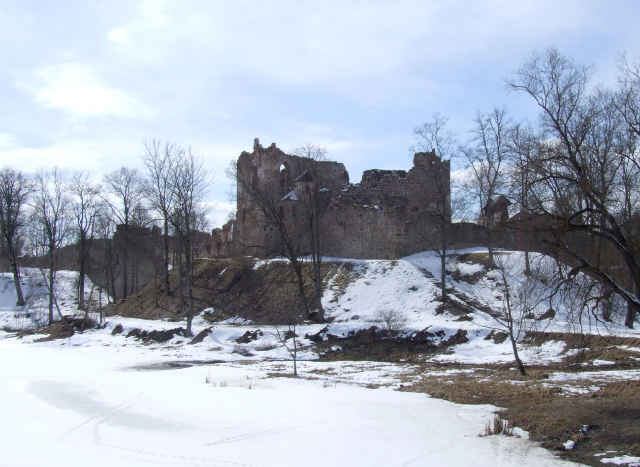
Currently, ruins of Dobele castle are one of the most important medieval monuments of south-eastern Latvia. To this day have survived the ruined main southern wing of the upper ward, defensive walls along almost the entire length of the perimeter, and partially the eastern building of the outer bailey, today without internal divisions. Unfortunately, the three remaining wings of the upper ward were significantly degraded, which makes a more accurate reconstruction of its spatial structure impossible. Apparently, there are plans to rebuild the vault of the castle chapel.
bibliography:
Alttoa K., Bergholde-Wolf A., Dirveiks I., Grosmane E., Herrmann C., Kadakas V., Ose I., Randla A., Mittelalterlichen Baukunst in Livland (Estland und Lettland). Die Architektur einer historischen Grenzregion im Nordosten Europas, Berlin 2017.
Borowski T., Miasta, zamki i klasztory. Inflanty, Warszawa 2010.
Herrmann C., Burgen in Livland, Petersberg 2023.
Tuulse A., Die Burgen in Estland und Lettland, Dorpat 1942.