
History
The Teutonic Knights castle in Daugavpils (German: Dünaburg) was the southeasternmost commandry in Livonia. It served as the most important political, military and commercial center of the Teutonic Order’s Latgale, where the Teutonic rule was threatened by both Lithuanian raids from the south and Ruthenian invasions from the east. The stronghold was built around 1275, probably on the initiative of the Land Master of Livonia, Ernst von Ratzeburg. It had favorable conditions for development because it was located at the intersection of two great trade routes connecting Lithuania with Ruthenia and through the Daugava River, Riga with Smolensk, Vitebsk and Polotsk.
The first test of the castle’s fortifications came in 1277, when Dünaburg was besieged by the Lithuanian Prince Traidenis. The three-week siege turned out to be ineffective and the troops withdrew to Lithuania. It was only in 1313 that the Lithuanian prince Vytenis captured the castle and probably damaged its fortifications. During the fighting, the Lithuanians captured the knight Joannes von Üxküll, probably of high status in the order. To free him, the Teutonic Knights slighted the fortifications under a truce, but in the same year Master Gerhard von Jork ordered reconstruction. In the following years, subsequent Livonian masters modernized the stronghold, especially Goswin von Herreke, on whose initiative four towers were to be added and a settlement under the castle was founded in 1348.
In 1396 the castle was partially burned, and after reconstruction, it was captured and destroyed twice: in 1403 and 1418. After another reconstruction, the castle remained unconquered for 60 years, until the invasion of Ivan the Terrible’s troops during the Livonian War. Soon recaptured by the Order, it remained in its hands until 1559, when it was annexed to the Grand Duchy of Lithuania, and later to the Polish-Lithuanian Commonwealth. In 1577, during one of the last attacks of the Moscow army, defended by the Polish-Lithuanian garrison castle, after a siege of over two weeks, was captured for the last time and then demolished. This time, the scale of destruction was so great that King Stefan Batory decided to move Dünaburg 19 km west, where a new town was established, later Daugavpils.
Architecture
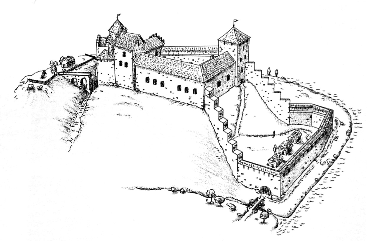
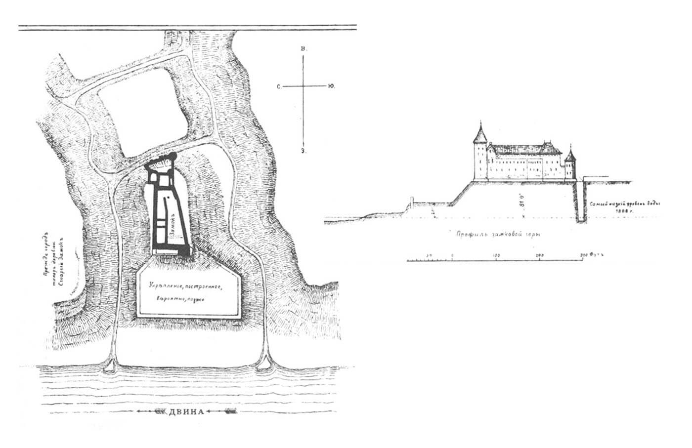
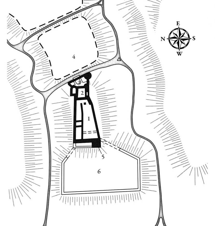
The castle was an irregular structure, adapted to the shape of the terrain, built mainly of stone, but with the use of bricks for architectural details. Dünaburg was situated on a hill between two streams to the north and south, flowing into the Daugava to the west. Between the river and the castle there was a vast economic bailey, which probably also included a harbor. A large part of it was located on a slope descending westward. The main entrance led from the east through a drawbridge over a moat. Behind it there was a craft and merchant settlement near the castle.
The plan of the castle was similar to an irregular trapezoid. Its oldest element, dating back to the 13th century, was the eastern wing of the upper ward. There was a chapel above the entrance gate, a solution often found in Teutonic Knights castles. The remaining wings, dating from the 14th century, apart from the utility rooms on the ground floor, such as the kitchen, pantries or brewery, probably housed the rest of the monastery chambers required by the rule. Among them there must have been a refectory and a dormitory.
The castle probably had three towers: one cylindrical from the south-east, which flanked the entrance gate, the second four-sided in the south-west corner, dominating the western bailey and the harbor, and the third one, also four-sided in plan, located on the north side. Their location was determined by terrain conditions and the need to protect the most important buildings, such as the eastern gate and the marina in the west. The entire layout lacked the regularity typical of Teutonic commandry castles.
Current state
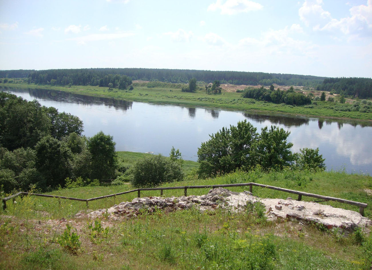
The foundations of the castle visible to the nineteenth century, now are mostly hidden by the earth. Admission to the castle hill is free, on the spot you can see the model of the medieval fortress Dünaburg.
bibliography:
Borowski T., Miasta, zamki i klasztory. Inflanty, Warszawa 2010.
Herrmann C., Burgen in Livland, Petersberg 2023.
Tuulse A., Die Burgen in Estland und Lettland, Dorpat 1942.