

History
The first information about the castle hill (est. Toompea) was related to the events of 1219, when, according to the chronicler Henry the Latvian, the Danish troops of Waldemar II won a victory over the natives and captured the pagan stronghold of Lyndanisse of the Revalian tribe, next to which the city of Tallinn later developed (German Reval). On the site of the stronghold, the Danes built the first castle (“Castrum Danorum”) of an unknown form, probably still of wood and earth. All attempts by the Balts to recapture it ended in failure.
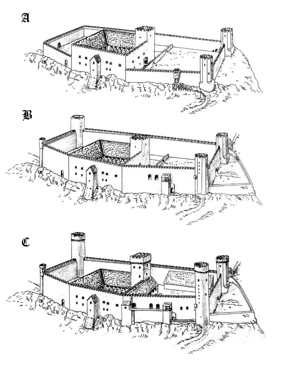
In 1227, the Livonian Brothers of the Sword took advantage of the weakening kingdom of Denmark and took over the northern part of Livonia. It was probably during this period that the first stone castle was built, in which the commandry was located. After the defeat at the Battle of Saule in 1236, the Knights of the Sword were forced to unite with the Teutonic Order and return Tallinn to Denmark in 1238 under the Stensby Agreement. The castle was under Danish rule until 1346, when, due to financial problems, northern Livonia along with the castle in Tallinn was sold to the Teutonic Knights. They began a thorough reconstruction of the castle, so that it could meet the requirements of the commandry’s seat. The main stage of these construction works ended before the end of the 14th century, but in the 15th century further expansion was carried out.
In 1560, the order led by Philipp Schall von Bell was defeated by the forces of Tsar Ivan the Terrible at Ermes. Teutonic Knights were unable to provide defense for his subjects, and a year later Tallinn passed under the protection of Sweden. Swedish troops defended the town and the castle twice: at the turn of 1570 and 1571 and in 1577, in both cases against invasions by Muscovite troops. After the end of the Livonian Wars, the Swedes transformed the castle, which was losing its military importance, into a representative and administrative center of political power in Estonia.
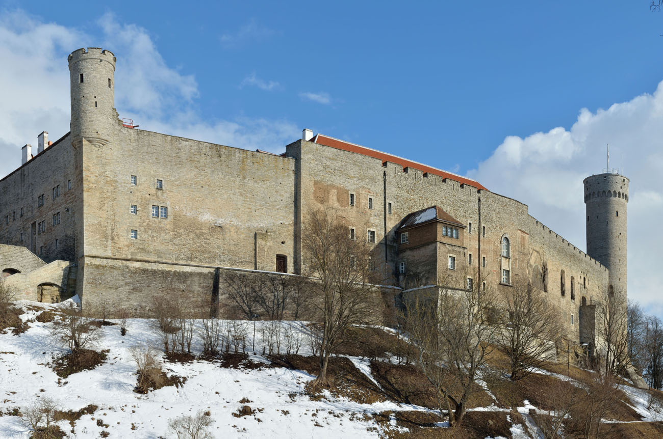
In 1710, Sweden lost the territory of present-day Estonia to the Russian Empire. The new administration eventually transformed the castle into a palace. In the eastern part of the castle complex, a Baroque and Neoclassical wing was added. It housed the governor’s offices and living quarters. In 1917, the upper ward burned down during the March Revolution. After reconstruction, it became a prison, which was partially demolished in 1920 in order to build the parliament building of the Estonian republic proclaimed in 1918.
Architecture
The castle was built in the southern part of a limestone hill, elongated south-west, north-east, towering about 50 meters above Tallinn Bay on the northern side. It took the place of an older pagan stronghold (“castrum minus”), while the central and northern parts of the hill may have originally been intended to a vast outer bailey (“castrum maius”), later transformed into the cathedral quarter of the medieval city with the curiae of canons and the bishop. On the eastern side, in place of the village near the castle and the market settlements of German, Scandinavian and Ruthenian merchants, a chartered city developed, from the end of the 13th century surrounded by defensive walls and separated from the castle by high hillsides.
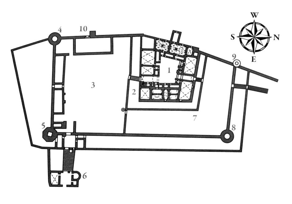
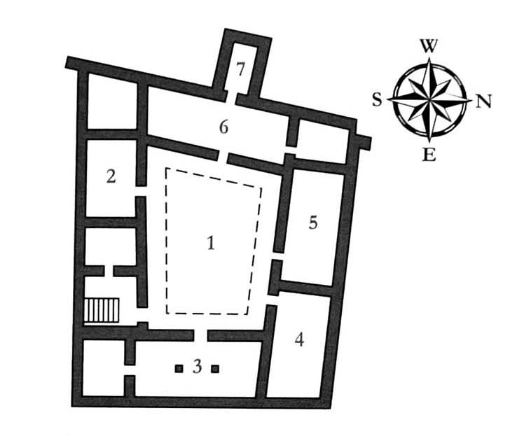
The castle from the second half of the 14th century was a multi-part structure with a plan somewhat similar to a rectangle elongated on the north-south axis, but with the walls on the western side bent due to adapting their shape to the edge of the hillside. The whole was about 132 meters long and from 56 to 75 meters wide. It consisted of a core in the form of a commandry upper ward, surrounded on three sides by external fortifications, which separated two outer baileys: the southern one with a rectangular courtyard and the northern one with an L-shaped plan. Only the western part the upper ward faced directly towards the foreground, but its protection was ensured by high and steep hill slopes. In sections protected by strong hillsides, building a ditch was unnecessary or even impossible.
The upper ward was a four-wing building on a square-like plan with dimensions of 52/43 x 40 meters, with a four-sided main tower in the south-eastern corner and with a dansker avant-corps on the western side, which received a massive plinth part due to its location on a slope. The wings of the upper ward were probably not high and did not exceed the defensive wall, especially since they were covered with characteristic mono-pitch roofs, supported by curtains. All the rooms required by the rule were traditionally located on the first floor: a two-aisle refectory in the eastern wing, a dormitory in the western wing (connected to the latrines in the dansker) and a chapel and chapter house in the northern wing, with the chapel probably occupying the north-eastern corner to properly orient the chancel. In the southern wing there were the commander’s private chambers. The rooms on the ground floor, such as the kitchen and pantries, served economic purposes. All wings were connected by an external cloister running around the entire courtyard.
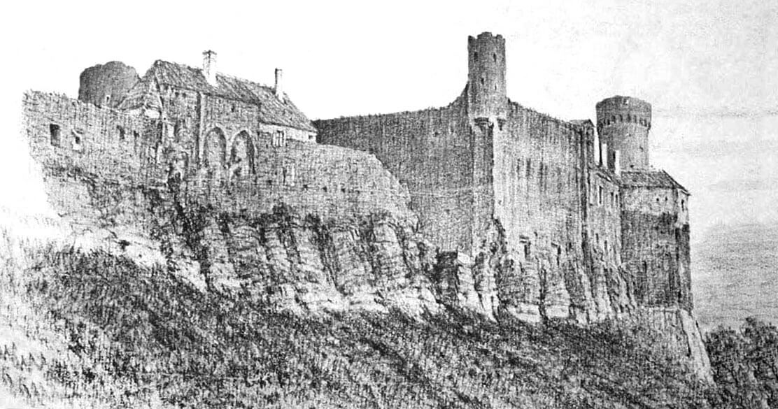
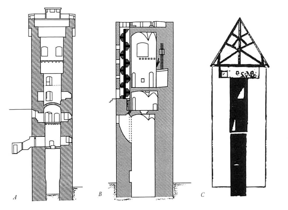
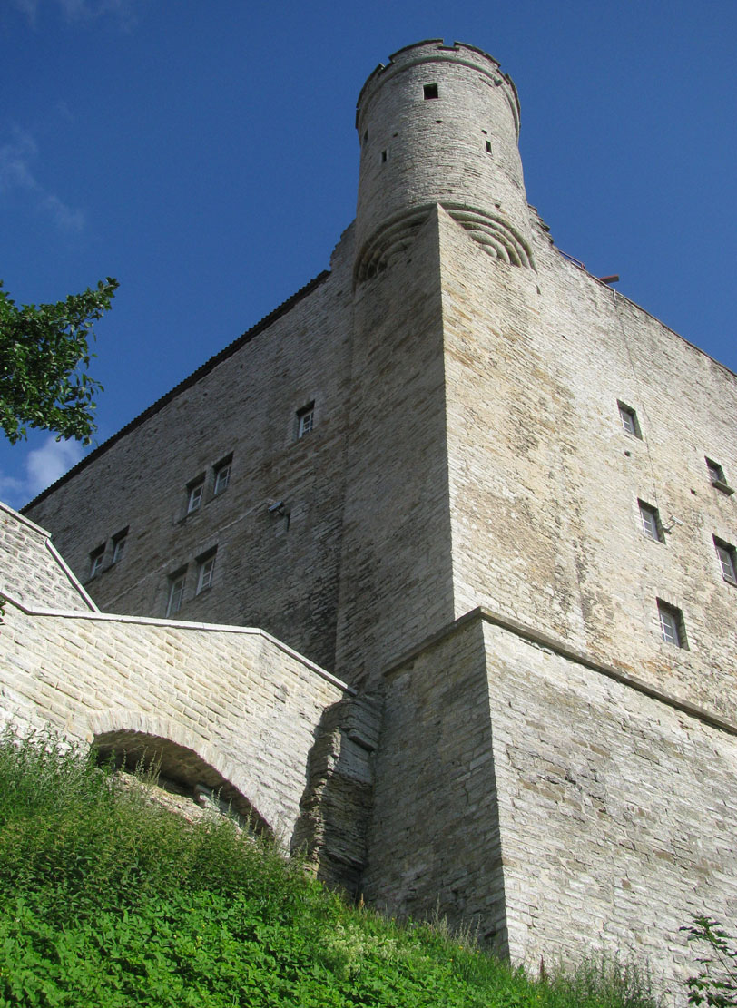
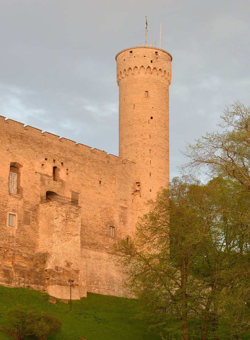
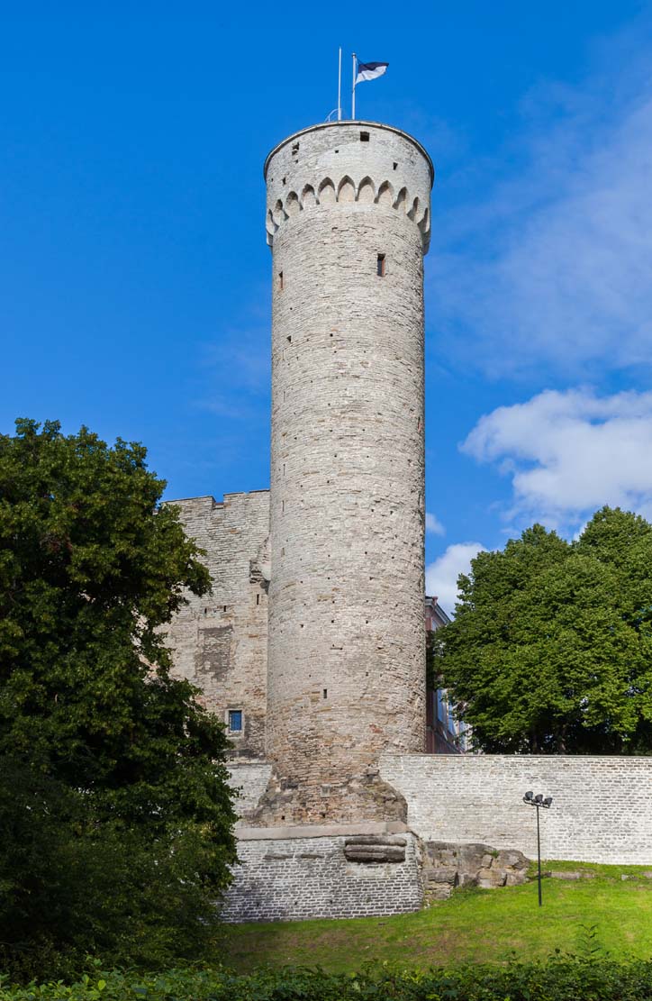
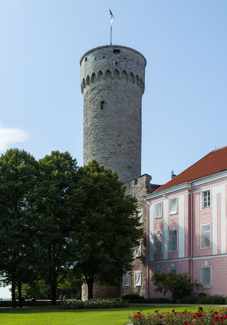
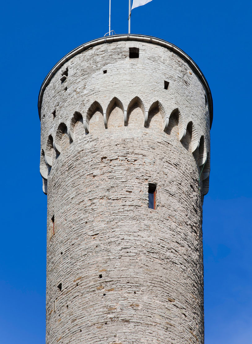
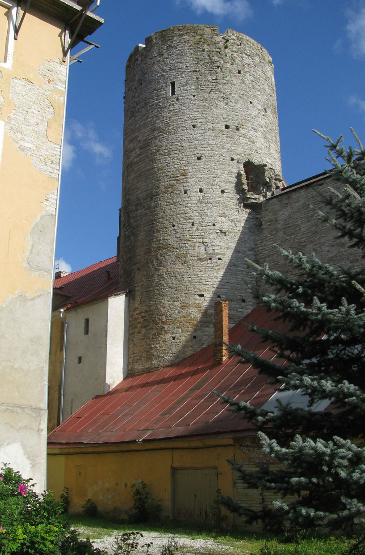
Probably before the end of the 14th century, a south-eastern six-sided tower, Stür den Kerl, and a south-west cylindrical tower called Pikk Hermann (High Hermann) were built in the corners of the outer wall. The latter was originally 35 meters high. At the beginning of the 16th century, it was raised to approximately 45 meters by adding the highest eighth storey, mounted on stone corbels forming ogival arcades. Both towers controlled the side gates of the southern bailey and the southern foreground of the castle, where the promontory of the hill was reinforced with a low retaining wall.
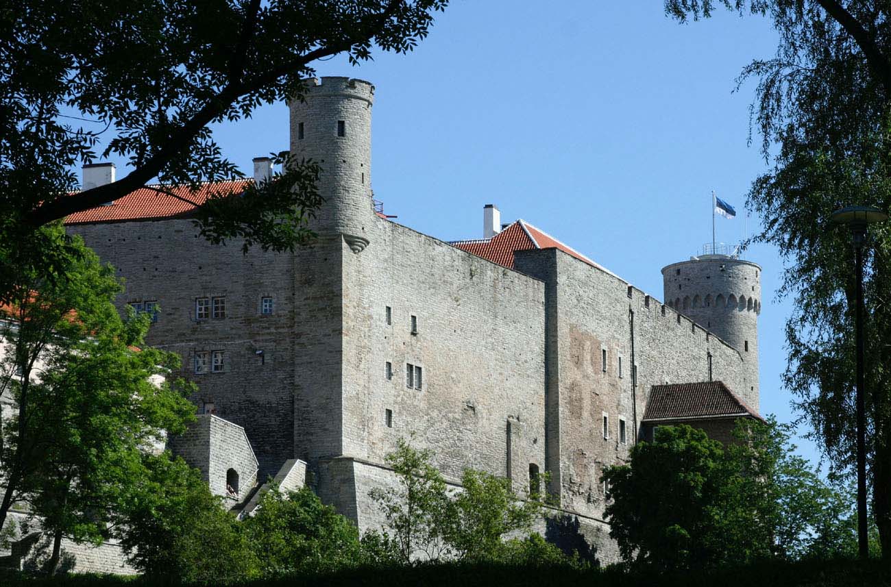
Before the mid-15th century, the height of the outer defensive walls was raised, leveled with the walls of the upper ward, and two additional towers were added in the corners on the northern side of the outer bailey: Landskrone in the north-east and Pilsticker in the north-west, the latter being only a rounded bartizan, hanging on the corner of the walls. The castle achieved its final appearance in the first half of the 16th century, when all the towers, like the above-mentioned Pikk Hermann, were raised with the highest floors topped with parapets mounted on corbels. In the late Middle Ages, the entire castle, apart from the safest western side, protected by high slopes, was protected by an outer wall of the zwinger.
Current state
Currently, Toompea Castle is the seat of the Estonian Parliament, government and the highest authorities of the republic. Its characteristic medieval tower, High Hermann, 45 meters high, is one of the symbols of the capital. Apart from this, the eastern side of the castle and the two northern towers, Landskrone and Pilsticker, have retained their original character. The remaining part has been thoroughly rebuilt, although the original arrangement of the upper castle and the two wards is still legible in the pictures from a great height. Unfortunately, the monument is not open to the public, with the exception of the underground under the Pikk Hermann tower.
bibliography:
Borowski T, Miasta, zamki i klasztory, Inflanty, Warszawa 2010.
Herrmann C., Burgen in Livland, Petersberg 2023.
Tuulse A., Die Burgen in Estland und Lettland, Dorpat 1942.
Zamki regionu Morza Bałtyckiego, red. T.Kjaergaard, Bydgoszcz 1995.