
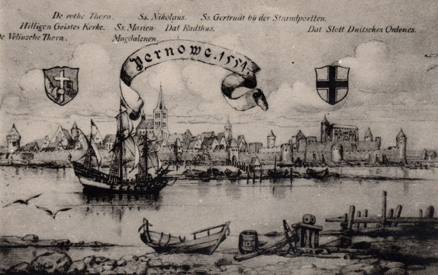
History
The original Pärnu (German: Pernau) was a right-bank settlement founded around the mid-13th century by the bishops of Ösel-Wiek. In 1263, an raid of pagan Lithuanians destroyed Old Pernau, and the bishops moved to northern Haapsalu. Taking advantage of the situation, the Livonian Land Master Conrad von Mandern in 1265 founded New Pernau on the left bank of the river and ordered the construction of a castle, initially probably of wooden construction. Although both centers had ports on the great trade route leading to Ruthenia, only Teutonic Pernau achieved the status of a full member of the German Hanseatic League and developed into one of the most important medieval cities of Livonia. At the beginning of the 14th century, during the times of Master Gerhard von Yorke, the castle was rebuilt into a brick seat of the Teutonic commandry, and the buildings layout of New Pernau was also formed, which in the second half of that century was surrounded by a perimeter of defensive walls, integrated with the Teutonic castle.
Over the next decades, misfortunes evaded both cities of Pernau and the castle. It was not until 1473 that not fortificated Old Pernau was looted by Baltic pirates. In 1560, the commander Rutger Wolf gave the castle and the town to the representatives of Lithuania, however, Pernau did not defend itself against the forces of Ivan the Terrible, which in 1578 took the town and the castle for four years. After regaining in 1582 by Polish–Lithuanian Commonwealth, it became the capital of the Polish province. One of the most important decisions of the Polish authorities was to liquidate the Old Pernau and resettle all inhabitants to the left bank of the river. During the Livonian War and then the Polish-Swedish war, the castle was destroyed. In 1617, the town was captured by the Swedes, whose rule lasted until 1710, when Pernau was taken by the Russians. The castle was already in ruins at that time, while the medieval town fortifications began to be transformed into early modern fortifications already in Swedish times.
Architecture
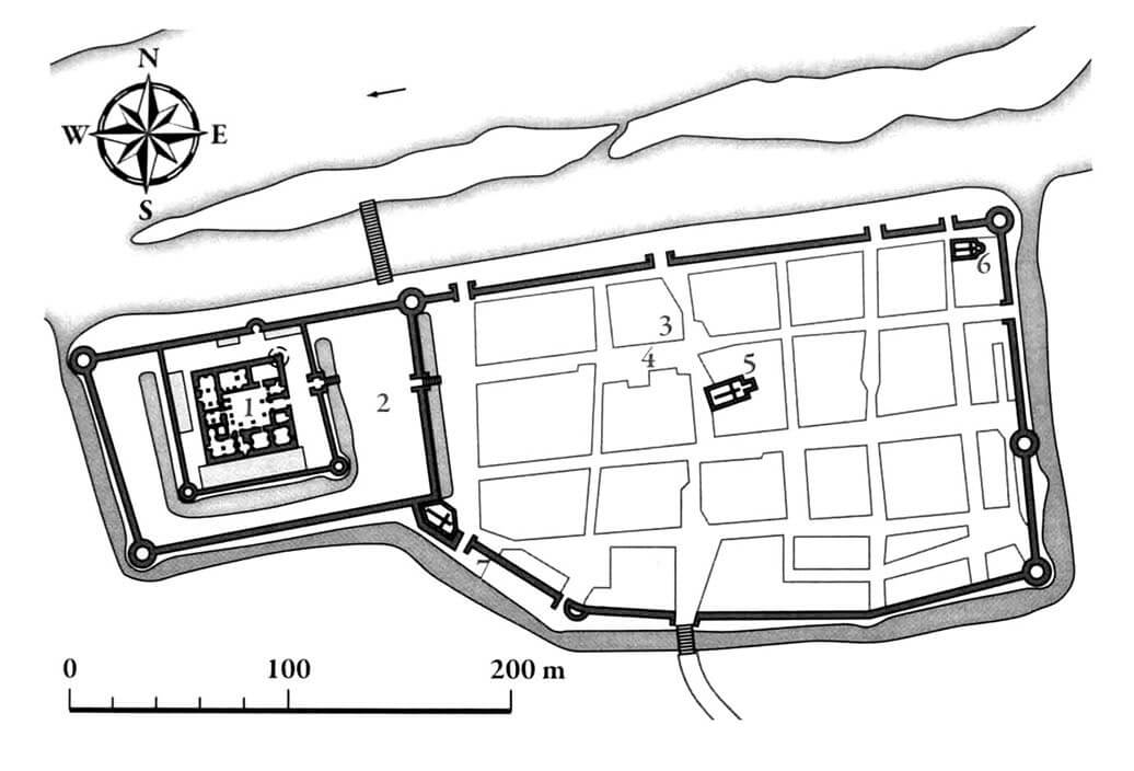
The town and the castle were founded on the southern bank of the Pärnu River, near its mouth into the Gulf of Riga. The castle and its outer bailey occupied the western part of the area, closer to the delta, while the town developed on its eastern side. Town and castle were separated by an irrigated moat, which also surrounded them, except for the northern side, protected by the riverbed. The town defensive walls were connected to the corners of the outer bailey, but the town did not have its own fortifications on the side of the castle.
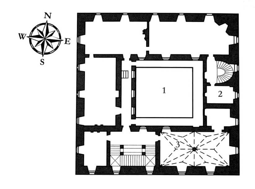
The Teutonic Castle in Pernau was a typical, square commandry complex with a side of 34 meters in length, with the most important monastery rooms located on the first floor, located in four wings surrounding the inner courtyard. Around it there was a stone cloister from at least three sides (eastern, western and southern). The castle also had at least one tower, located in the north – east corner of the upper ward. The entrance was located in the center of the east wing, so it faced the town. The stronghold was surrounded by two lines of defensive walls equipped with corner towers. The first walls circuit separated the zwinger, surrounding upper ward area, and the second set a large outer bailey.
The northern and eastern sections of the town walls ran in a straight line, the southern part had two small bends. The whole was about 900 meters long. The town wall was constructed of erratic stones, limestones and fragments of bricks bound with lime mortar. Clay was also used to seal the walls in case the water level in the moat or river rose. On the river side, the thickness of the wall ranged from 1.3 to 1.8 meters, on the eastern side it was about 1.5 meters, and on the southern section from 1.3 to 1.7 meters.
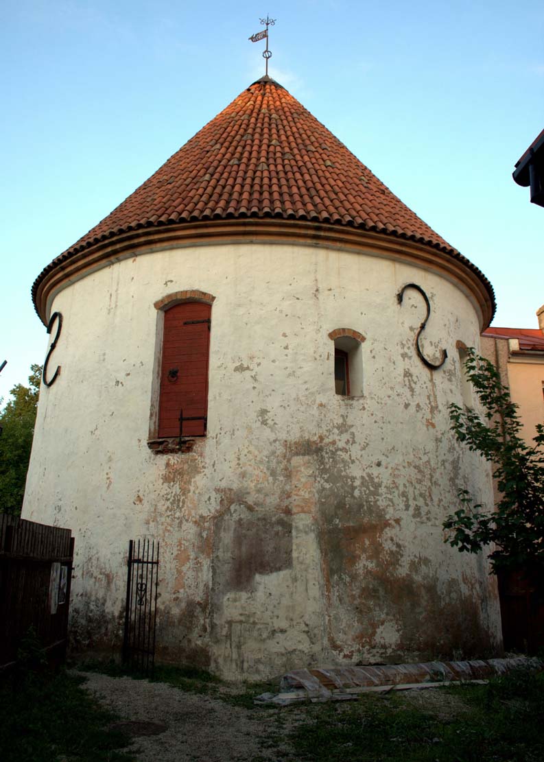
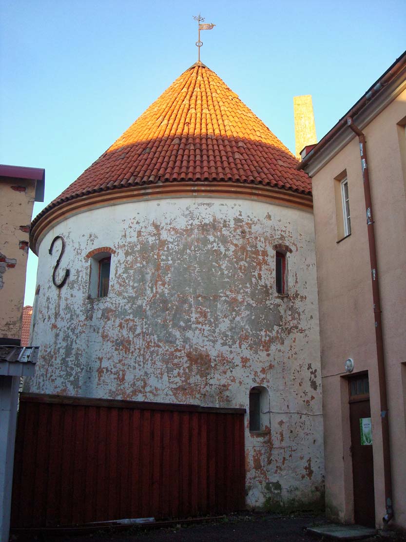
The town defensive wall was reinforced by six towers. The north-eastern and south-eastern corners were reinforced with cylindrical towers, the latter of which was called the Red Tower. Originally, it was four-story high and its walls were up to 2.5 meters thick. White Tower was even more massive, with walls on the ground floor about 3 meters thick. In addition, the walls had several semi-cylindrical towers. As many as eight gates lead to the Pernau, the most important of which were: River Gate, Water Gate and Guild Gate on the northern side, Cow Gate on the eastern side, Riga Gate and Holy Spirit Gate on the southern side. Most of them probably had a tower form with passages on the ground floor.
Current state
The teutonic castle did not survive in the slightest way to modern times. The only preserved fragment of town fortifications is a tower between the houses from the first half of the 14th century, known as the Red Tower or the Prison Tower. Currently, it is one level lower than the original appearance.
bibliography:
Bernotas R., New aspects of the genesis of the medieval town walls in the Northern Baltic Sea region, Turku 2017.
Borowski T., Miasta, zamki i klasztory. Inflanty, Warszawa 2010.
Herrmann C., Burgen in Livland, Petersberg 2023.
Tuulse A., Die Burgen in Estland und Lettland, Dorpat 1942.