
History
Lais castle was established as one of the border strongholds of the Teutonic Order, administratively subordinate to the commandry in Fellin (Estonian: Viljandi). It also guarded the northern section of the border between the order territory and the authority of the Dorpat (Estonian: Tartu) bishops. The first record of the castle was from 1406, and about the castle burgrave in the years 1416-1417, but it was probably built in the fourteenth century.
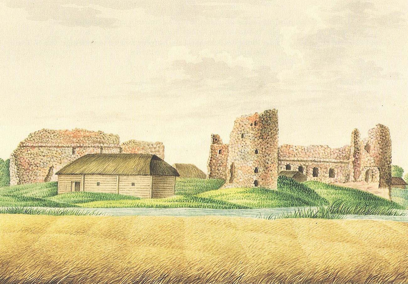
Importance of the castle increased with the threat of Livonia on the side of the Grand Duchy of Moscow. Therefore, it was thoroughly rebuilt in the 15th century and its fortifications were adapted to use firearms. The castle walls and the gate have also been strengthened. However, even such a modernized castle succumbed to the troops of Ivan the Terrible and after being captured in 1559, it was partially destroyed. On the truce of Yam-Zapolsky, from 1582, it became the northernmost eldership of the Polish-Lithuanian Commonwealth. Andrzej Orzechowski became the starost, whose efforts the castle was rebuilt, and around 200 settlers from the Swedish part of Estonia were brought to its vicinity.
The development of the starosty (eldership) was stopped by the Polish-Swedish war. In 1600, the Swedes besieged the castle and captured it only after four weeks. Due to the death of the Orzechowski, the garrison gave up. However, a year later, the stronghold returned under Polish rule and remained the center of eldership until 1622, when it was again passed into Swedish hands. Eventually, the destruction of the castle was brought by the Great Northern War in the early 18th century.
Architecture
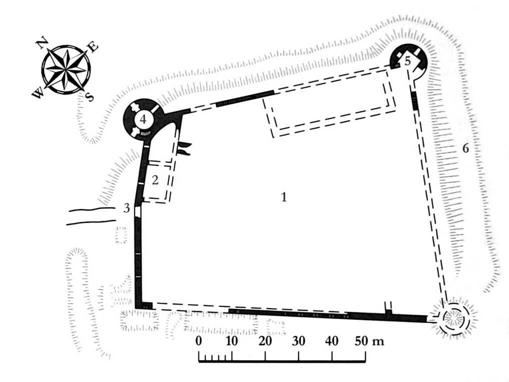
Lais Castle was built on a small knoll of land located in the bend of the Laiuse River, which surrounded the castle from the north and east. It was planned on a trapezoidal plan, defined by stone defensive walls, with three straight curtains and a western section with a slight bend. The entire complex, measuring approximately 100 x 50/70 meters, was surrounded by a moat. The fortified castle gate was located approximately in the middle of the western section, where there was probably a drawbridge.
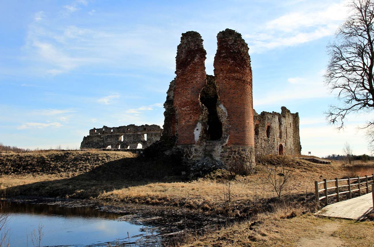
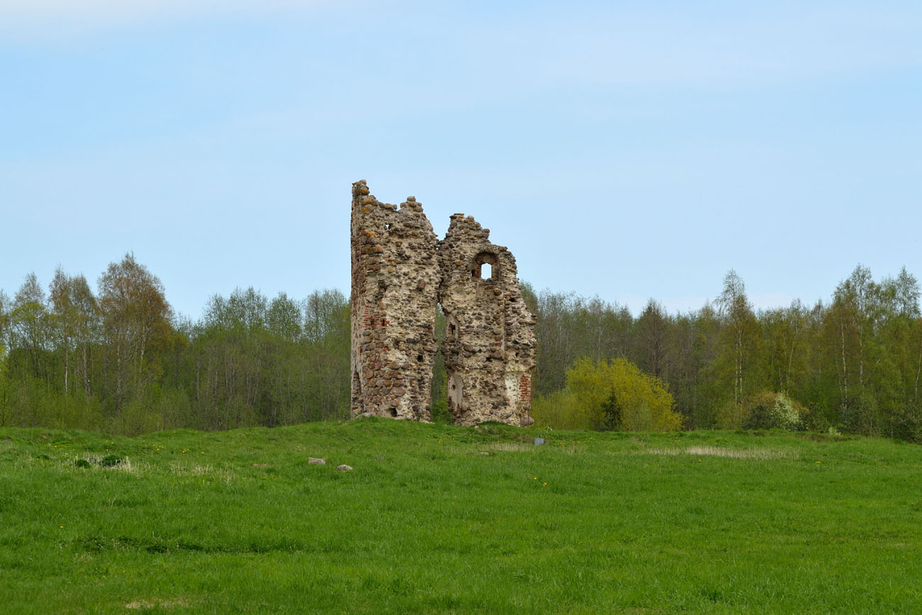
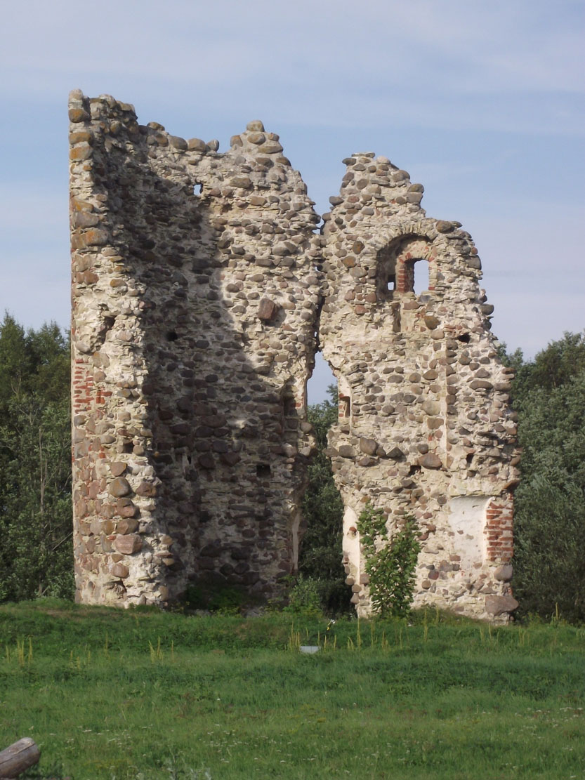
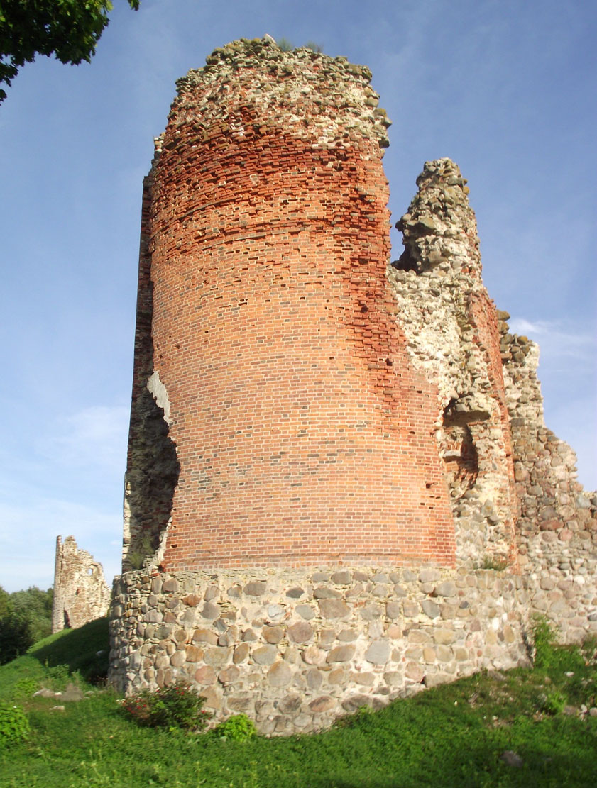
The most important defensive element in the 15th century was a massive artillery tower with a diameter of 14 meters and a wall thickness of 4 meters, situated in the north-west corner of the stronghold and almost entirely protruding in front of the perimeter of the defensive walls. Above the widened stone plinth, it was almost entirely made of brick, which distinguished it from other parts of the castle. A slightly smaller, analogous tower was located in the north-east corner, and a similar one could also be on the south-east side. Certainly the last south-west corner of the castle was not secured by round tower, where only the remains of a much smaller turret have survived to this day.
The largest building was adjacent to the curtain of the north-eastern wall. The second building with two rooms on the ground floor was located on the north-west side, another on the opposite side of the gate, in the south-west corner. In plan, it had dimensions of approximately 21 x 11.6 meters. Most of the spacious courtyard was left free, serving as a place for possible camping of troops or as a shelter for merchant carts or transports with supplies. The whole complex was surrounded by a ditch.
Current state
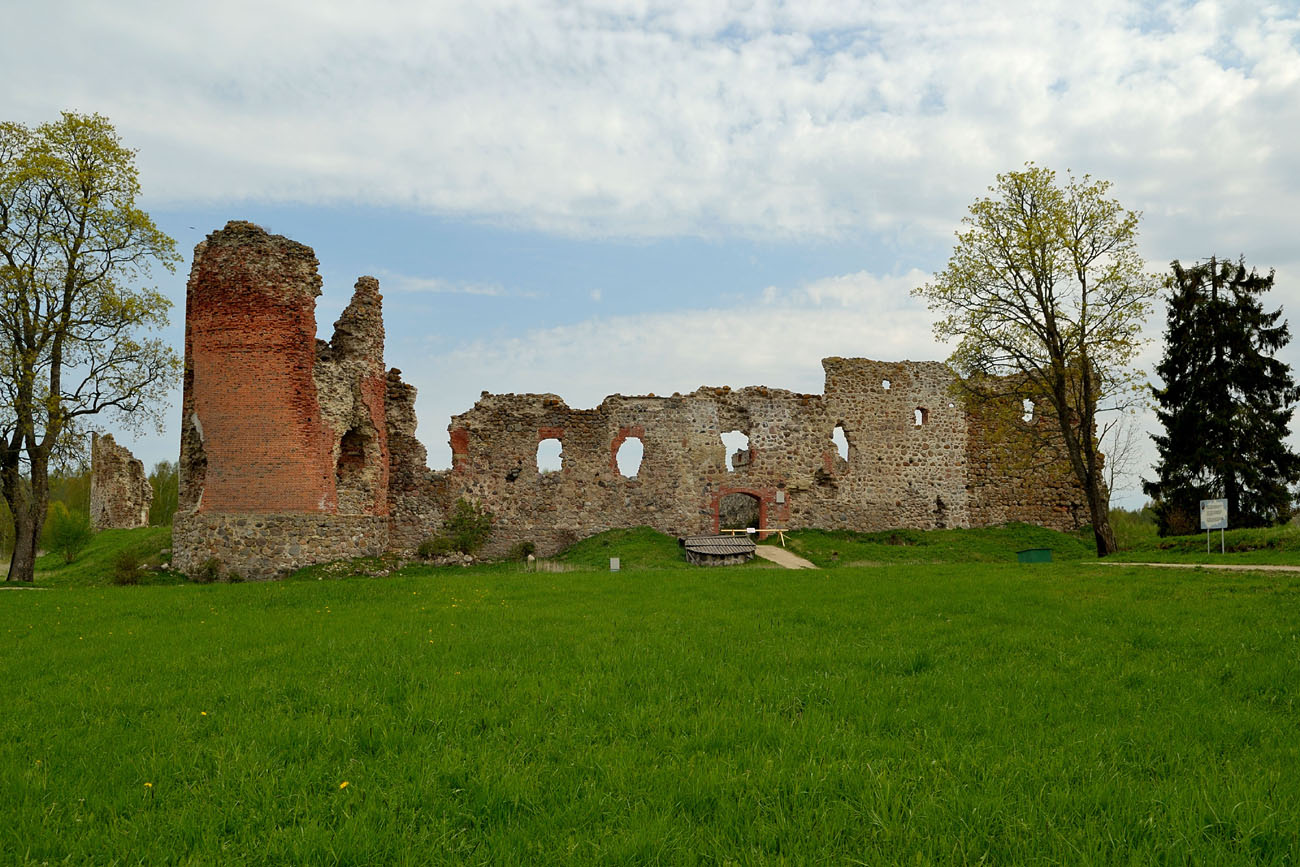
The castle is currently an advanced ruin. The round north-west tower, the curtain on the south and west sides, and the now isolated relics of the north-east tower have survived in the best condition. The moat is still visible on most of the perimeter. Admission to the castle grounds is free.

bibliography:
Borowski T., Miasta, zamki i klasztory. Inflanty, Warszawa 2010.
Eesti arhitektuur 4, Tartumaa, Jõgevamaa, Valgamaa, Võrumaa, Põlvamaa, red. V.Raam, Tallinn 1999.
Herrmann C., Burgen in Livland, Petersberg 2023.
Tuulse A., Die Burgen in Estland und Lettland, Dorpat 1942.