
History
The Karkus castle, like many other Estonian strongholds, probably was built in the place of an earlier hillfort, which in the first half of the 13th century came under the rule of the Teutonic Knights. In 1248, the Teutonic vogts Hermann and Werner were already recorded. The stronghold managed by them was still wooden at that time and probably for this reason it fell to Lithuanian invasions several times, including in 1297 and 1366.
The construction of the stone castle probably ended only at the end of the third quarter of the 14th century. It was an important administrative center and a significant rest point along the vital route connecting the south and north of Livonia. The high rank of the stronghold is also evidenced in the middle of the fifteenth century, by the raise of the rank of vogt residing in the castle, to the dignity of the land vogt. Although the castle never reached the formal rank of seat of the commandry, in the fifteenth century, the commander of Fellin temporarily resided in it. It was probably then that subsequent upgrades were made (additional wall line from the east). This proved to be useful in 1481, when Karkus was attacked by Muscovite troops. Unfortunately, in 1560 the fortification did not withstand the next Moscow invasion and the castle was captured by the tsarist army.
In the last years of the 16th century, Karkus changed owners several times before it became a part of the Polish–Lithuanian Commonwealth in 1582. Polish governments did not last long, because at the beginning of the seventeenth century, the Swedes captured the castle, occupying it for another hundred years. Medieval fortifications were already heavily damaged, and what remained was finally destroyed in 1708, during the Great Northern War. In the later years of the 18th century, some of the castle buildings could have been used to build an early modern church, although in the 19th century the walls and towers of the outer bailey were in relatively good condition.
Architecture
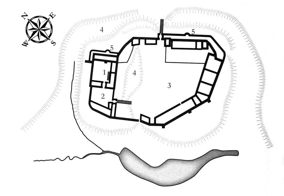
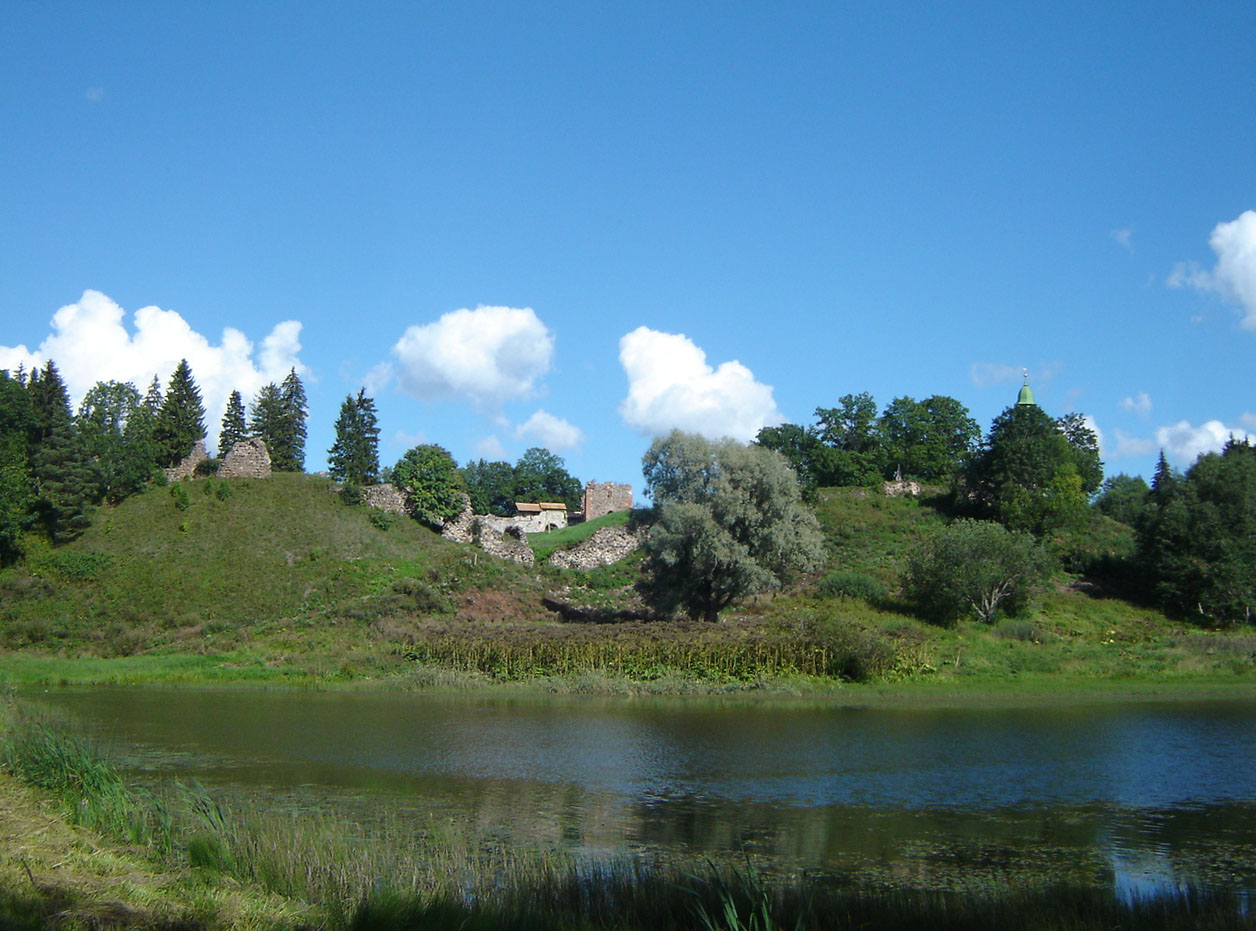
The castle was located on a hill on the eastern side of the lake situated in a valley and the streams connected to it. The slopes were steep on the valley side, only in the north and east, where the main access road led, the terrain was flatter. It was also there that the castle fortifications finally acquired their most developed form. Karkus was a large defensive complex, built of erratic stone, with the occasional use of bricks. It had the upper ward on the northern side and two adjacent baileys: a smaller one, located west of the upper ward, and a vast southern outer bailey separated by a ditch.
The upper ward was built on a rectangular plan, with three wings surrounding the courtyard and a simple curtain closing it from the north-west. The most important residential and representative rooms were probably located in the narrow north-eastern wing, located opposite the entrance gate from the inner bailey. Based on analogies with other Teutonic buildings, the ground floor of the wings was probably occupied by economic and auxiliary rooms, the main floor by residential chambers, and the attic served storage and defensive functions. The castle chapel could be located in the south-eastern part of the main wing or above the gate passage.
The smaller inner bailey probably had only one large stone wing opposite the entrance to the upper ward and a smaller wing at the south-eastern gate to the outer bailey. The latter had buildings along the defensive wall on each side, except for the section facing the upper ward, from which, as mentioned above, it was separated by a ditch. Probably in the 15th century, the castle fortifications were expanded by an additional line of walls with semicircular towers or bastions on the eastern side. A longer section of the zwinger protected the frontal part of the outer bailey, the shorter was at the upper ward, in front of the main wing.
Current state
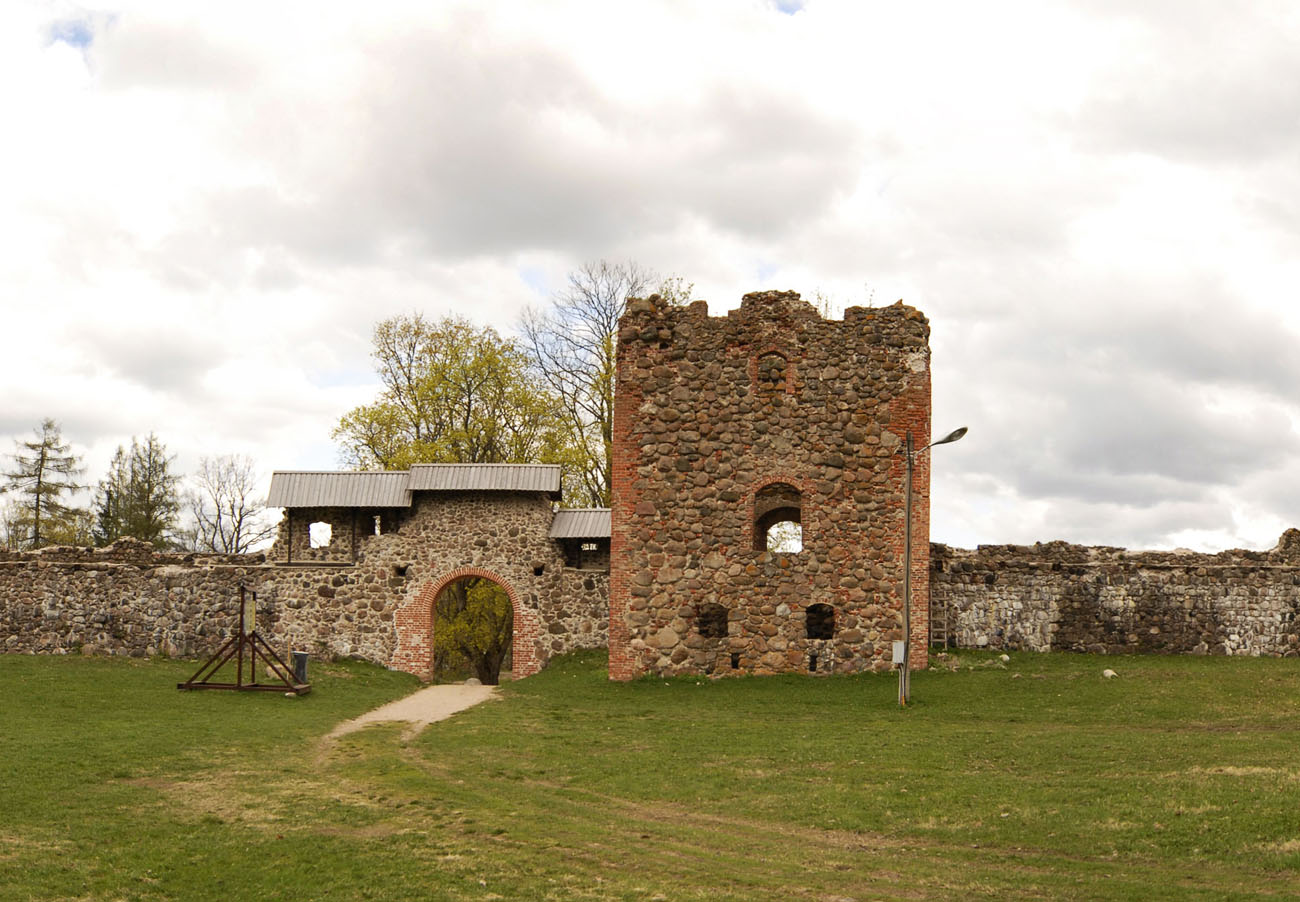
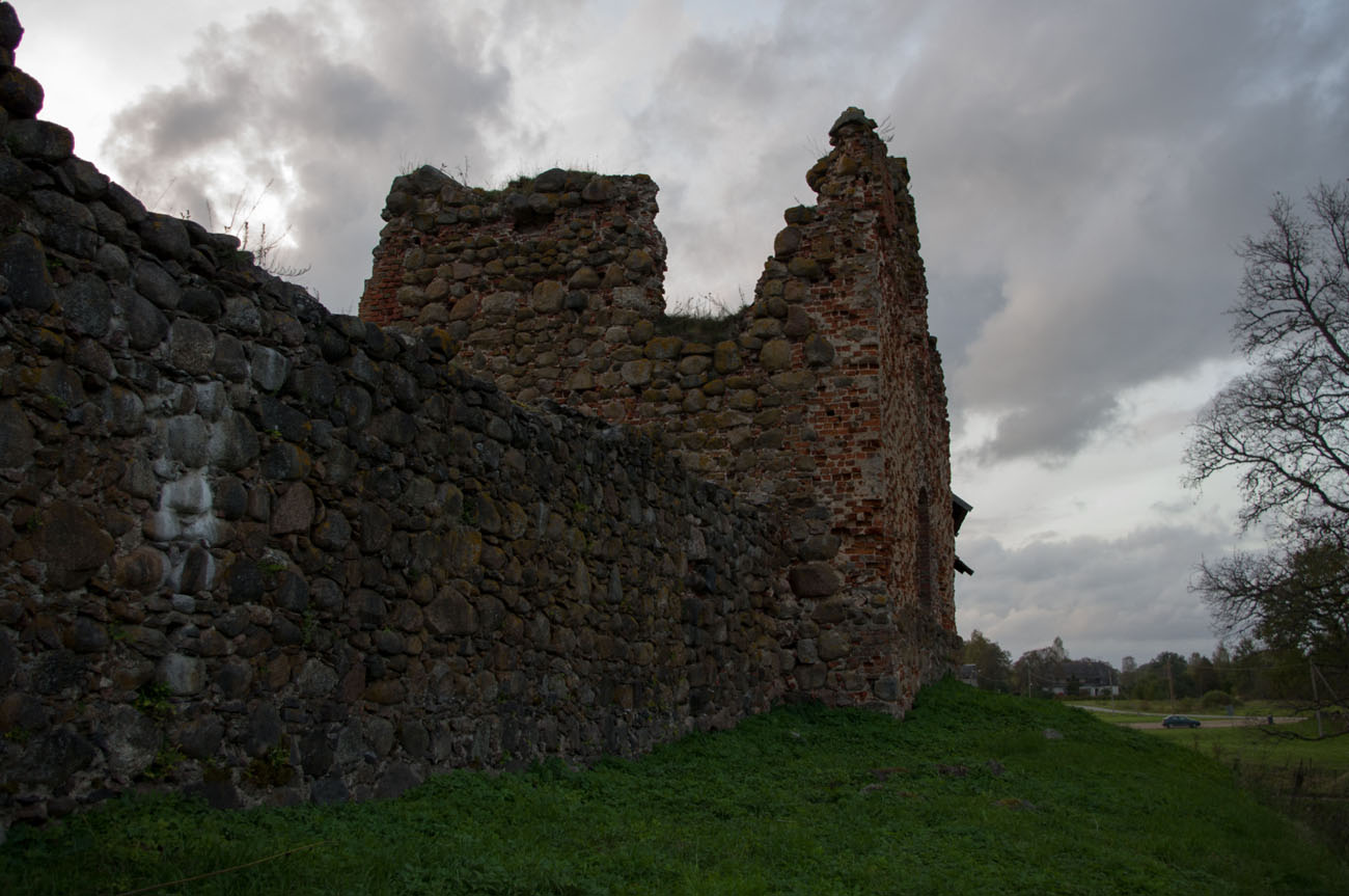
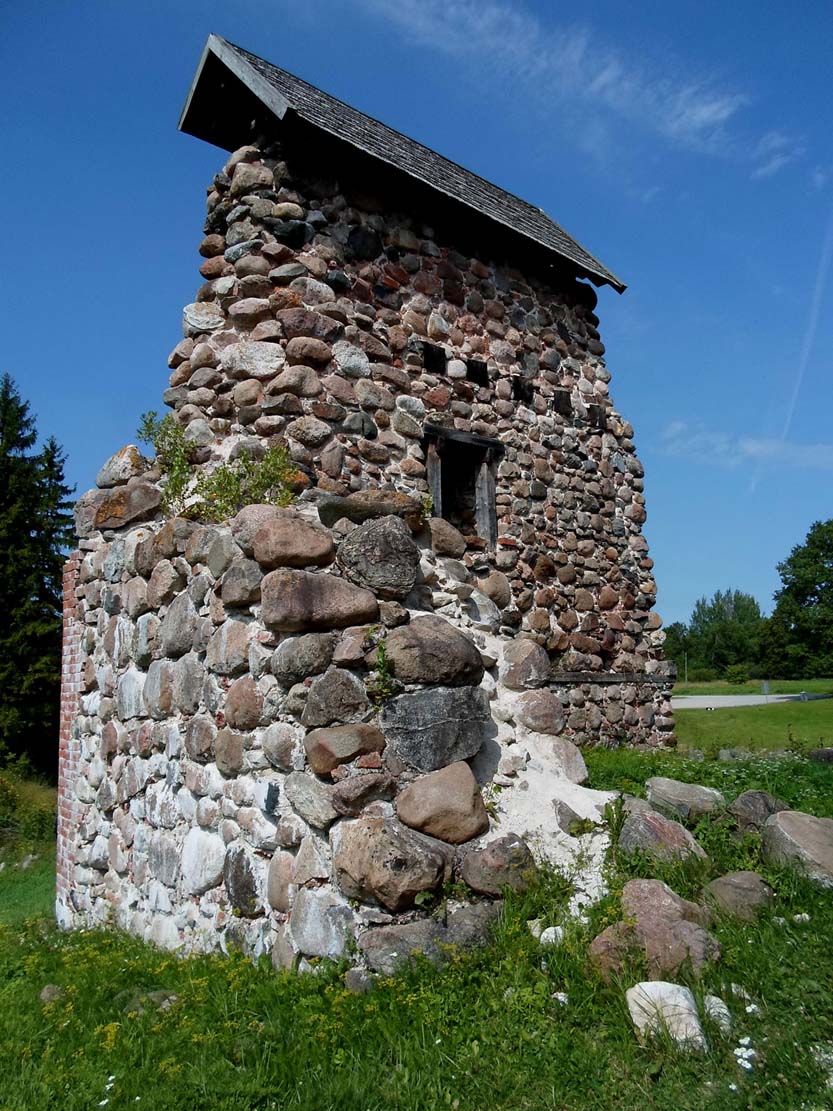
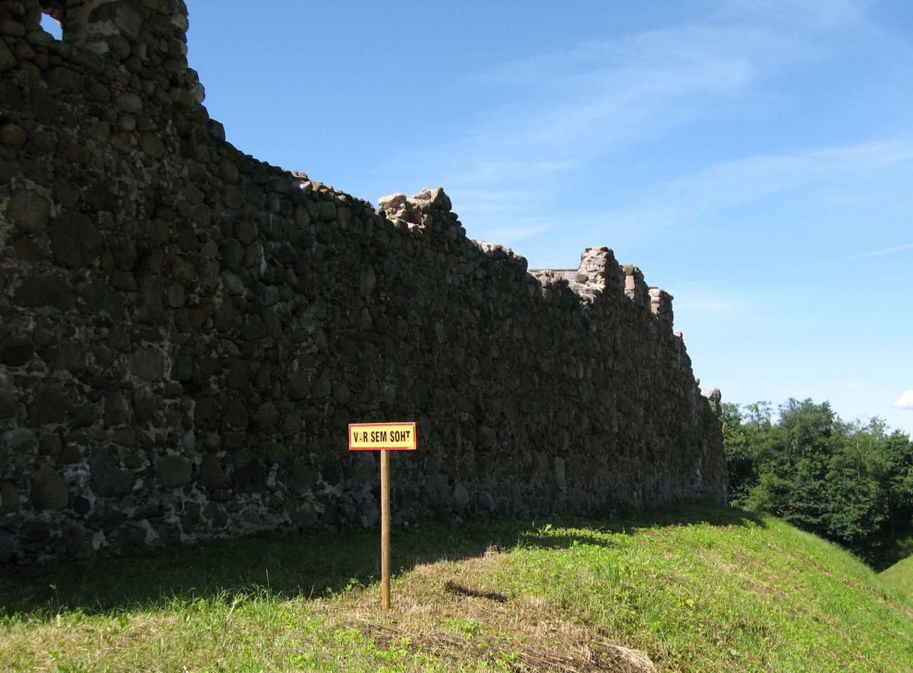
Until today, the castle has been preserved as an advanced ruin. The best-preserved elements are located in the eastern part of the extensive outer bailey, where a four-sided tower at the gate and adjacent sections of the defensive wall are visible. The buildings of the upper ward are severely degraded. The ditch separating the upper ward and the eastern outer bailey is still visible, while in the inner, western bailey, only isolated fragments of the lower parts of the walls have survived, scattered here and there. In recent years, the castle area has been tidied up and adapted for sightseeing.


bibliography:
Borowski T., Miasta, zamki i klasztory, Inflanty, Warszawa 2010.
Herrmann C., Burgen in Livland, Petersberg 2023.
Tuulse A., Die Burgen in Estland und Lettland, Dorpat 1942.