
History
The castle in Drawno was mentioned for the first time in written sources in 1421. It should be assumed, however, that the castle was built earlier, probably at the beginning of the fourteenth century. It was built on the initiative of the Wedel family on a hill, which was a remnant of an early medieval wood and earth stronghold. It secured the ferry over Drawa and the trade route. It was erected on the lands given by the margraves of Brandenburg to the powerful knights’ families, after in the short time of the end of the 13th century, New March grew by over 100 km to the east. Maintaining the acquired territory required numerous defensive points, which the margraves themselves were unable to erect and had to rely on the help of families like the Güntersbergs, the Wartburgs and the Wedel family.
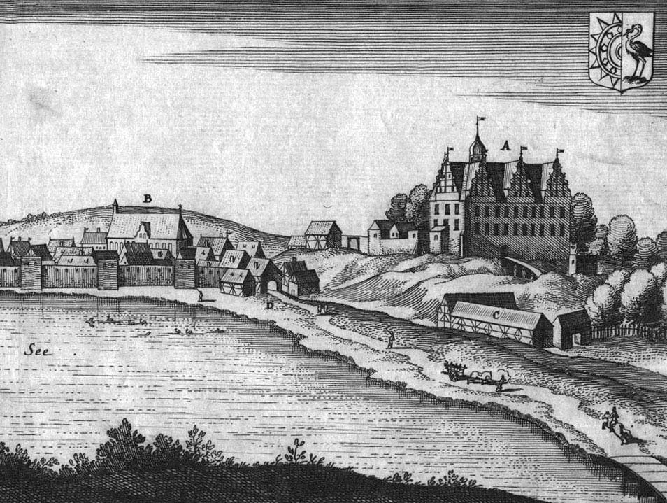
In the first half of the fifteenth century, the castle came under the rule of the Teutonic Knights, and it was not until 1478 that the elector Albrecht Achilles recapture the stronghold together with the town and restored the electoral sovereignty. Around 1600, the castle was rebuilt into a renaissance-style residence. Destroyed during the Swedish wars in the seventeenth century, in the next two centuries fell into complete ruin.
Architecture
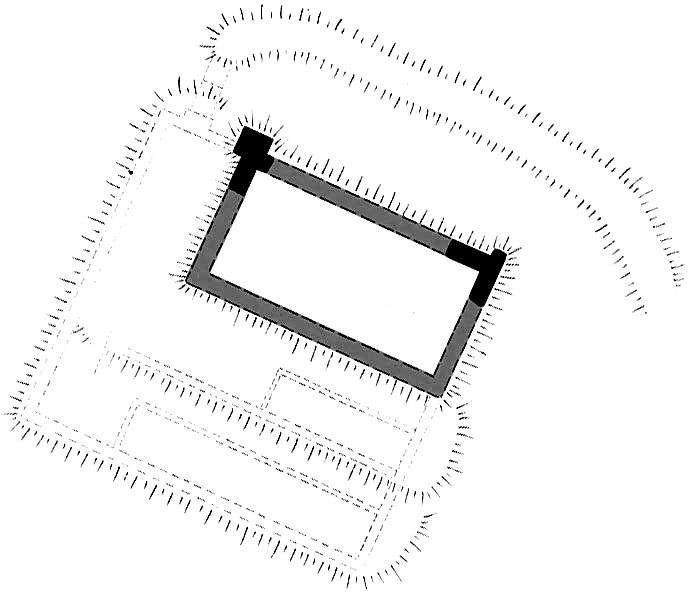
The castle was built on a small hill, on a headland cutting into the waters of Dubie Lake. As a result, it was protected by a wide water on three sides: from the north, east and south, while from the west the castle was secured by a fortified town. Its walls, reinforced with open towers, approached the foot of the hill, so that one of the town gates was flanked from the castle area, as was the road running south of the castle, right by the shore leading to the lake crossing in the south-east.
The main element of the castle was a brick, three-story house on a rectangular plan with dimensions of 15 x 28.7 meters. Two narrow, walled courtyards adjoined it from the west. The first one was located 2 meters lower and had a width of about 10 meters. The next one, with a similar width and correspondingly lower, was 10 x 40 meters and was located only from the west. Along the west side of the castle, that is from the side of the former road, economic buildings were located. From the north, an entrance gate with a bridge over a dry moat was adjacent to the residential wing. The whole, surrounded by a wall with a thickness of 1.7 meters, formed a quadrilateral measuring 35×38 meters. The castle was surrounded by the already mentioned moat and about 7 meter high steep hill slopes.
The north-east corner was supported by a massive buttress, and the south-eastern corner had a slightly smaller butt with a width of 1.4 meters. The building had three floors: a ground floor with a height of 3.15 meters, a first floor with a height of 4 meters and a second floor with a height of about 3 meters. All floors were covered with ceilings. The first floor was equipped with niches with arrowslits from the east side, and the ground floor was devoid of openings, which made the building a defensive structure. The gables of the building were decorated with shield-shaped blendes.
Current state
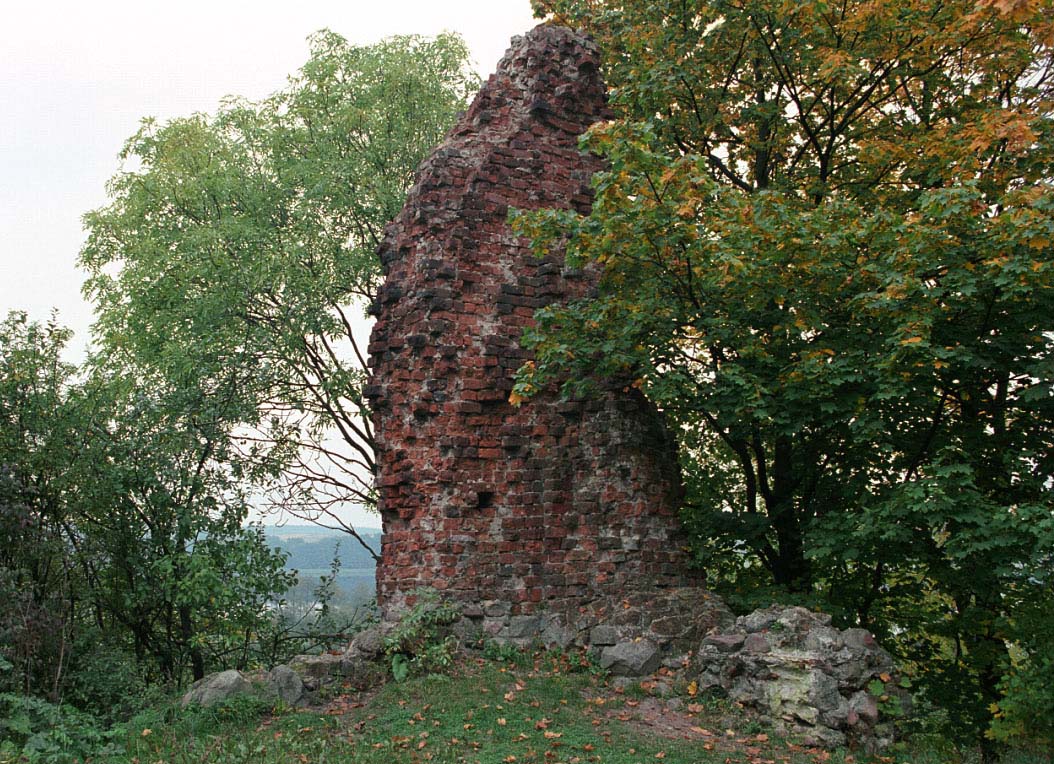
Until today, only two corners of the building have survived on the hill. Entrance to the former castle is free.
bibliography:
Leksykon zamków w Polsce, L.Kajzer, S.Kołodziejski, J.Salm, Warszawa 2003.
Radacki Z., Średniowieczne zamki Pomorza Zachodniego, Warszawa 1976.